8/9 - Rob's Midweek "Gray/Gloomy" Forecast
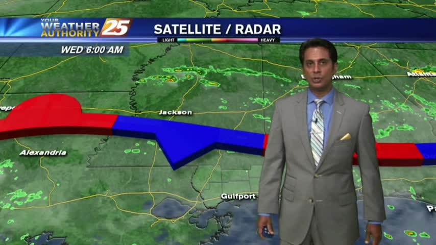
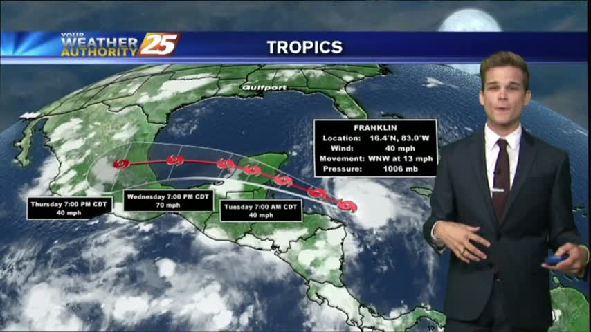
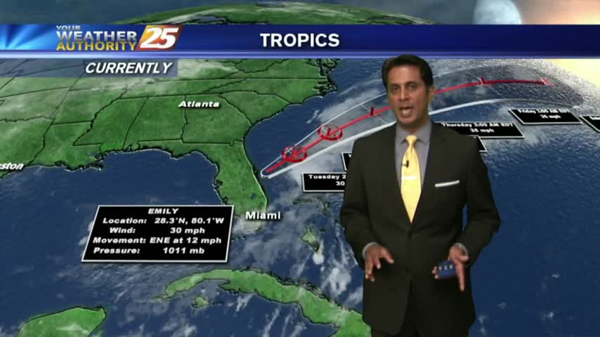
As TS Franklin moves west across the bay of Campeche, it's a warm/humid start to the day with light rain moving in from the GOM.
As TS Franklin moves west across the bay of Campeche, it's a warm/humid start to the day with light rain moving in from the GOM.

Our earlier showers have all but cleared, though more rain is expected every afternoon through the rest of the week. Watch the full forecast for more.
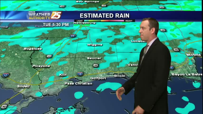
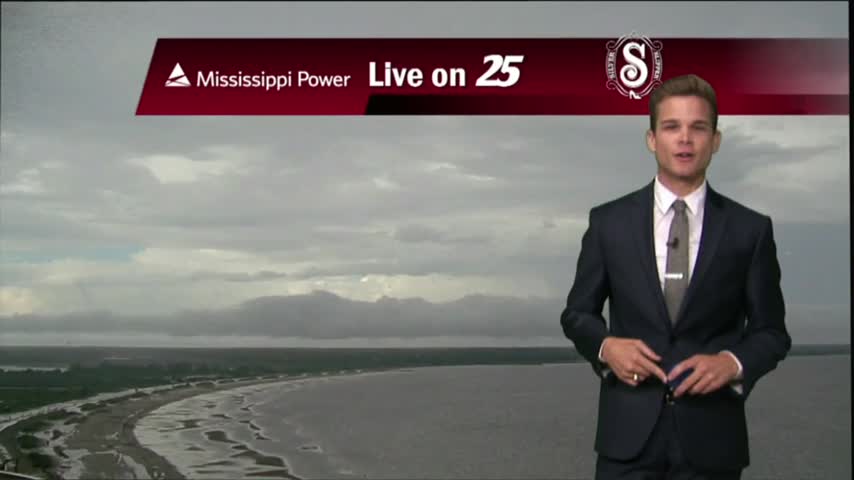
Overcast and rainy as expected, but most of the rain stayed North of the three coastal counties. Expect much more in the coming days, but you'll have to watch the full forecast for details.

We continue to see isolated showers and thunderstorms starting to develop.

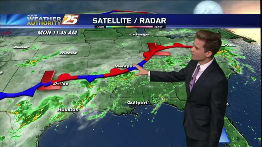
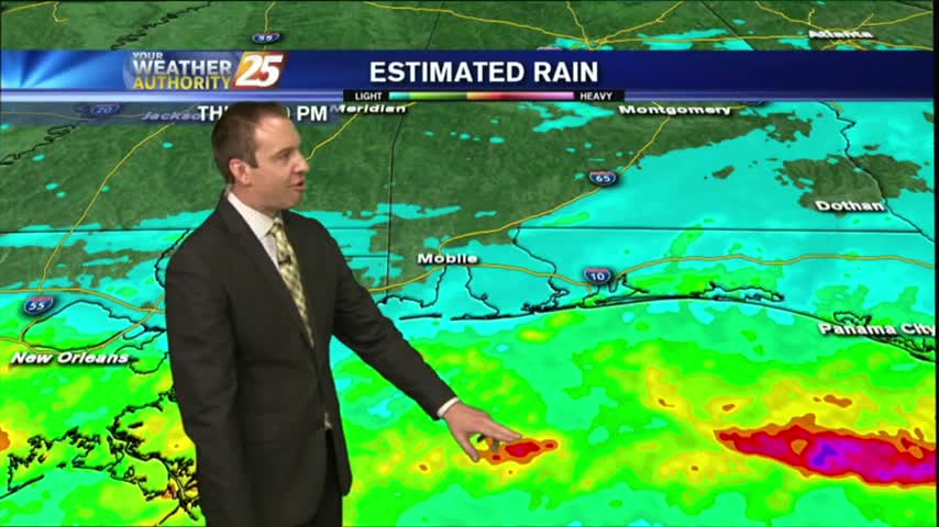
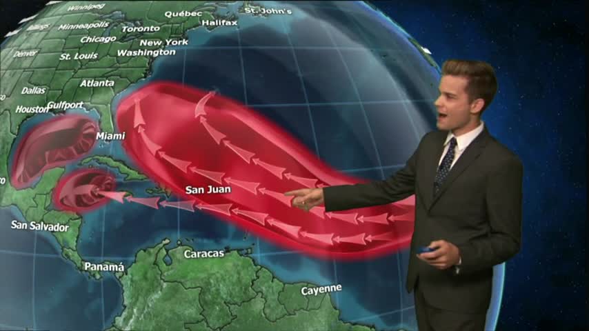
As we continue to keep an eye on TS FRANKLIN moving across the Yucatan peninsula, a VERY TROPICAL air mass continues to dominate the region...
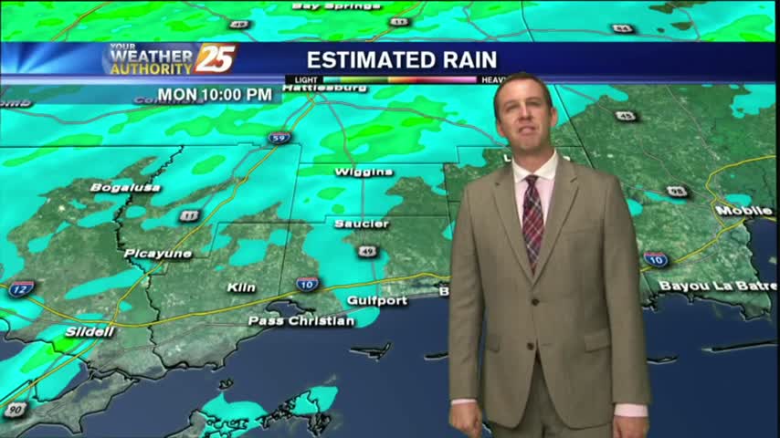
Not much rain earlier, but the rain started to move in late this evening and will continue each afternoon for the next few days. Watch the full forecast for details.
A frontal boundary is moving into the Southeast, but is not expected to pass through South MS. It will however, linger in the area causing several rainy days. Forecast details inside.
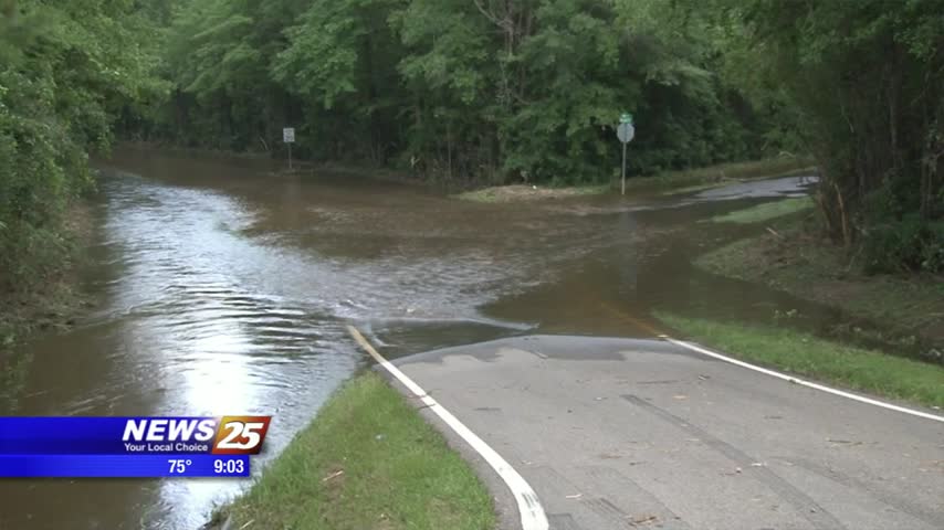
The Harrison County area is still dealing with the aftermath of yesterday’s heavy rainfall. At last check, the Biloxi River was over flood stage, cresting right around 15 feet. The good news is the water is now descending. The Biloxi…
Isolated showers and thunderstorms are possible this afternoon.

After clear skies overnight, the clouds along with isolated showers are moving in from the south...
An isolated shower is not out of the question tonight, but most should remain dry.

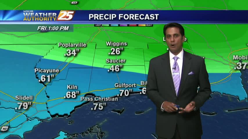
Heavy showers and thunderstorms across the area today dumped up to seven inches in some areas.
Heavy showers and thunderstorms across the area today dumped up to seven inches in some areas.

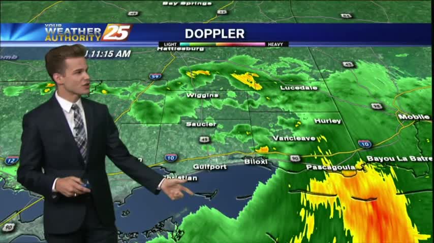
As the majority of energy stayed south yesterday, the activity has moved into south Mississippi this morning...
Didn't see the rain totals I expected for today, but rain will move in and linger through the weekend. Check out the full forecast for details.
Most of the activity is staying to our south today as it fights drier air as it moves north, but scattered showers are possible for the remainder of the day.

The stationary front from the south has moved into the area as a warm front with widespread rain through the region...

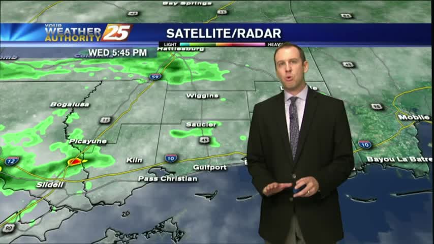
The clouds have thickened as expected throughout the day, but we haven't seen many showers yet. That will change overnight, and continue through the weekend. Details inside.
Clouds increased as expected today, and showers will begin over the next few hours. Be sure to watch the full forecast for all of this weekend's rainy details.
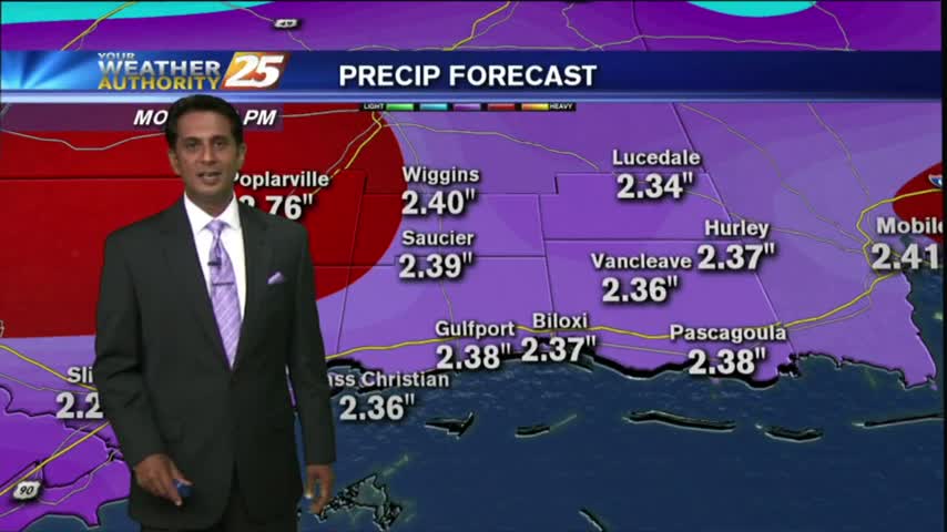
A quasi-stationary front will move into the area from the central Gulf of Mexico later this evening...the WET PATTERN will begin.
A more humid start to the day with partly/mostly cloudy skies moving in from the west...

Today was the last of the dry, sunny, and pleasant days; but the really yucky weather won't start until Thursday. Watch the full forecast for details.
A beautiful day to start August with temperatures in the upper 80s and sunny skies, but changes are on the way.
A pleasant start to the day with several reporting sites in the mid/upper 60s, under clear skies...