10/26 Ryan’s “Calm Before the Storms” Tuesday Night Forecast
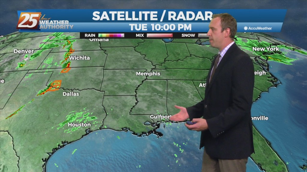
A weak front brought some short-lived changes today, but it's just the calm before tomorrow's storms. That’s all going to be due to a much stronger…
A weak front brought some short-lived changes today, but it's just the calm before tomorrow's storms. That’s all going to be due to a much stronger…
A weak front brought some short-lived changes today, but much more significant changes begin tomorrow. That's all going to be due to a much stronger front, which will bring…
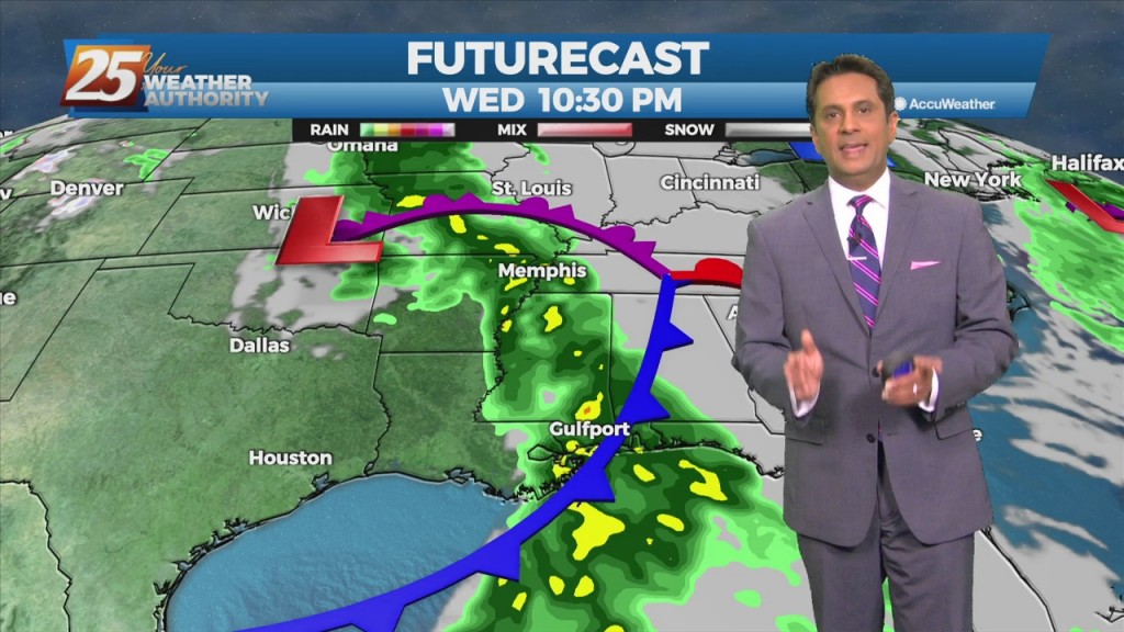
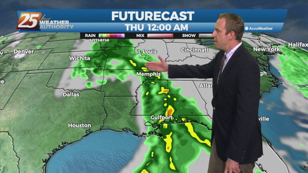
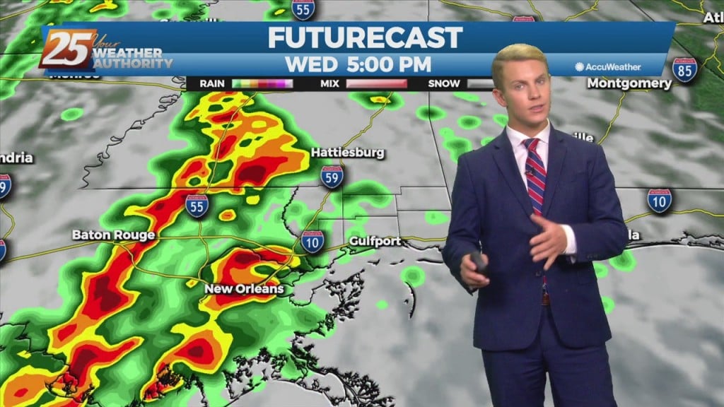
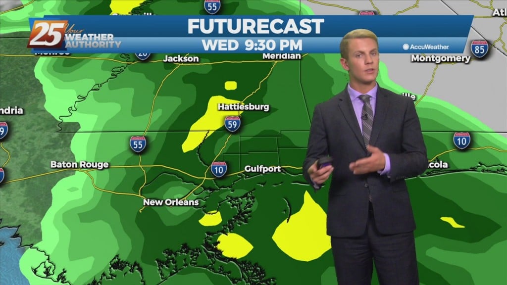
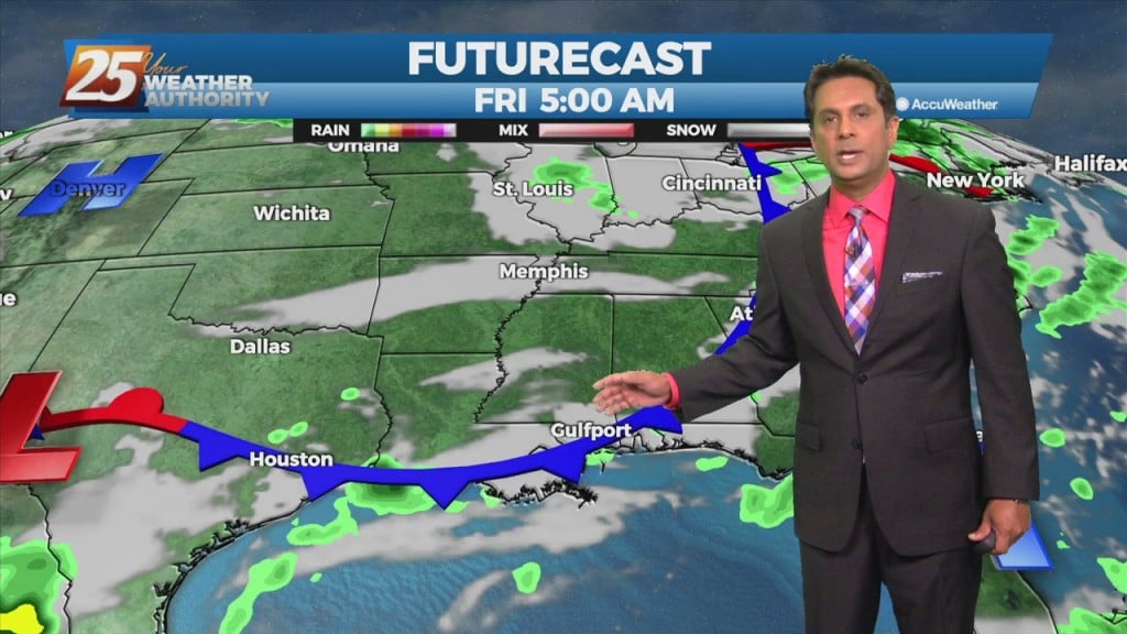
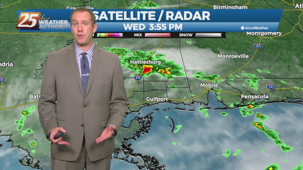
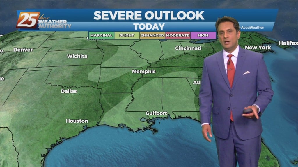
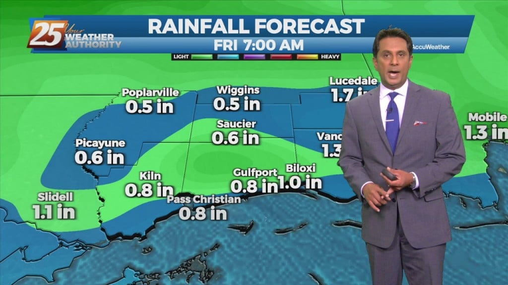
We continue to see a severe weather/heavy rain threat Wednesday afternoon and Wednesday night with much cooler weather to follow. An approaching cold front Wednesday will bring the…
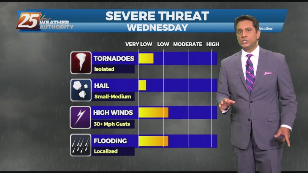
A lovely day today post dry frontal passage last night. We continue to see a severe weather/heavy rain threat Wednesday afternoon and Wednesday night with much cooler weather…
A backdoor cold front was sinking southwestward passed southwest of Baton Rouge and New Orleans since midnight. Backdoor front will gradually slip off the coast today,…
A cold front is right on top of us and will bring a sunny, drier day tomorrow, but we’ll see a quick turnaround ahead of a stronger front.…
Some big changes to our weather pattern will take place this week. Dry weather prevails at least for the beginning of the week heading into Tuesday with high…
Some big changes to our weather pattern will take place this week. Dry weather prevails at least for the beginning of the week heading into Tuesday with high pressure…
Not really any cooler today despite a cold front crawling through the area today, but tomorrow will be slightly more. Even then I'd like to be sure…
A weak cold front overhead will get an additional push further SE this evening/overnight. There is no cool down with this system but slightly drier air will…

A weak cold front overhead will linger along the coast until later afternoon before getting an additional push to the SE. Areas of patchy dense fog this…
Similar to last week, we’re seeing a cold front come through as the week comes to an end. Sadly though, this front won’t be nearly as strong and…
A shallow cold front continues to move SE through the region. Sufficient moisture in place with enough instability to support showers and a few thunderstorms will continue this…
The upper level pattern shows a trough racing eastward through the upper Mississippi Valley towards the Great Lakes. It will be too shallow to bring the associated…
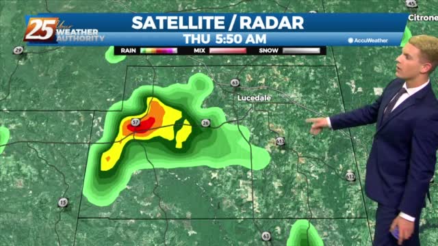
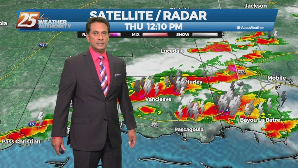
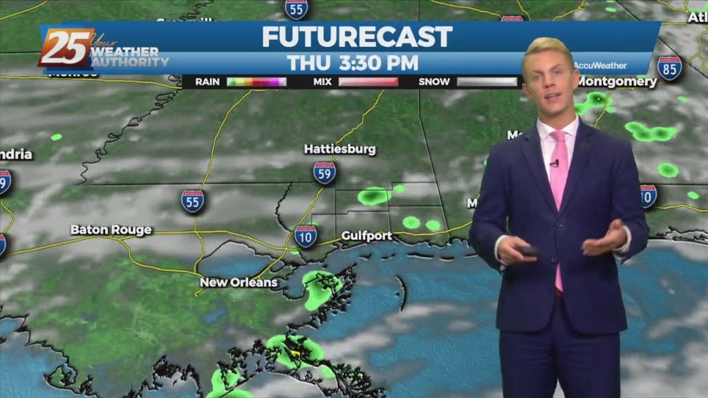
Showers and a few embedded thunderstorms are expected to increase in coverage through Thursday morning then diminish during the afternoon leaving isolated showers and storms for Thursday…
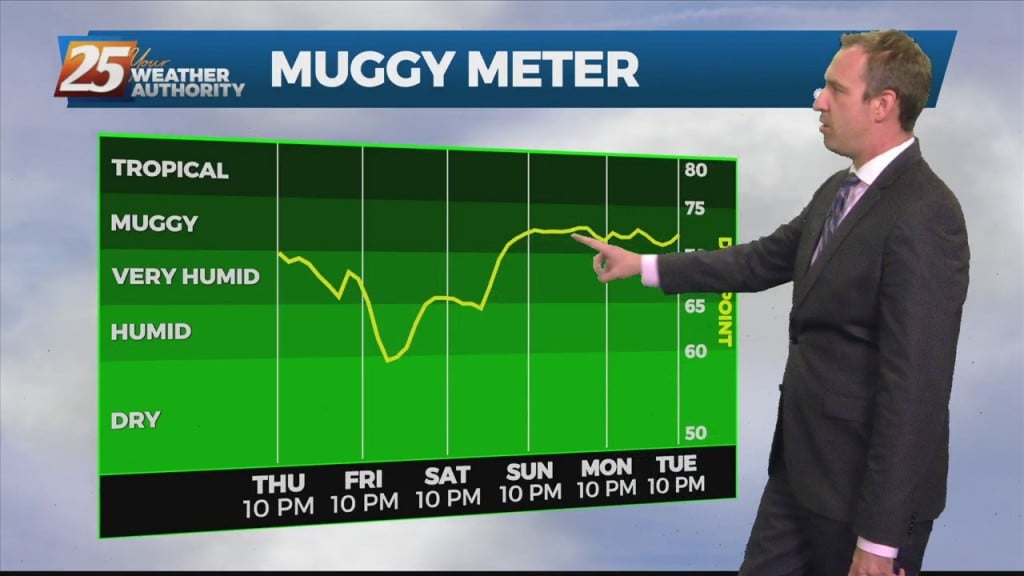
Today brought our first wet weather in over a week as much drier, cooler weather has dominated until now. That changed quickly last night as warmer, more humid…
Today brought our first wet weather in over a week as much drier, cooler weather has dominated until now. That changed quickly last night as warmer, more humid air…
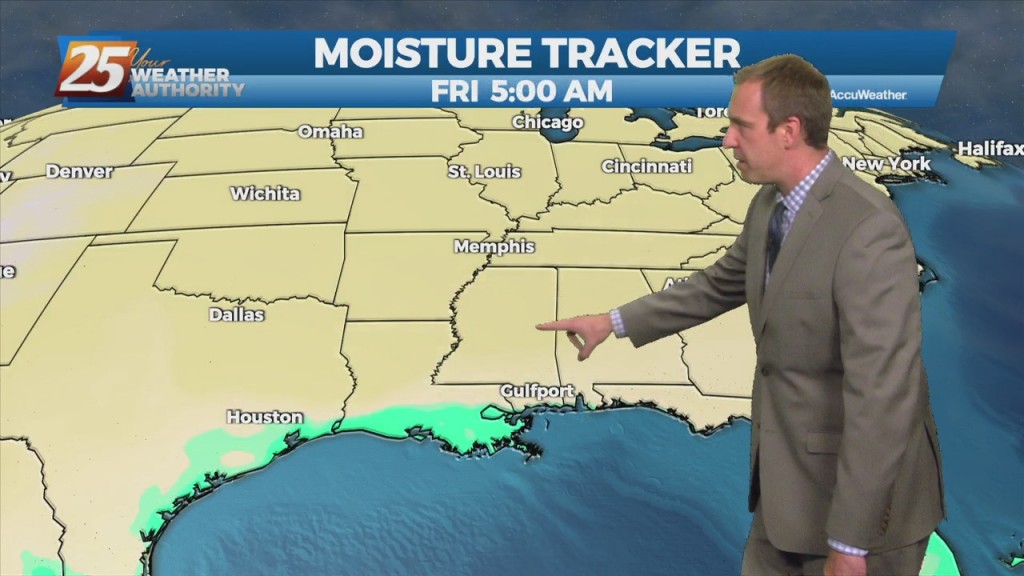
A region of high pressure NE of the area is steadily moving SE'ward, allowing for more moisture to move in from the south. A weakness in…
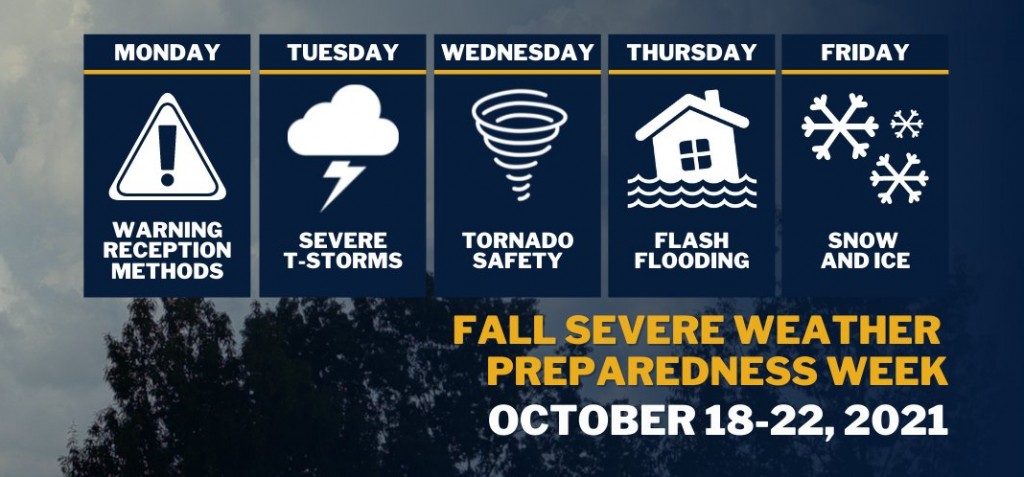
Governor Tate Reeves has declared October 18-22, 2021, as Fall Severe Weather Preparedness Week in Mississippi. “Mississippi is no stranger to severe weather,” said Governor Tate Reeves. “By preparing in advance of a storm, Mississippians can ensure they stay safe.…
Today, wet weather returns to the forecast. We are expecting quite a bit of shower activity along with a few thunderstorms. Although there may not be more than…
The weather has been nice since last weekend, but today was the last seasonal day we’ll see for over a week. This afternoon was still warm with lower…

The weather has been nice since last weekend, but today was the last seasonal day we'll see for over a week. This afternoon was still warm with lower…

High-pressure currently extends from the Gulf Coast to the Great Lakes. A minor disturbance to he SE will move NW through the area through Wednesday night. In doing so,…
A broad upper level high-pressure extends from the Gulf Coast to the Great Lakes. A trough of low-pressure off the east coast of the country will sag southwest today. In doing so, the flow will shift to more onshore which…