Wxxv25 “Today”

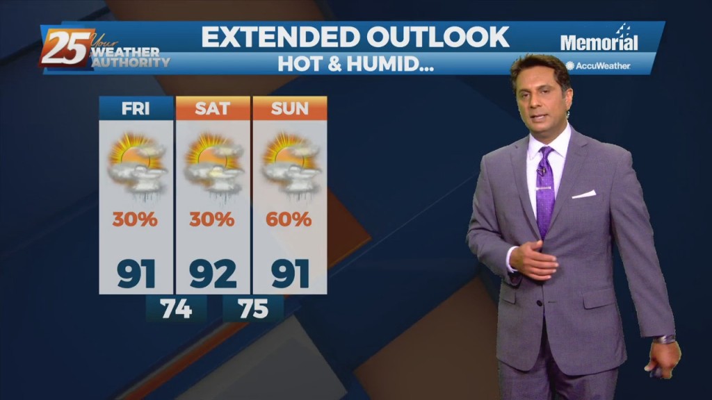
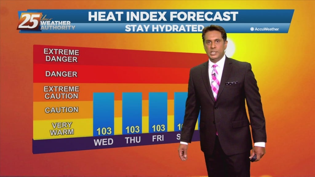
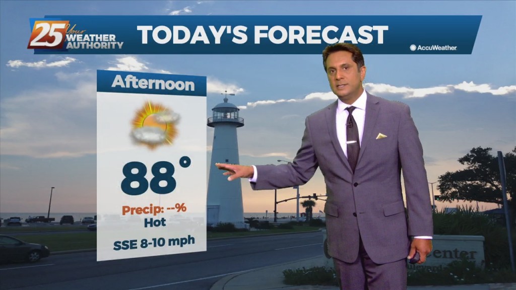
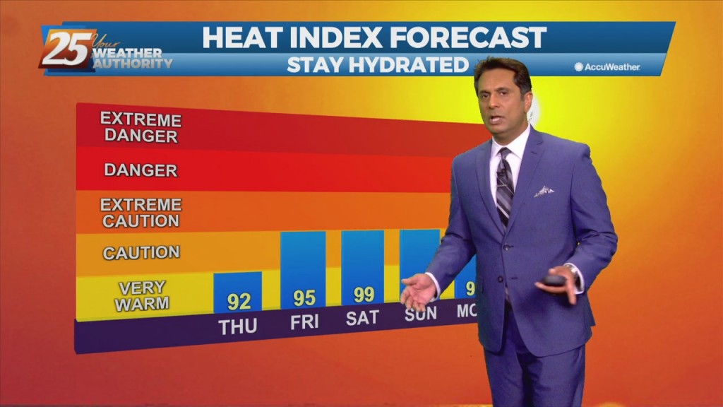
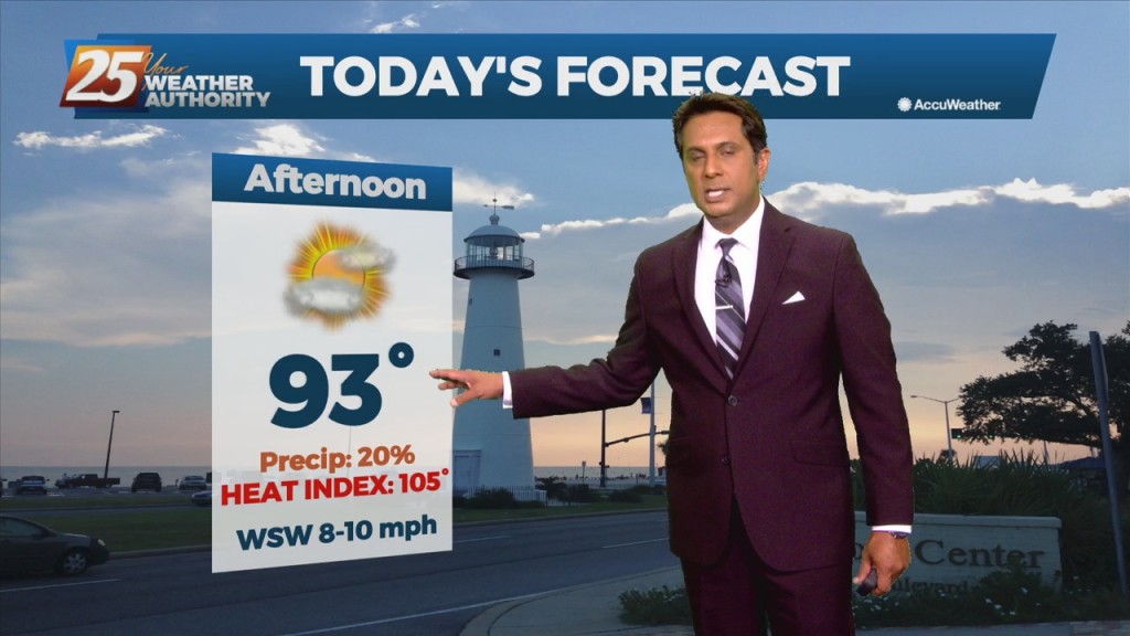
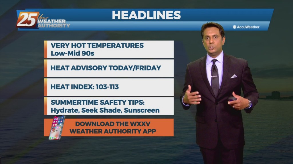
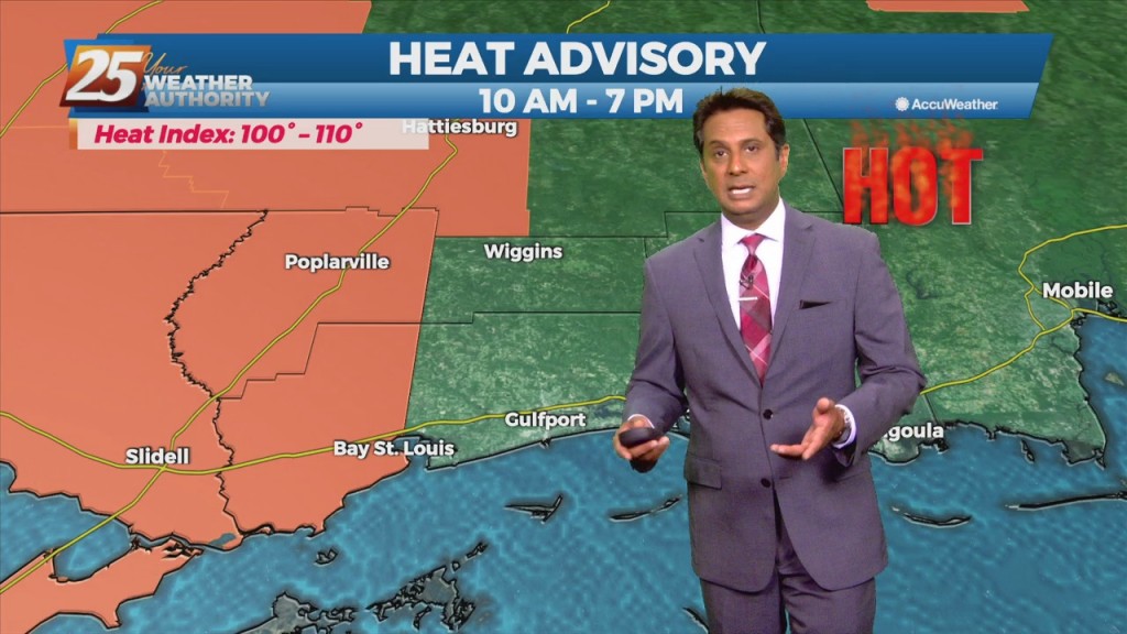
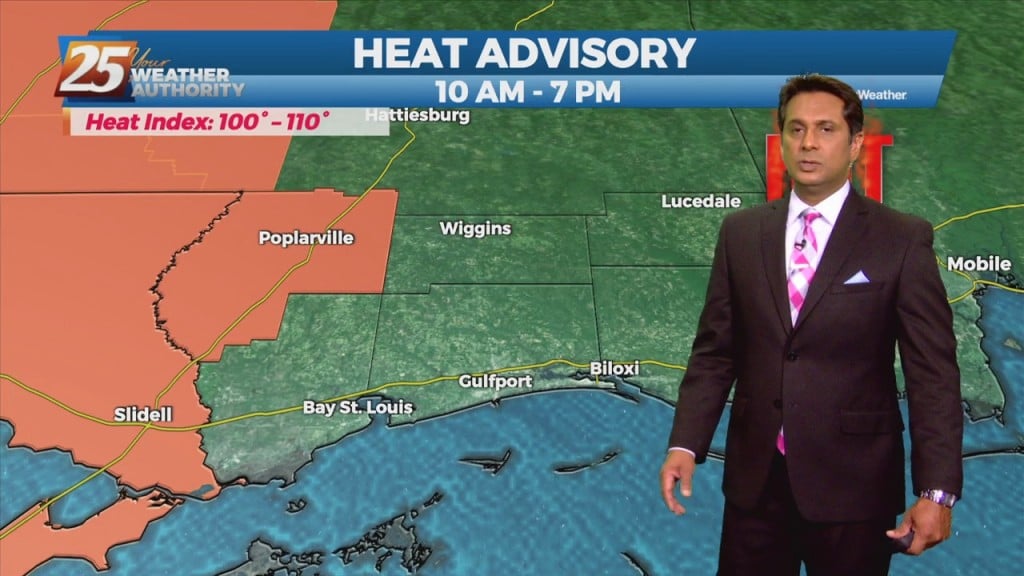
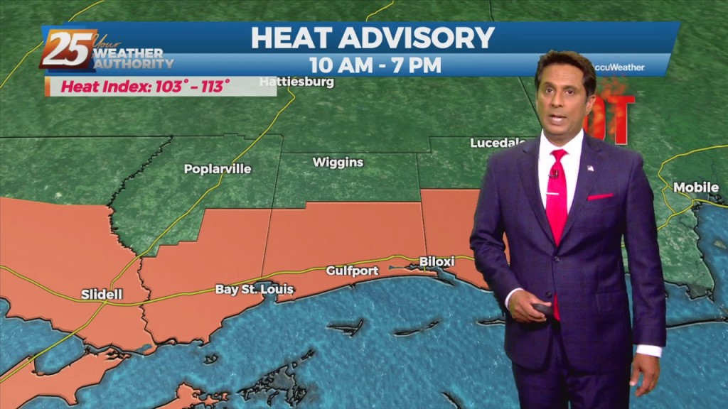
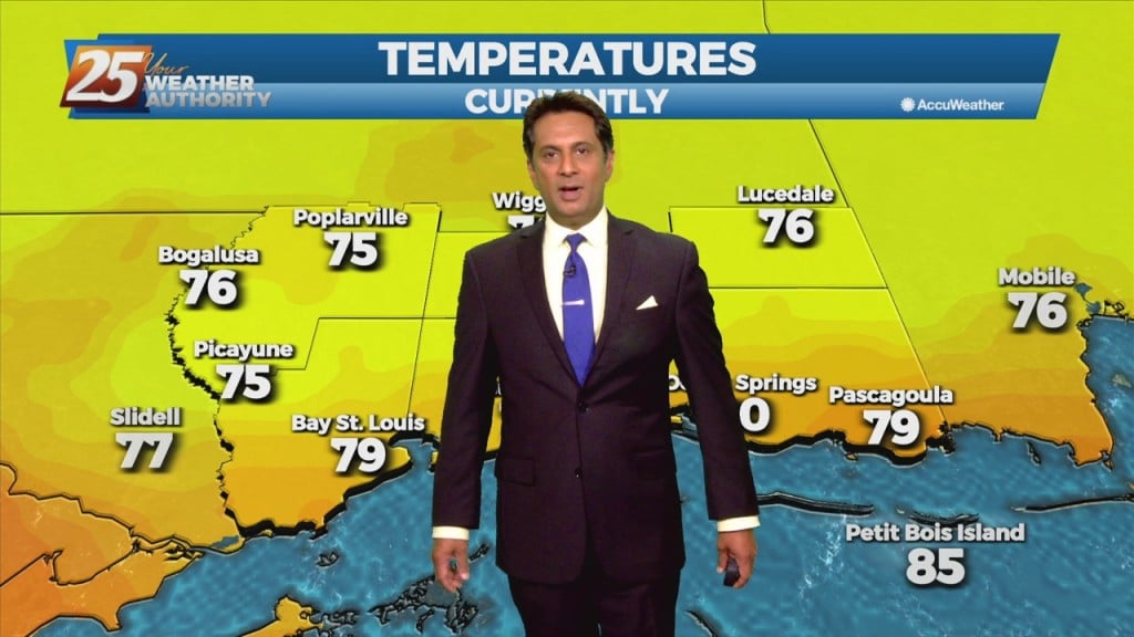
8/17 - Rob's "Higher Heat Index" Morning Forecast

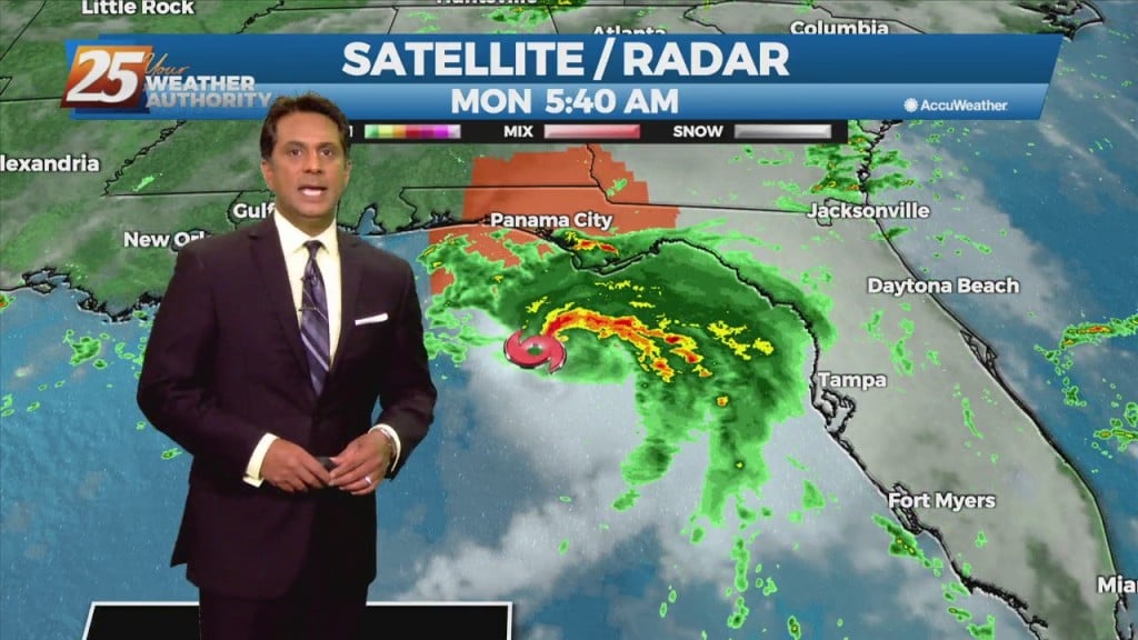
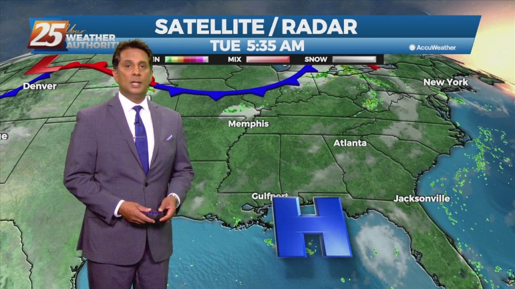
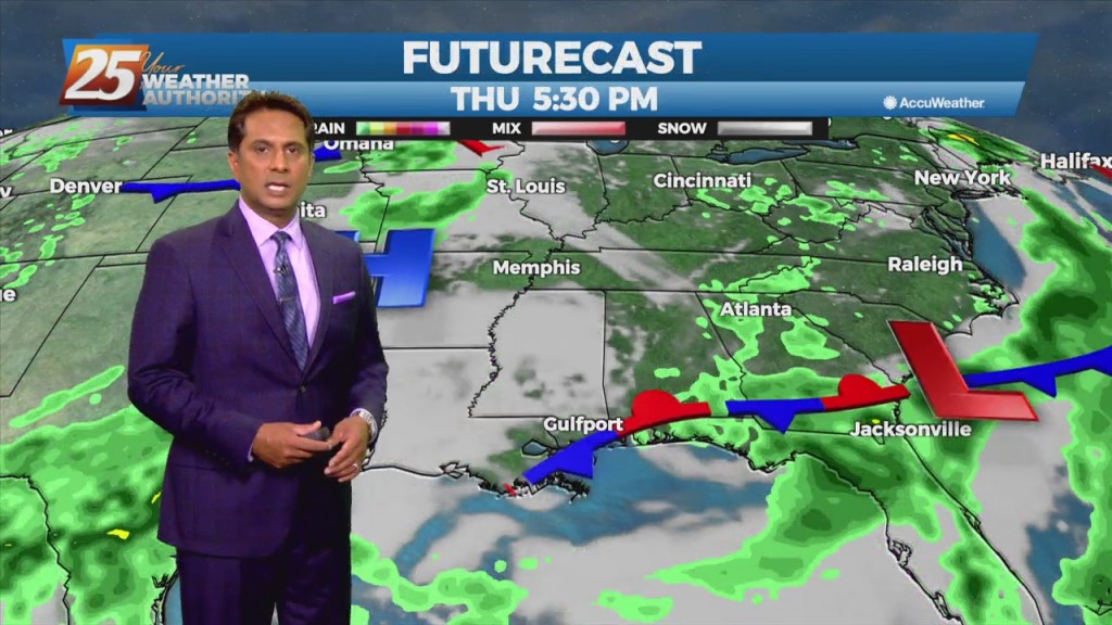
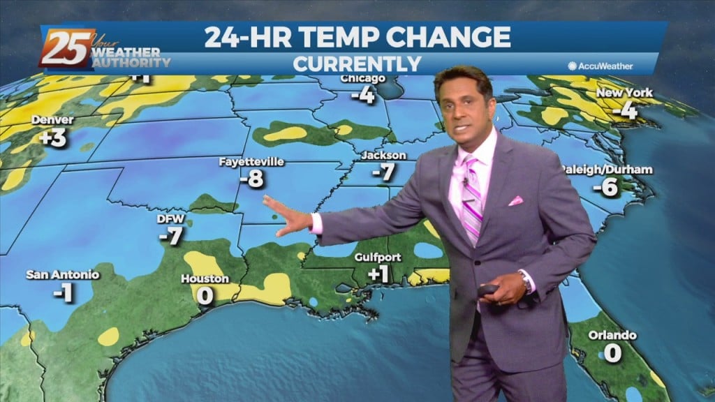
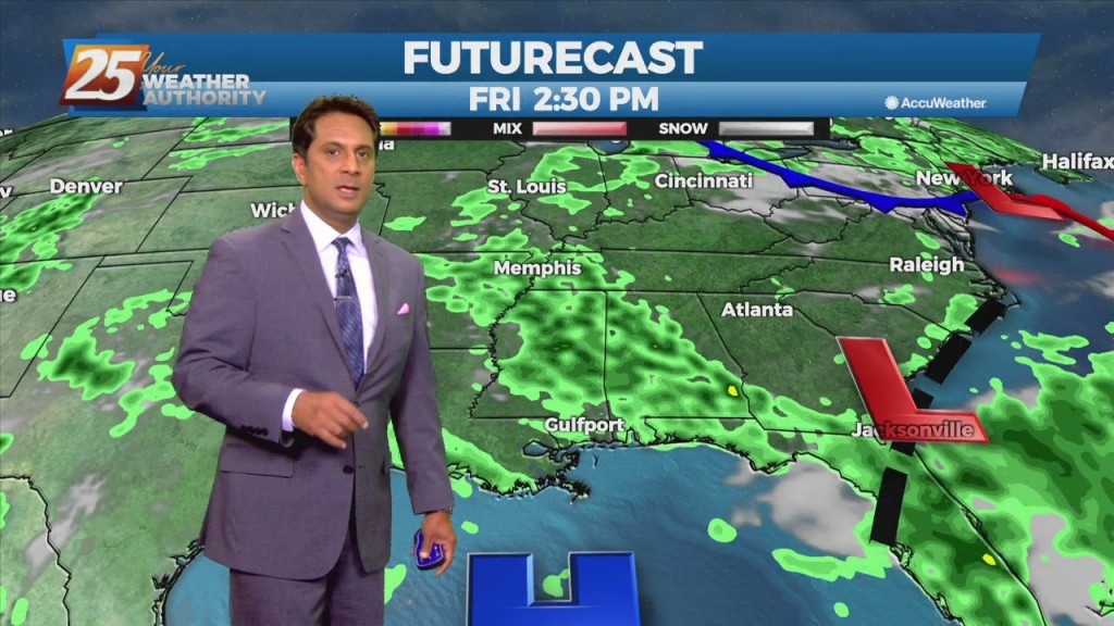
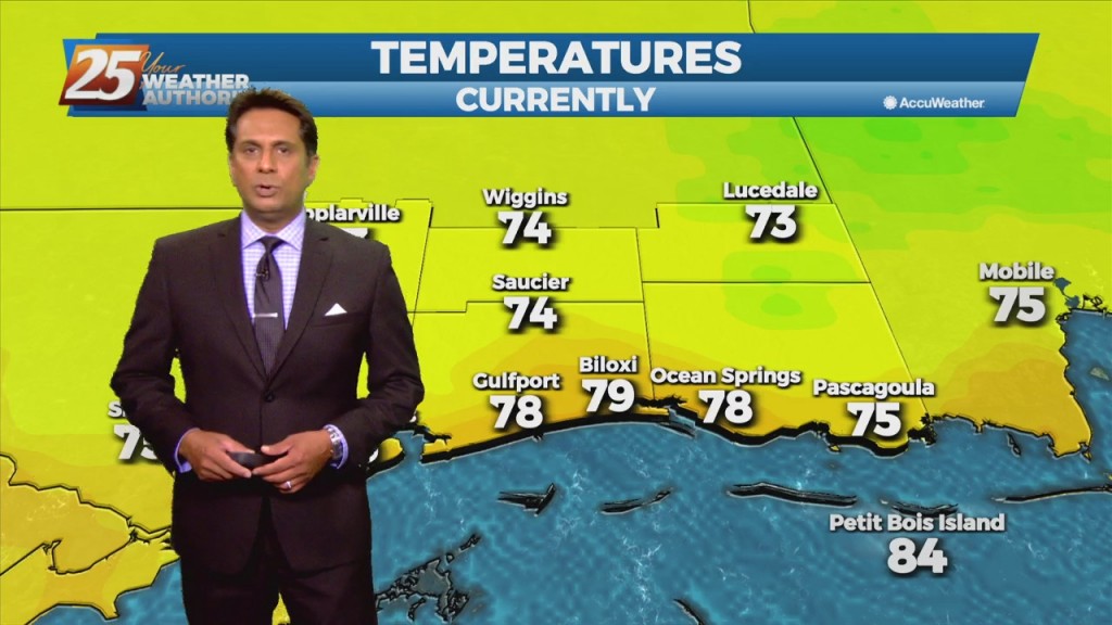
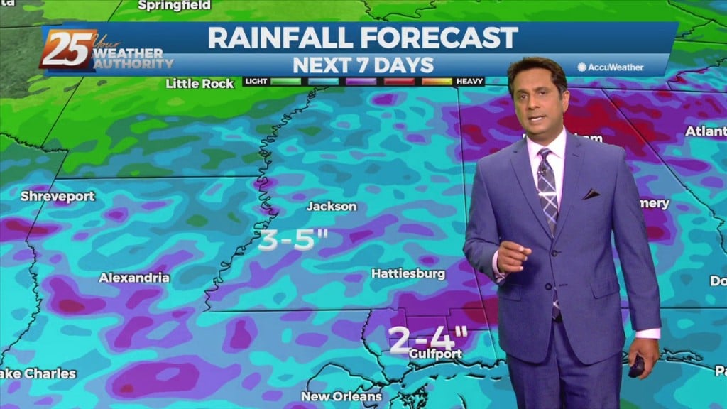
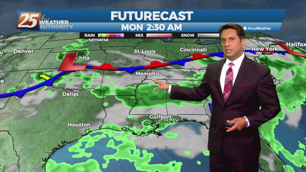
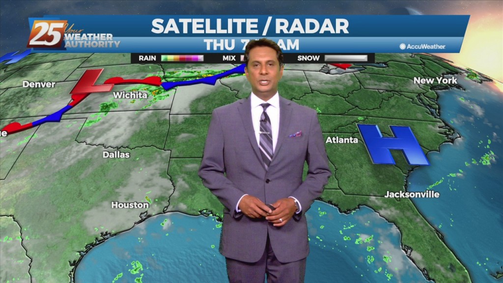
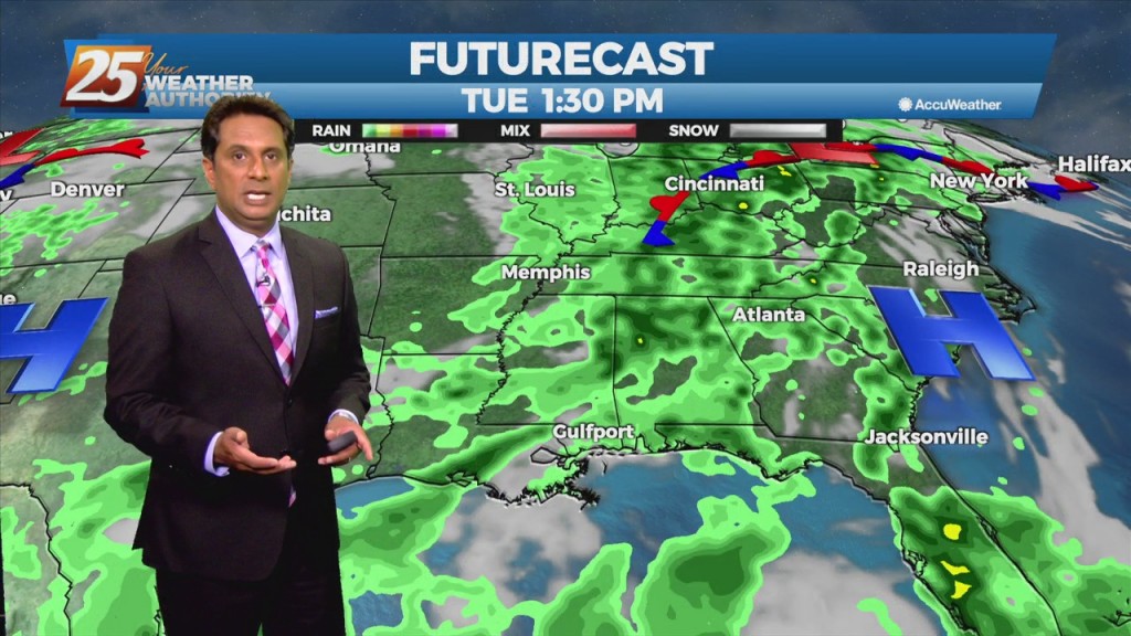
Fred has been downgraded to a tropical depression drifting north-northeast through western Georgia. Meanwhile along the northern Gulf coast, we remain parked underneath light westerly flow aloft upstream from the western section of departing TS Fred. Winds from the southwest…

8/16 - Rob's "Tracking TS Fred" Monday Morning Forecast

A typical summer day is ahead with the exception of minor additional effects from TS Fred in the NE'tern GOM. With the trough in the upper levels moving south and the continued moist air mass; this should keep some convection…

8/11 - Rob Knight's "Tracking The Tropics" Morning Forecast

Another day of afternoon shower and thunderstorm activity is on tap with precipitation chances a good deal higher overall than they were yesterday, mainly during the peak heating of the afternoon hours. This should in turn help to keep temperatures…

8/10 - Rob's "Elevated Heat Index" Tuesday Morning Forecast

The normal summertime pattern will be dominate the region through Thursday. Southerly to southeasterly surface winds will help to enhance warm air advection and moisture advection over the next few days, which will help with lifting in the environment. Scattered…

8/6 - Rob Knight's "More Humid" Friday/Weekend Forecast

The less humid pattern will begin a slow transition later today through the weekend. An area of high-pressure will move into the GOM as a warm front over the N'tern GOM moves north Saturday. The moisture flow will be felt…

8/5 - Rob's "Lower Humidity" Thursday Morning Forecast

Today and Friday, the lingering frontal boundary will continue to move southward into the open Gulf waters. Upper level high-pressure will build in on Thursday followed by a short wave upper level weakness moving through Friday overnight. Overall rain chances…

8/4 - Rob Knight's "Less Humid" Morning Forecast

Early this morning, what is left of a weak stationary front remains draped across our area. The front is now south of the area making a transition to a stationary front. This will bring a drier air mass into the…

8/3 - Rob's "T-Storms Continue" Tuesday Morning Forecast

Now that we've broken the back of the heat wave, our concern returns to thunderstorms and heavy rain. The frontal boundary currently along the interior counties will gradually work its way southward over the sound by tonight. The potential for another…

8/2 - Rob Knight's "Big Changes" Monday Morning Forecast

The words "cold front" and "August" are not often associated together in the Gulf coast. The persistent high-pressure over the west will allow a cold front to lag across the region through mid/late workweek. The stretch of heat and humidity…

7/29 - Rob's "Heat Advisory" Thursday Morning Forecast

More of the same hot, muggy weather is expected to continue for the next couple of days. Afternoon and early evening showers will be possible over the next few days, with a slight elevation in precip chances into the weekend.…

7/27 - Rob's "Heat Continues" Tuesday Morning Forecast

Humid air, warm temperatures, and light winds will keep the current heat advisory posted through today. The main hope for cooling will be any thunderstorm development which will be embedded in a deep easterly flow. Afternoon seabreeze should provide a…

7/22 - Rob's "Summertime Pattern" Thursday Morning Forecast

A much drier trend is already beginning to take hold with less than 20% coverage for showers/t-storms. The upper level weakness continues to hold over the mid-Atlantic and northeast with upper level high-pressure in place over the nation's mid-section. Our…

7/21 - Rob's "Changing Pattern" Wednesday Morning Forecast

A frontal boundary remains stalled from the Carolinas to southeast Texas, with a weak impulse of low-pressure currently over south central Louisiana. The boundary will remain stalled over the area today thus widespread showers and thunderstorms will develop along it…

7/20 - Rob's "Wet Tuesday" Morning Forecast

This stubborn active summertime pattern will continue throughout the middle of the workweek before a gradual drying trend expected by the end of the week. There's an area of upper level weakness over New England in place through the early…

7/15 - Rob's "Continued HOT" Thursday Morning Forecast

The Bermuda high-pressure is at the surface and aloft, extending westward across the Gulf Coast into east Texas early this morning. The eastern portions of the area may squeeze out one more relatively dry day today, as moisture flow will…

7/13 - Rob's "Hot & Hazy" Tuesday Morning Forecast

Today will bring much less in the way of rainfall than we have seen over the past several weeks. We will need to watch just how much coverage of convection develops across the coastal areas. The good news is we…