7/10 - Rob's Wednesday Morning Tropical Update
The latest on the potential for tropical impacts in South Mississippi
The latest on the potential for tropical impacts in South Mississippi
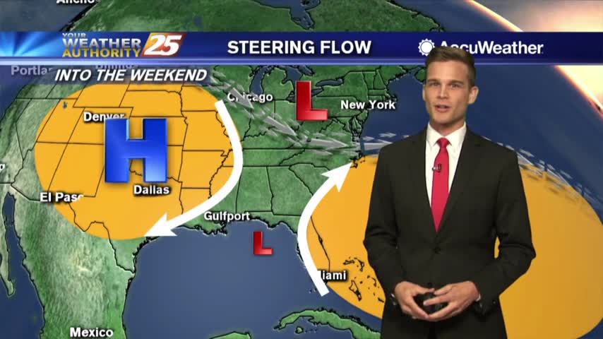
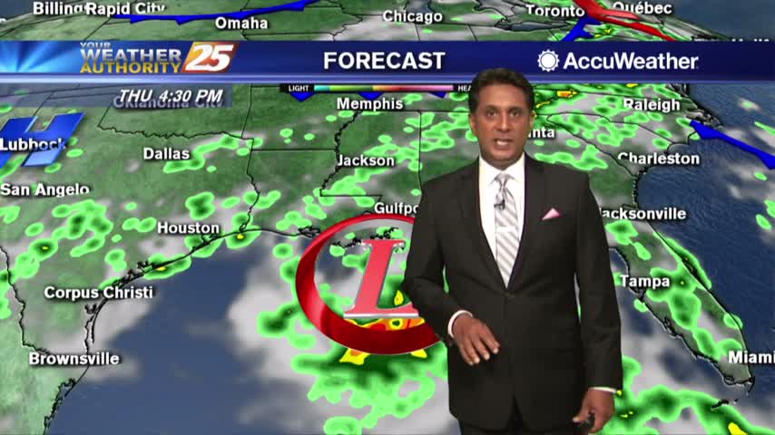
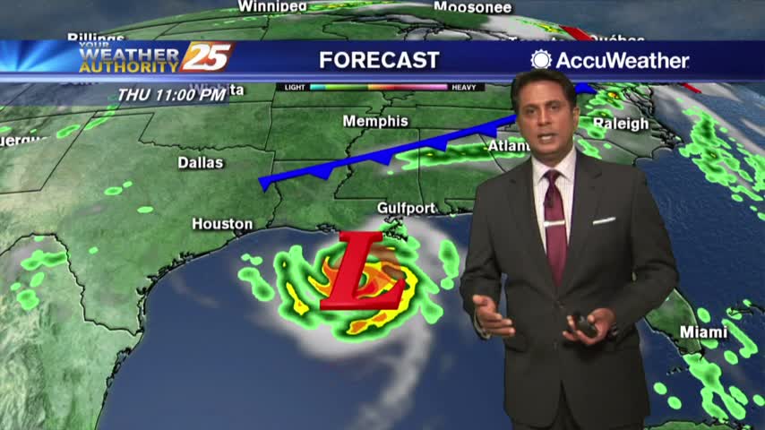
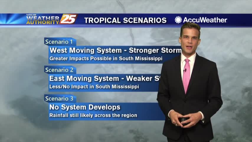
Tropical development is still likely, but impacts remain uncertain.
Another hot one and a tropical system will likely form in the Gulf of Mexico...the latest here.
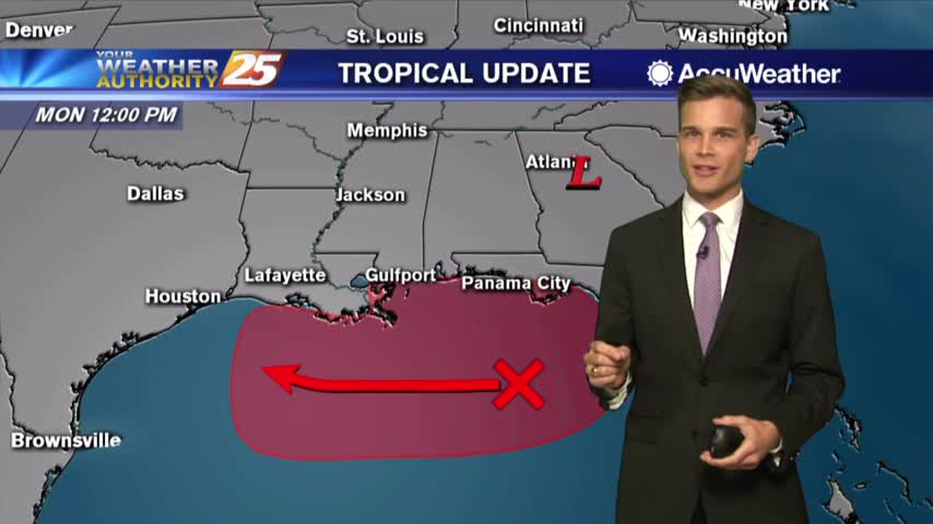
High Chance for Tropical Development in the Gulf. Here's the Latest.
The latest on the heat and tropics...
We're watching the tropics...here's what you need to know.
Temperatures are soaring into the low/mid 90s but the HEAT INDEX is making it feel like the low 100s...
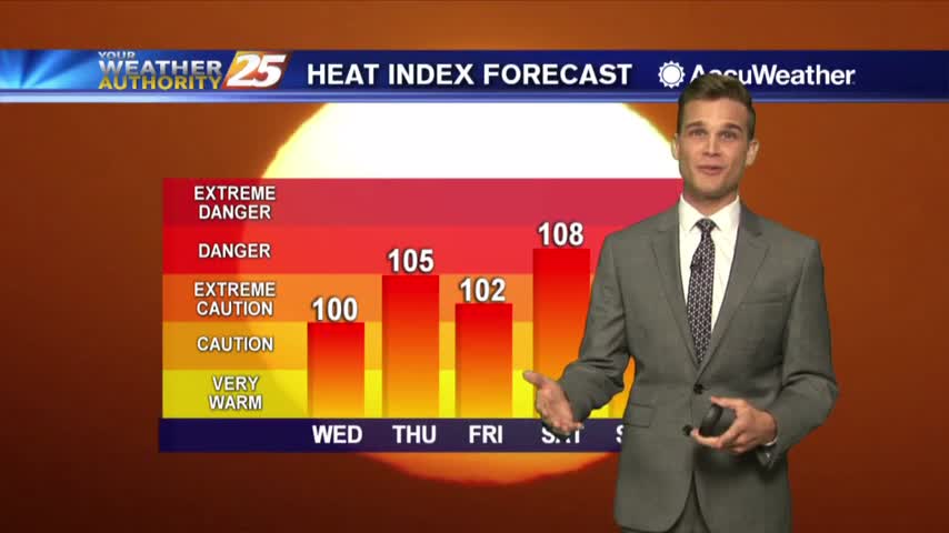
More heat and humidity. Heat index values might reach over 105 for Independence Day.

Summer in full swing but cloud cover is helping for now.
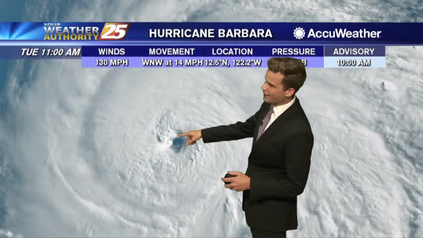
Hot and humid here...A major hurricane in the the Pacific.
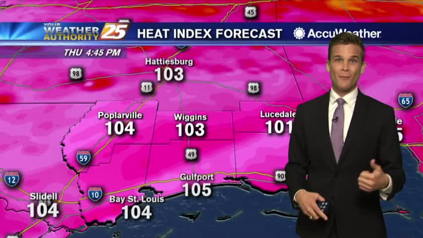
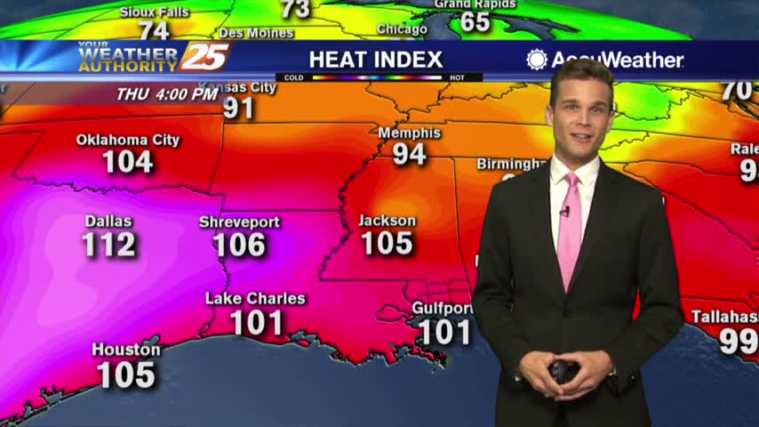
Heat index values may reach over 110 as we head into the weekend.
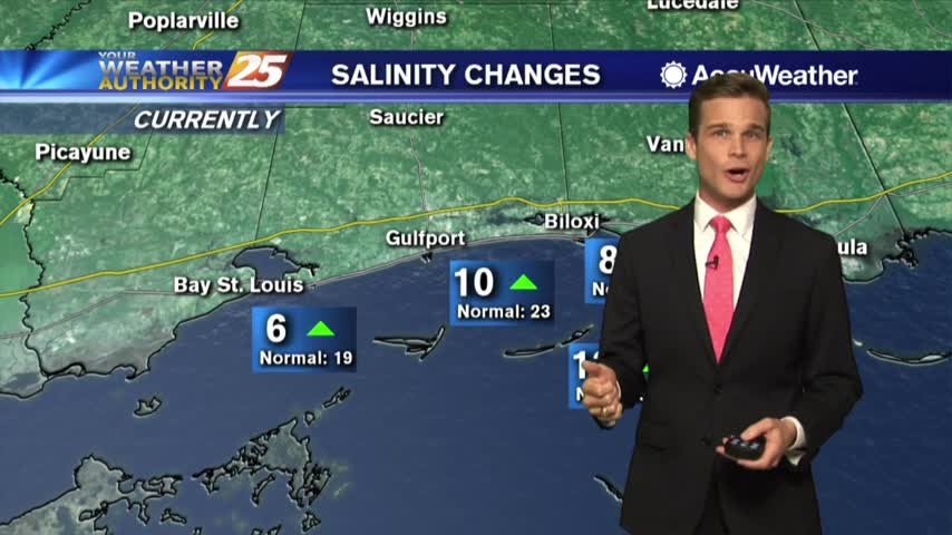
Hot & humid to start the month...and an update on salinity levels.
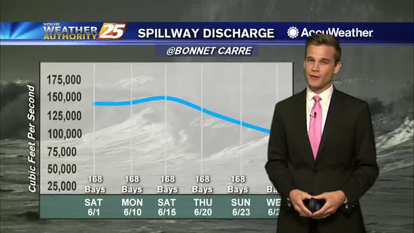
Not a lot of change in the summertime forecast...and the latest on our gulf waters.
Subsidence was quite strong yesterday and will likely keep convection from becoming numerous today…but rain potential will be slightly higher.
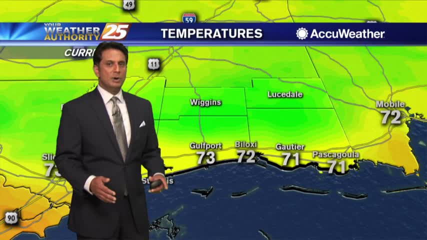
Starting off the morning dry with somewhat lower humidity...
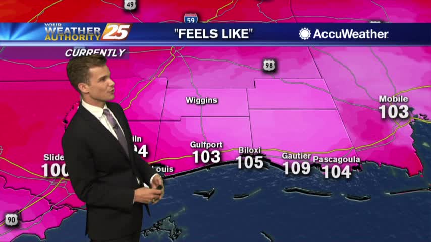
Heat indices over 110 in some location this afternoon...if you're lucky you might see some rain.
A few t-storms this afternoon could produce gusty winds and small hail.
Not as bad this afternoon with cloud cover, but the heat returns soon... the tropics remain quiet.
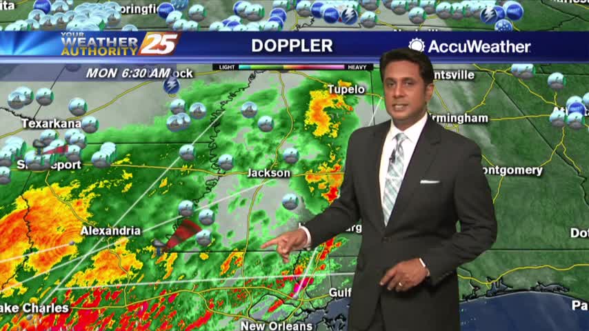
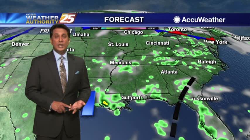
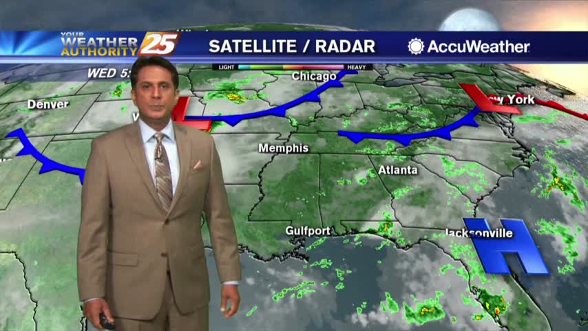
Early this morning, regional radars show a line of thunderstorms moving into the area
Maybe some relief for you Monday in the form of rain!
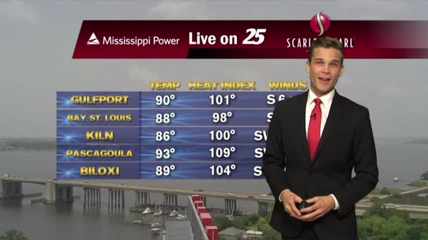
Heat Advisory until 6 PM. Limit Outdoor Activities
Heat indices over 100 this afternoon.
Another hot and humid one with a low low chance of a popup t-storm on the coast.
Drier and hotter conditions expected today, but a few t-storms can't be ruled out..