06/15 Ryan's "Wet Start, Rainy Week" Monday Forecast
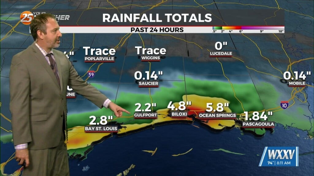
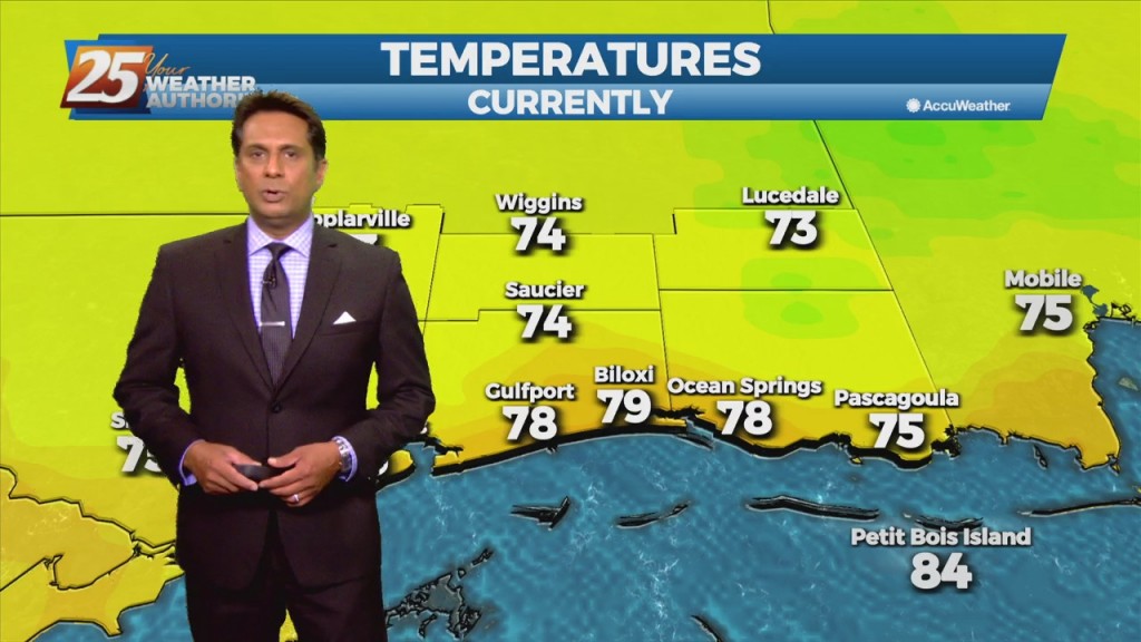
We're starting off this week on the wet side and that isn't going to change as we head into the days ahead. We already blew today's rainfall…
We're starting off this week on the wet side and that isn't going to change as we head into the days ahead. We already blew today's rainfall…
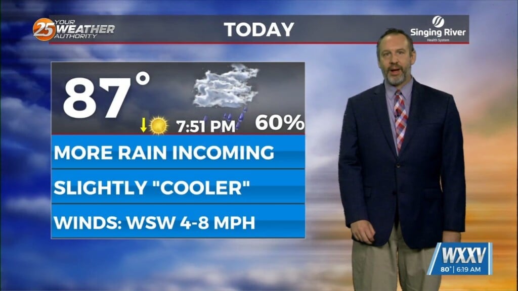
Another week, another wet start as we continue the summertime pattern we spent the last several weeks of spring enjoying. That typically means coastal/Mississippi Sound showers and thunderstorms…

Multiple disturbances are moving through west-southwesterly mid-level flow across the northern Gulf Coast. Most of the thunderstorms with these impulses are expected to track south of the area.…

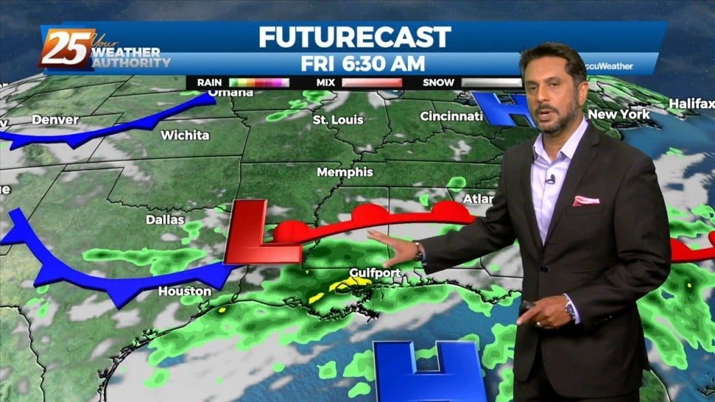
A warm front will remain along the coast today while the surface low-pressure developing over the NW gulf rides along it. This system will kick east rapidly through…

The low pressure system that brought some measurable rainfall across the region yesterday as well as gusty winds will continue to move downstream today. In the…
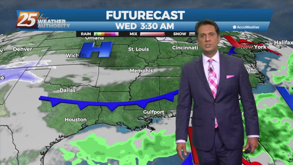
The surface analysis shows that the surface low has formed and is sitting just off the coast of Mobile early this morning. This low will continue to…
The upper system is quickly lifting northeastward through Missouri toward the Great Lakes, with the next disturbance quickly on its heels moving through the northern Rockies. Line…
Multiple disturbances expected to move through the eastern US today. One is moving through Arkansas and east Texas into Louisiana, while a stronger one is dropping…

The upper high pressure over Colorado this morning will gradually build southeastward over the next few days, even as the trough to our northeast continues to…
The broad upper level ridge stretching across the CONUS is the main pattern the area will be in for the short term (and majority of the long…

A broad upper level high pressure system is centered near the 4-Corners region extends from Mexico to Canada and CA to around MS. This eastern portion of…
Onshore flow has been a little more persistent along the Mississippi coast, and a cluster of showers/storms has been moving northward across portions of Harrison, Hancock and…
An upper low-pressure system this morning is moving into Missouri, with the associated cold front appears to extend from Jackson to Lafayette, probably just moving into the Baton…
Instability is still not impressive with this system as it moves east across the Mississippi Gulf Coast this morning. Scattered showers/t-storms will move across the area this morning…

The frontal boundary will stall just off the northern Gulf Coast thanks to high-pressure to the SE. Isolated rain with a few t-storms possible this morning with…
The main concern for today will be the front moving into the area this afternoon. The front is expected to enter the western portion of the region…
Although the front is now east of the area, post frontal rain will continue this morning, spotty rain this afternoon. It will take most of the day for…
Today we will see the moisture axis that is currently draped north to south over southeastern Louisiana almost stall out and continue to sit over the area as…
An area of low-pressure to the south along with a cold front north will continue to bring rain to the area. May not see a lot of movement…
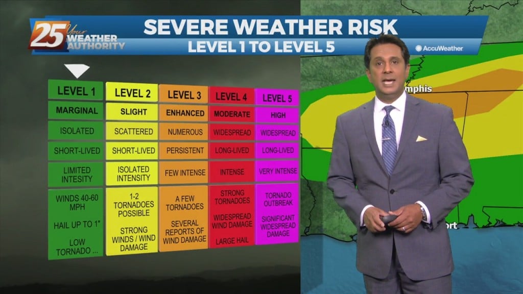
The high pressure remains just east of Florida and we'll see another impulse moving around the ridge. In the words of SPC, the chance for severe weather…

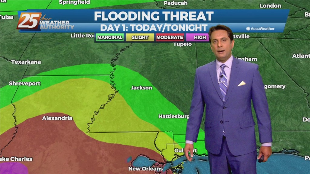
Main forecast question is on rain but it is all related to the development and location of a cutoff low-pressure. This will have some greater impacts on the forecast for Tuesday and Wednesday if the low does dig into LA. As…
As Nicholas continue NNE after making landfall last night, rain will continue through much of the region. The fetch over the gulf will also increase along with wind speeds to around 15-25kt and remain there for about 24 hours maybe…
A frontal boundary remains stalled from the Carolinas to southeast Texas, with a weak impulse of low-pressure currently over south central Louisiana. The boundary will remain stalled over the area today thus widespread showers and thunderstorms will develop along it…
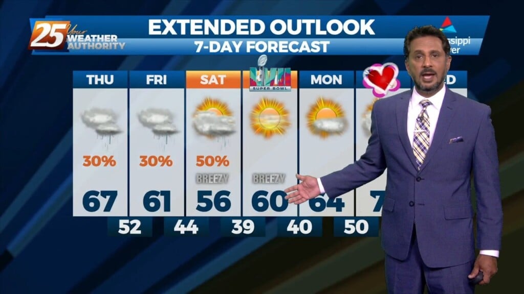
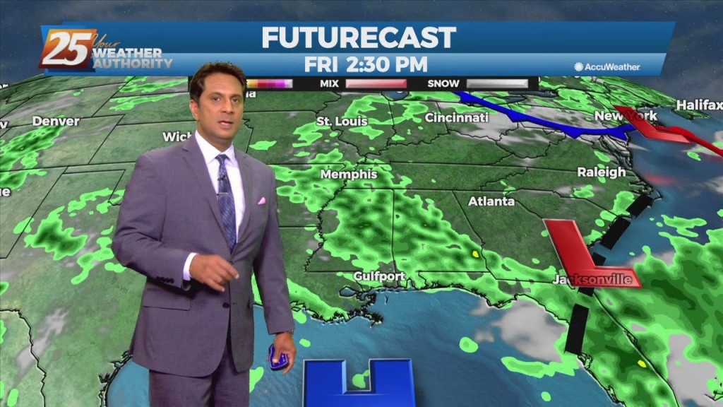
This stubborn active summertime pattern will continue throughout the middle of the workweek before a gradual drying trend expected by the end of the week. There's an area of upper level weakness over New England in place through the early…