12/2 - Rob Knight's "VERY WARM" Thursday Afternoon Forecast
Not much change in forecast parameters for the next 24 hours, with fog threat being rather high again overnight tonight. There should be enough air movement Friday…
Not much change in forecast parameters for the next 24 hours, with fog threat being rather high again overnight tonight. There should be enough air movement Friday…
Main weather issue over the next few days will be the threat of fog during the overnight hours through mid-morning. Not much change in forecast parameters for the…
HOT temperatures this afternoon then our attention shifts to the west as our next cold front approaches early Thursday. A few light showers may develop Wednesday night…
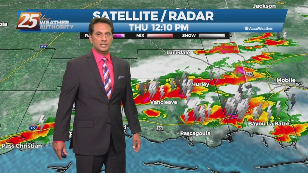
A shallow cold front continues to move SE through the region. Sufficient moisture in place with enough instability to support showers and a few thunderstorms will continue this…
The upper level pattern shows a trough racing eastward through the upper Mississippi Valley towards the Great Lakes. It will be too shallow to bring the associated…
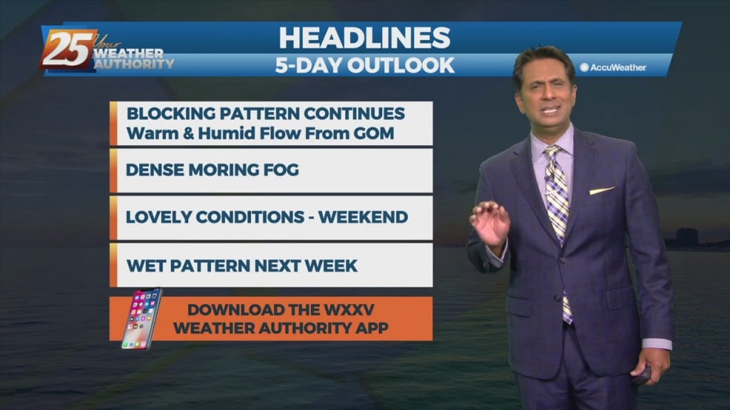
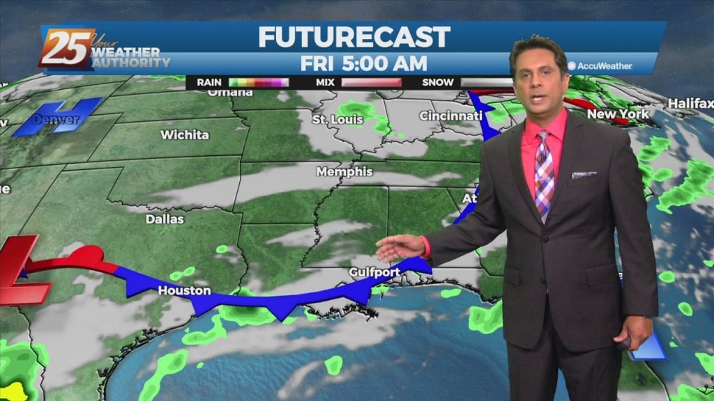
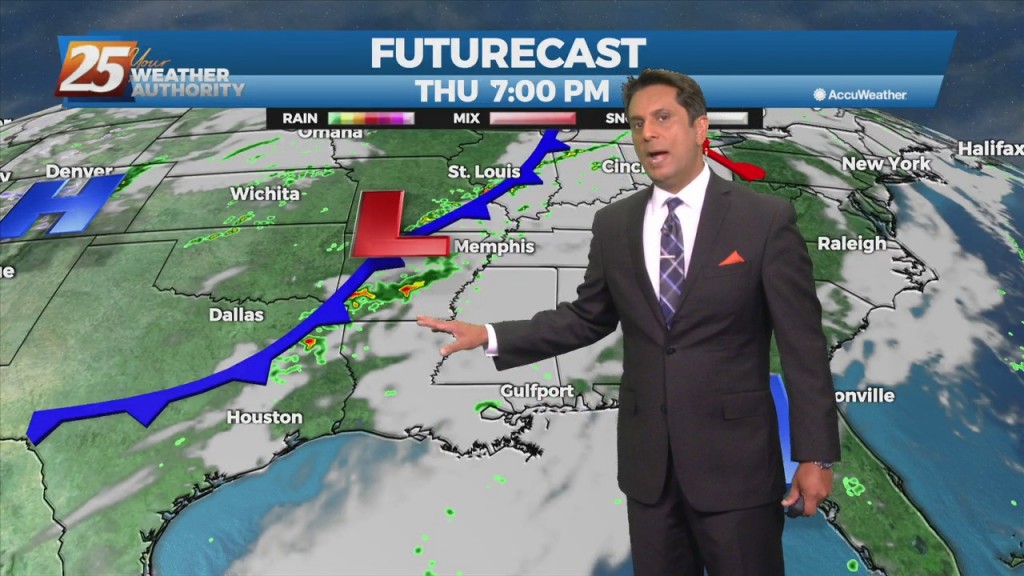
Warm & humid will continue today as an area of low-pressure along a cold front near Wichita Falls will race northeastward toward Lake Ontario by midnight tonight. The associated cold front is expected to reach northwest Louisiana by mid to…
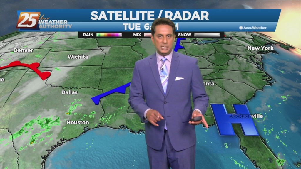
Today will bring advance moisture flow to the area in advance of a front now moving east across the southern plains. As instability slowly decreases, a few showers will be possible through tonight. A few showers will also affect the…
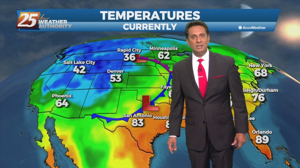
Southerly return flow around high-pressure to the east will keep us in the same weather pattern we have been in for the past week with mainly dry conditions and slightly above normal temperatures. The high-pressure will start to retreat to…
High pressure will remain anchored along the eastern seaboard and northern Gulf Coast region through most of the period. Southerly return flow around the high will keep us in the same weather pattern we have been in for the past…
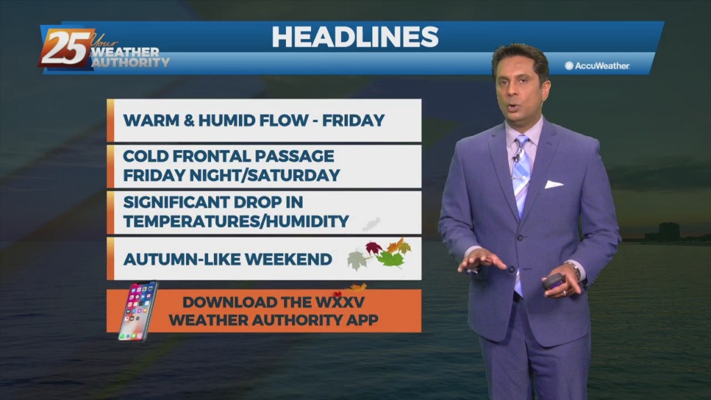
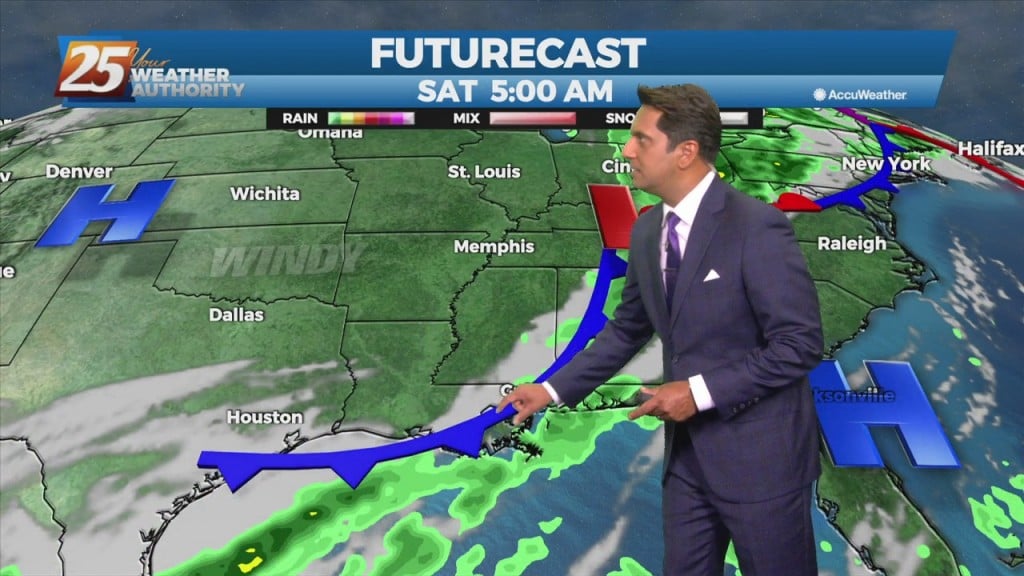
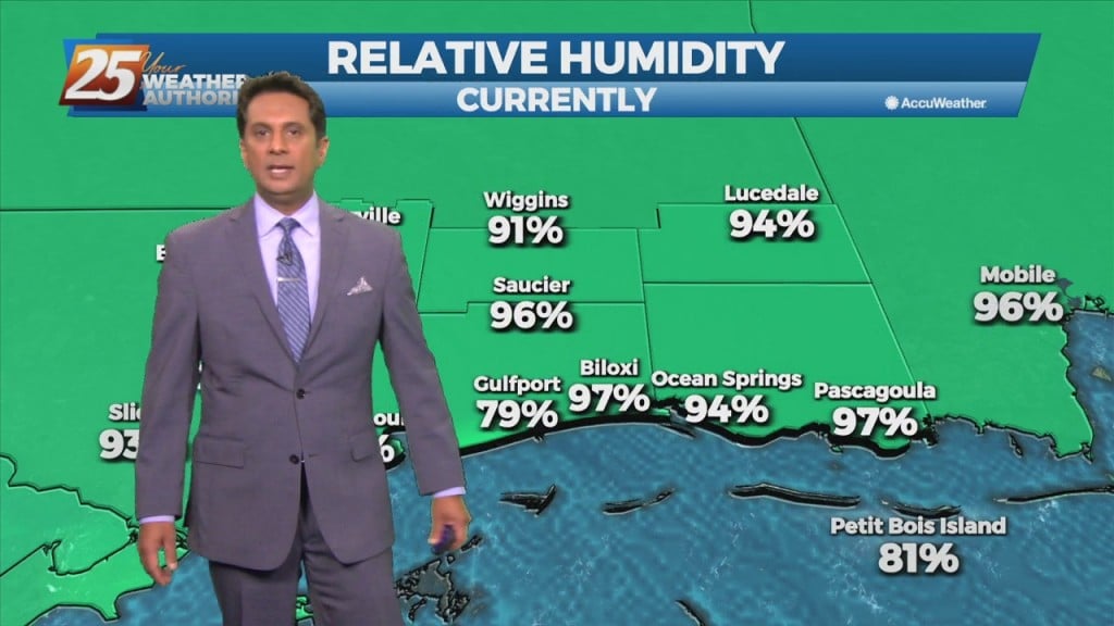
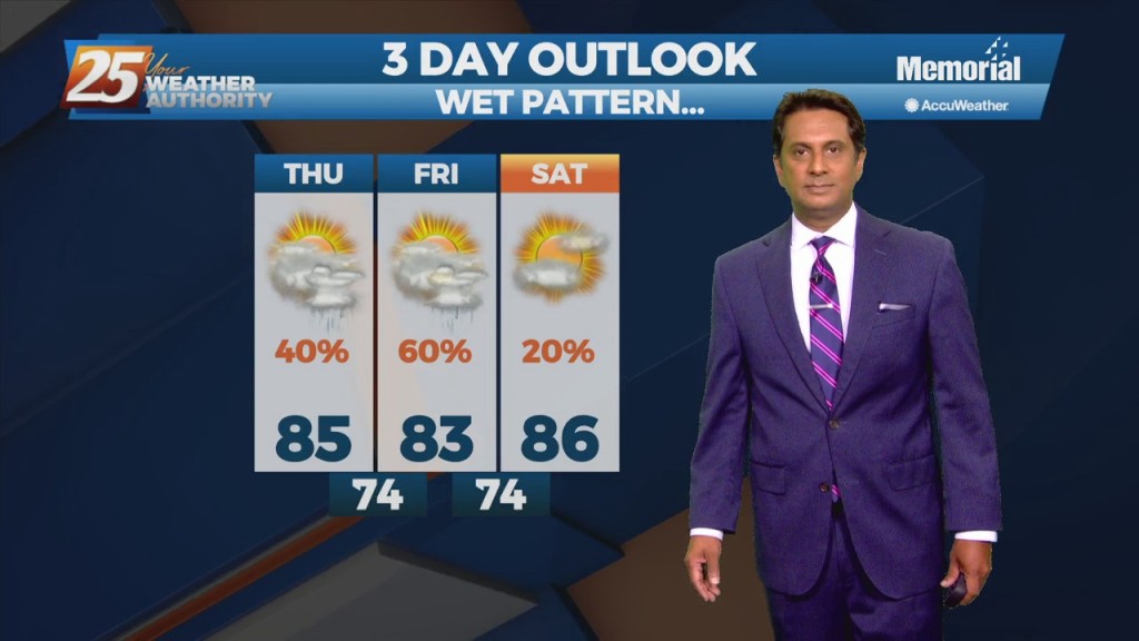
Warm & humid conditions will continue through the workweek as the return flow will yield a gradual increase in low-level moisture. Another front will make it into the Gulf south this weekend with Friday and Saturday to be the most…
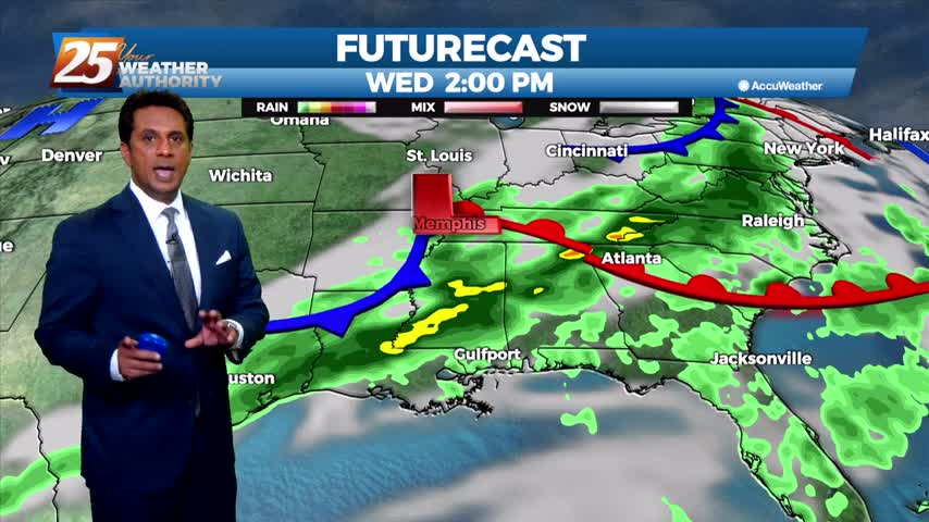
A cold front extended southward from an area of low-pressure across the Midwest, Mid-South, and then southwestward across central and southwestern LA. This will be about as close the front will make it to our area as southerly return flow…
High-pressure is expect to pretty much remain in place through the short range portion of the forecast. An approaching cold front to the NW will slowly move E/NE and ride north of the Hattiesburg area. By late Tuesday through Wednesday…
Upper level high-pressure is expect to pretty much remain in place through the short range portion of the forecast. An approaching cold front to the NW will slowly move E/NE and ride north of the Hattiesburg area. By late Tuesday…
Pulses of weak Energy from the west are expected to continue to aid a wet environment favorable for more isolated showers and thunderstorms. Isolated showers and thunderstorms may still form later than previous days and affect west of the local…
An upper level high-pressure is developing along the Mississippi Valley from Canada to the Gulf of Mexico. The moisture recovery has occurred since yesterday evening. A disturbance in the NW'tern GOM will continue to slowly move to the NW towards…
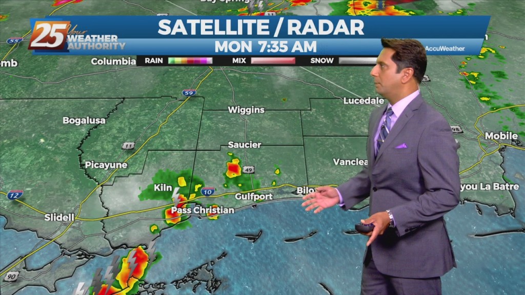
A disturbance with an associated cold front are expected to move across the area Tuesday night into Wednesday morning. Models indicate moisture flow decreasing slightly today/Tuesday, but still sufficient for at least scattered showers/t-storms. Scattered convection is also possible just…
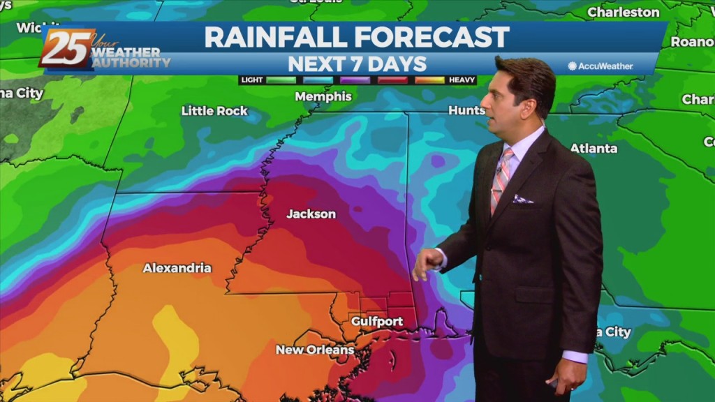
The moisture flow is back with a vengeance, which for the next several days showers/t-storms will be able to produce heavy rainfall. Activity will be moving at a good pace for the next few days which will help keep rainfall…
Another day, another wet forecast as focus will be out towards our west at a disorganized cluster of showers and storms ongoing across central LA and eastern TX. This activity remains supported by noticeable instability denoted by a broad unstable warm…
The upper level pattern analysis shows the typical summertime ridges centered to the west over Arizona and to the east in the Atlantic. In addition to that, there`s a weak upper low centered around south Texas. A trough swinging…
Clouds have rolled back in as a warm front will move north though south Mississippi this afternoon...
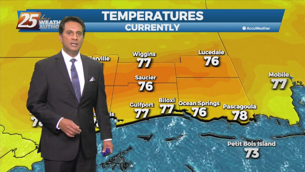
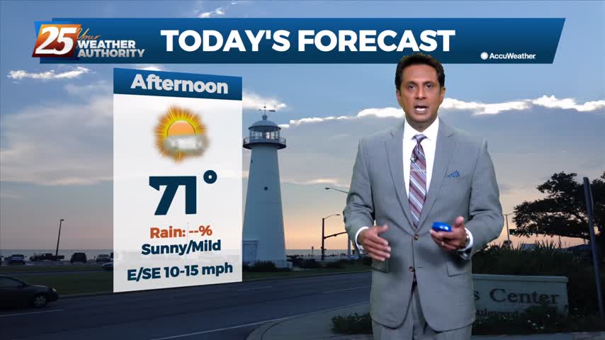
A pleasant start to the day with warmer temperatures...
This week started clear and sunny but will end grey and damp, a trend we'll continue into next week.
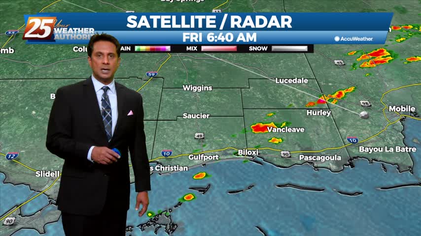
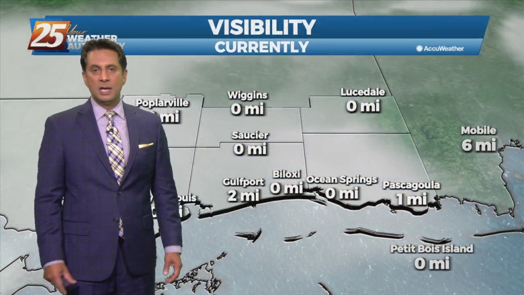
Areas of DENSE FOG affecting south Mississippi with spotty light rain...
Clouds continue to move into the area as the rest of the workweek will bring rainfall...