02/16 Ryan's "Warming...Barely" Tuesday Night Forecast
Going to be another exceptionally cold night by South MS standards, but it is warming.
Going to be another exceptionally cold night by South MS standards, but it is warming.
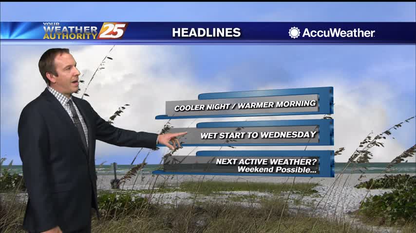
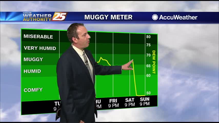
Another foggy night ahead with calm, humid conditions...and rain returns before long.
Only change from last night is even warmer and more humid air continues to flow in ahead of a series of fronts.

Expecting another cold night ahead and cool afternoon tomorrow, but things warm up quickly from there.
Not much has changed over the last few days as cloudy days and foggy nights linger, but change is moving in quickly tomorrow afternoon.
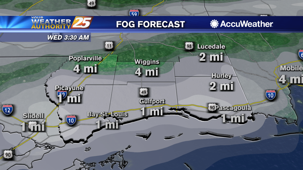
Going to be much warmer than last night, but rising humidity will lead to a few foggy areas early tomorrow morning.

Another small chance of a wintry mix tonight, but much more consistently sunny weather is on the way...it just won't be any warmer.
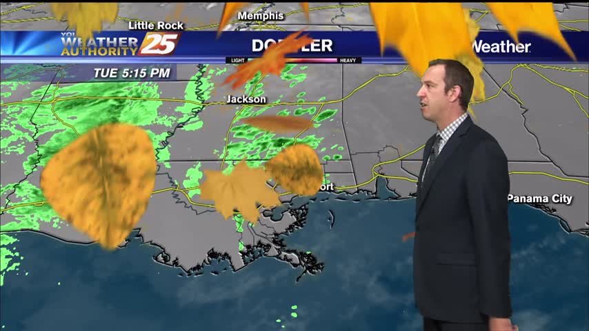
Weak front last night cleared the skies, but clouds are moving right back in overnight as our next frontal system moves in.
Our last front moved through Sunday with very little fanfare, but tonight's will be slightly more organized...still clearing out quickly though.
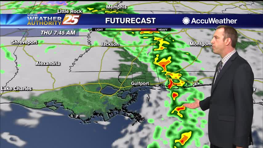
Still cloudy from the weekend, but now rain is starting to pop up and will become more frequent through the night.
We're in the midst of a nice, quiet pattern for the rest of the week, but rain does return eventually....
Another quiet day for today with another on tap tomorrow, though it does start warming significantly towards the end of the week.

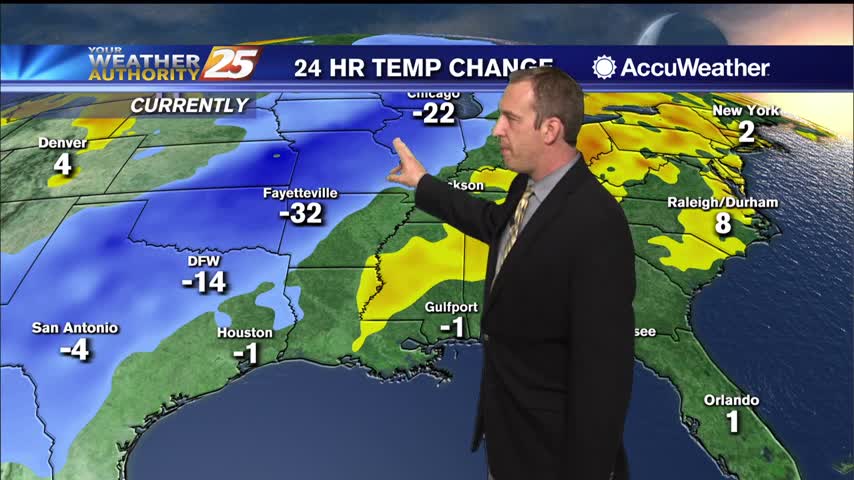
If it makes anyone feel any better about tonight's very cold weather, it will be slightly warmer than last night...slightly....
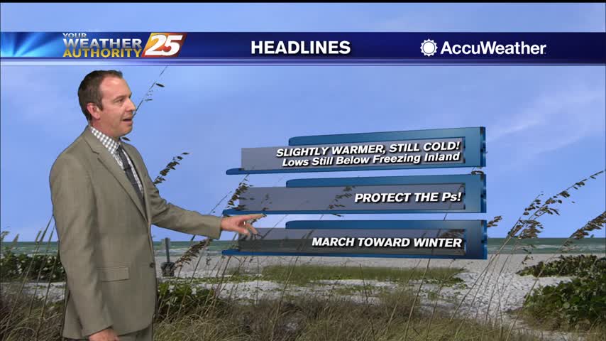
Still going to be very cold tonight, still below freezing in many areas, but will be a little warmer than last night was...a trend that'll continue through the middle of the week.
A complete 180 in only 24 hours as last night's chilly, dry air is rapidly being replaced by warm, muggy air as a new frontal system moves in....
Expect a big difference between last night and tonight as warm, moist air moves in; leading to a cloudy and wet end to the week.

Just as cool as last night and even drier, but it won't last forever....warmer, more humid days lie ahead.
Much more fall like for the next 24 hours or so, but a warming trend is on the way...as is higher humidity.
Even warmer and more humid today with a few showers, but some drier air is moving in soon...just won't be all that much cooler.
Cooler, drier air remains, but we will continue to warm steadily through the week.
Cooling has stopped, so now warming can begin as we head into the rest of the week and the weekend.
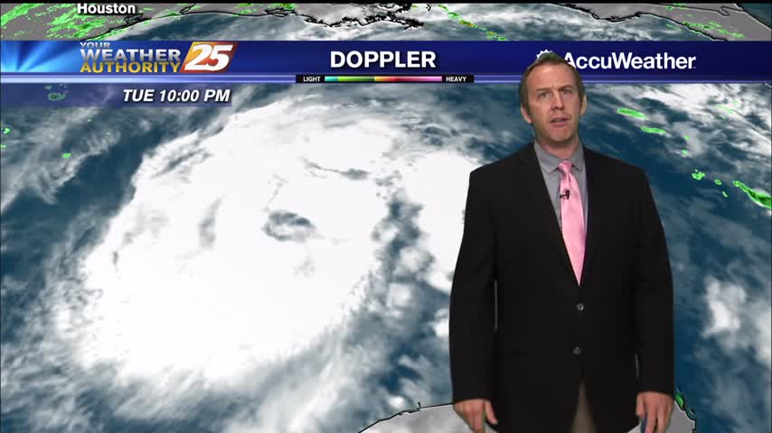
Zeta remains a tropical storm for now, but will regain hurricane status as it bears down on the Gulf Coast tomorrow evening.
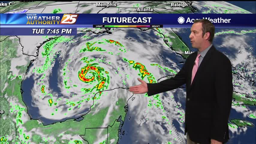
Tropical Storm Zeta is in the Gulf and expected to regain hurricane status before moving towards South MS tomorrow.
Feels more like early summer or late spring than fall right now, but slightly cooler and drier weather is on the way.