8/6 - Payton's Sunday Night Forecast
An isolated shower is not out of the question tonight, but most should remain dry.
An isolated shower is not out of the question tonight, but most should remain dry.
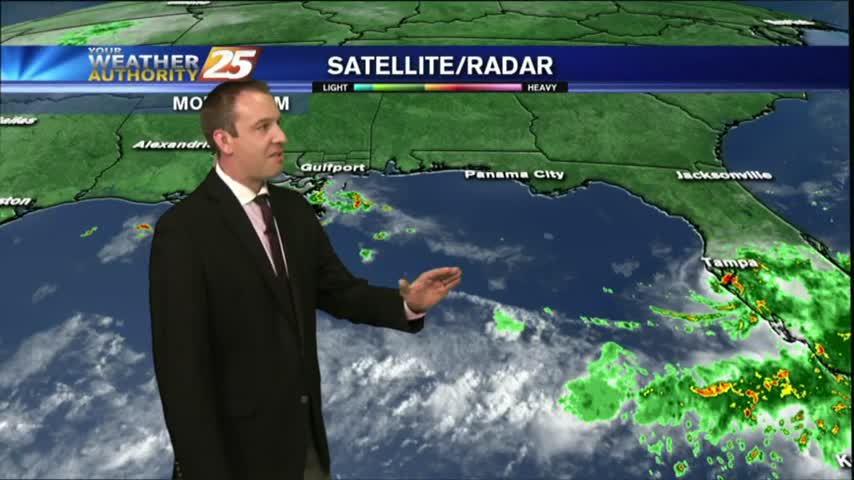
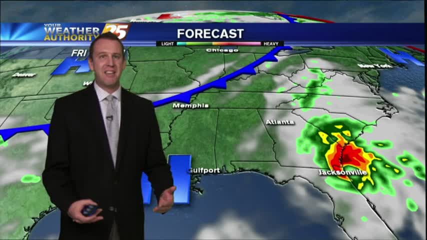
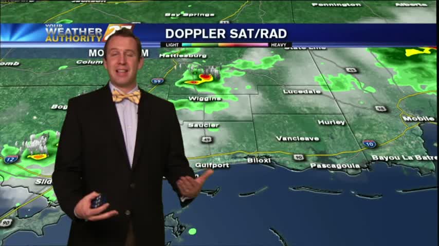
Heavy showers and thunderstorms across the area today dumped up to seven inches in some areas.
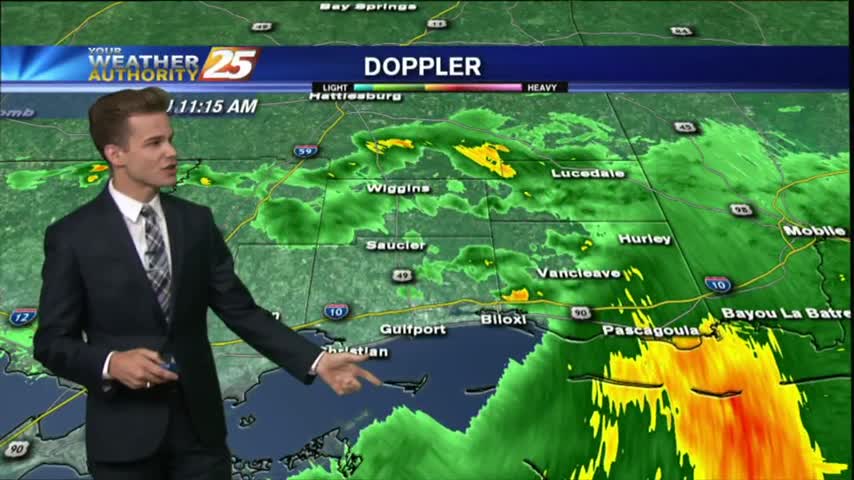
Most of the activity is staying to our south today as it fights drier air as it moves north, but scattered showers are possible for the remainder of the day.
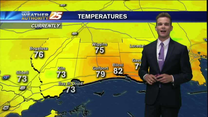
A beautiful day to start August with temperatures in the upper 80s and sunny skies, but changes are on the way.
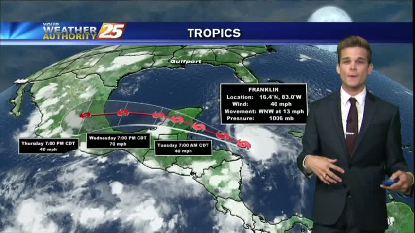
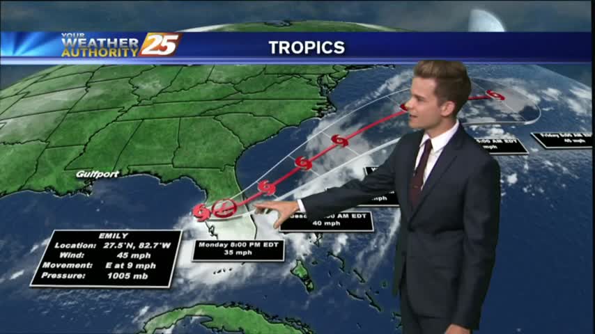
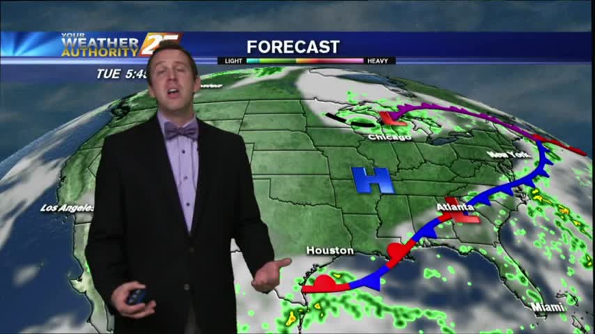
Drier and slightly cooler conditions moved into South MS, just as a developing Tropical Storm moved East! Great conditions last a little longer, but change soon. Read full forecast for details.
After a beautiful day yesterday to close-out the weekend, the drier air mass will continue to affect the region through Tuesday, but more rain is on the way.
The beginning of the week will be hot and dry, but with less moisture it won't feel quite as hot as it has the past couple weeks.
A typical summertime pattern for South Mississippi continues for most of this week.
Today will be much like yesterday with hot/humid conditions with isolated showers and thunderstorms.
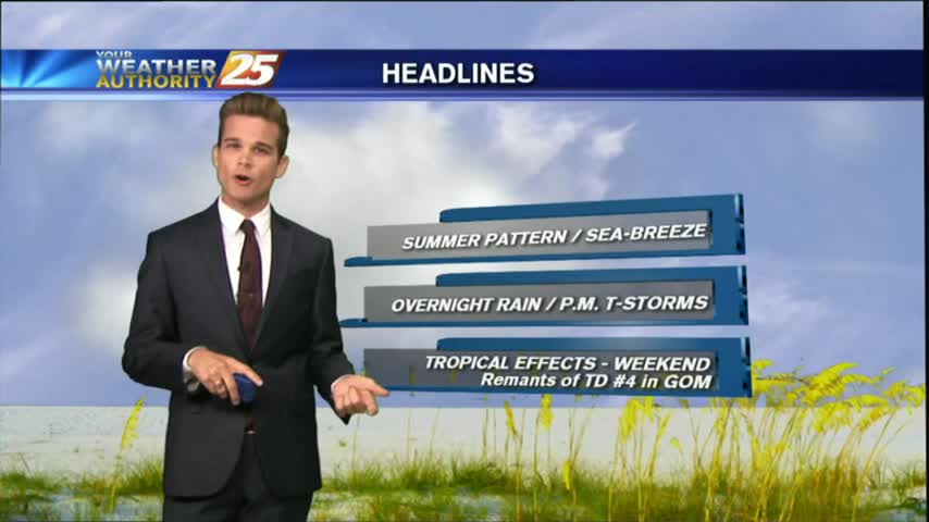
After a mostly dry holiday weekend we're in for a considerable amount of rain and a tropical storm effects! Watch the forecast for more.
Happy Father's Day! After showers and thunderstorms in the area this afternoon, most of the activity has decreased and left us with warm and muggy conditions.
Another warm & humid evening ahead tonight, but cooler days and nights are ahead. Details inside.
After a cloudy ending to a dry and sunny week, we're poised to see some Fall-like conditions all week long! Details inside.
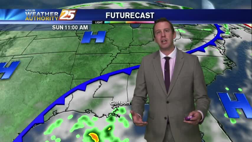
Tonight's storms are beginning to dissipate, but will return throughout the weekend. Details inside.
We finished off last week much drier than usual, but the humidity has already returned to normal. What's in store for the rest of the week? Find out, inside.
The good news is that we'll see a drier and clear evening after today's beautiful afternoon, the bad news is today was the last dry day and our humidity is returning. Temperatures will finally return to the 90s as early…

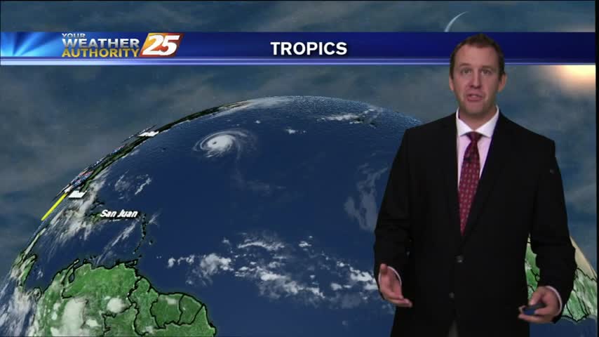
Hermine officially made landfall just after one in the morning last night. Where is she headed now? Details inside.

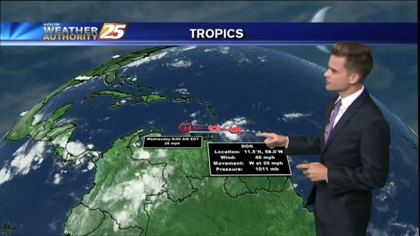
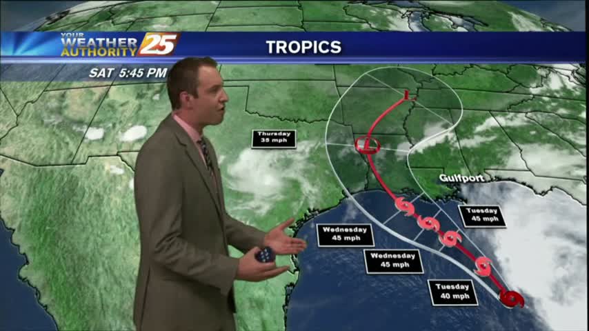
TD 9 finally reached Tropical Storm status, but just where is she headed? Find out inside.
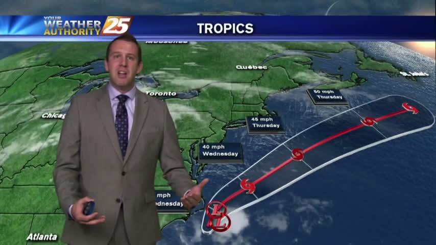
Still playing "hurry up and wait" with the tropics. Details inside!
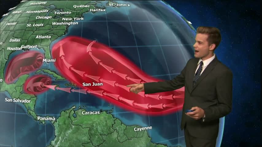
11 years after Katrina and we're still seeing some of the damage left behind. Also, several potential tropical systems moving around the Atlantic, so I break it down inside.
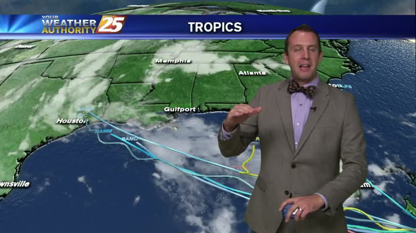
More developments in the tropics but still no growth to invest 99L. Tropical forecast details inside.
No answers from the Tropics today, but models have continued to bring a developing Tropical system into the Gulf. Details inside.
The latest we can tell you about Invest 99-L
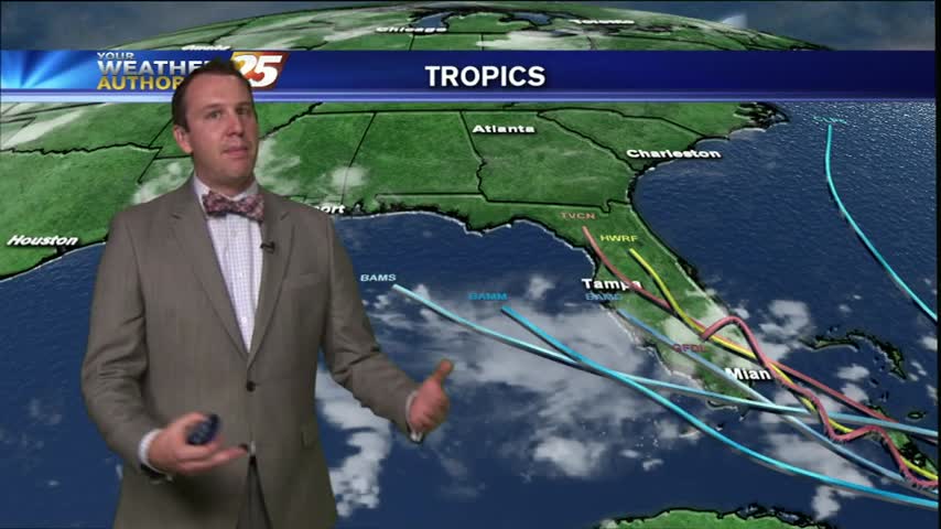
I start off with the tropics today to try and quell some fears, but some concern is warranted. Check out the forecast for details.