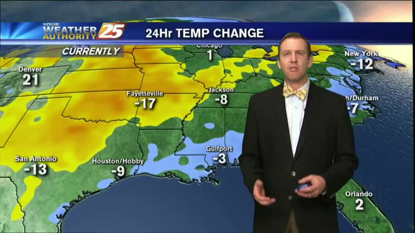
11/23 Ryan's "Cold Turkey" Thursday Forecast
All week long we've been waiting for the beautiful weather we saw this afternoon, and now the near-and-below freezing temps we'll see in South MS tonight. Details inside.
All week long we've been waiting for the beautiful weather we saw this afternoon, and now the near-and-below freezing temps we'll see in South MS tonight. Details inside.
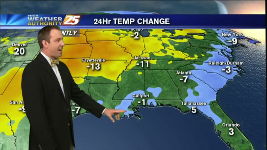
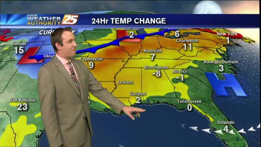
If you haven't had your fill of turkey yet there's still plenty of time left in the day, and you may need the extra "padding" with the temperatures we're going to see tonight. A freeze warning has already been issued…
Clouds will tonight after our cloudy day, with much cooler and drier conditions tomorrow. Watch the full forecast for details.
We've been talking all week long about how the increasing moisture would eventually lead to some significantly foggy evening, and those are finally moving in. Details within.
The clouds cleared out a bit, but the temperature and humidity continued to rise as expected. Click the forecast link for the full forecast.
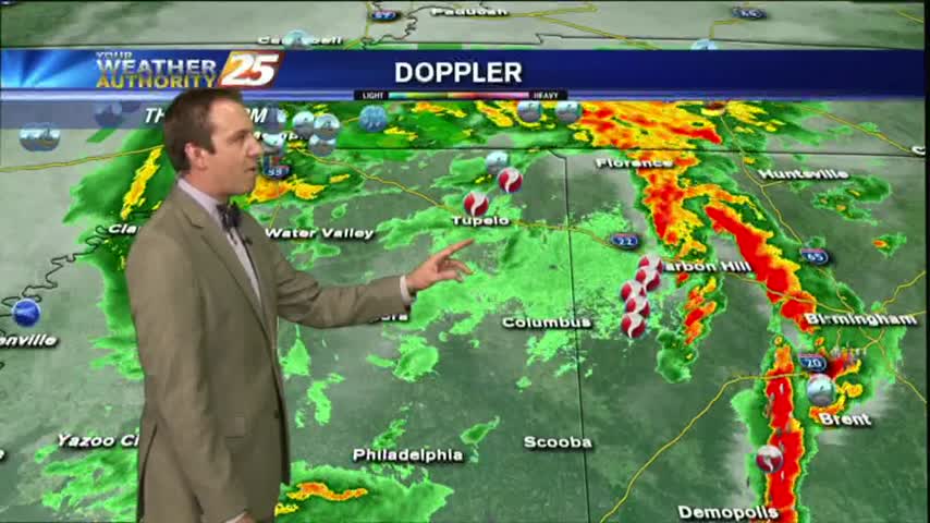
The humidity and temperature will continue to rise into tomorrow ahead of our next cold front, which could bring some damaging weather overnight Friday. Watch the full forecast for details.
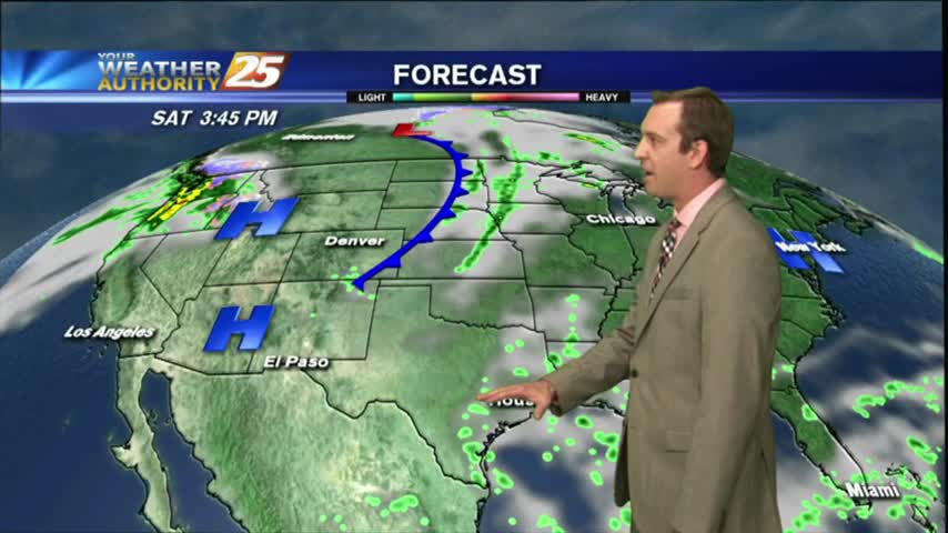
Doesn't seem like active, dangerous weather is just over 24 hours away, but a cold front is racing through the plains and brings a "marginal" risk to the area tomorrow night. Watch the forecast for details.
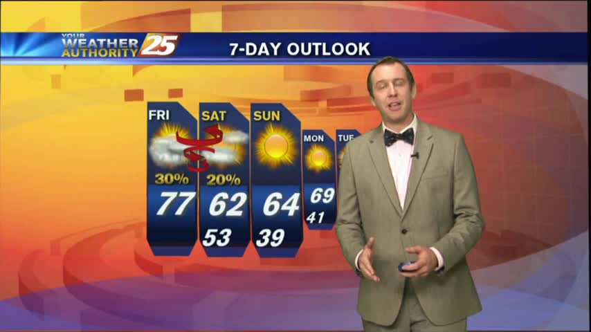
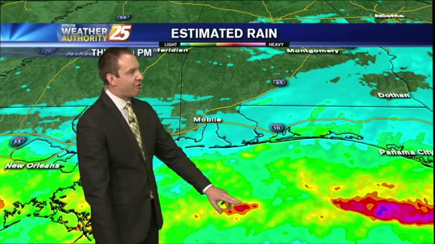
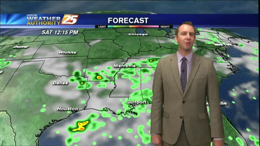
Moisture was on the rise this afternoon and will wane a bit tonight, but expect it to return in earnest for the weekend just before a front brings thunderstorms. Watch the full forecast for more.
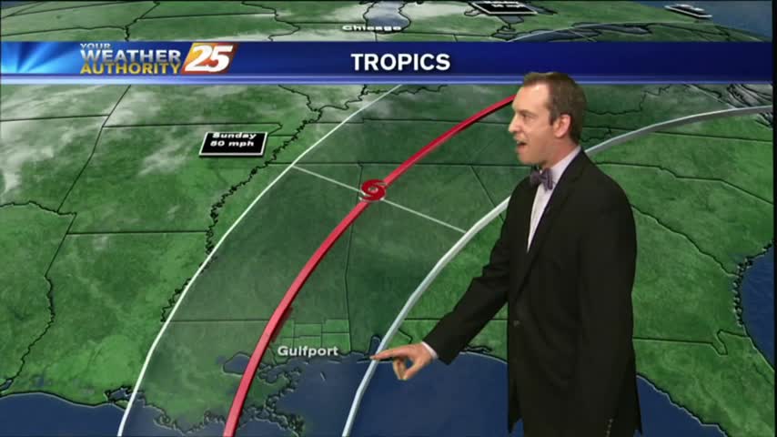
Tropical storm Nate continues to move across Central America, and will be in the Southern Gulf by Saturday morning. The forecast path comes close to home but is still uncertain, so watch the full forecast for more.
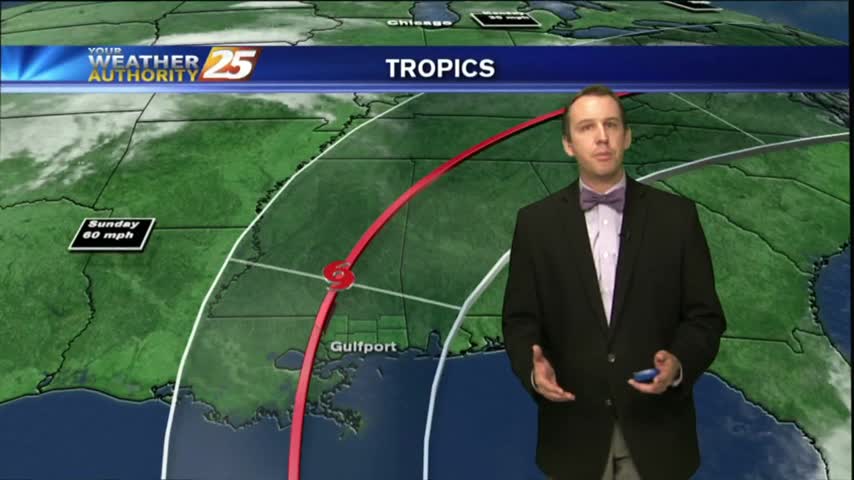
The local weather will remain gorgeous for one more day, then we'll begin seeing the outer bands of a tropical system that has a good chance of land-falling nearby. Click for details.
Cold front moved through earlier today, but the cooler air will take a bit longer to filter in. Watch the full forecast for details.

Today may have been the last full day of summer, but don't expect fall weather just yet. Full forecast within.
It's clear now, but clouds will begin to move in overnight and we'll see a little rain over the weekend. Watch the forecast for details.
We promised one last day of nearly perfect, fall-like weather and today did not disappoint, but we're already feeling the humidity increase & rain is on the way. Details inside.
Irma continues to close in on a potential U.S. landfall, but the forecast path still holds on to a considerable amount of uncertainty through the weekend. Click the link for details.
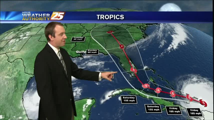
Local conditions continue to impress, but Irma continues to bear down on the Southeast coast. Click this link for a full tropical update.
Harvey has finally moved far enough away to become inconsequential to the local forecast, so drier and sunny days are ahead! Click the link for the full forecast.
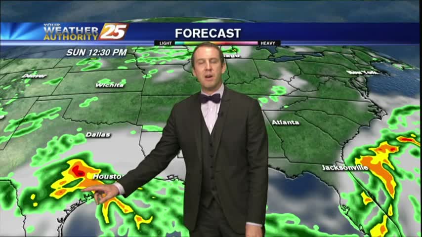
Harvey continues its rapid intensification, and will strike Southeastern TX overnight tomorrow. We'll see some enhanced rain locally, but you'll have to click the link for details.
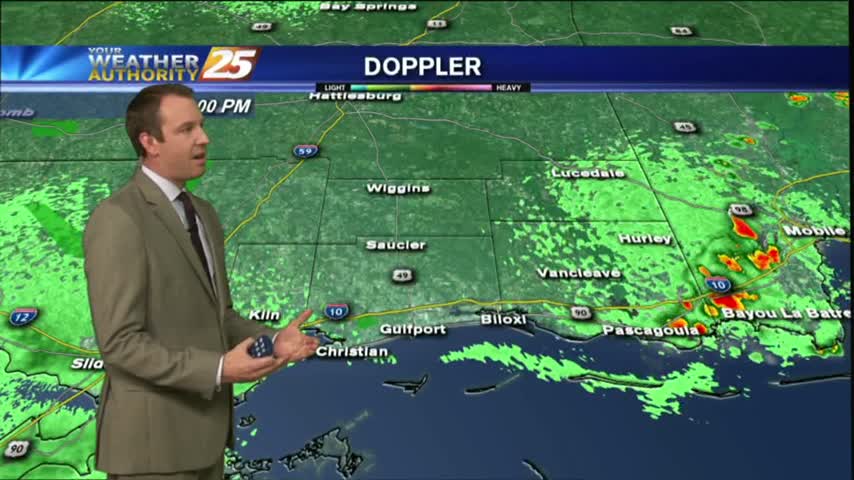
While last night was the exception, we're again seeing our earlier showers & t-storms dissipating and and even some slight sky clearing. Rain returns quickly though, so watch the full forecast for details.
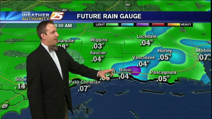
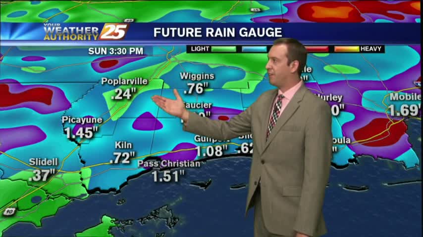
Didn't see the rain totals I expected for today, but rain will move in and linger through the weekend. Check out the full forecast for details.
Mostly clear skies will help us cool into the mid-to-upper 70s, but we'll see very hot conditions tomorrow. Watch the full forecast for details.
Much drier today with only a few showers popping up in the West, but the high heat indices we expected definitely showed up. Another dry and hot day ahead before rain arrives, so watch the full forecast for details.
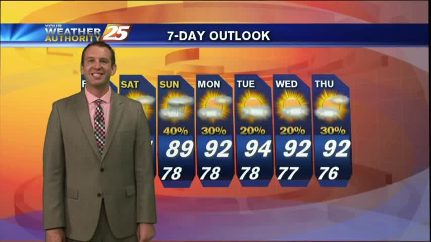
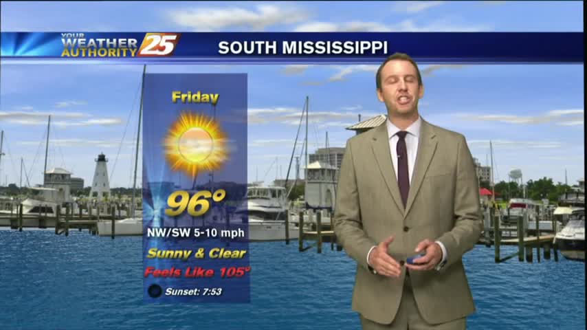
We expected little rain and warmer temperatures and that's exactly what we got! The temperature will drop some during the weekend, but expect a few dangerously hot days first. Details inside.
Very predicable weather patterns continue through the weekend, but rain chances/totals should receive a small bump from tropical influences. Watch the full forecast for details.