03/24 Ryan's "Wetter" Wednesday Night Forecast
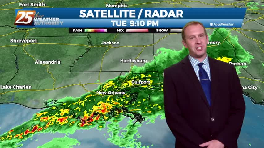
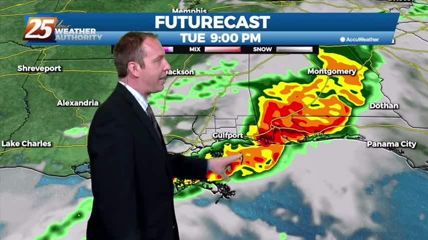
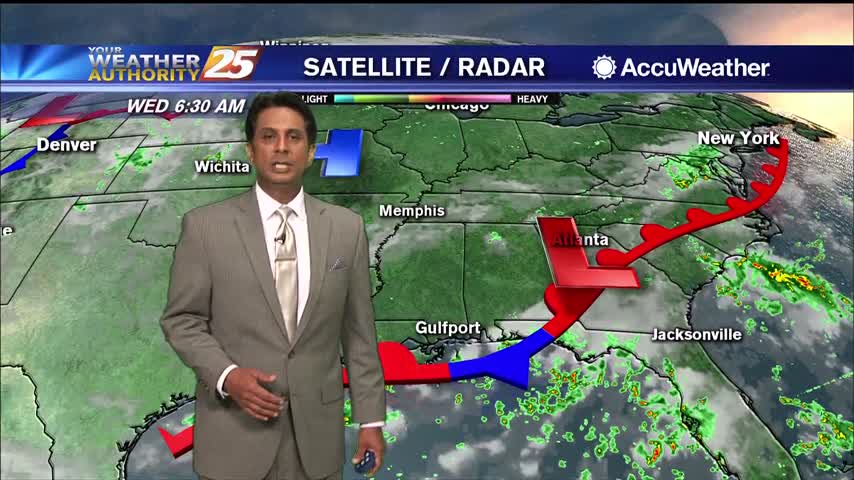
After even more rain today, flooding issues are becoming more and more obvious with another stormy day ahead....
After even more rain today, flooding issues are becoming more and more obvious with another stormy day ahead....
Today was a complete 180 after yesterday's clear skies, and the bad news is the rain isn't stopping anytime soon....
Today was a beautiful start to the week after cooler, drier weekend, but heavy rain will return to the Gulf Coast sooner rather than later....
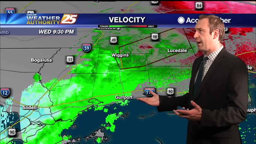
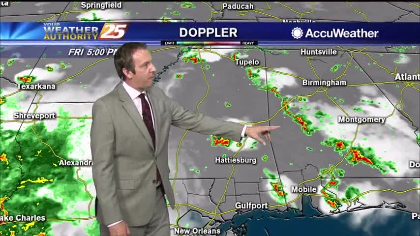
The line of storms expected tonight has sped up some, and will be quickly leaving the area through the early morning hours.
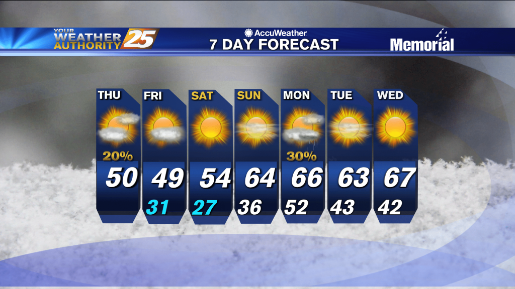
Showers and storms are streaming through for the rest of the night, bringing another round of colder, drier air for the end of the week.
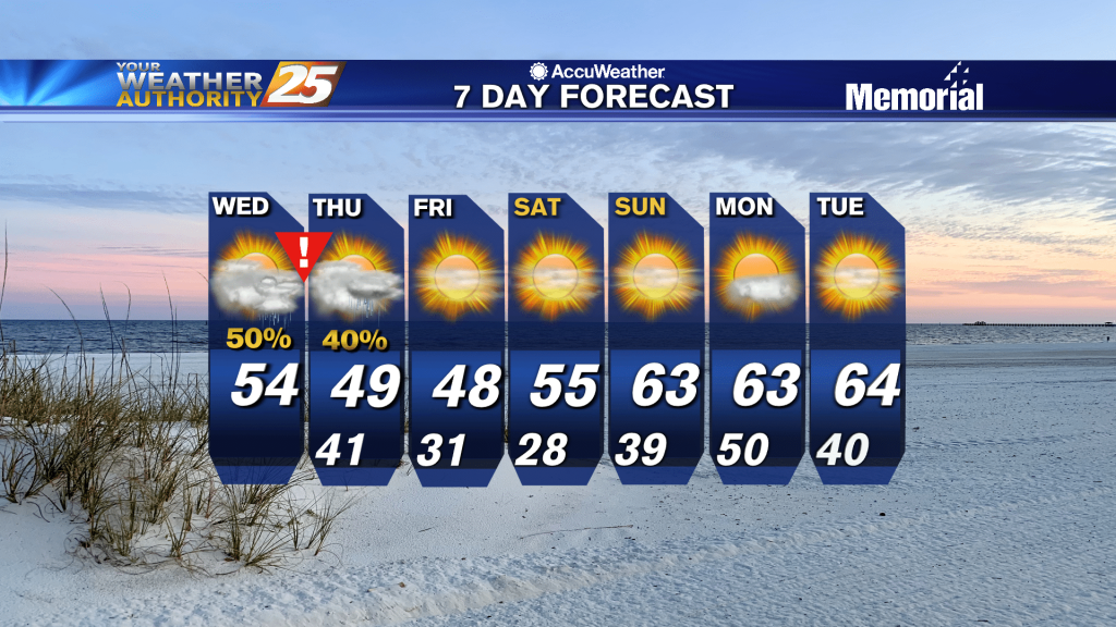
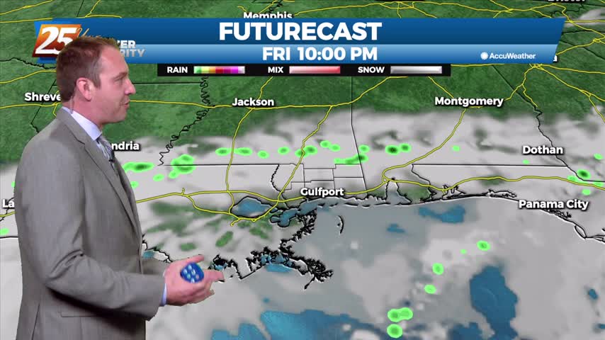
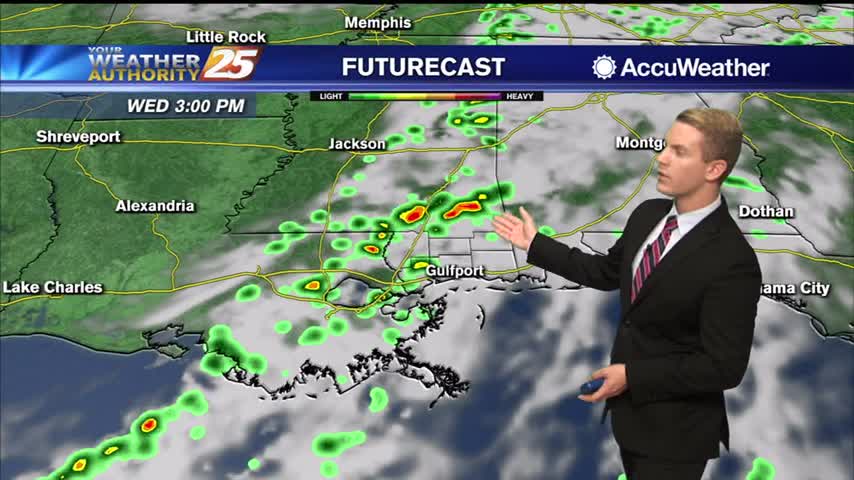
Showers and thunderstorms are expected Wednesday, mainly in the evening and overnight timeframe. All of the ingredients are there including enough lift and moisture in place, fairly widespread rainfall (1 to 2 inches on average) is expected to develop across…
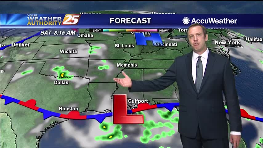
Our next front is closing in and active, potentially stormy weather will be moving in during the wee hours of the morning....
We’re starting off the day much warmer than what we did yesterday. It will be warm and muggy with some showers pushing into the area for the second half of the day. Temperatures will be in the mid to upper…

Cold front moving through will finally bring some significantly drier air, so fall-like weather is moving in soon!
What's left of Beta is slowly pushing inland and bringing more rainfall, cloudy skies, and gusty winds.
Beta's remnants are now post-tropical and drifting across the state, bringing more cloudy, rainy weather....
Dreary conditions this afternoon thanks to the tops of storms blowing our direction, otherwise not a lot of activity again today....
Wednesday looks to be mostly sunny with high temperatures topping out in the lower to mid 90s once again. A handful of showers and thunderstorms will be possible in the afternoon with rain chances at around 40 percent. Thursday, more…
A stationary front will linger over the area through Thursday night. Conditions continue to look favorable for increased t-storm activity today during the late afternoon and evening hours, and have rain chances of 30 to 40 percent forecasted. There continues…
More evening showers tonight with more on the way over the weekend, but it is making things nice and cool.
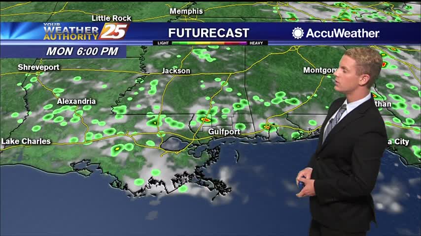
The increased deep layer moisture combined daytime heating and convergence along the seabreeze will lead to increased thunderstorm coverage on Monday. Isolated showers will develop near the coast in the morning, gradually increasing in coverage and developing inland through the…
Most of this week was dry, but rain chances began to increase yesterday and will remain quite high over the weekend.
Our summertime pattern continues, so expect more hot and humid weather with afternoon showers...for at least one more day.
Another active afternoon in the books, but we're in for another quiet night before doing it again tomorrow.
Things will cool down slightly in the days ahead due to more afternoon rain, but otherwise not much else changes.
Hot and humid start to the week after a miserably hot and humid weekend, but some slight relief is moving in.
A strong line of showers and thunderstorms moved through late in the afternoon, something we're expecting to see less of over the weekend.
Didn't see as much rain today as expected, but that's largely becuase a huge line of afternoon thunderstorms just missed us to the west. This weekend overall will be quite wet though.
The week started on the drier side, but afternoon rain has moved in each afternoon for the last few days. Expect to see much more rain over the weekend though....