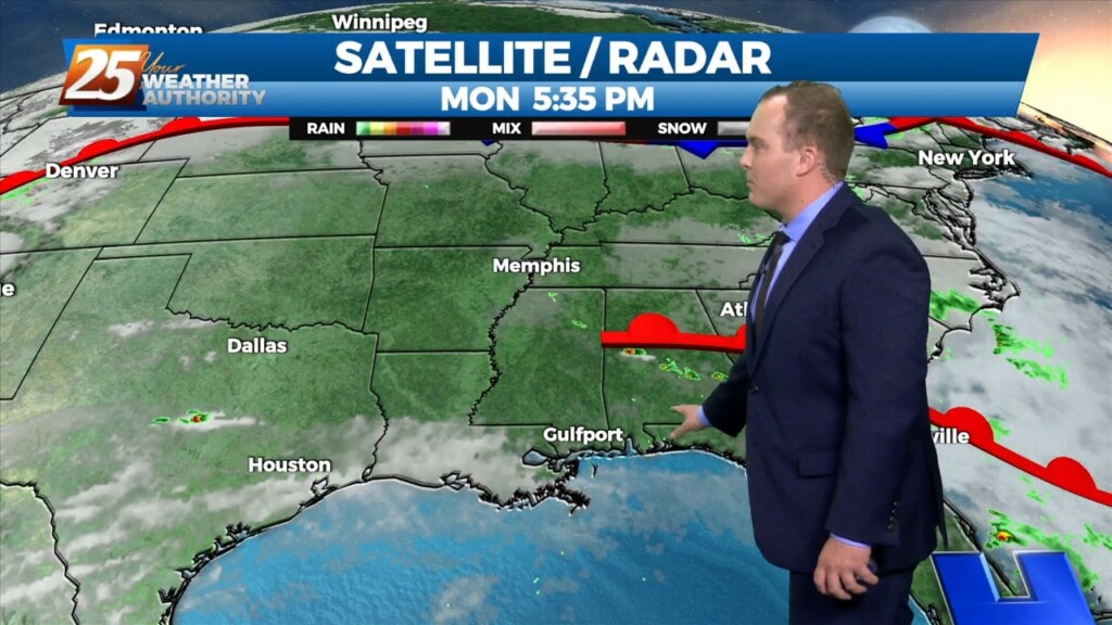
4/24 - Jeff Vorick's "Clearing" Monday Evening Forecast
Cloud coverage has remained across the area today. Clearing will come tonight and winds will relax somewhat which will allow for more efficient cooling. On and off cloud…
Cloud coverage has remained across the area today. Clearing will come tonight and winds will relax somewhat which will allow for more efficient cooling. On and off cloud…
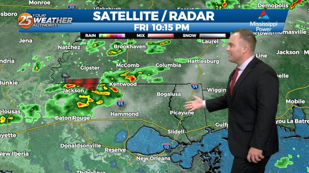
A round of showers and thunderstorms will make their way through South Mississippi over the next few hours. The cold front will follow suit shortly after leading to…
Clouds will increase overnight as a system draping a cold front moves into the region. It will be mild and dry overnight light south-to-southeasterly winds. Cloud coverage…
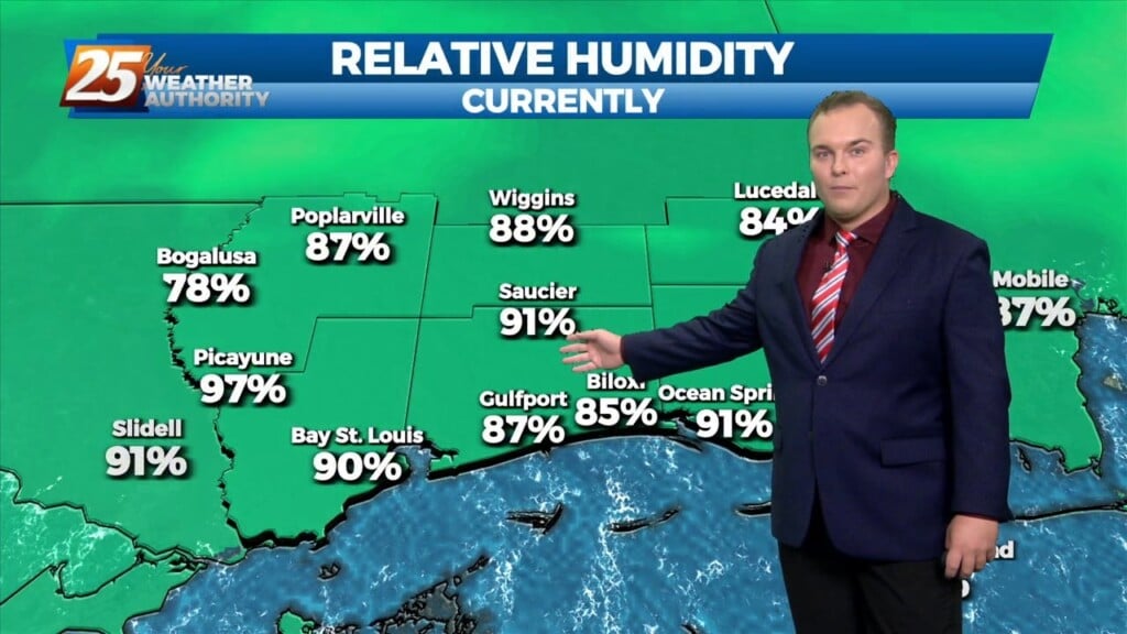
Yet another warm and quiet day across our area as our pattern is in transition. Humidity is on the increase ahead of a storm system. Clouds will…
Tonight will be quiet for the most part with milder temperatures. Some light fog and low clouds could develop but that will quickly clear out tomorrow. Expect sunny skies…
The pattern has moderated to provide for lovely conditions. Temperatures will remain mild overnight as winds will back off to a light southeasterly flow. Some spots could see…
Cloud coverage will dissipate overnight as a disturbance is weakening under the influence of high pressure. Expect mostly cloudy skies to turn to a few clouds by daybreak…
Tonight will be quiet with increasing cloud coverage towards daybreak. Temperatures will be mild across the area and humidity will be on the increase. Tomorrow will…
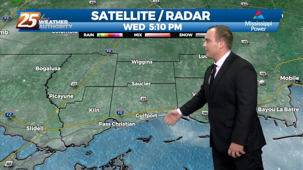
Today has been a near-perfect spring day across the coast. Other than passing clouds, dry conditions have provided for a comfortable feel. Things begin to change tonight…
Skies will clear out tonight thanks to drier air filtering in. It will be cool tomorrow morning with clearer skies around. Other than passing clouds tomorrow afternoon,…
Skies have cleared somewhat this afternoon. Drier times will be around tonight as low pressure pulls away. Clouds will dissipate overnight and temperatures will also be cool again…
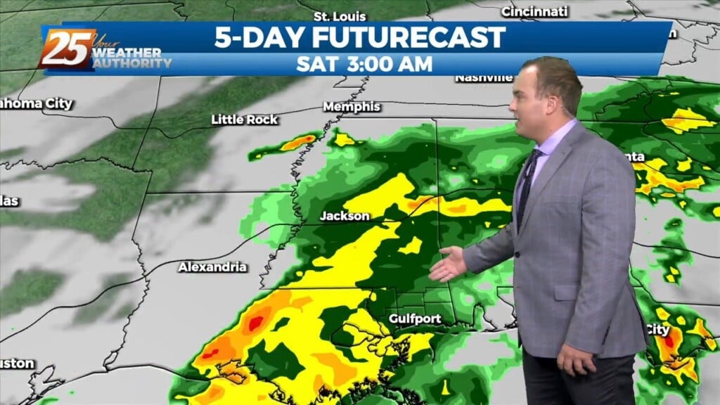
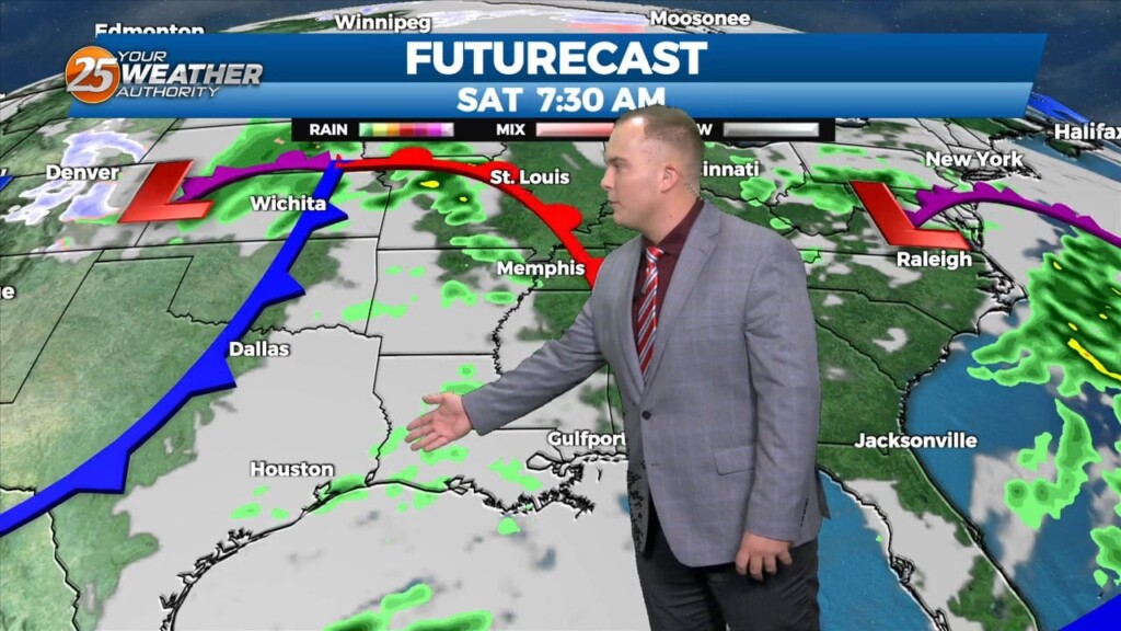
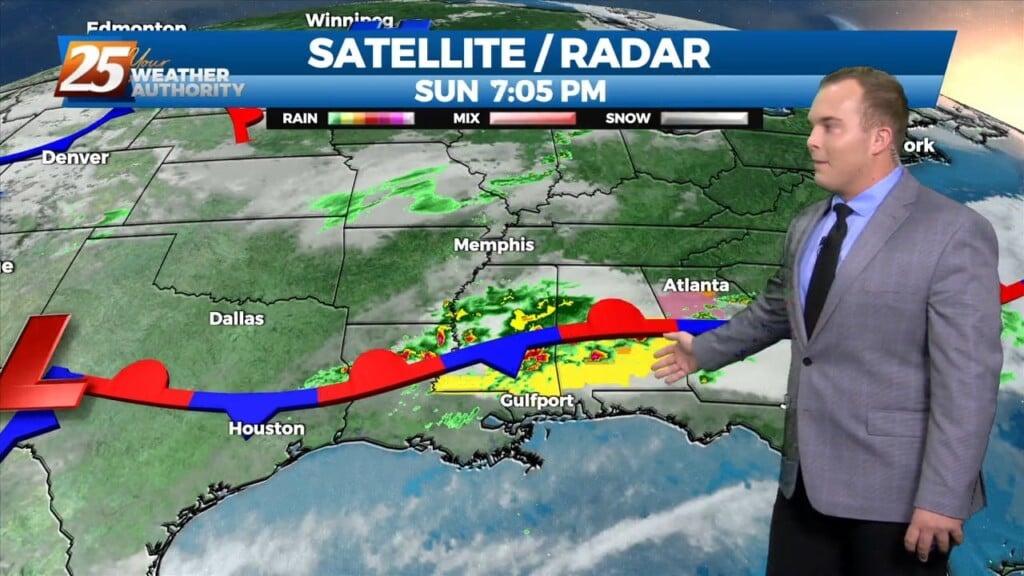
Shower and thunderstorm coverage will increase overnight as energy rides along the front. The stationary front will eventually move out of the area through this…
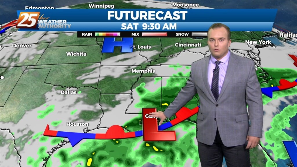
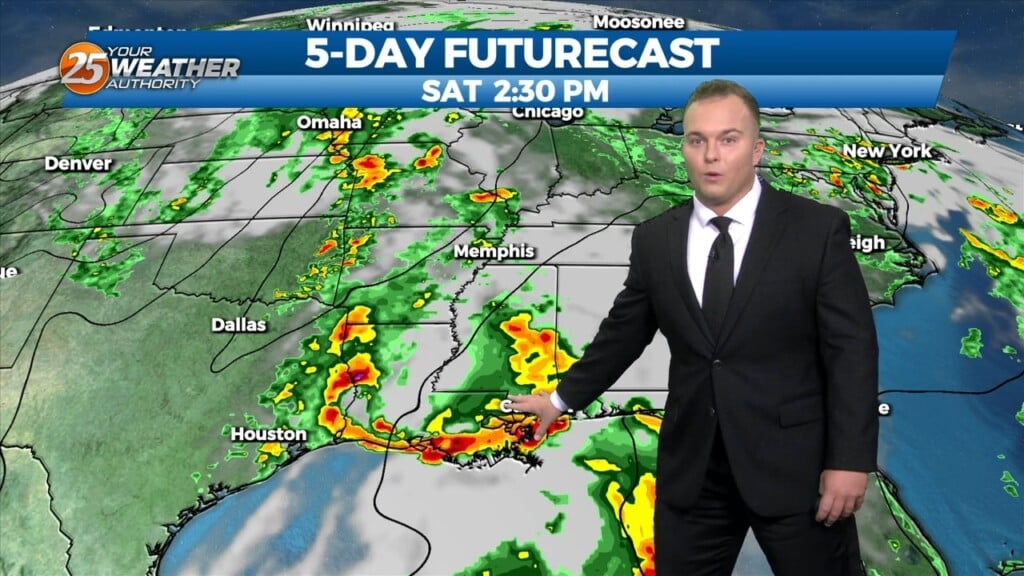
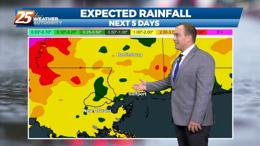
A wetter outlook is here for the next 24 hours. Showers and thunderstorms are possible this evening, then more rain will move in overnight. 80-90% coverage of…
Clouds are increasing this evening and it remains mild across the coast. There will be a 30% chance of showers and thunderstorms overnight. Tomorrow will provide for much…
Warm and breezy conditions have been present much of the day with very limited, if any sunshine. Clouds will dissipate slightly this evening only before the clouds…
Today will be much like yesterday with clearing skies and very warm temperatures. Overnight, clouds will build back in and light fog is possible. Things begin to…
Some direct sunlight allowed for temperatures to warm into the 80s for a lot of the area today. Tonight, abundant moisture in the low-levels will allow for clouds to…
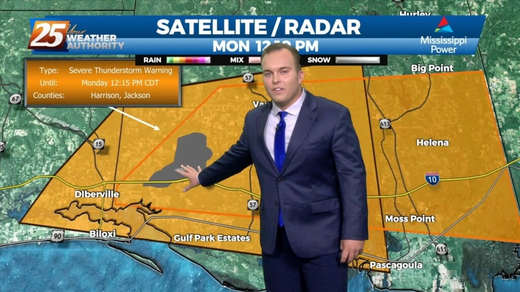
Thunderstorms, some strong to severe at times are moving through the area this afternoon. They have been capable of producing hail and strong winds. Coverage and intensity…
The front has retreated north helping to bring a very warm and humid airmass into the region. The majority of the activity has been well to our…
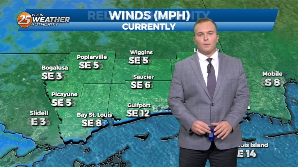
Cool conditions will remain today under abundant sunshine. Winds will be shifting to an easterly, and then southeasterly direction as high pressure moves farther east. Thanks to southerly…
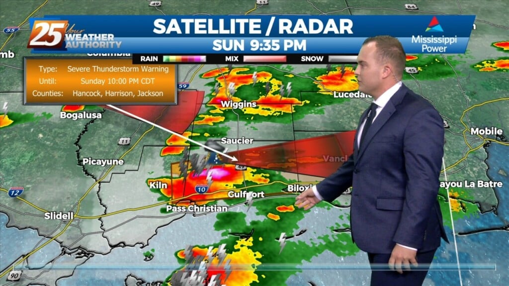
Showers and a few thunderstorms are making their way through South Mississippi as a cold front transits the region. High wind gusts and small hail can…
Upper level ridging will dominate the pattern for the next day or so ahead of an approaching upper level trough. Southerly surface winds will help to advect warm air…
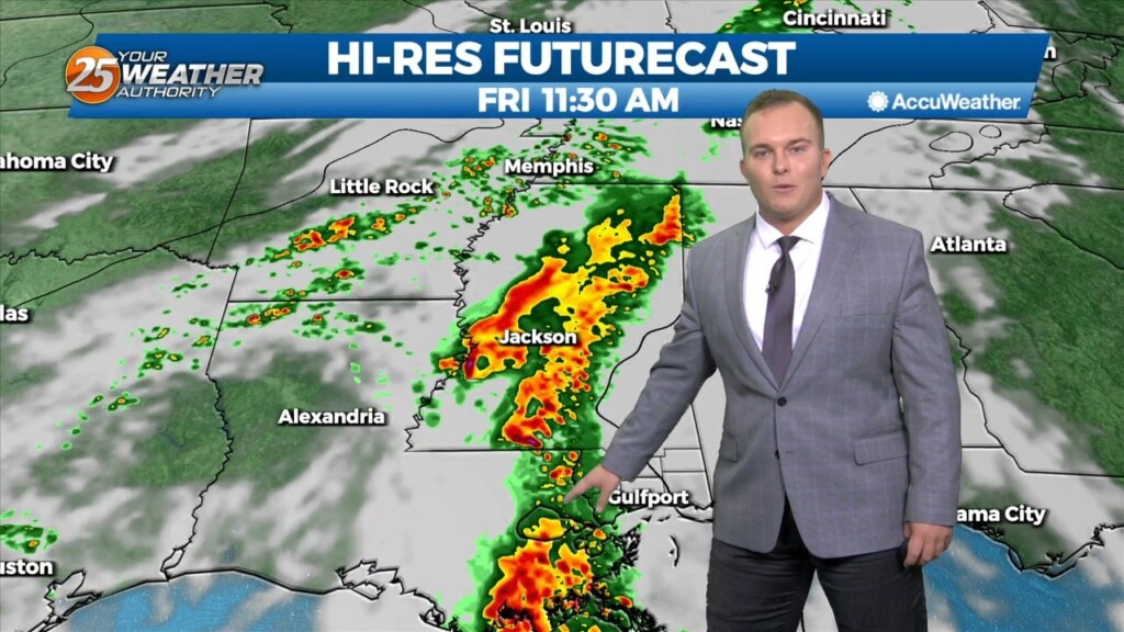
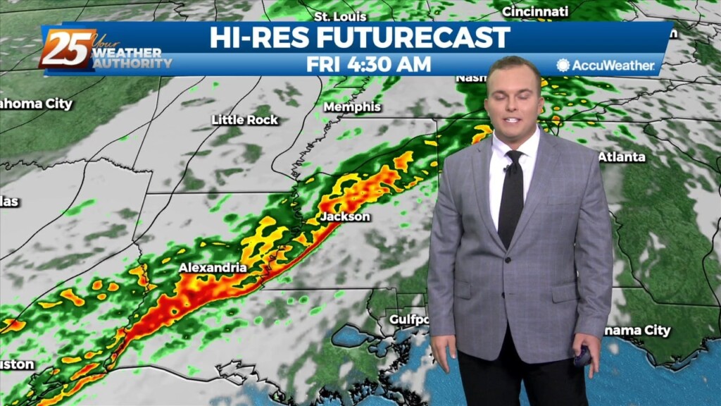
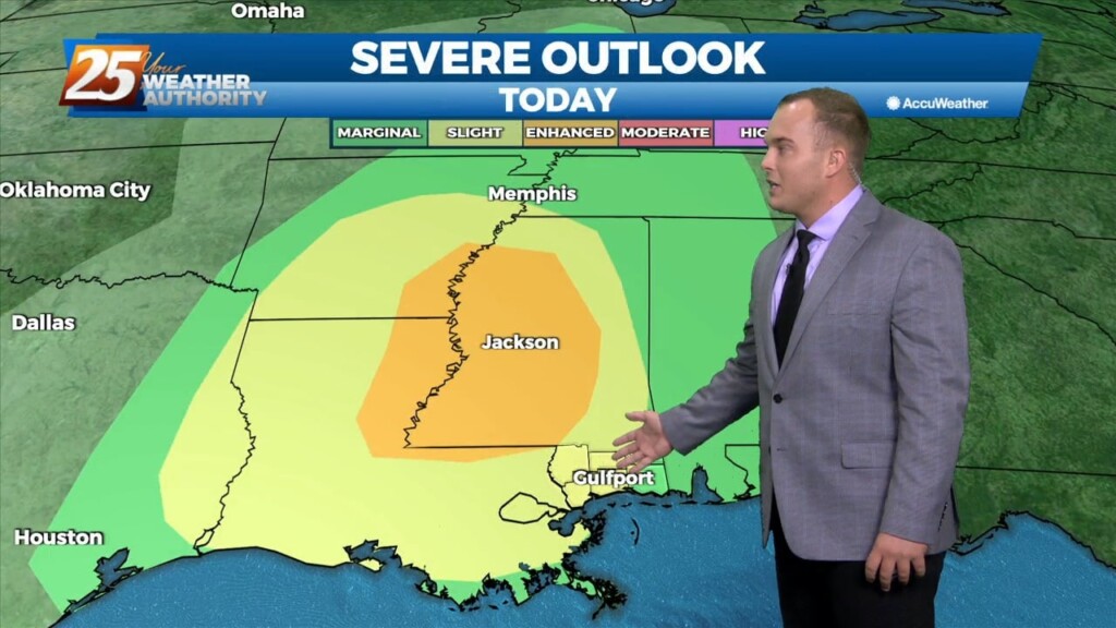
The biggest concern in the short term is the potential for severe through the remainder of this afternoon and overnight tonight ahead of an approaching cold front. Already…
Mostly cloudy skies, warm temperatures, and a 50% coverage of scattered showers and thunderstorms are expected this afternoon. A line of showers and thunderstorms that will…