6/13 - Sam Parker's "Rain Free" Thursday Midday Forecast
Today will bring increasing subsidence through the area as high pressure begins to expand eastward from the southern Plains. Cumulus cloud development can be expected this afternoon…
Today will bring increasing subsidence through the area as high pressure begins to expand eastward from the southern Plains. Cumulus cloud development can be expected this afternoon…
An area of weak low-pressure overhead will slide to the east and dissipate. We will transition into somewhat lower dew-points and maintain those conditions for the next…
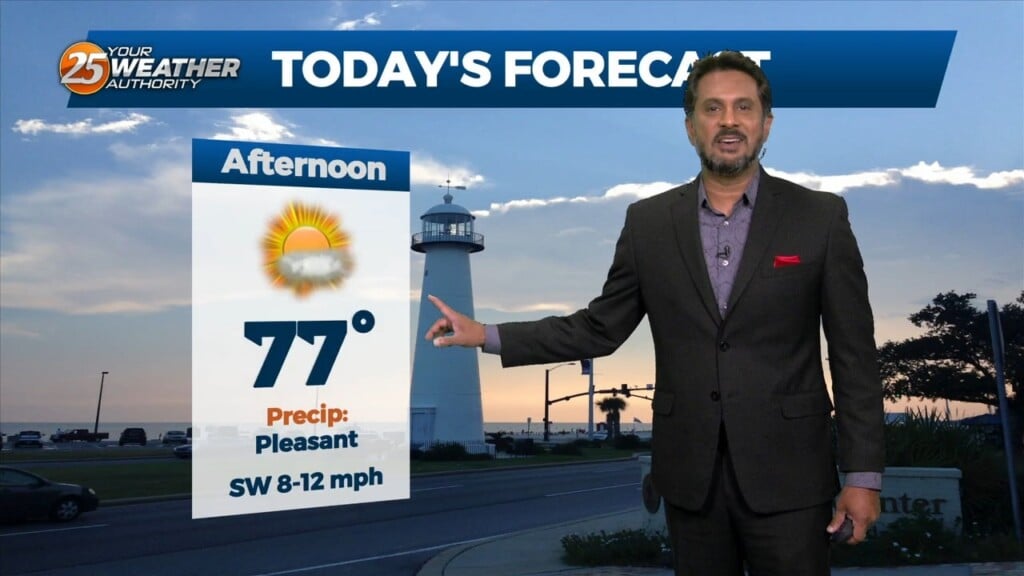
Sunny skies on-tap this afternoon as the cloud cover continues to move to the east. Again tonight, it will be a radiation fog night as well…

A post frontal airmass continues to push into the region with the center of surface ridge currently over the state of Mississippi. The remainder of…
A lovely day ahead with sunshine and cool temperatures before the next system moves in. A new surface low-pressure system to the SW will develop and…
An upper-level disturbance moving into New England and the Pacific Northwest will provide for high pressure moving out of the Rockies into the Plains States. At…
A rather cool day is in store, however, with high pressure building in over the lower MS River Valley, expect plenty of sunshine today, so overall…
Clouds really hung around yesterday and definitely had an impact on the highs and then winds have held on for much of the evening and even…
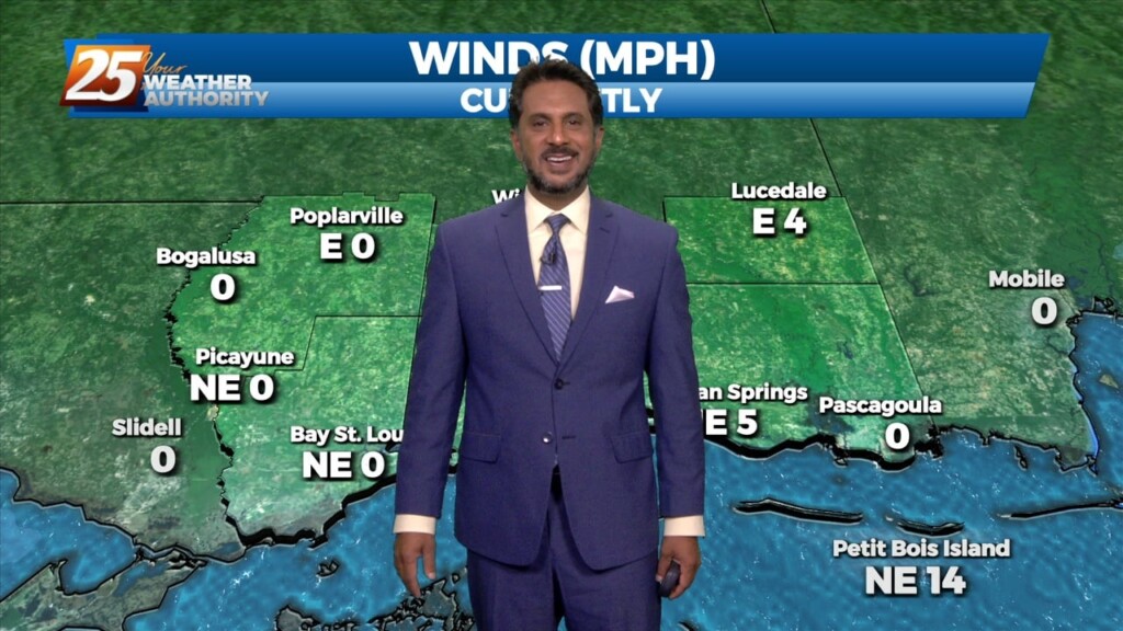
Overall, it’s a very tranquil and "cool" morning across the region with temperatures generally in the 60s with light northerly surface flow continuing. Surface dew-points…
Not much has changed with the overall pattern though the region. A strong upper level low pressure system is currently located over the Ohio Valley and…

Yesterday’s frontal system will continue sliding east out of the area. Zonal flow will dominate the upper level pattern, with a northerly surface winds becoming SE…
With high pressure in control of the region, we won’t see much in the way of moderation through at least through Tuesday as we will basically…
The surface low has exited our area at this point, with some weak high pressure expected to pass through today. This keeps things rather quiet today,…
The return flow will become more established today and remain that way through the short term. This will help add to the warming trend over…
Today will be warmer with southerly return flow developing and slightly higher heights aloft. Mostly sunny skies early will give way to partly to mostly cloudy skies…
Generally a dry west or northwesterly flow currently resides over the region. At the surface, high pressure continues to spread eastward over the mid/lower MS River Valley…
A beautiful start to our workweek is expected with high pressure remaining in control over the area. Afternoon high temperatures will sit in the low to…
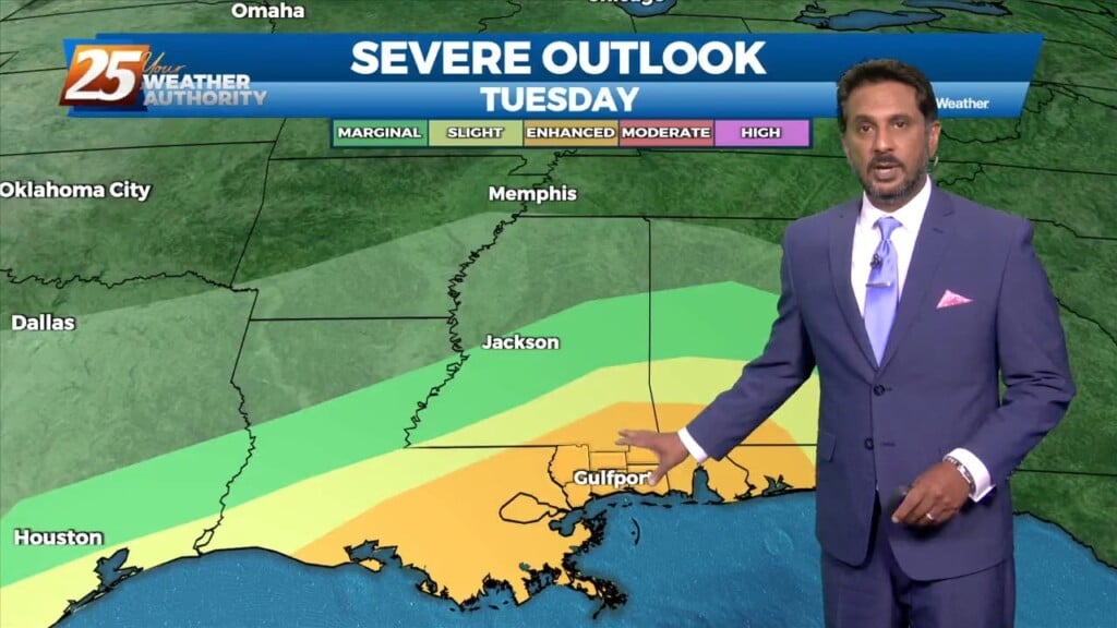
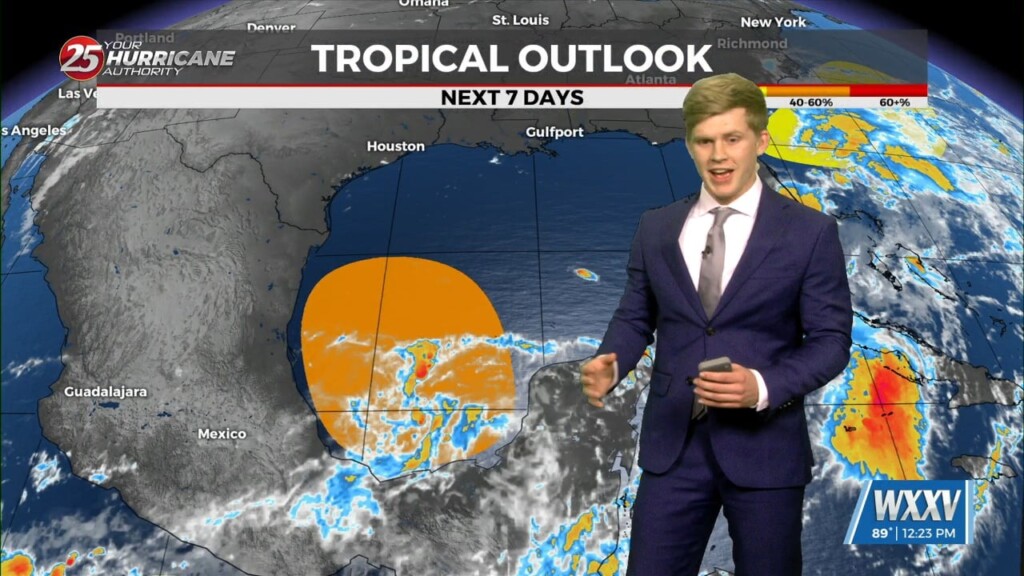
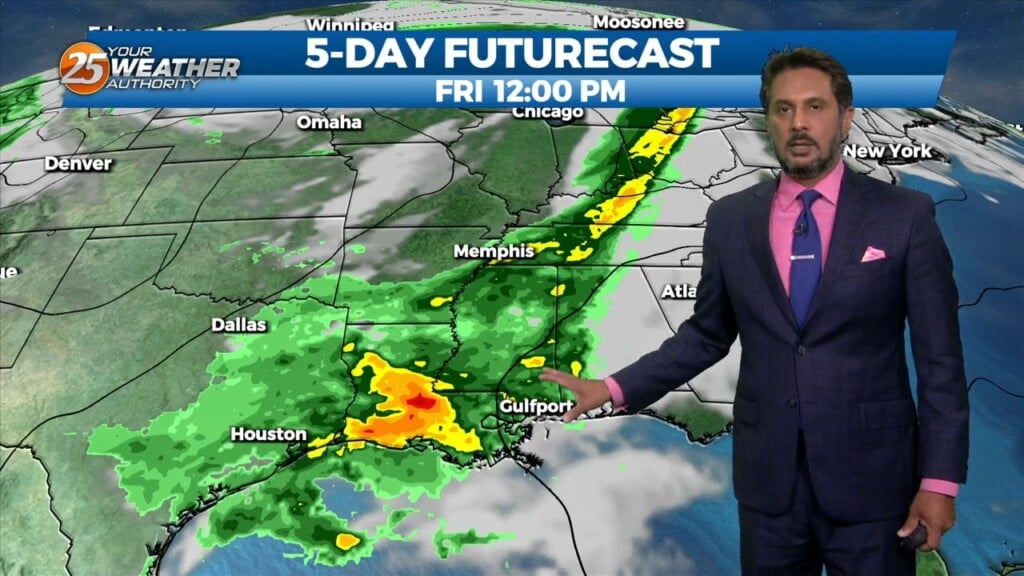
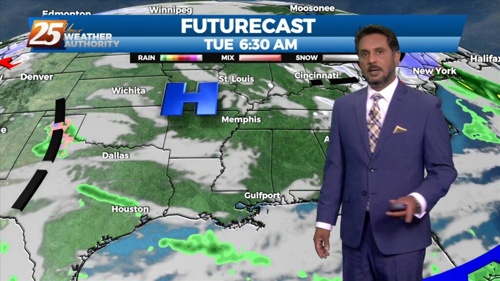
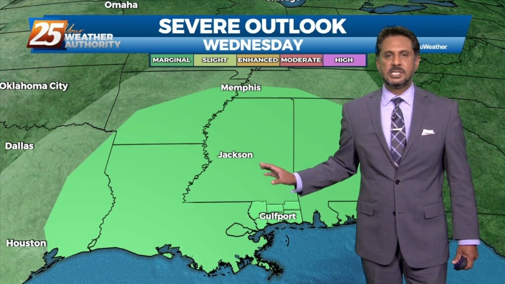
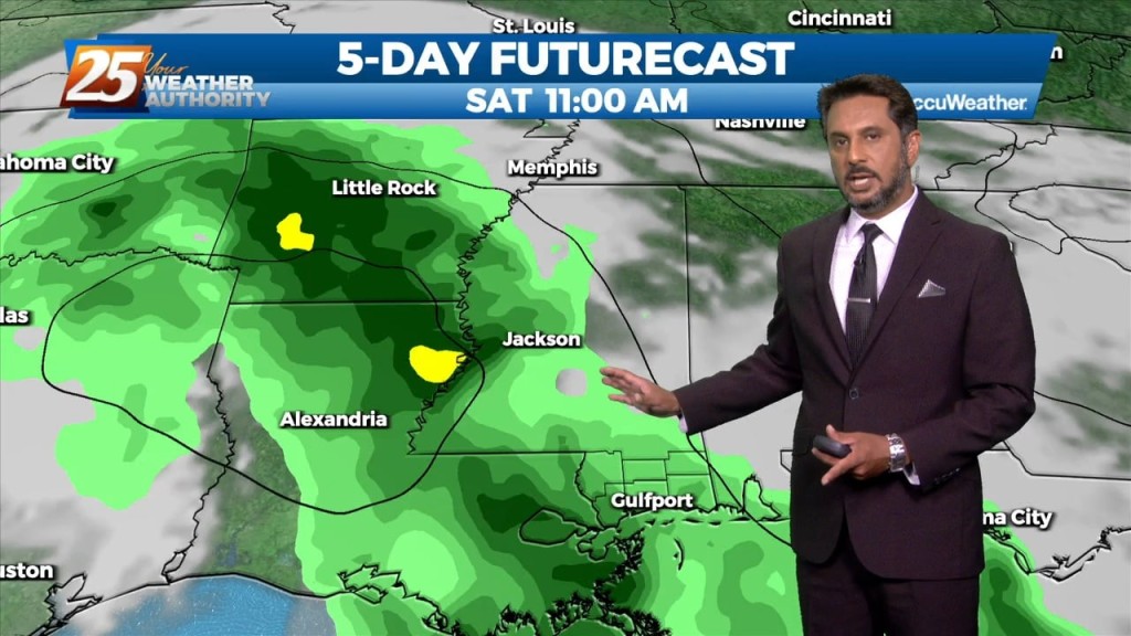
Bottom line up front...main concern for this forecast package will be with the storm system expected to impact the Gulf Coast Tuesday into Wednesday morning, with the…
The pattern will remain quiet today with transitional conditions tomorrow. A fast-moving upper level disturbance will move past the area late tonight, but with little moisture…
A weak disturbance will be passing over the area within the next few hours, but not causing much noise as it comes through. It will delay…
While the main upper level disturbance is moving off the East Coast, another minor feature is diving down the west side of the trough over…
The cold front that moved through the area is certainly being felt this afternoon. Temperatures are very cool and a northwesterly breeze is blowing across the area.…
A cold front east of the area continue to move east as high pressure to the NW will shape the short term forecast. Most of the…
Northerly surface winds will help advect drier and more stable air into the area. Looking at the models, conditions will be dry over the next few days…