5/10 - Rob Knight's "HOT PATTERN" Tuesday Morning Forecast
Hot and dry pattern continues as upper level high-pressure builds SW to NE across the Mississippi Valley. This will easily supports high temperatures around 90 degrees, with…
Hot and dry pattern continues as upper level high-pressure builds SW to NE across the Mississippi Valley. This will easily supports high temperatures around 90 degrees, with…
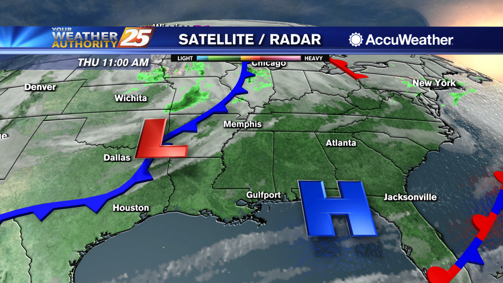
At the surface, high pressure extended from the Great Lakes southward to Florida with a weak extension southwest into the western Gulf of Mexico. This will…
An upper level high-pressure will begin building in and across the southeastern CONUS today through Saturday. As a result, onshore flow continues to become well established. Those 2 changes will enhance moderating period that started yesterday. We will see about…
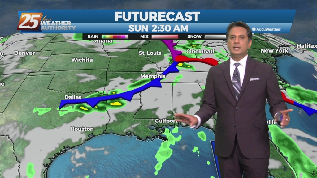
A disturbance along the four Corners will weaken over the next 36 hours as it moves eastward. The Canadian trough behind it will move into…
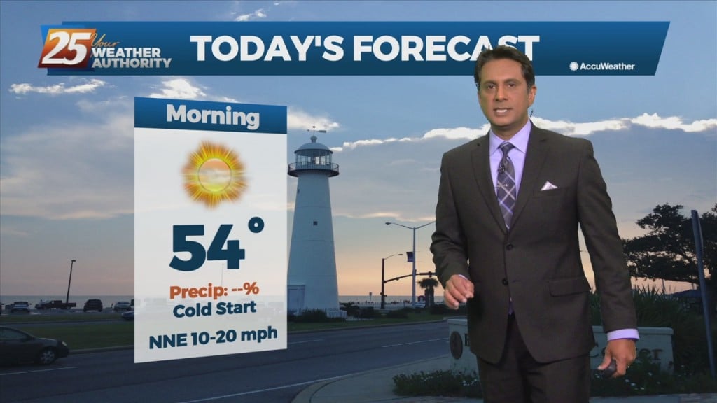
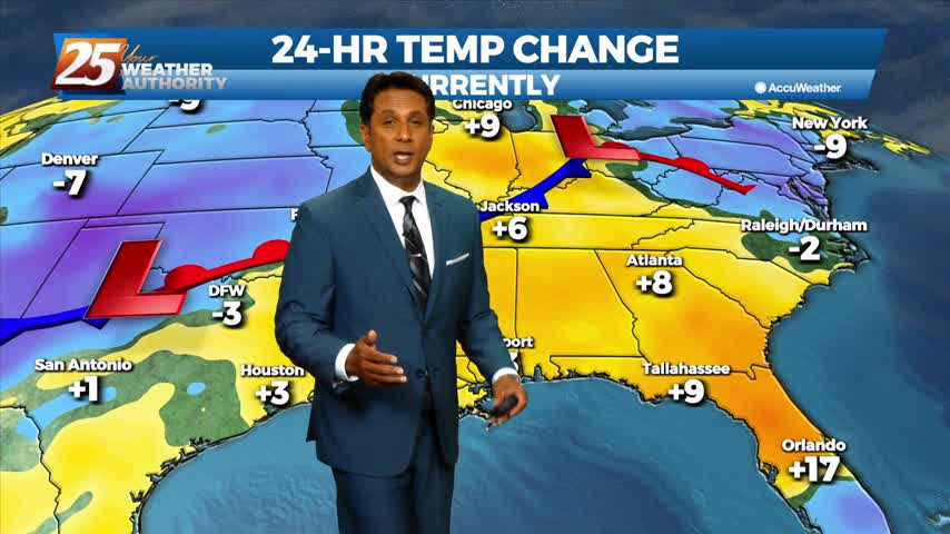
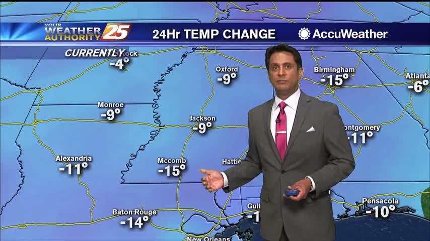
Daytime temperatures today will see almost 20 degree difference from yesterday's temperatures. Tonight temperatures will be chilly once again with lows in the upper 40s to low…
Clear skies will continue overnight as temperatures will once again drop into the 30s. Just a bit warmer than last night as a few locations will be in…
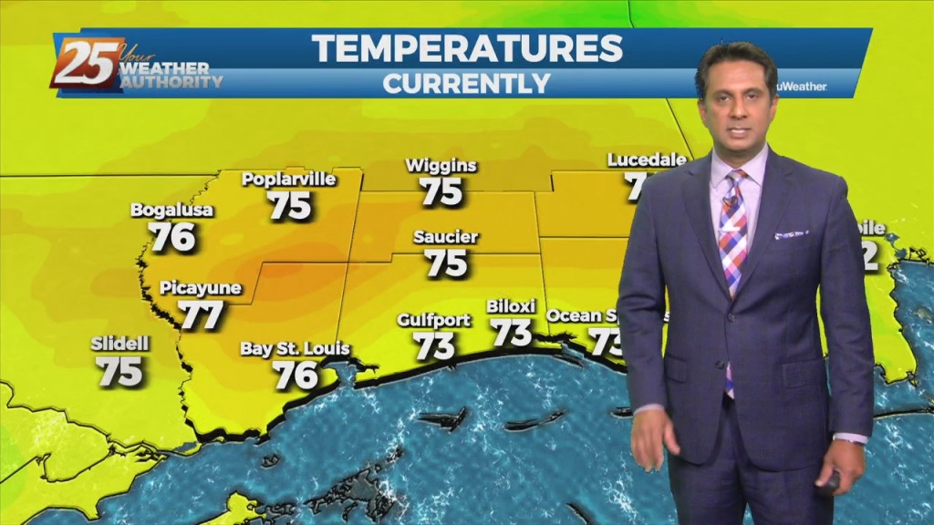
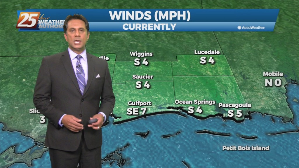
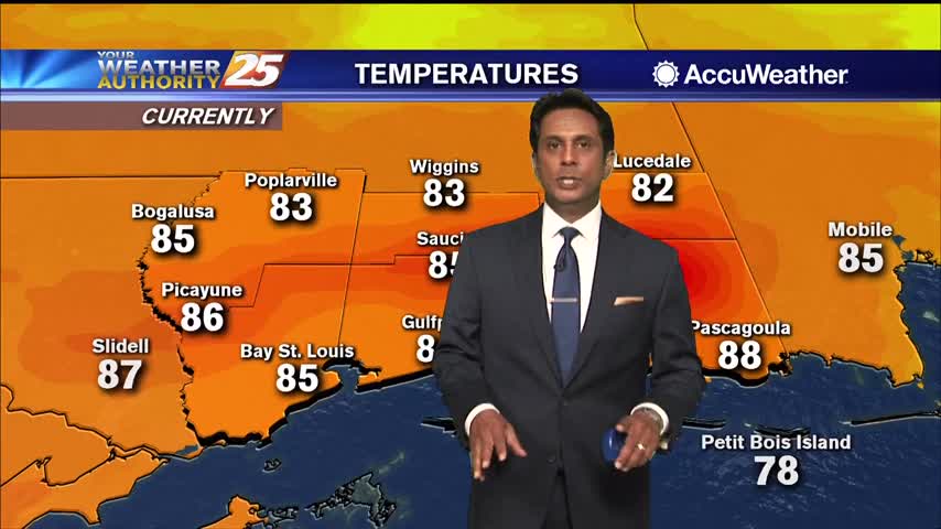
Starting out with early this morning, surface high pressure has built in across the southern MS valley region/NW GOMEX. The high center is just to our west…
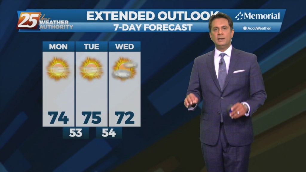
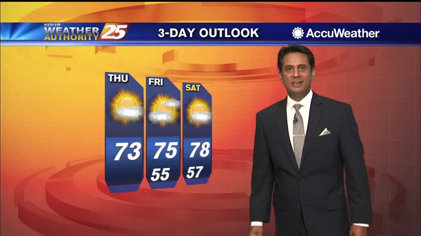
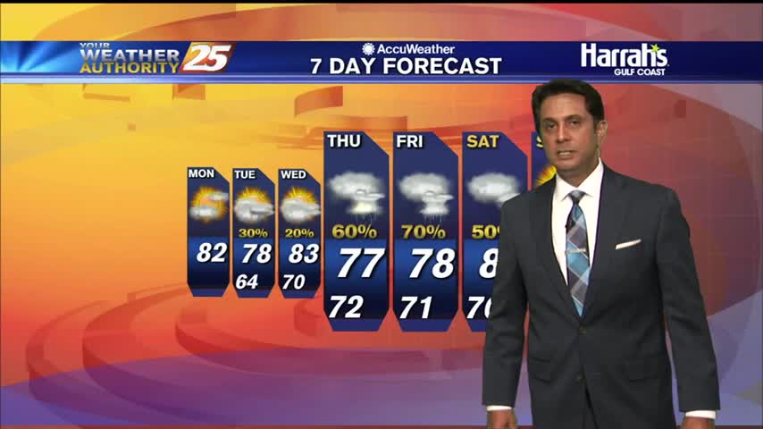
HOT temperatures this afternoon then our attention shifts to the west as our next cold front approaches early Thursday. A few light showers may develop Wednesday night…
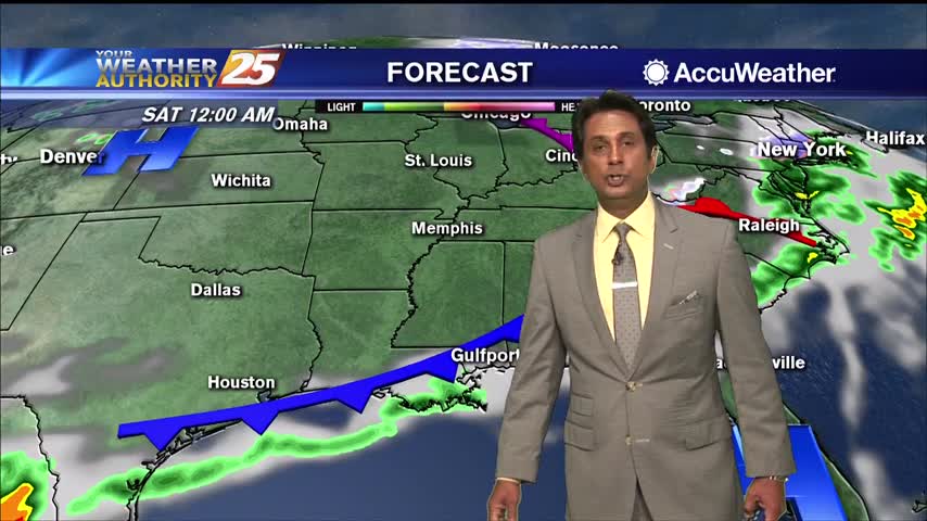
Surface moisture flow will gradually in advance of the next pressure system. Tonight, the area will see more in the way of DENSE FOG with potentially an…
Today and Tuesday will bring sunny skies and light winds as highs/lows each day becoming a few degrees warmer than previous days. Thursday, an upper level disturbance…
A very dry and stable airmass in place will affect the Mississippi Gulf Coast through mid-week. Overall, the pleasant period of weather experienced over the weekend…

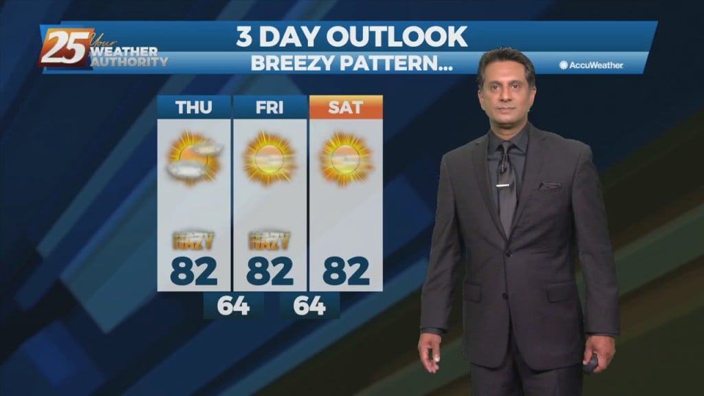
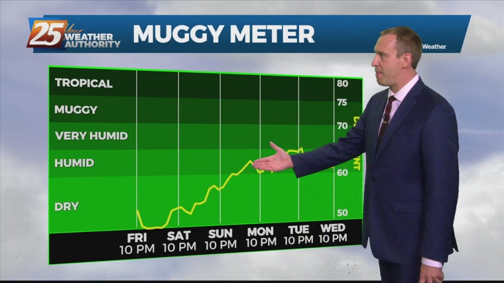
High-pressure NW will slowly move SE into the region this weekend. This will keep dry weather and lower humidity over the forecast area, although humidity levels/dew-points will be coming up slightly on Sunday to more muggy readings. Diurnal temperatures…
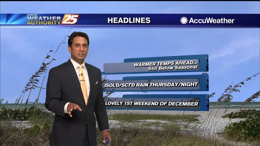
Don't expect a noticeable change to the weather as a sunny and dry weekend lies ahead, but it'll get warmer and more humid next week. Skies remain largely…
A most excellent Monday afternoon ahead with warm temperatures and sunny skies...
A lovely sunny afternoon with warmer temperatures...
A lovely afternoon ahead with sunny skies and slight warmer high temperatures in the low 60s...
Warmer temperatures ahead this afternoon as the humid flow has begun...

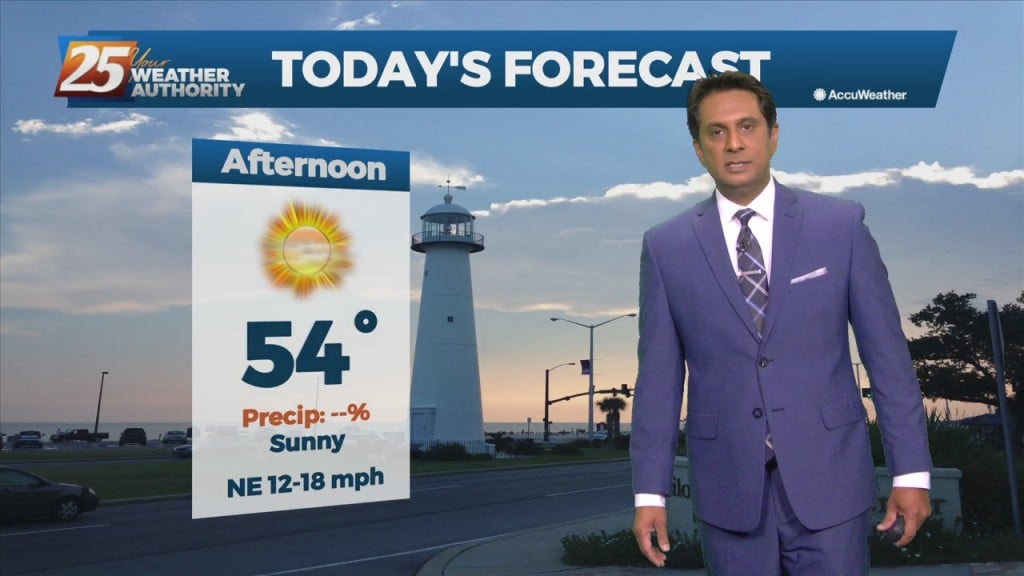
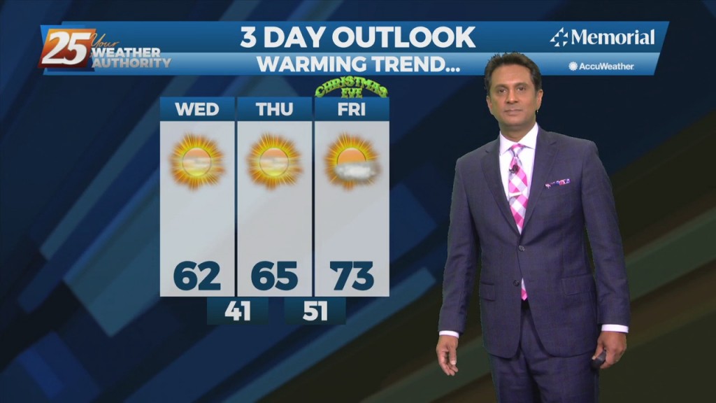
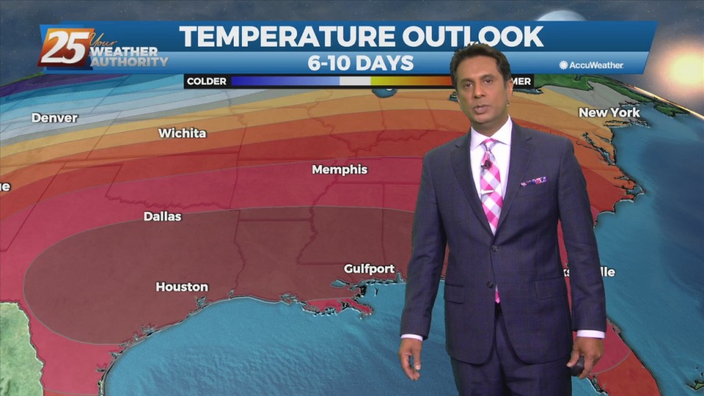
After the coldest temperatures of the season earlier this morning, the warming trend now begins...
A very nice start this morning under clear skies with overnight temperatures beginning to warm...
An ABSOLUTELY beautiful start to the day with cooler temperatures and very low humidity...
A nice afternoon ahead with only a pop-up shower or t-storm...
A CHILLY start this morning as very low humidity continues to affect the area...
A GORGEOUS Friday afternoon throughout the Mississippi gulf coast...

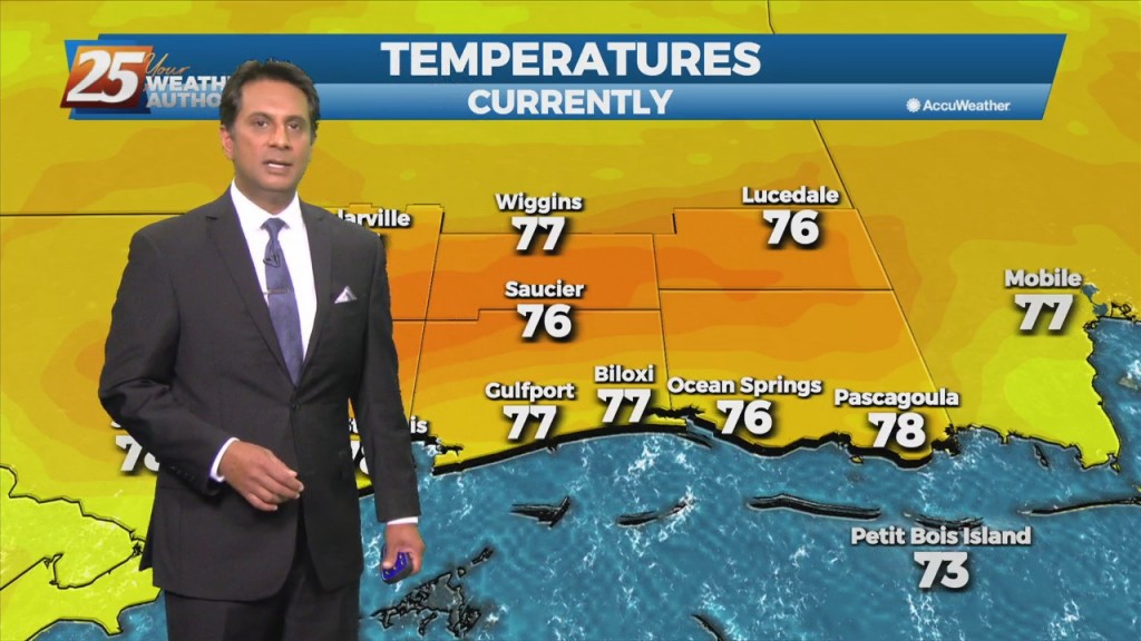
After another CHILLY start to the day, temperatures are warming nicely into the 70s...