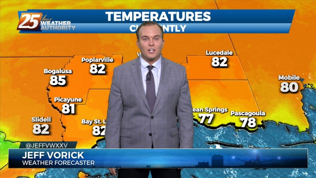
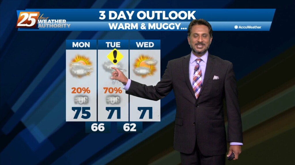
2/27 - Jeff's "Very Warm" Monday Afternoon Forecast
Temperatures are soaring into the 80s for a lot of the area. Winds will remain elevated with gusts of 25-30 MPH this afternoon. Winds will back off and…
Temperatures are soaring into the 80s for a lot of the area. Winds will remain elevated with gusts of 25-30 MPH this afternoon. Winds will back off and…
The threat for severe weather will be in the area this afternoon/evening with a cold front approaching from the west. Severe weather variables are not remarkable…
The old stalled cold front that retrograded west has primed the area with warmth and instability. But there is still a weak cap in the low levels…
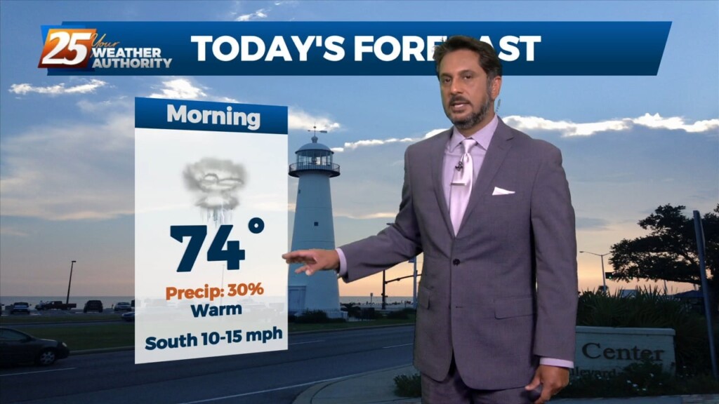
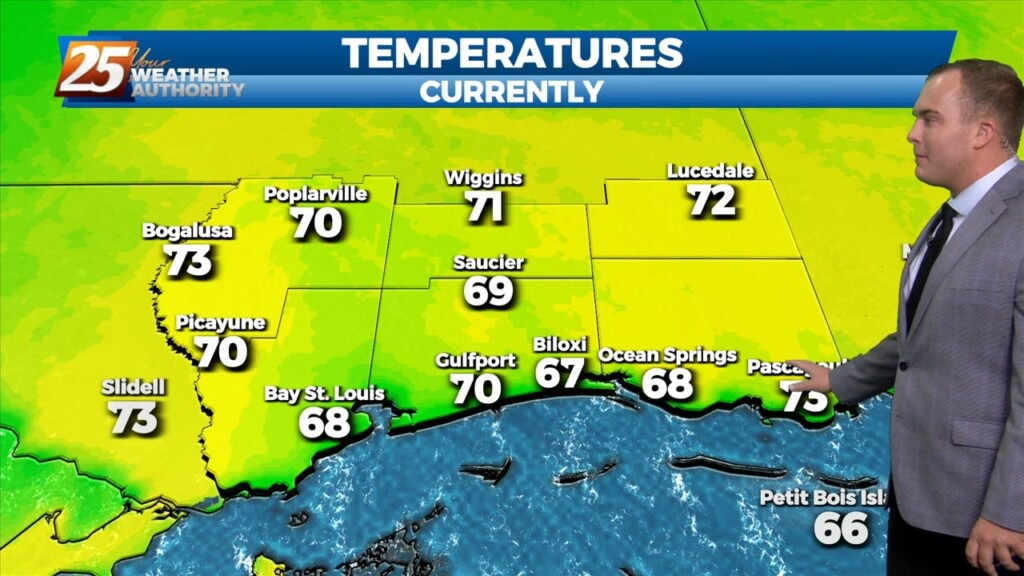
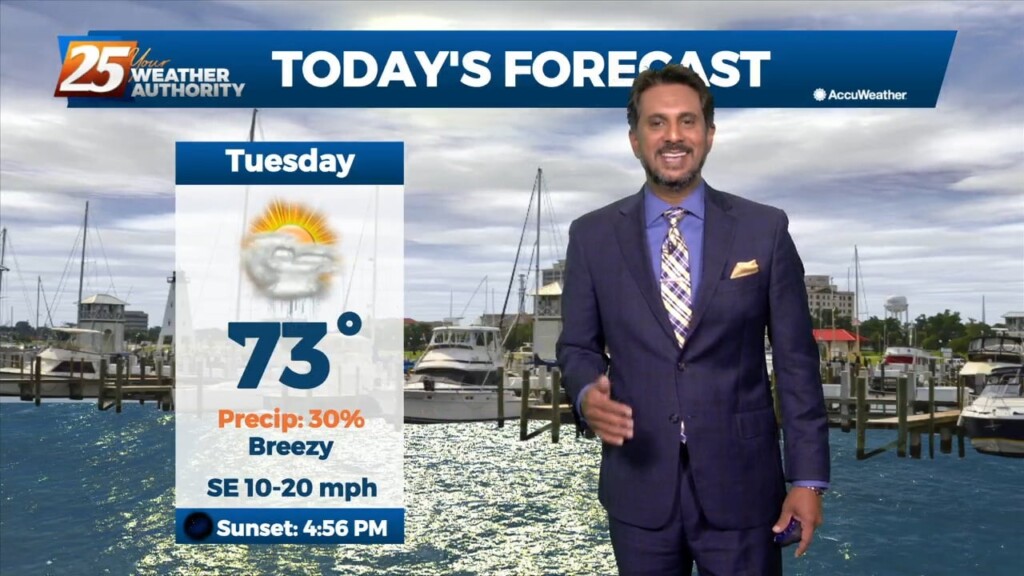
The warm and humid pattern continues across South Mississippi. Temperatures will be in the 70s this afternoon under predominantly cloudy skies, with breaks in the clouds…
It’s a warm one this Valentine’s Day. Winds are elevated and will remain breezy the rest of this afternoon. Clouds are on the increase. We…
A cold front moving toward the area today will do so at a rapid pace but will not only pump the brakes but will stand on them…
High pressure centered over Florida this morning, with an upper level disturbance to the west with an associated surface cold front. Light southeast winds continued…
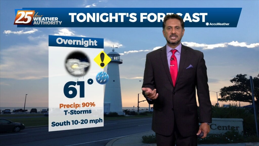
A warm front will lift out of the gulf and move over the area around noon today. This front will allow some showers/t-storms to develop by…
Sunshine is back to start the week! Temperatures will be near our seasonal norms this afternoon with only a few upper-level clouds. Tonight will be another cold one for…
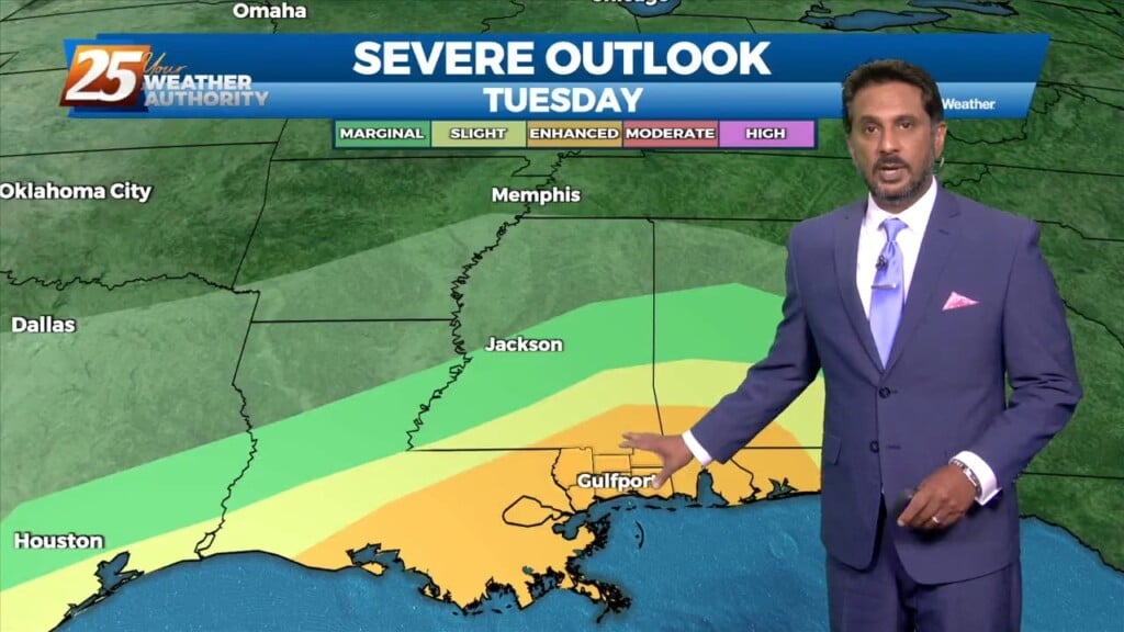
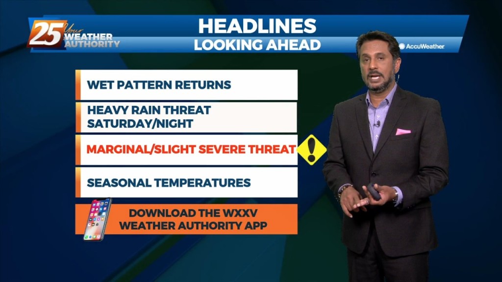
Bottom line up front...main concern for this forecast package will be with the storm system expected to impact the Gulf Coast Tuesday into Wednesday morning, with the…
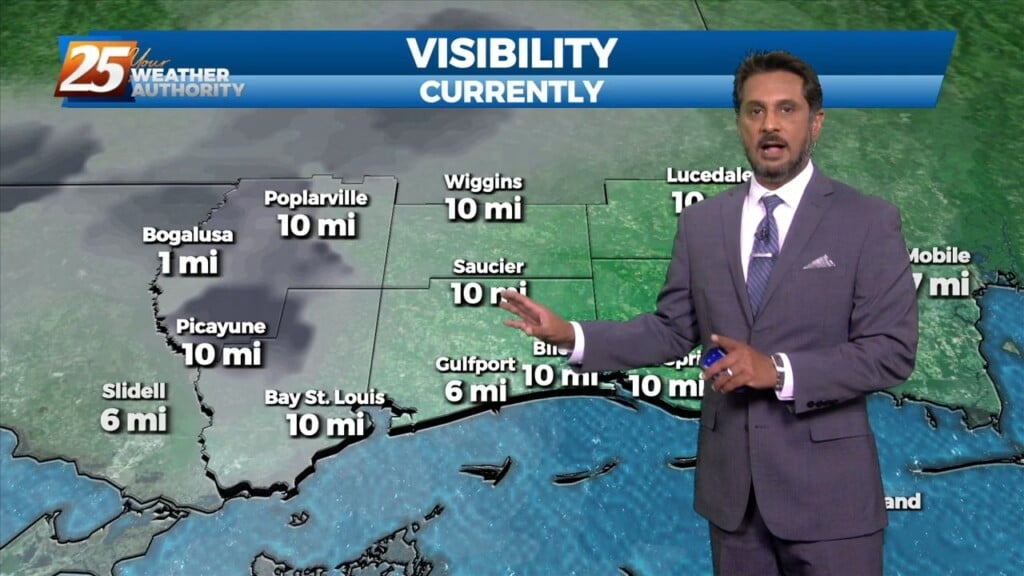
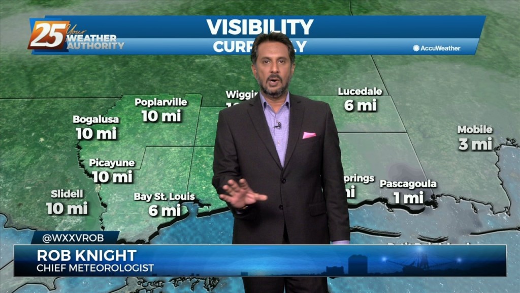
Sea fog will also pin right along the coast today so not expecting much improvement from earlier this morning. Outside of the fog, eyes start…
2023 is off to a busy start weather-wise across our area. We’ve had fog issues that will plague us again tonight. Sea fog is settling…
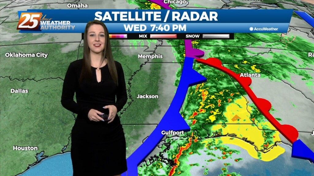
As we head into the latter part of our evening, we're finally seeing clearing conditions behind a dynamic and intense cold front that slowly pushed through our area throughout…
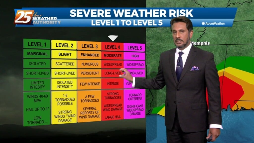
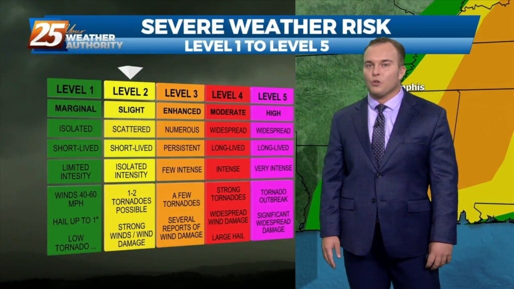
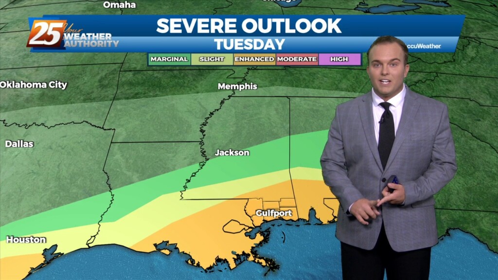
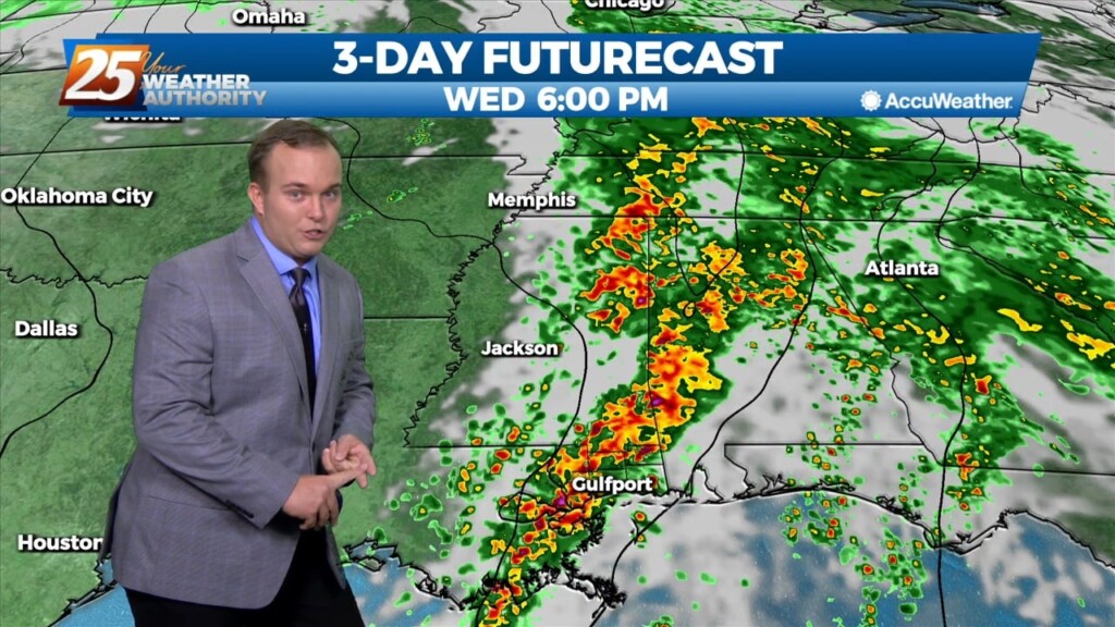
Significant severe weather and excessive rainfall threats can be expected this afternoon into mid-evening...especially from the Interstate 10 corridor northward. A vigorous system just to the…
The main forecast issues for the entire forecast package occur in the first 18 hours of the forecast...today and this evening. Significant severe weather and excessive…
The beginning of the pattern change is underway across South Mississippi. Winds have increased and it will continue to be a breezy afternoon. A warm front associated with…
A very complex forecast through the period, with a potent storm system starting to develop across the high plains just east of the front…
This warm , humid air mass will continue as a high pressure spreads east over the Mid Atlantic. The southerly/southeasterly winds really begin to ramp as…
Ongoing activity will begin to settle down this morning as a front moves through the region. A drier/cooler northerly wind will develop across the region…
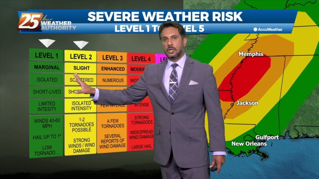
A pleasant day ahead with high-pressure to the NW shaping the short-term forecast. The primary headline to monitor beyond today is severe weather and excessive rainfall potential…
Cloudy skies will continue this afternoon with breezy conditions from the North at 10-20 mph. Tomorrow, a stronger system will move across the Southern Plains, finally…
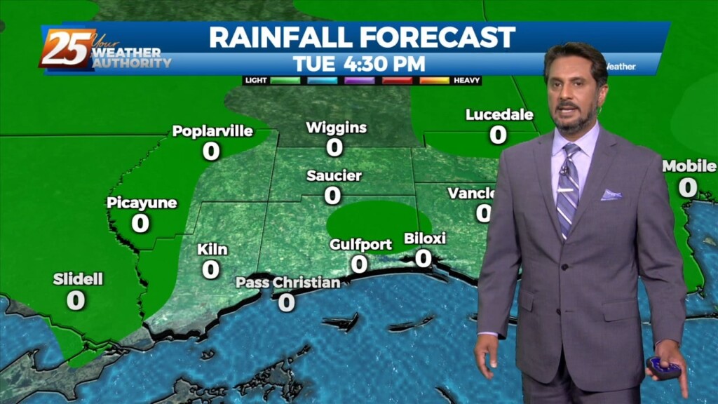
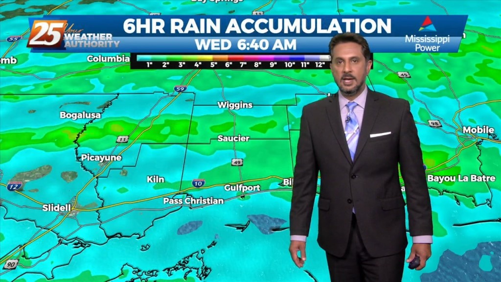
The main issue continues to be the heavy rain threat across the area as showers and thunderstorms continue to move from west to east across the…
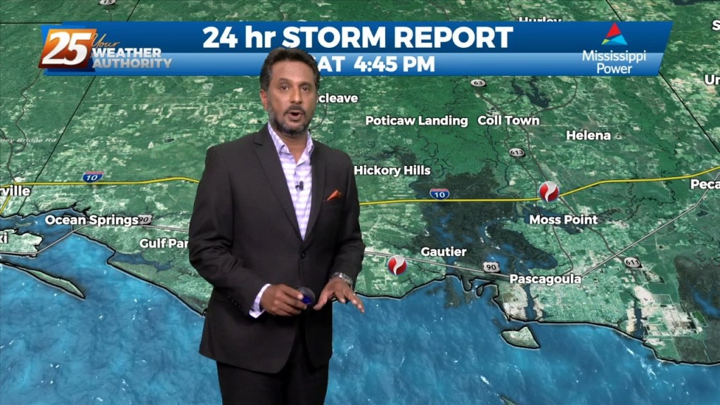
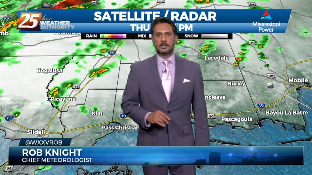
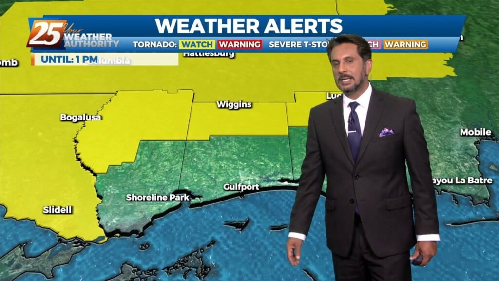
Doppler continues to indicate low-level rotation with a broken line of showers/t-storms training north in Jackson and George county. A tornado was confirmed in…
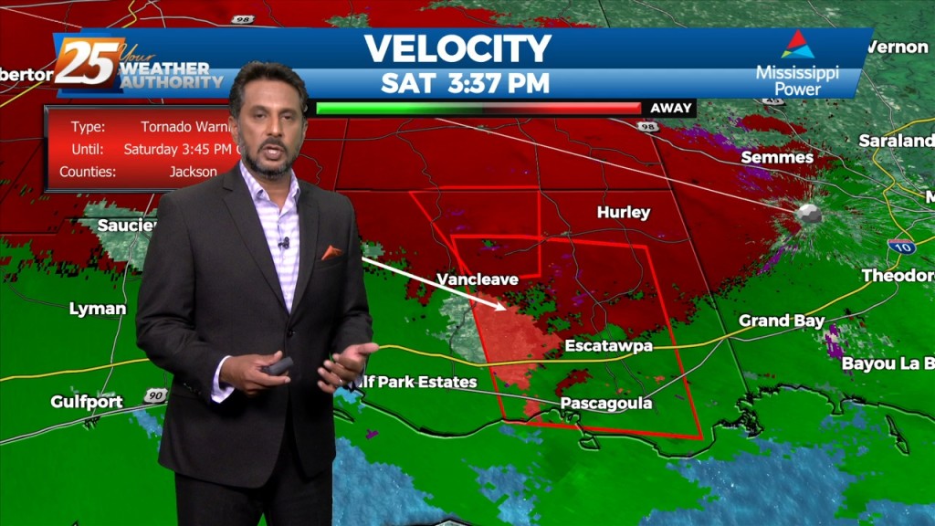
Multiple tornado warnings are being indicated by Doppler in SE Jackson County. Stay safe and stay weather aware...