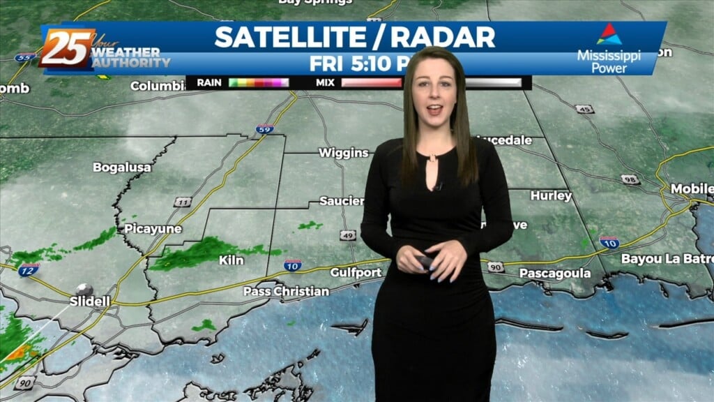
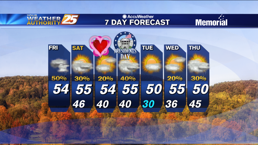
3/10 - Brittany's "MAR10 Day" Friday Evening Forecast
We've officially had a cold front make it's way through our area and can expect colder and drier conditions behind the front for a brief period of time.…
We've officially had a cold front make it's way through our area and can expect colder and drier conditions behind the front for a brief period of time.…
Widely scattered afternoon/evening showers and a few t-storms will affect the area this afternoon, dissipating this evening. The prospect of locally dense fog forming…
Some weak convection has developed over the MS Sound and near the Pearl River this afternoon. This is likely in response to steel low level lapse rates/enhanced…
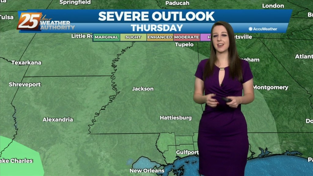
As far as threat timing is concerned, the tornado threat peaks this afternoon ahead of the cold front when SRH and surface-based instability is maximized while with…
The biggest concern in the short term is the potential for severe through the remainder of this afternoon and overnight tonight ahead of an approaching cold front. Already…
Upper level analysis shows a ridge centered just south of Florida, a broad trough over the northern half of the country east of the Rockies and a…
Upper level analysis shows a ridge centered just south of Florida, a broad trough over the northern half of the country east of the Rockies and a…
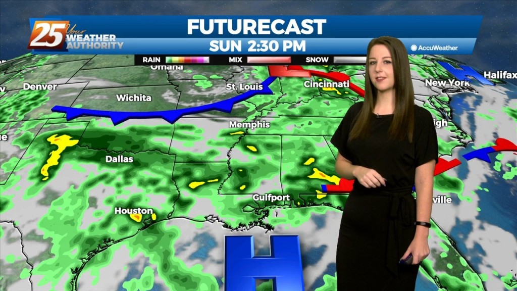
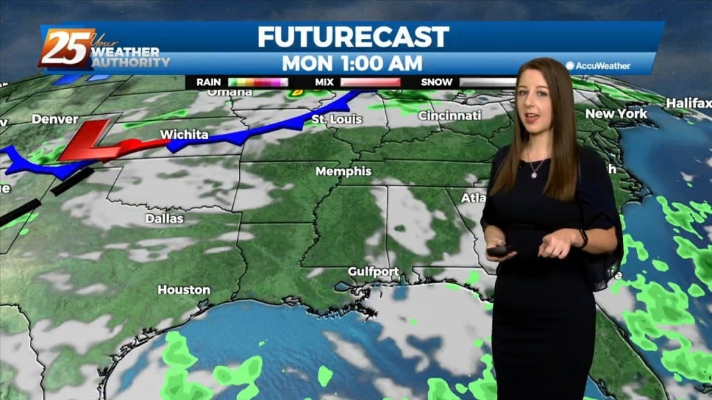
Main concern in the short term will be rain potential the next 48 hours but when will rain actually reach the ground is more of an unknown. 12z…
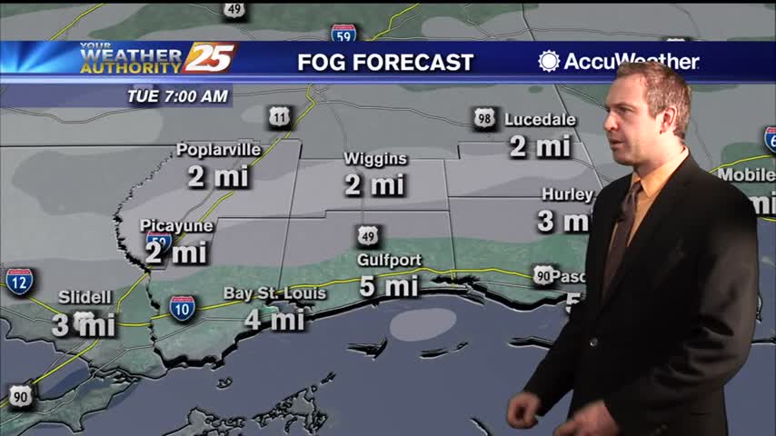
We're on tap for a cool, quiet, and overall mild night, with the exception of morning fog. The quiet and dry conditions will be short lived though because beginning…
We're on tap for a cool, quiet, and overall mild night, with the exception of morning fog. The quiet and dry conditions will be short lived though…
A weak front along the coast will dissipate by tomorrow. A more typical August pattern of high pressure extending westward across the eastern Gulf and…
Forecast remains stubbornly similar for the next few days before a more focused system impacts the region late this week. The mid level ridge that has been…
Through Tuesday, the upper ridge flattens as low pressure systems move through southern Canada. With ample moisture in place, and only weak influence of the upper ridge, generally scattered…
An area of low pressure located of across Central Alabama is producing showers and thunderstorms that are expected to move to the north and east. This low…
An area of low pressure located of across the Northern Gulf of Mexico is producing showers and thunderstorms that are expected to move to the north and…
Low pressure is currently over southern Indiana with a cold front southwestward to near Memphis and Shreveport. As the surface low continue to lift northeastward, the cold front will…
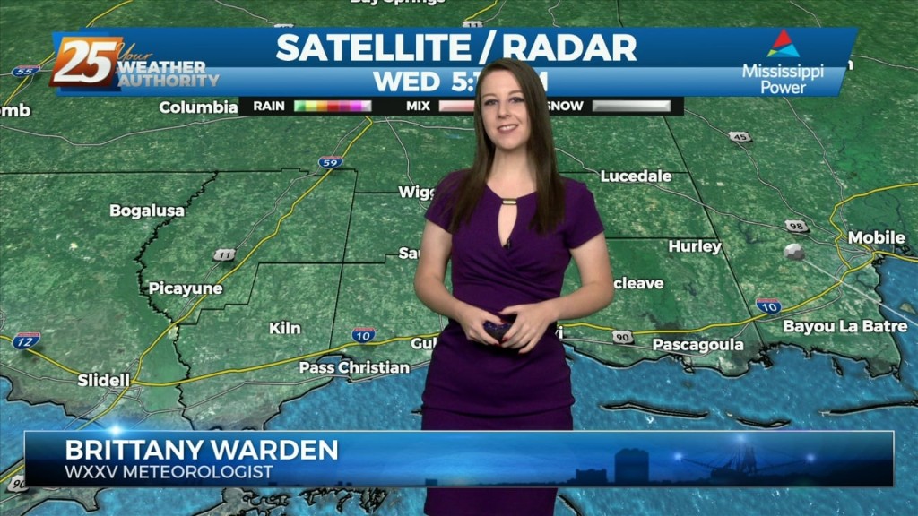
Today brought our first wet weather in over a week as much drier, cooler weather has dominated until now. That changed quickly last night as warmer, more humid…
Today brought our first wet weather in over a week as much drier, cooler weather has dominated until now. That changed quickly last night as warmer, more humid air…
The forecast today through the weekend will be similar to the last few days however there is one hiccup that may keep convection from being as widespread. High-pressure in the western Atlantic and over the western CONUS west of the…
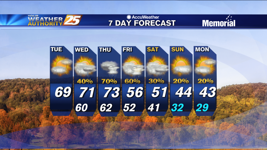
Just more of the same from the end of last week as we begin this one, but more rapid changes will be moving in soon.
One last grey, rainy day before the sun returns for an extended period, but it isn't going to cool all that much....
Not much change initially, but much cooler weather is expected in the days ahead before Arctic air moves in to begin next week.
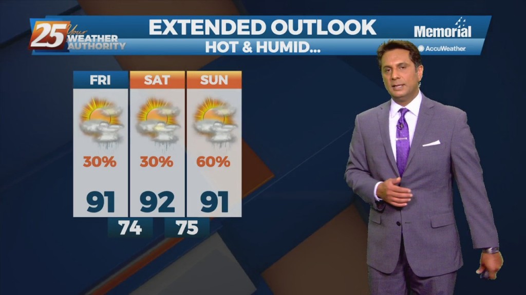
Going to be considerably warmer and more humid than the weekend was, and get ready for a big change by the start of next week!
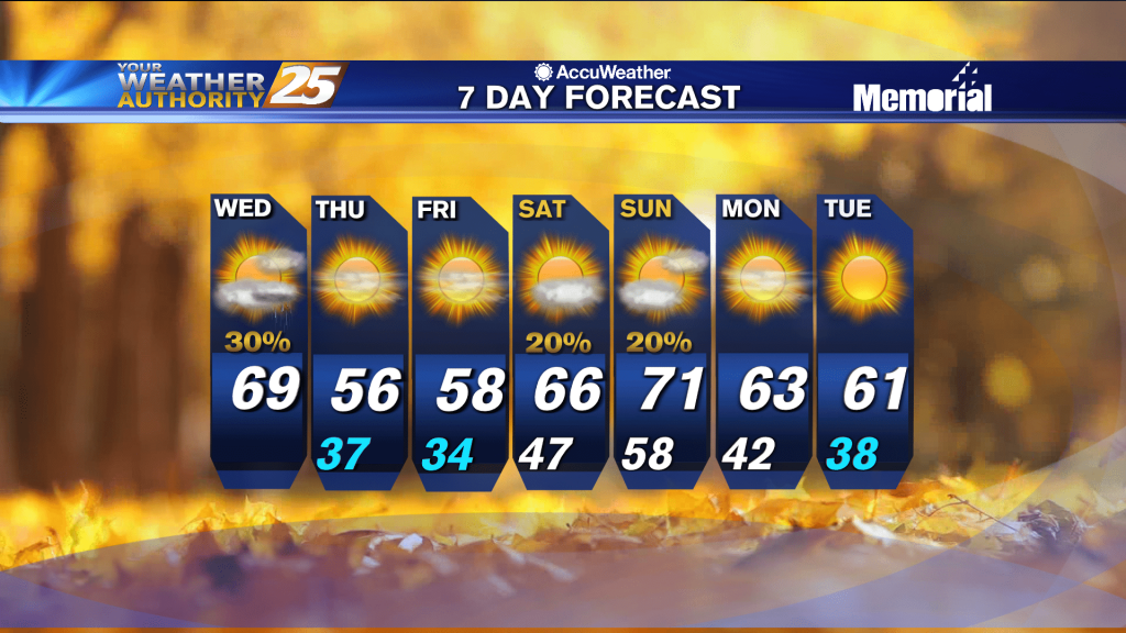
Not much has changed over the last few days as cloudy days and foggy nights linger, but change is moving in quickly tomorrow afternoon.