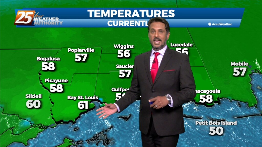
1/23 - The Chief's "Cold Start" Monday Morning Forecast
Bottom line up front...main concern for this forecast package will be with the storm system expected to impact the Gulf Coast Tuesday into Wednesday morning, with the…
Bottom line up front...main concern for this forecast package will be with the storm system expected to impact the Gulf Coast Tuesday into Wednesday morning, with the…
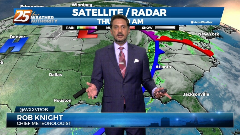
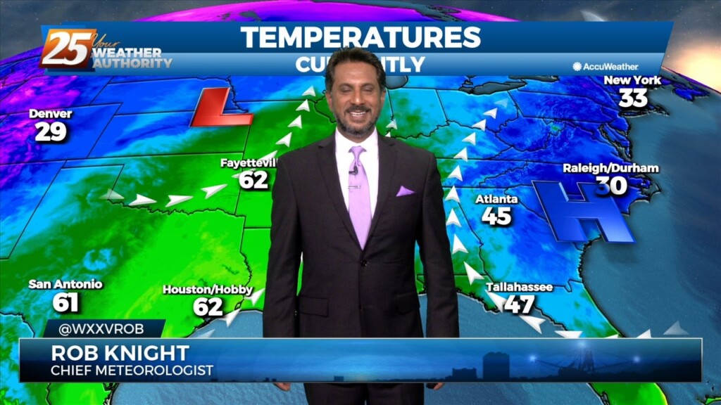
At the surface, the Wednesday night's cold front is well out into the central Gulf of Mexico, with high pressure extending from Wyoming to near…
Areas of upper level low pressure over the Great Lakes and near Las Vegas early this morning, with the local area in southwesterly upper flow, which…
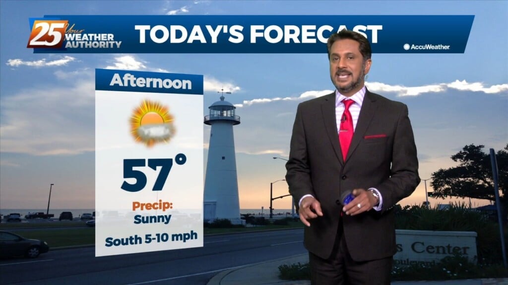
With no significant cold advection behind this morning's cold front, we should mix out deep enough to get temperatures back in the 70s today with much…
The cold front is now east with high pressure shifting eastward across the area today and Friday in a very progressive upper pattern. This will provide a mostly…
A low pressure system over Wisconsin is dragging a cold front north of the !-20 corridor. Isolated rain south of the boundary exists all the…
We start to enter a more active weather pattern starting today as an upper level disturbance moves eastward with an associated front forming at the…

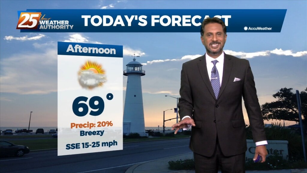
A BEAUTIFUL afternoon ahead with breezy conditions out of the SW. A cold front moves through Thursday and should enter the area around 9am and…
The pattern will remain quiet today with transitional conditions tomorrow. A fast-moving upper level disturbance will move past the area late tonight, but with little moisture…
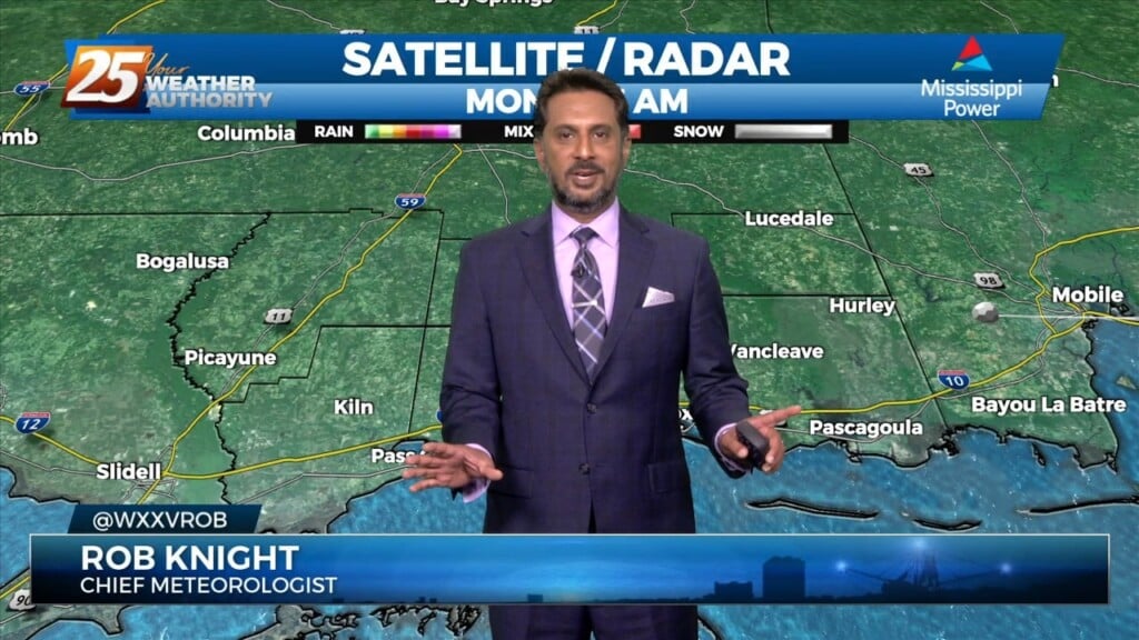
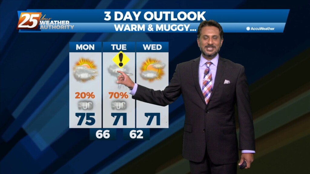
In a nut shell - Generally quiet weather conditions expected through the short term with near normal temperatures through tonight and above normal temperatures Tuesday and…
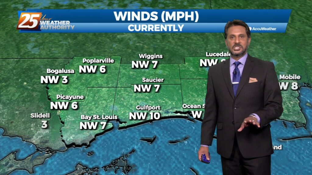
Surface high pressure will continue to spread into the region, which should limit surface winds keeping things light and variable through the short term period.…
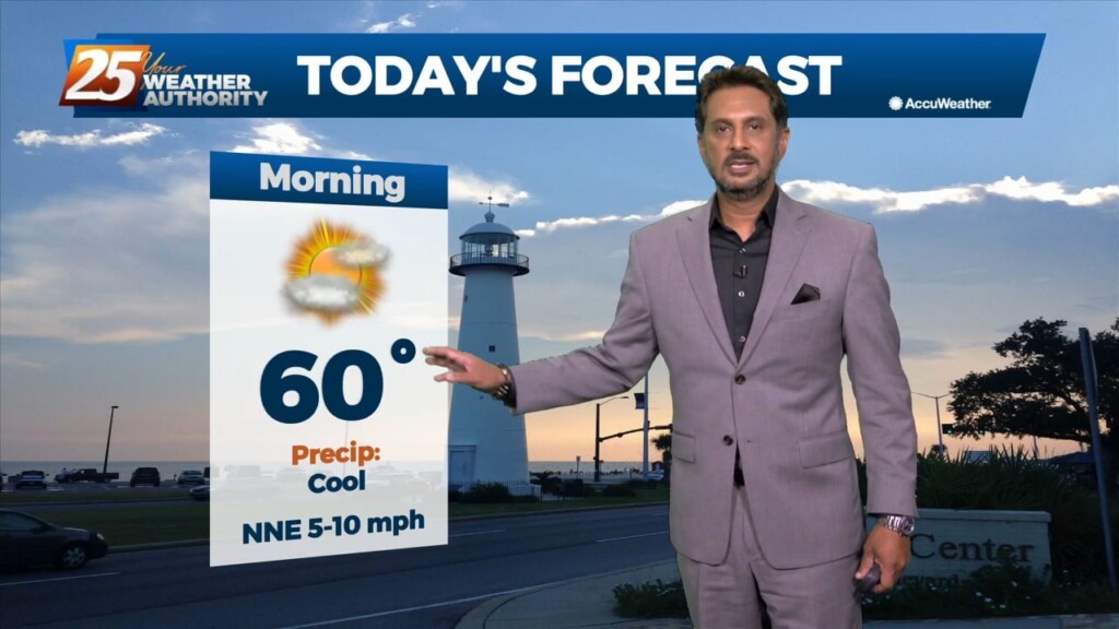
It will be a bit cooler today, but overall a very beautiful day ahead across the lower Mississippi River Valley/North Central Gulf Coast. Aloft,…
A cold front is currently east of the area moving east with a few lingering showers. Behind the front, very subtle Cold Air Advection will…
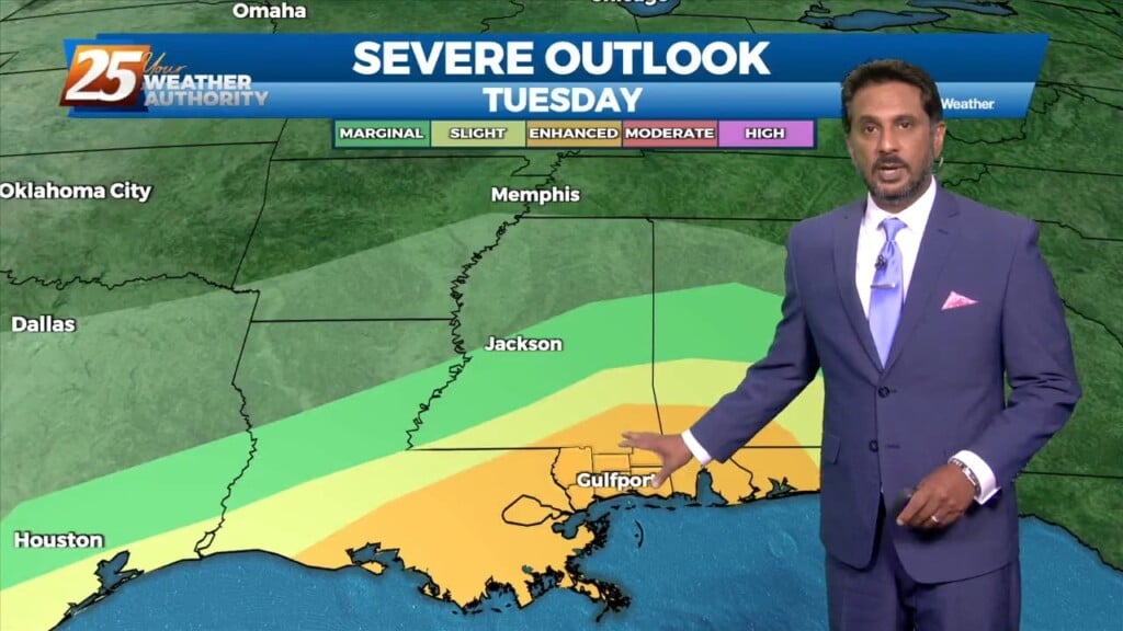
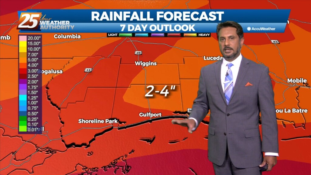
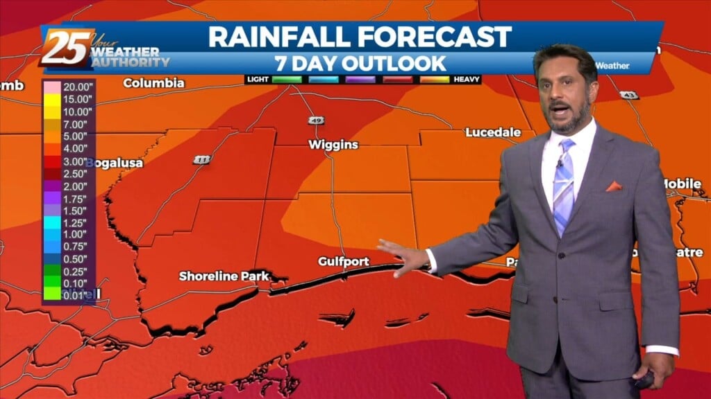
The front to the west has begun to slow with discrete super-cell t-storms developing in advance of the main system. The low level jet does somewhat…
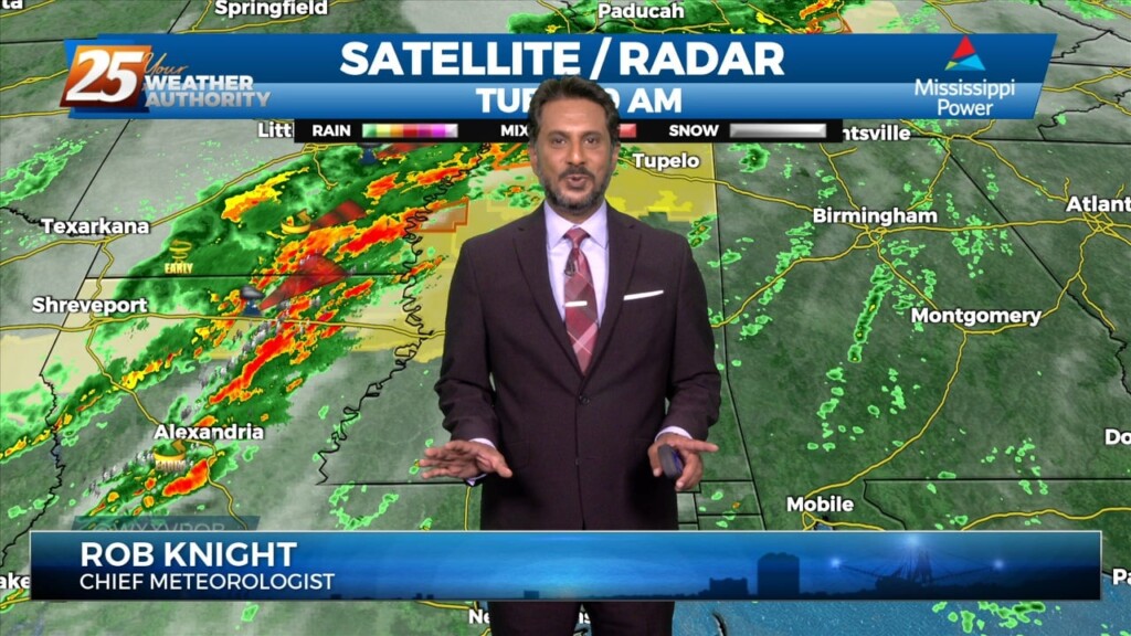
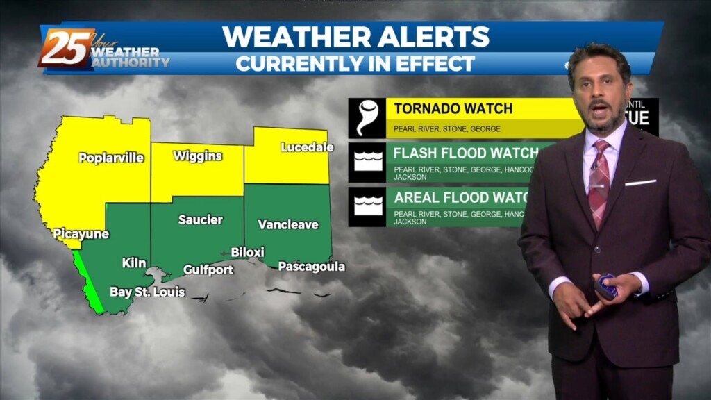
The focus today is the storm system due into our region. Expect the overall forward progression of the front to slow, with the main threat of discrete super-cell…
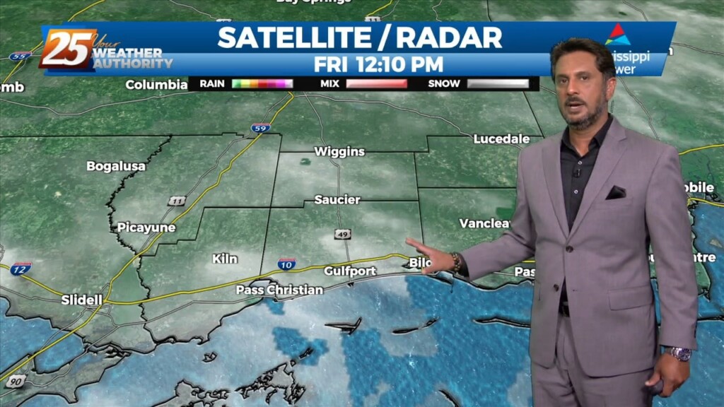
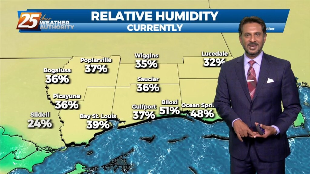
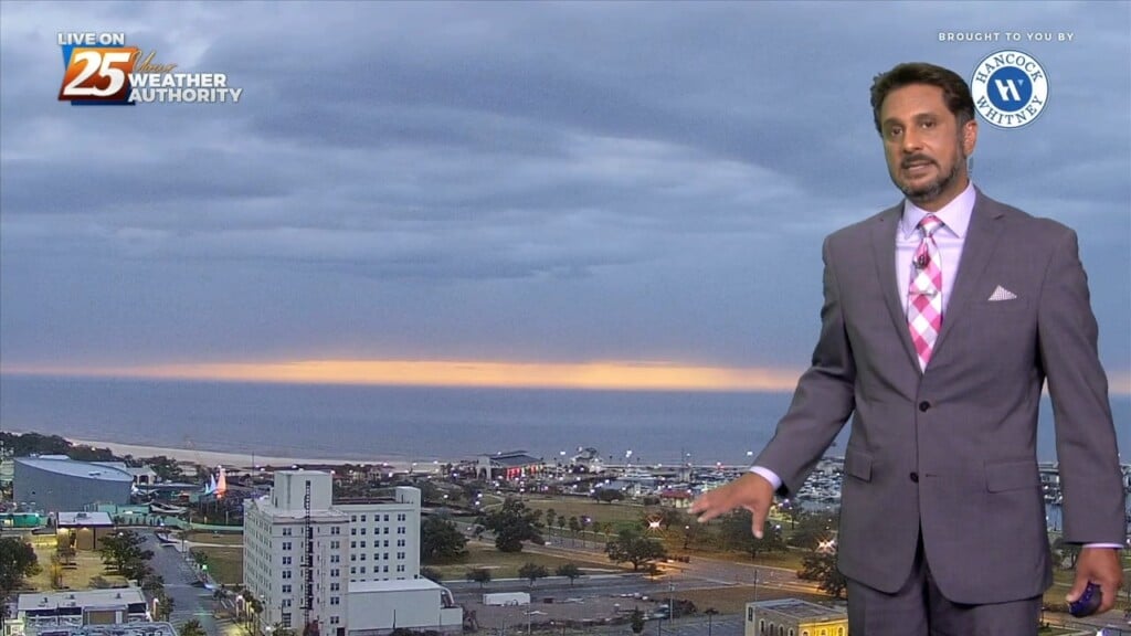
Sea fog will also pin right along the coast today so not expecting much improvement from earlier this morning. Outside of the fog, eyes start…
The fog machine continues across the region this morning. Southerly flow is helping advect 65-70F dew-points over sea surface temperatures generally ranging from the lower to…
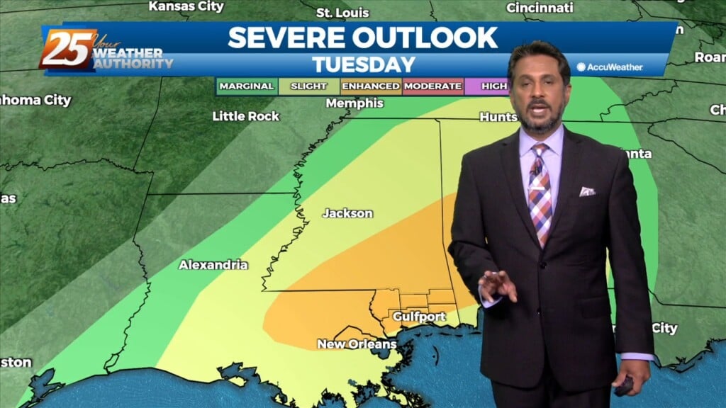
A line of strong to severe thunderstorms will move through our area this afternoon. As this line moves into our area it will…
After today we will be heading into a much more active pattern. A Major disturbance will be digging down through the Central and Southern Plains…
Today will be a very nice December day with partly cloudy skies and afternoon high temperatures in the low to mid 70s. After today we will be…
This afternoon will remain mostly quiet outside of a couple possible showers over the coastal waters. We see our first real warm-up day of the warming…
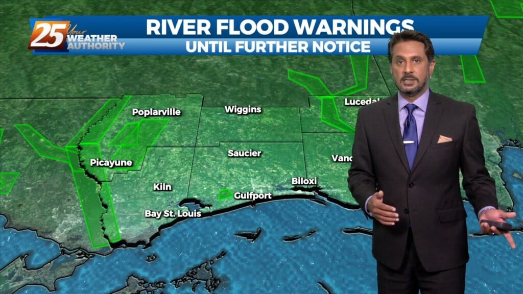
The forecast remains mainly unchanged, with heavy rain possibilities and fog potential remaining the focuses of the short term. Today will remain mostly quiet outside of…
Surface high pressure will build into the region behind this front today bringing mostly sunny skies and calm winds. Heading into the late evening and…
A weak disturbance will be passing over the area within the next few hours, but not causing much noise as it comes through. It will delay…