5/3 - The Chief's "Benign Weather Pattern" Wednesday Morning Forecast
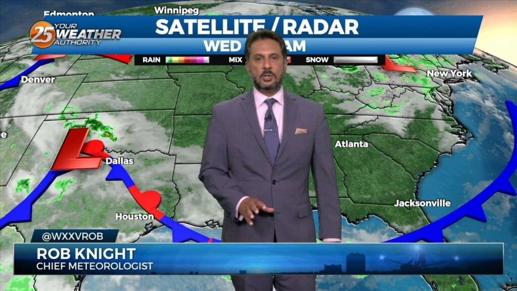
Not much has changed with the overall pattern though the region. A strong upper level low pressure system is currently located over the Ohio Valley and…
Not much has changed with the overall pattern though the region. A strong upper level low pressure system is currently located over the Ohio Valley and…
There really isn’t a whole lot of material for discussion in the package as we’re in a period of benign weather. Upper level northwest flow on…
The center of a broad upper level disturbance is currently near the Great Lakes with weakness encompassing almost 2/3`s of the country…
Yesterday’s frontal system will continue sliding east out of the area. Zonal flow will dominate the upper level pattern, with a northerly surface winds becoming SE…
As an area of low pressure continues to drag a cold front through the region, isolated t-storms will continue this afternoon but begin to diminish late afternoon.…
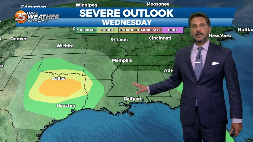
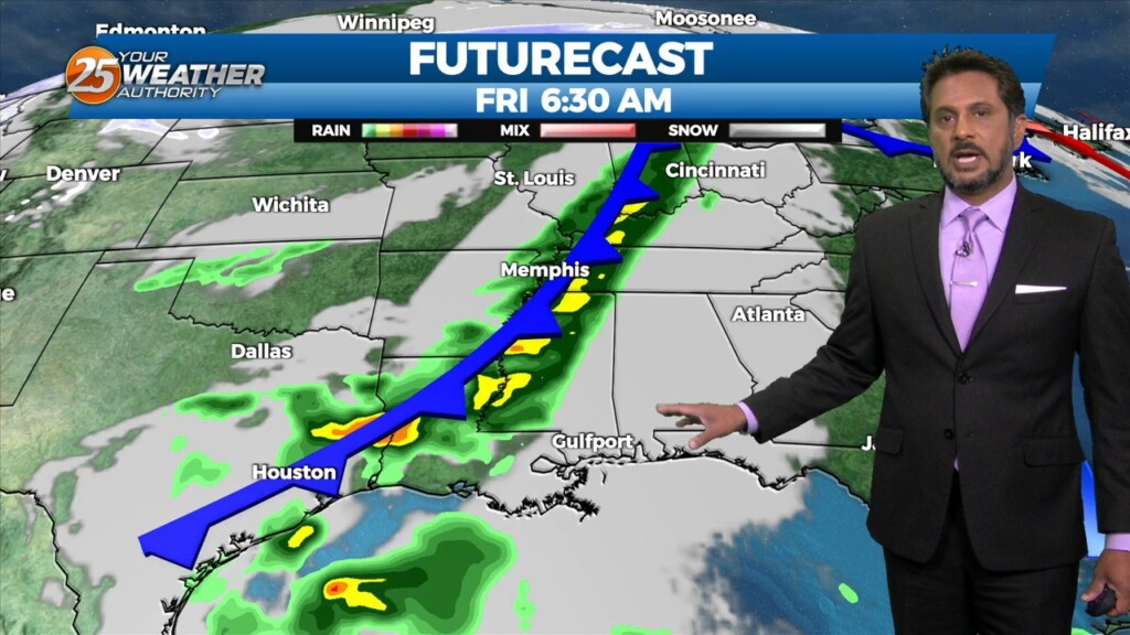
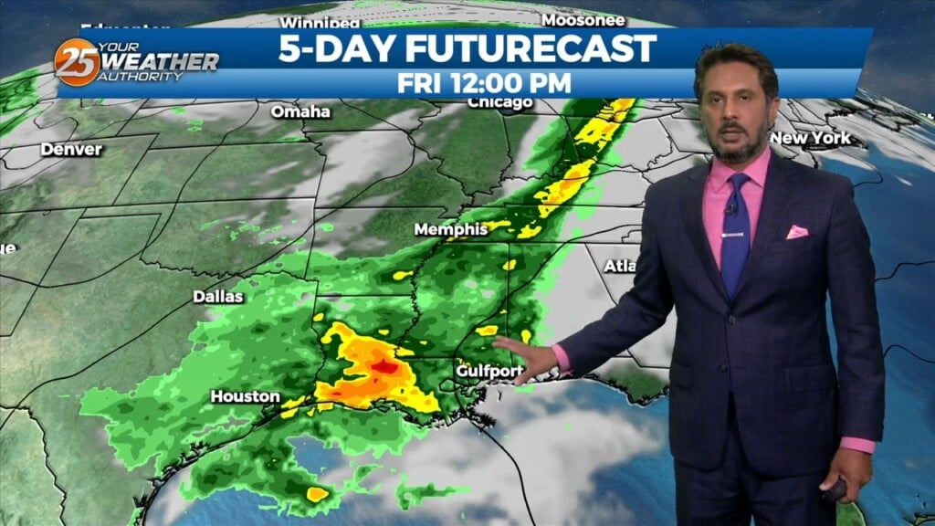
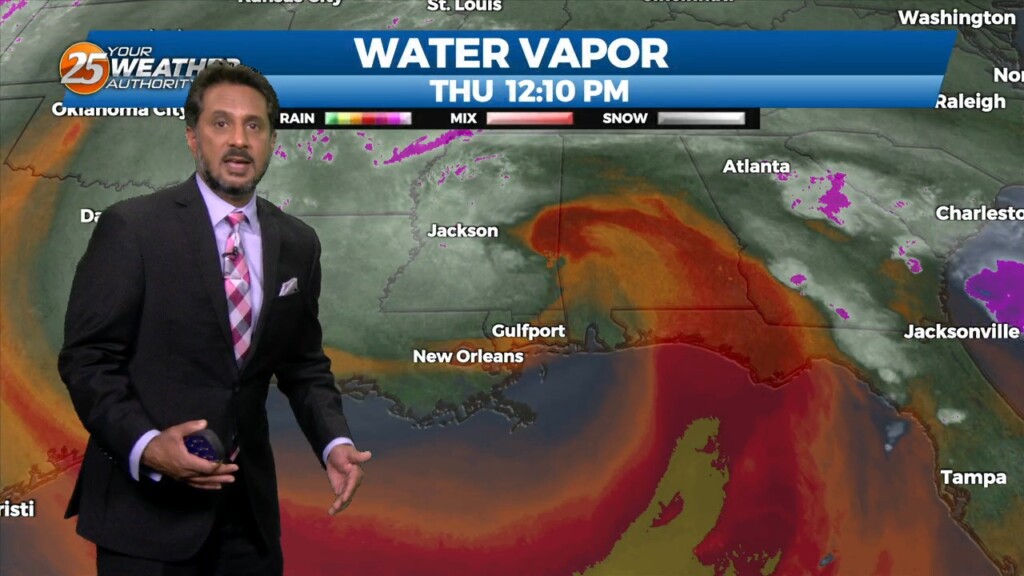
A weakening upper low currently moving through the Central Plains will continue east across the lower/mid-Mississippi Valley this afternoon and evening. With increasing low level moisture, cooling…
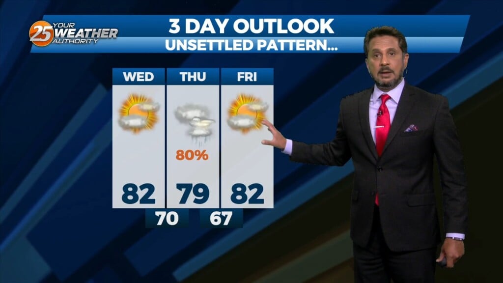
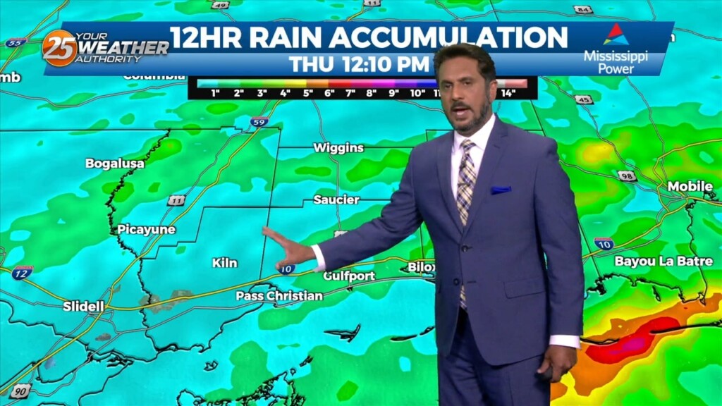
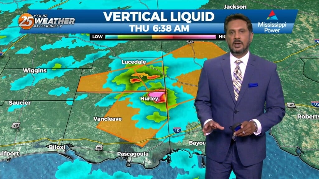
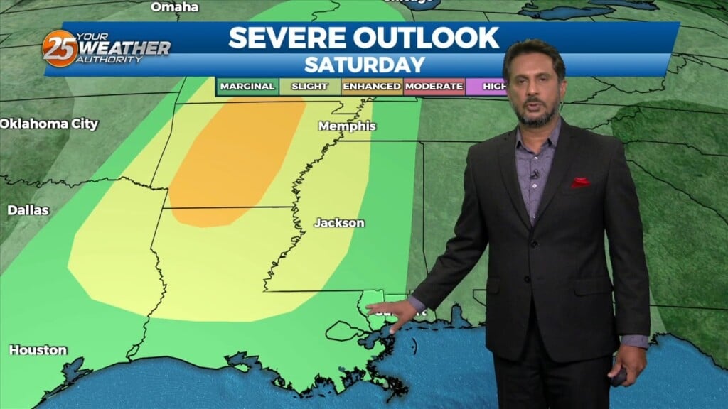
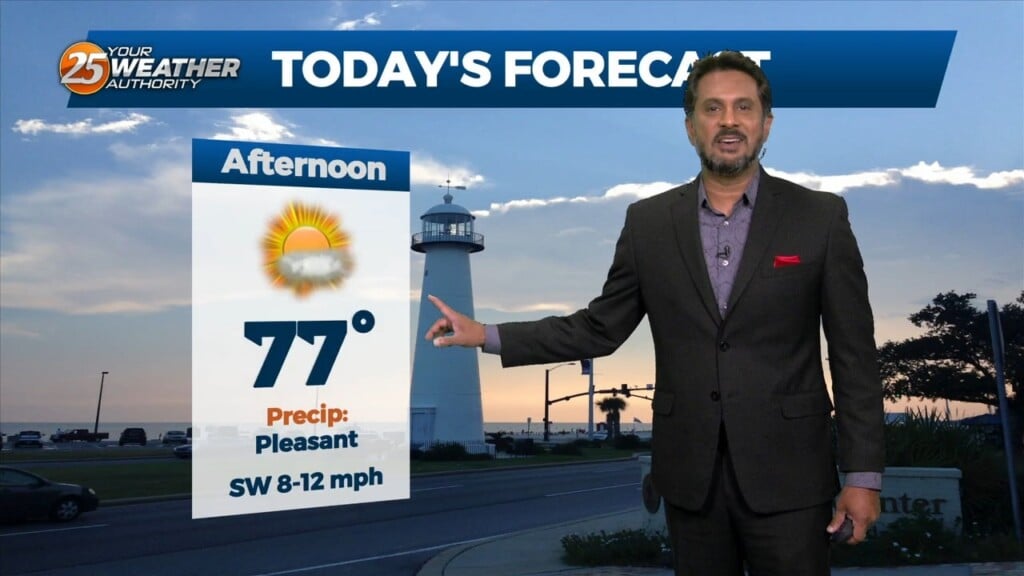
This afternoon will bring pleasant conditions as sky condition will vary between partly/mostly cloudy skies. Much of the focus is on Thursday as severe weather seems…
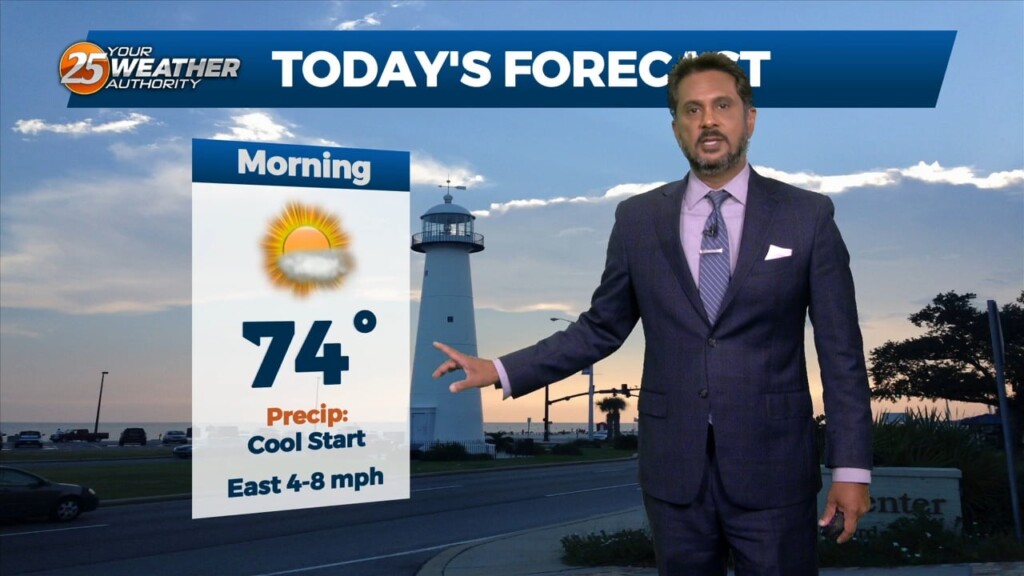
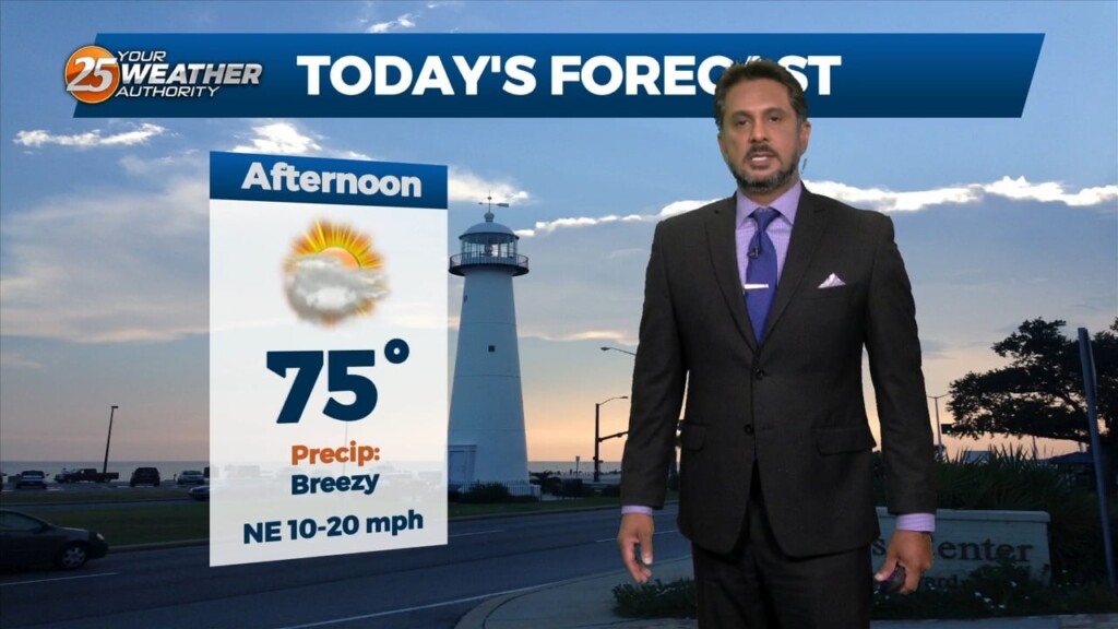
Today will bring a fairly quiet weather pattern with cloud coverage varying through this evening with slightly warmer as low-level winds start turning more onshore flow. The…
Starting on Wednesday, a disturbance over the northwest is expected to eject over the southern plains. This will pick up a stalled front over the coast and…
With a disturbance over the Great Lakes, and another disturbance over the northwest, we look to stay in zonal flow for the next couple of days, keeping…
High pressure over the northern Rockies is setting up a quasi-zonal flow across the southern third of the country. At the surface, a reinforcement of drier…
An area of low pressure remains over the Great Lakes this morning, with a disturbance moving into the Pacific Northwest. High pressure was noted over the…
A surface, a cold front will slowly move across the area with a nearly solid line of showers and thunderstorms this afternoon. The main…
Early this morning, a strong upper disturbance extended from the Upper Mississippi River Valley southward into Texas. At the surface, a cold front extended from…
The upper pattern this morning has high pressure over the Great Lakes, with weakness from Montana into west Texas, and over Florida. At the surface, high…
There is upper troughing over the northwest and northeast corners of the country with high pressure over the northern Mississippi River Valley. The shortwave that moved…
The upper troughs are located north of the Great Lakes and off the British Columbia coast this morning with high pressure over the center of the…
With high pressure in control of the region, we won’t see much in the way of moderation through at least through Tuesday as we will basically…

As high pressure will shape the forecast, the next few days is primarily a temps and cloud cover forecast. As the deep closed low continue to…
Things will be rather quiet today, with mostly sunny skies and drier conditions making for a nice day as high temperatures reach the mid-70s to low…
The surface low has exited our area at this point, with some weak high pressure expected to pass through today. This keeps things rather quiet today,…
As the surface low pressure exits the area we will see brief high pressure move in which will slowly begin to clear the clouds. Friday will be…
The surface analysis shows that the surface low has formed and is sitting just off the coast of Mobile early this morning. This low will continue to…

A surface low pressure is developing over the central gulf at the moment but this will move north today with an explosion of storms offshore of the…