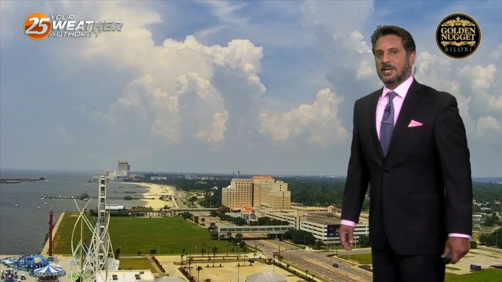
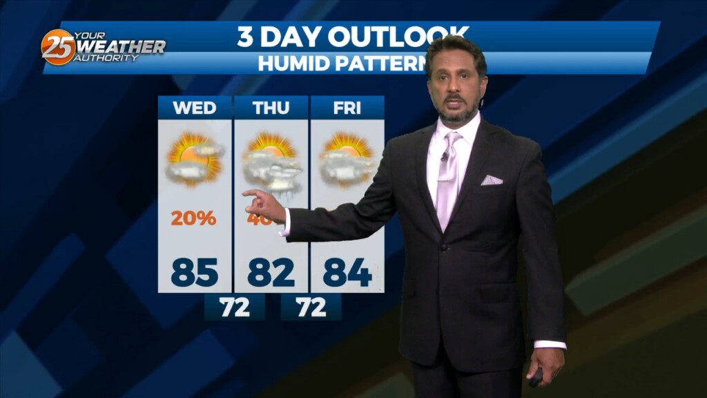
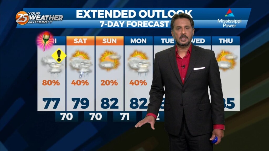
5/24 - The Chief's "Slight Cooler" Wednesday Afternoon Forecast
Models signal very similar activity during peak afternoon heating compared to yesterday. Temperatures today look to vary a good bit, as highs will max out in the lower…
Models signal very similar activity during peak afternoon heating compared to yesterday. Temperatures today look to vary a good bit, as highs will max out in the lower…
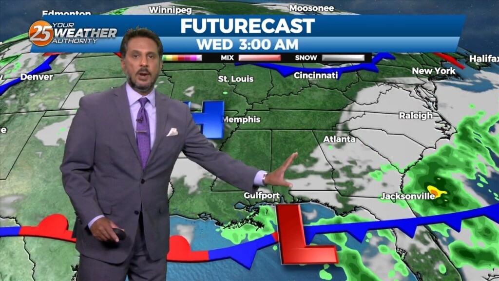
Under a further amplifying disturbance, the region will remain on the dry side of this feature. The best lift and instability will be through the Gulf South.…
With the cooler upper levels and amplifying disturbance, expect a continuation of lower end rain chances despite being on the drier side with upper level flow becoming…
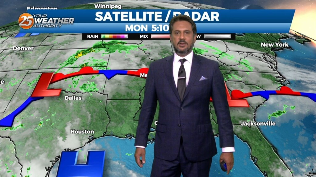
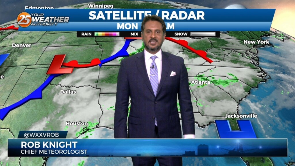
A deepening upper level disturbance is situated over the Southeast U.S. An approaching weak backdoor cold frontal boundary is expected in the region later this…
Some weak marine convection has developed near and east of the mouth of the MS River this morning. A few lightning strikes have occurred, but…
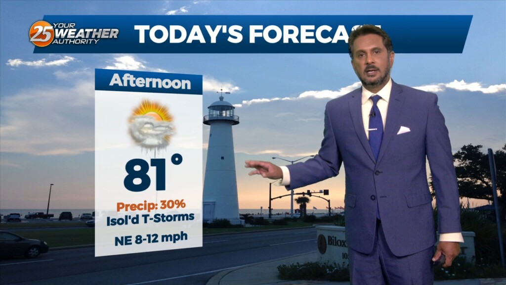
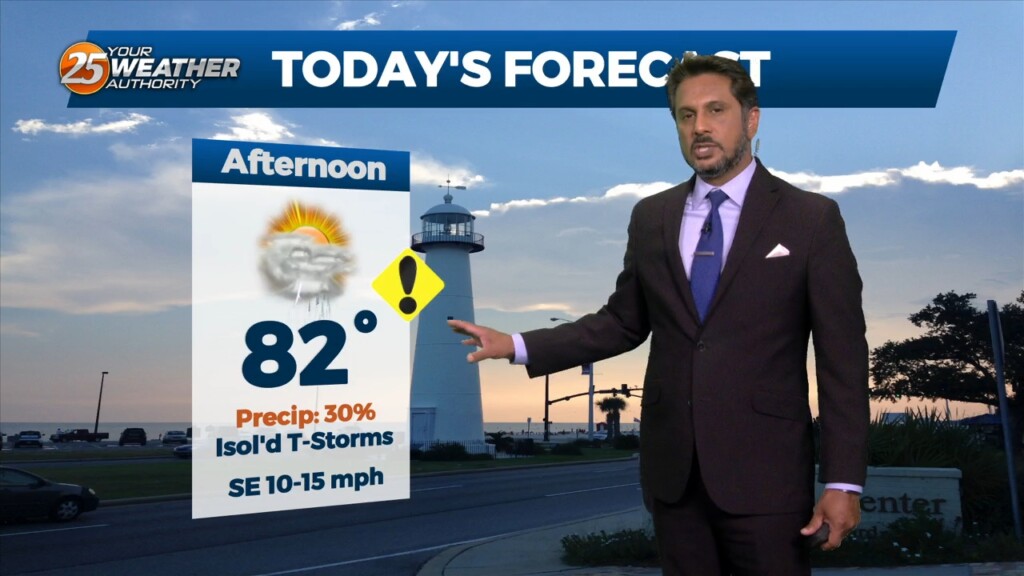
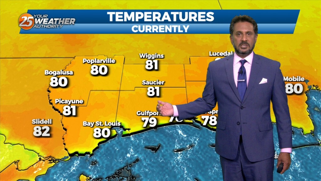
Today I’m expecting temperatures to climb into the lower 90s (heat indices nearing mid 90s) today across much of the area so be mindful to stay hydrated…
Despite the frontal passage overnight, temperatures will actually be slightly warmer today given the drier mid-levels holding down afternoon convective development. Rain chances will be lower…
Mid-level dry air is moving into the area from the west this morning on the backside of the exiting upper level disturbance retrograding back to the…
Light westerly flow ahead of the weak surface front will favor initiation of thunderstorm activity on the eastern side of Lake Pontchartrain and coastal MS earlier…
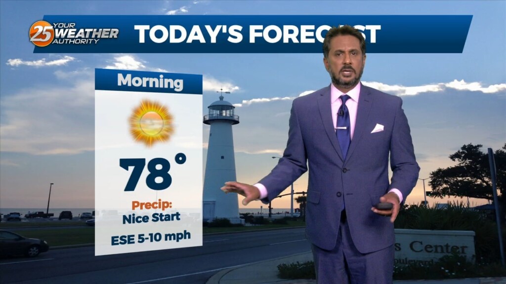
Surface warming will once again commence bringing us to convective temperatures in the upper 80s by noon, however, more abundant high clouds may just keep us…
More of the same summer-like weather will persist today despite the mid-level high pressure gradually waning. Convective temperatures in the upper 80s to low 90s will be…
An upper-level high pressure that has been parked over the area should break down throughout the course of today. Although the ridge should be breaking…
A HOT & HUMID afternoon ahead with breezy conditions out of the SE. High temperatures will max out in the mid to upper 80s, some areas…
Another hot and muggy day is in store today with highs in the mid to upper 80s, some areas reaching 90F as morning clouds clear out…
An upper level weakness continues to reside over Texas this afternoon keeping our region under an active southwesterly flow aloft with impulses circulating around this upper level…
Overall, a complicated forecast through the short term, mainly due to the upper level pattern over the region. An upper level weakness continues to reside…
This afternoon will bring drier conditions from the spotty rain moving across the area earlier. The lack of convection will lead to warmer afternoon temps but…
The high pressure that has been over the region has been providing for little to no resistance to convection working into the area from the…
A line of showers & t-storms moving across SW Mississippi should continue to slowly spread/work east-southeast through the pre-sunrise hours and slide east through 9 a.m. before…
This pattern will be in place today through Sunday. This onshore flow regime will advect in a substantially more humid airmass into the area today and…
A very persistent pattern of weak upper level high pressure with passing disturbances will continue through the Lower Mississippi Valley. This pattern will be…
An upper level high pressure will build in across the middle of the country from the Gulf Coast all the way to the Northern Plains.…
A broad longwave disturbance is currently encompassing the eastern 1/3 of the country and will continue east today and tomorrow. Upper level high pressure…
A strong upper level low pressure system is currently located over the Ohio Valley and moving into New England is holding some influence interacting with…