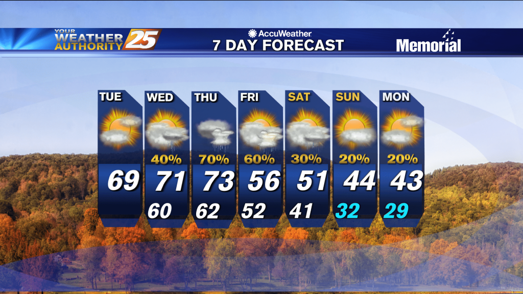
09/28 Ryan's "Damp" Tuesday Evening Forecast
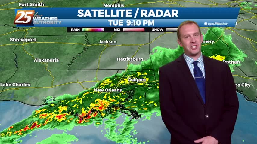
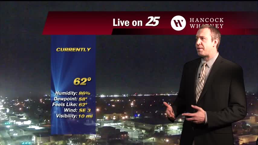
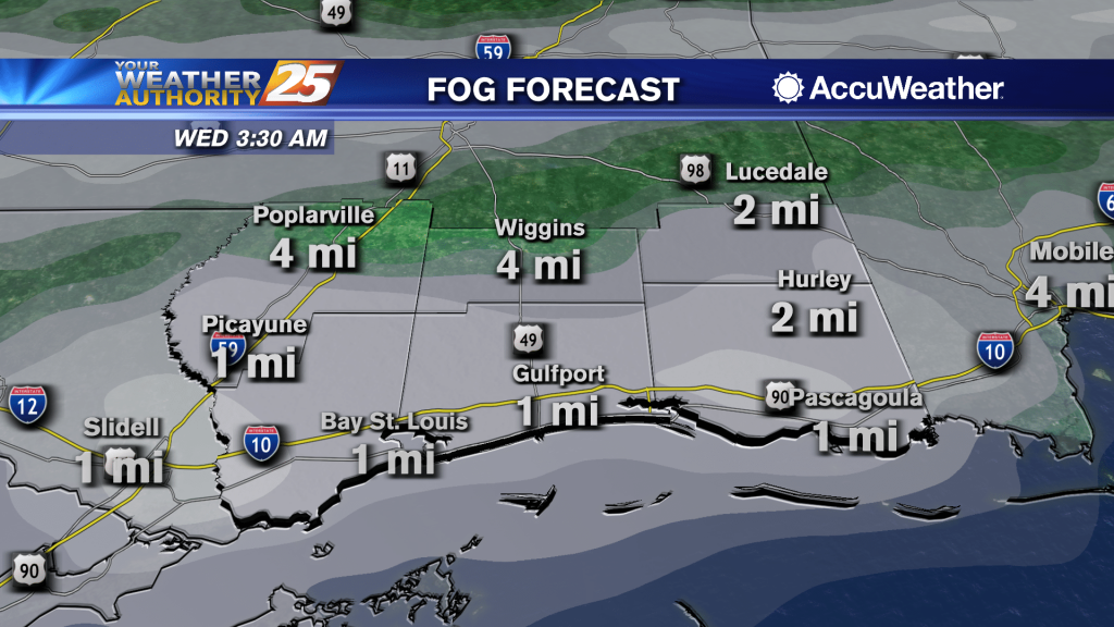
Afternoon and early evening rain created cool, damp conditions at the surface, so we're likely on our way to another foggy night. So far there aren't any real trouble…
Afternoon and early evening rain created cool, damp conditions at the surface, so we're likely on our way to another foggy night. So far there aren't any real trouble…
The cooler, drier weather of last week is gone and calm, more humid weather is moving in. That means our cooler, drier period is over as drier, more…
It had to end some time, so get ready to see rain soon as we get back to a more "late summer-like" pattern. That means our cooler, drier…
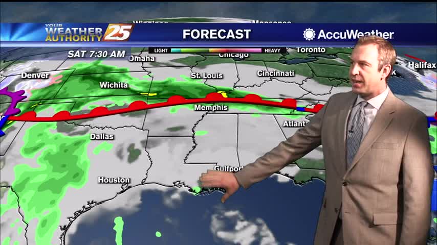
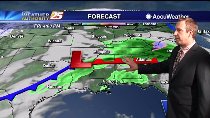
The less humid pattern will begin a slow transition later today through the weekend. An area of high-pressure will move into the GOM as a warm front over the N'tern GOM moves north Saturday. The moisture flow will be felt…
Today was the last of the week we'll see clear, blue skies, but our cloudy, stormy weather won't last too long into the weekend.
Expect to have seen the last clear skies for most of the week as clouds and rain move in, but they'll be on their way out by the weekend.
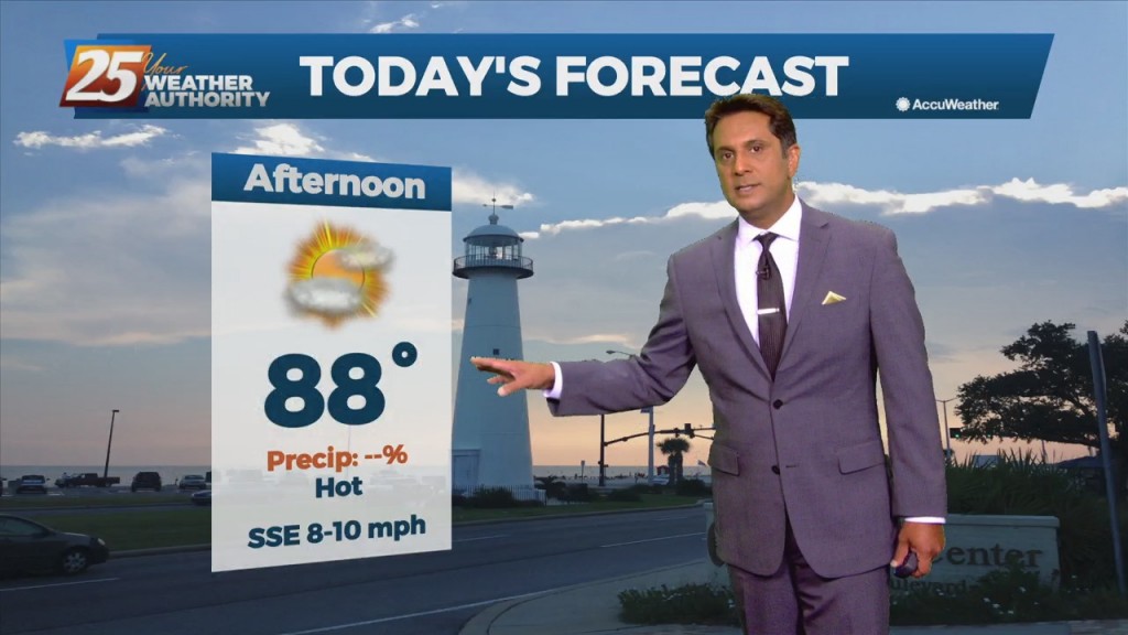
The weekend was sunny, dry, and mild, though it has continued to get warmer and more humid each day....
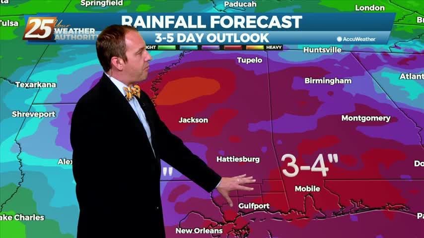
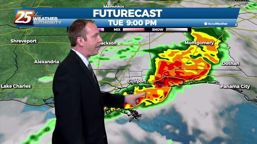
After even more rain today, flooding issues are becoming more and more obvious with another stormy day ahead....
Today was a complete 180 after yesterday's clear skies, and the bad news is the rain isn't stopping anytime soon....
Today was a beautiful start to the week after cooler, drier weekend, but heavy rain will return to the Gulf Coast sooner rather than later....
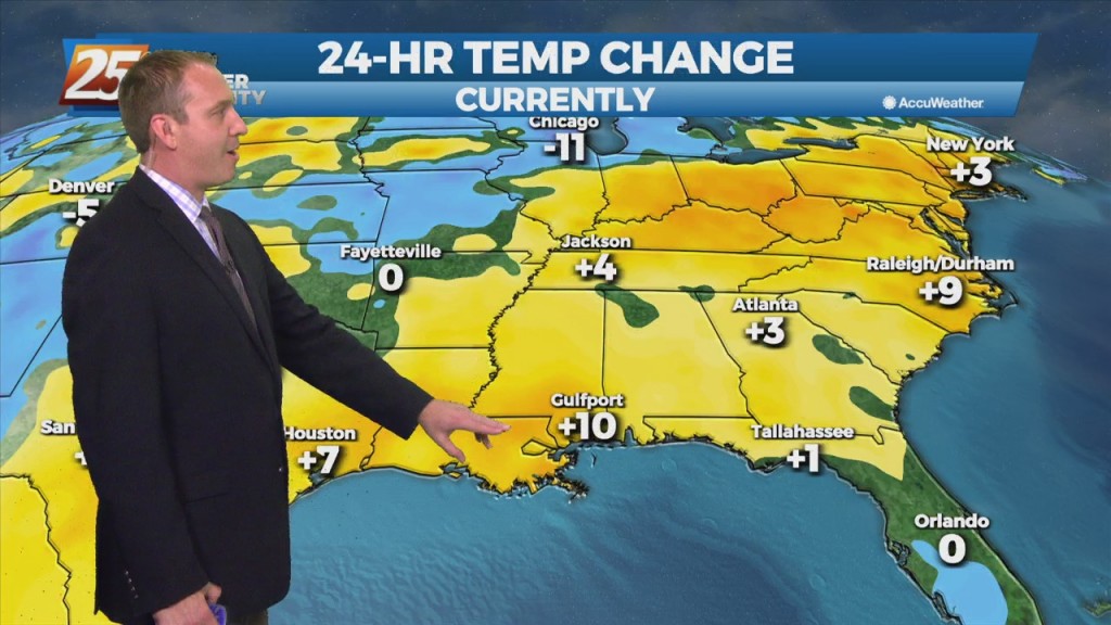
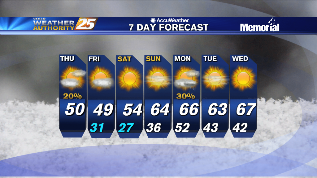
All of the trends we've had since the beginning of the week are still in effect, so expect more cloud cover, higher temperatures, more humidity, and more fog in the next few days.

Clear skies for now, but clouds will slowly build over the next week before our next round of active weather moves in over the weekend.
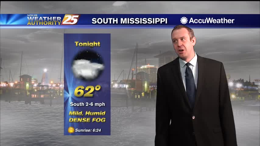
We'll see several warm, foggy nights in a row before anything changes noticeably, taking us well into next week....
Warmer, more humid air is setting up shop and won't leave South MS any time soon, and we'll see several days with low rain chances.
Getting warmer and more cloudy through the night, as days of grey, wet days are on the way.

Cooling trend is over, and we're starting our warming trend that will take us through the rest of the week.
Showers and storms are streaming through for the rest of the night, bringing another round of colder, drier air for the end of the week.
Only change from last night is even warmer and more humid air continues to flow in ahead of a series of fronts.
Going to be considerably warmer and more humid than the weekend was, and get ready for a big change by the start of next week!
The weekend will start cloudy, but we'll see a bit more sun as we begin next week...just won't last long.
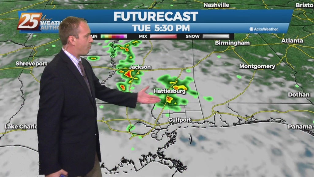
It was nice and sunny again today, but clouds have already begun to build in and rain arrives around midnight as a front closes in.
Starting to see more noticeable changes as clouds and more moisture move in, but even light rain still not expected until tomorrow afternoon.
Going to be much warmer than last night, but rising humidity will lead to a few foggy areas early tomorrow morning.

Our next front is closing in and active, potentially stormy weather will be moving in during the wee hours of the morning....