
02/17 Ryan's "Finally Clear" Monday Morning Forecast
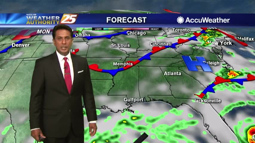
The last couple of weeks have trended on the much-warmer-and-more-humid side of things, but this week is starting cooler, drier, and clear! That means plenty of sun for today,…
The last couple of weeks have trended on the much-warmer-and-more-humid side of things, but this week is starting cooler, drier, and clear! That means plenty of sun for today,…
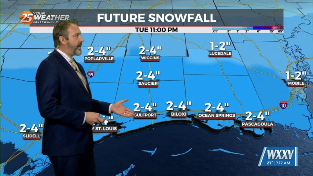
Get ready for one of the most "wintry" weeks we've had in several years as cold weather will linger all week long, and some rare winter weather is moving…

Things cleared out for the start of the weekend, but saw rain return quickly on Sunday setting us up for a chilly & damp start to the week.…

It was clear and frosty across South MS once again, a continuation of the dry weather we saw move in after last week's front. Our afternoon highs will…
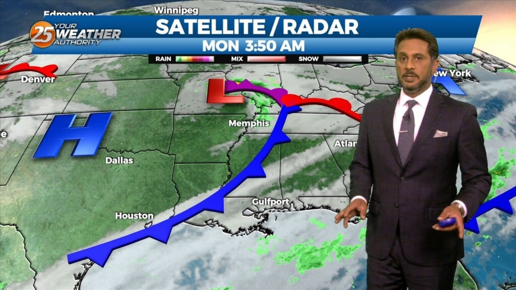
A broad upper level disturbance over the eastern third of the CONUS will be the primary feature impacting the forecast area through Wednesday. Pacific based…
Upper level high pressure is currently entered over the Gulf of California extending northward through the northern Rockies. Weakness extended from the Appalachians into…

Ahead of a front today will be quiet the windy day and warm. Because we will be able to mix out quite high we will…
As an area of high pressure sneaks into the area on the backside of distant low pressure, a warmer pattern takes hold. It’s only a small adjustment…
Strong cold and dry air advection has allowed for freezing temperatures across the entire area this morning and is expected again on Tuesday morning. A…

A warm start to the day with slightly less humid conditions compliments to a NW wind...
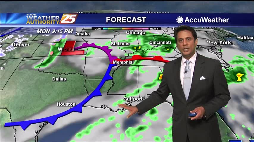
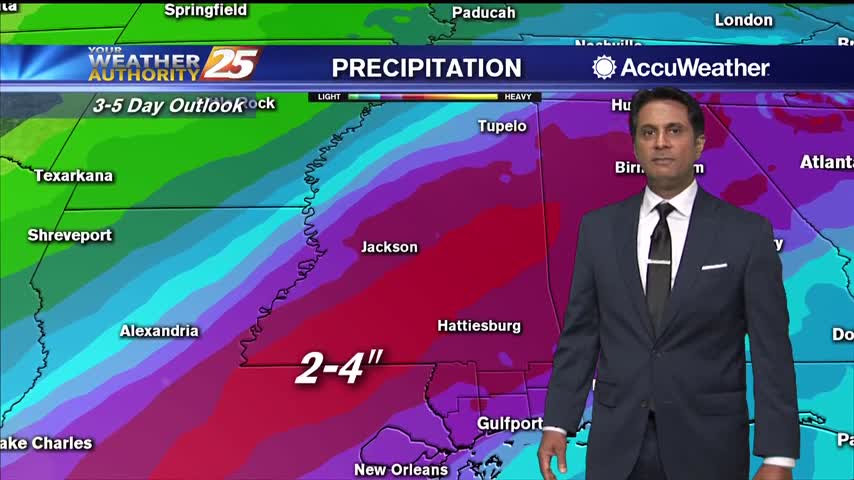
A wet start to the workweek with rain moving in from the SSE...

An area of low-pressure overhead moving east has brought patchy fog and light rain this morning...

After clearing skies yesterday afternoon, clouds have returned to the region...
A warm and humid start with areas of patchy fog affecting south Mississippi...
A cool start under mostly cloudy skies as winds begin to elevate...
A cool start with areas of light patchy fog...
A mild and humid start with spotty rain beginning to move in from the SW...
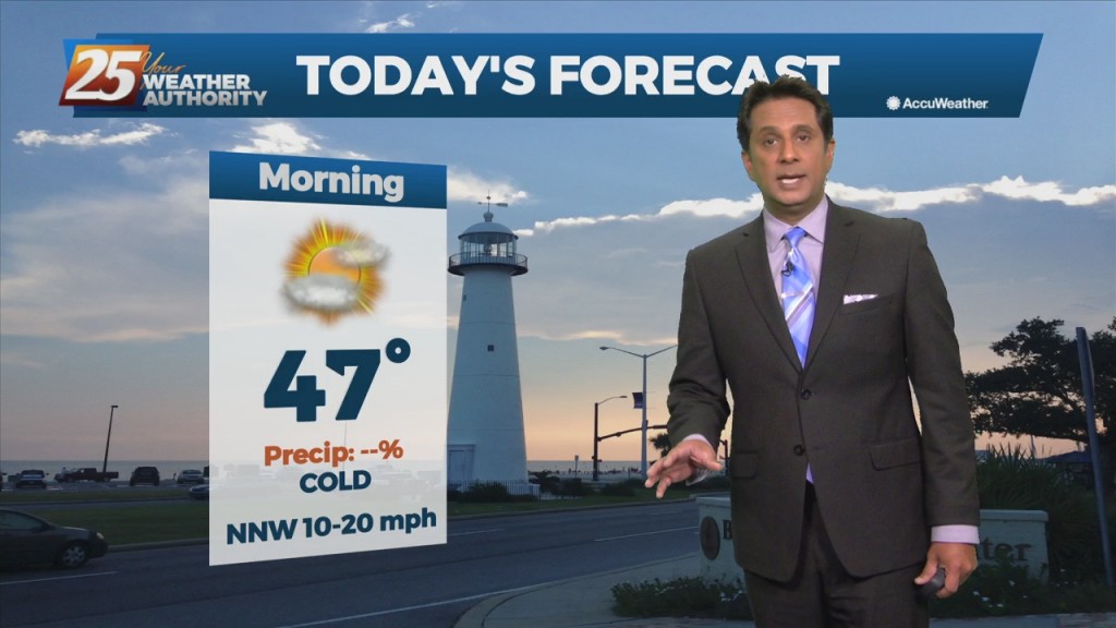
A cold front has moved east of the area with clearing skies and colder air moving in from the NW...

Cloud coverage continues through the area but a few breaks are starting to let sunshine in...
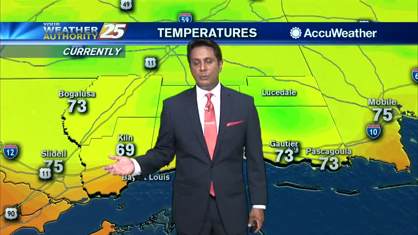
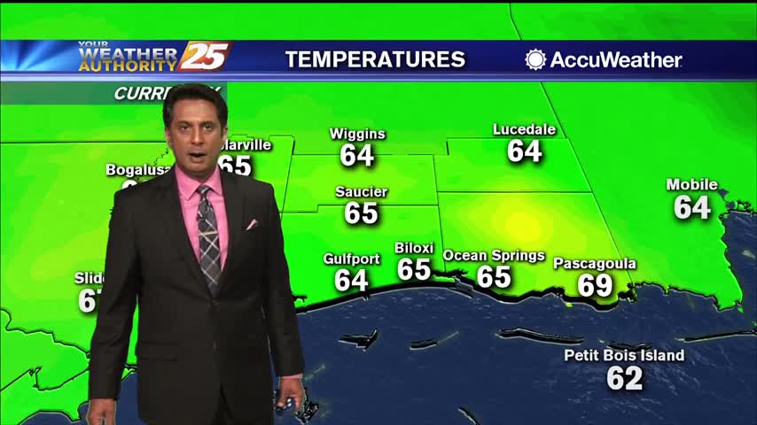
A warm start to the workweek with temperatures in the low 70s as upper-level clouds move across the area...
A very nice start with clear skies and temperatures in the low/mid 70s...

A warm start to the day with a rare late spring cold front approaching from the west...

A CHILLY start to the day with upper-level clouds from the SW moving into the area...

A COLD start this morning in the wake of yesterday's cold front...