
5/26 - The Chief's "Very Nice" Friday Morning Forecast
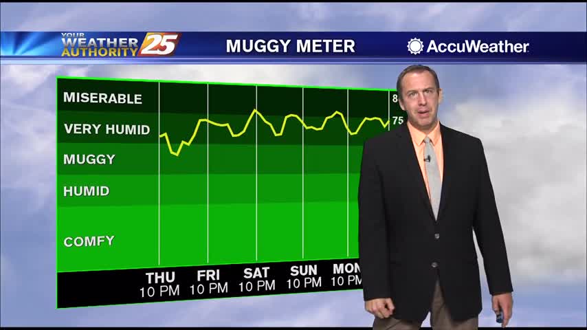
Relative humidity has been rather low the past few days…and that trend will continue heading into the weekend. The current weak upper low pressure over the FL…
Relative humidity has been rather low the past few days…and that trend will continue heading into the weekend. The current weak upper low pressure over the FL…
As a cold front makes its way through the area this evening, we can expect the lowest overnight lows we've seen all summer. Temperatures will bottom out in the…
This morning’s cold front is long gone, and in its wake is a pleasant drop in humidity. High pressure will shape the forecast through the area…
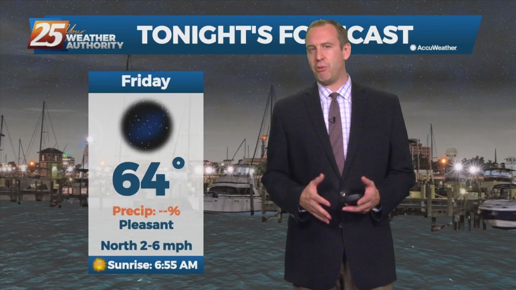
What a difference a day makes with a change in wind direction…now breezy out of the north with temps running at least 15 degrees cooler tonight. Humidity…
Skies clear out this evening with noticeably lower humidity. Lows will range from 50-55, about 5 degrees below our seasonable norms. We stay with that theme…
Expect another sunny day tomorrow afternoon, but also our coolest start of the week as well. Otherwise, don’t expect any big changes, and tomorrow afternoon will likely even warm…

Expect peak sun content tomorrow afternoon, but things will finally start cooling off soon. Don't expect any big changes, and tomorrow afternoon will likely even warm a degree…
We saw more blue skies today and will see even more in the days ahead, but we're still going to be in for more morning fog. This air…
We saw more blue skies today and will see even more in the days ahead as drier air takes hold. This air won't be much drier at the…

We’ll see only the slightest dip in the humidity in the days ahead, but much drier, more sunny days are coming. We saw some of that as…
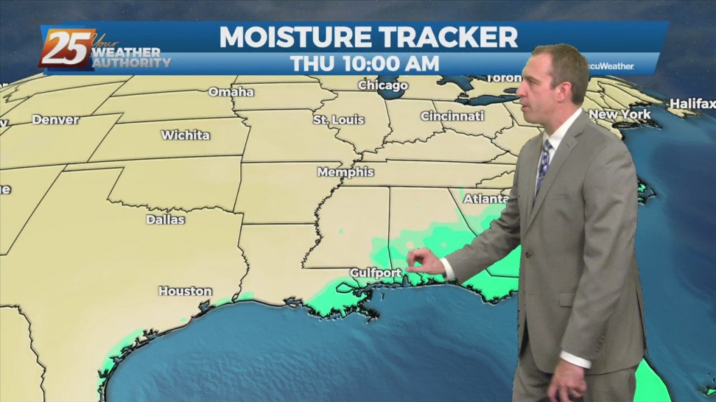
We have more rain ahead for the short-term, but a cold front will bring drier, less humid weather for the weekend. Probably more prudent to call it a…
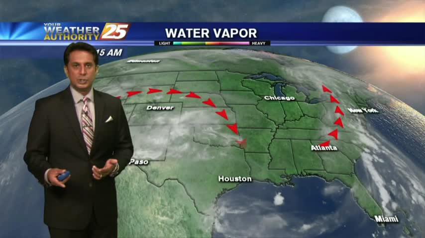
Early this morning, what is left of a weak stationary front remains draped across our area. The front is now south of the area making a transition to a stationary front. This will bring a drier air mass into the…
It's been a wet, grey, cloudy, and now windy week so far; but now we're heading into another sunny, drier weekend!
Finally seeing some clearing in the skies over South MS, but that humidity won't be going very far away....
It has been quite humid for the last few days, but slightly cooler and drier air is moving in just in time for the weekend.
A rather pleasant start to the day as lower humidity from this past weekend continues...
It's been dry for quite some time now, but that will begin to change very soon.
Temperatures are above average, but the weather outside doesn't feel too bad thanks to slightly drier air. Doesn't last forever though....
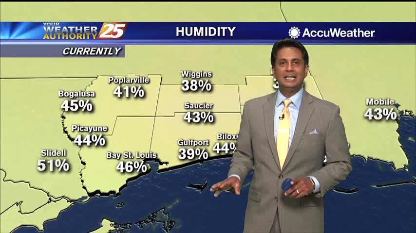
Temperatures not feeling as hot as yesterday with lower humidity in the area...
I expect today will be the hottest day of the week as upper level features move away from us, but fall-like weather is still quite a ways away....

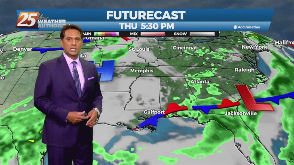
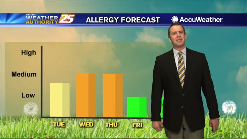
A warm start to the day with a rare late spring cold front approaching from the west...

Weekend storms are gone, but flooding issues remain despite our sunny skies....
Starting off this week with plenty of sunshine, but rain moves in again before the week ends....
In the wake of yesterday's rare cold front, it's a clear and mild start t the day...