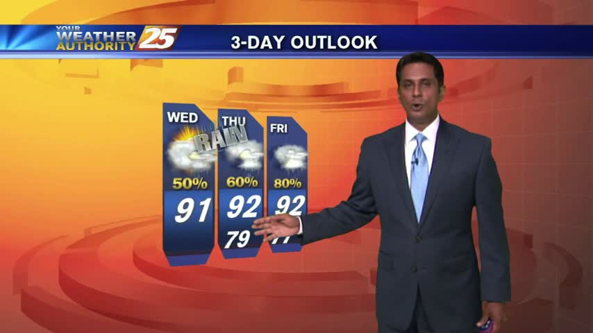
7/14 - Rob's "Wet Thursday" Forecast
Isolated t-storms continued overnight...the activity will begin early today and continue through this evening.
Isolated t-storms continued overnight...the activity will begin early today and continue through this evening.
It's been an on-again-off-again active weather kind of day today, and the evening forecast is calling for more rain in the near future. We're cooling off a bit more than expected tonight, so I've dropped my evening low to 77.…
Moisture coming in from the gulf is being heated, with a low-level deck of clouds now in the area...
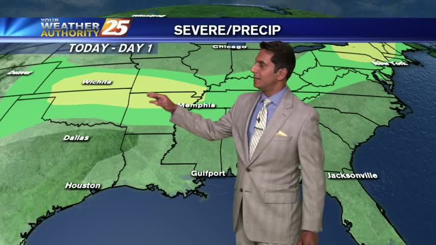
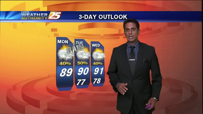
A warm start with another day of showers/t-storms, along with elevating rain potential through the weekend...
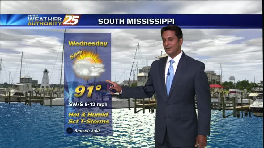
It's been a humid Tuesday so far, and the immediate forecast doesn't call for very much change. Cloud cover will remain moderate through the night, leading to an increased low, near 80. As we head into Wednesday, increased cloud cover…
Another rain-free start but the activity is beginning to build, so expect early morning showers and then t-storms...
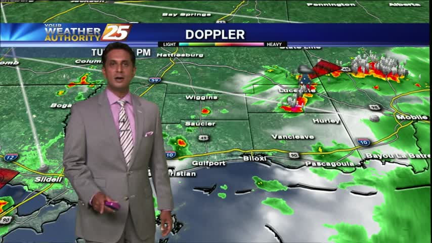
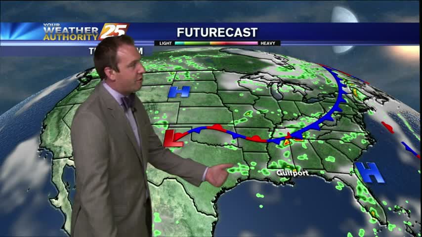
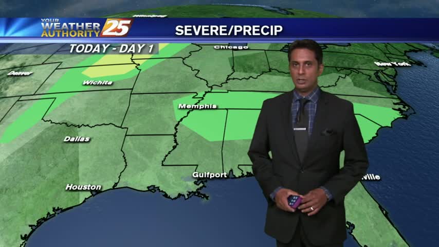
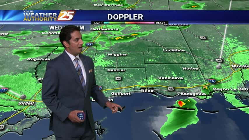
Showers & t-storms developing and moving into south Mississippi from the sound...
Today was a fairly typical Summer day in early July and the forecast doesn't deviate much from what was expected last week. We'll start out with mostly cloudy skies, but after gradual clearing we'll end up with mostly clear. The…
Isolated thunderstorms continue to pop along the sound and coastal counties...
A humid and warm morning along the Mississippi gulf coast, to start off the workweek.
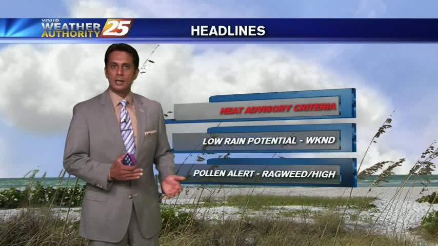
The heat advisories expired yesterday for our neck of the woods, but the forecast calls for more hot and humid days...just not as hot. Tonight looks to be another warm one though, low near 80, with light Southerly winds becoming…
Showers have developed and will continue to build into t-storms this afternoon...about a 30% chance.
A HOT start with temps in the low/mid 80s to start off the weekend...
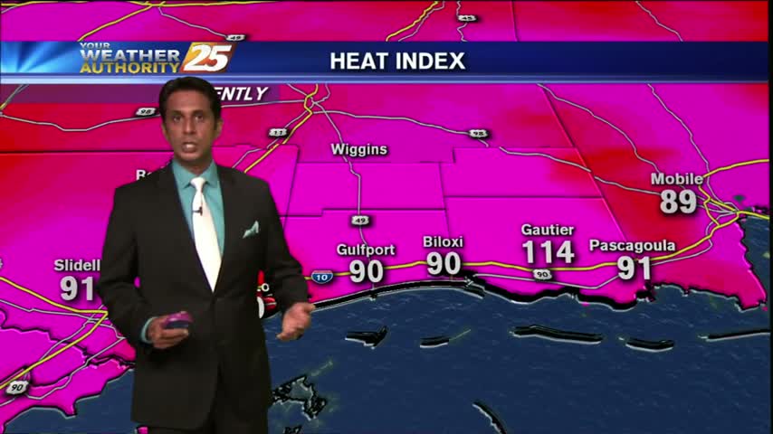
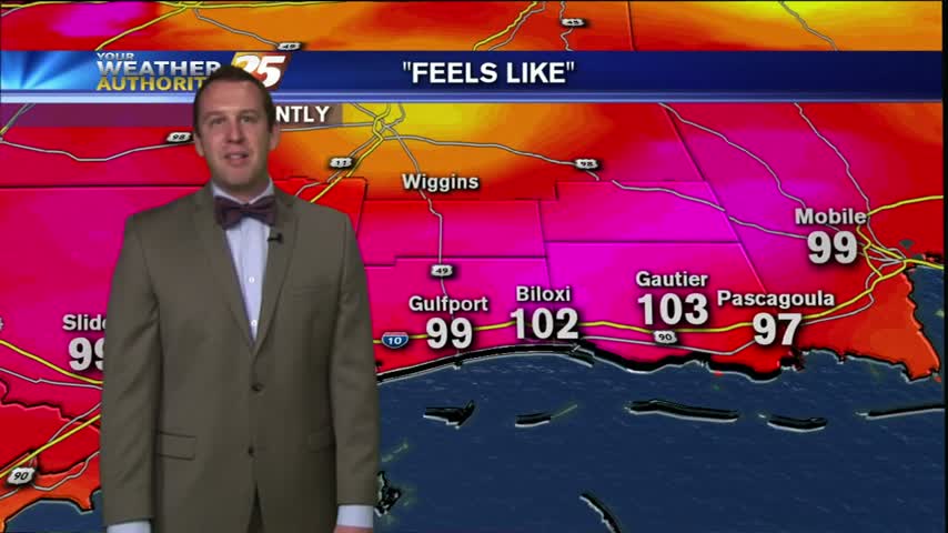
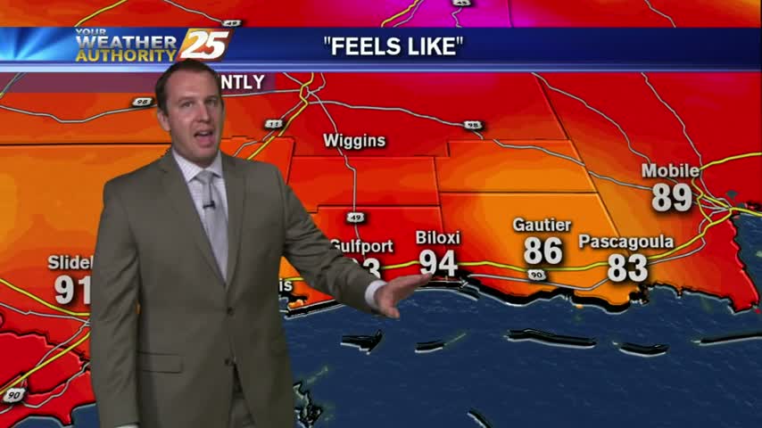
After a rain-free morning, it's HOT & HUMID with the HEAT INDEX already over 100 degrees...

It's a rain-free start along the Mississippi gulf coast, but hot and humid conditions continue...

Another hot day in the books and it looks like we're in for a hot Wednesday night as well. Expect clearing skies and a low near 80 for tonight. Tomorrow will be another sunny and hot day, with a high…
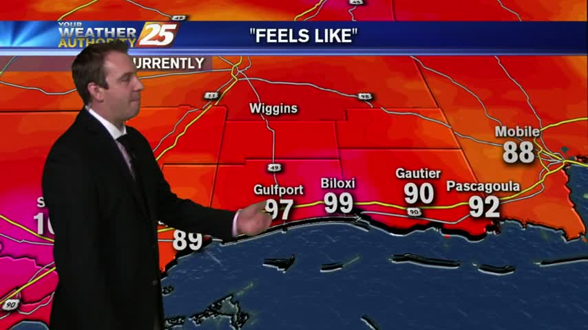
It has been an uncomfortably hot and humid Wednesday night so far with heat indices remaining in the hundreds through ten o'clock at night. We will begin to cool off eventually, and expect to end the night near 77 under…
Another warm and humid start with isolated showers building into t-storms; moving into the area from the sound...
You don't need a heat advisory to knot that it's been a hot Tuesday so far, but we've got one until tomorrow afternoon at 7 PM. The hot conditions don't stop when the sun goes down either since we're expecting…
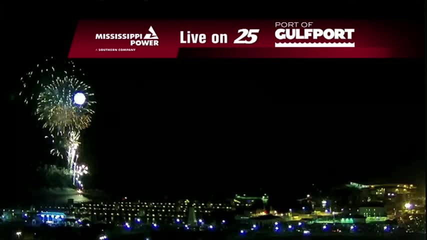
I hope everyone had a great, safe Fourth of July today! We had a few showers and t-storms move into the Northwest area around 5 PM, but as predicted they began to dissipate before ruining anyone celebrations. It will remain…

After early morning showers, HOT & HUMID will continue with winds gusting into the 20 mph range...
It's been a calm and quiet Friday night so far, and I'm not expecting much to change in the next few hours. Expect a very similar day tomorrow, with an afternoon high near 94 and light Southerly winds in the…

Well, July 1st is here and it feels like mother nature was holding a few degrees back until just now. We still have a few hours of sunlight left and have already reached an afternoon high of 95, so we…
Another day, another afternoon of summer storm activity. Skies were pretty clear most of the day, but just like the last few evenings we're seeing the development of some isolated, slow moving thunderstorms. Not much is expected out of these…