
6/20 - Jeff's "More Rain Chances" Tuesday Night Forecast
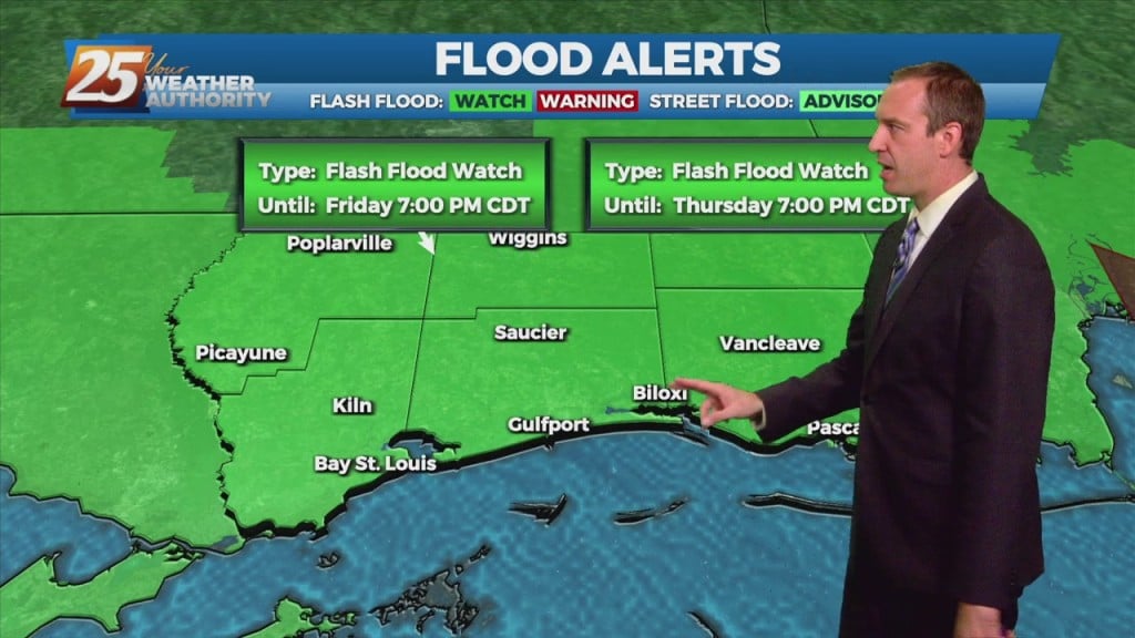
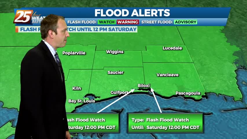
The Flash Flood Watch for our area will be allowed to expire at 10 PM. South Mississippi will be drying out gradually from the heavy rainfall earlier.…
The Flash Flood Watch for our area will be allowed to expire at 10 PM. South Mississippi will be drying out gradually from the heavy rainfall earlier.…
Coverage of showers and thunderstorms will gradually lessen over the next few hours. A Flash Flood Watch for our area will expire at 10 PM. Gradual…
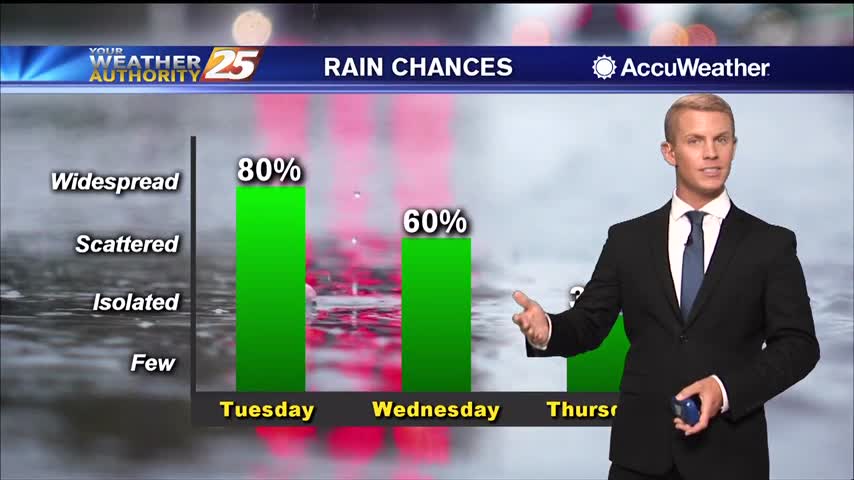
A wetter outlook is here for the next 24 hours. Showers and thunderstorms are possible this evening, then more rain will move in overnight. 80-90% coverage of…
The boundary will lift tonight, and there will not be as much of a focus for rainfall that develops. Southerly surface winds will help to enhance…
I have a professional interest in active weather and even I wish it would stop raining, but it won't and our Flash Flood Watch has even…

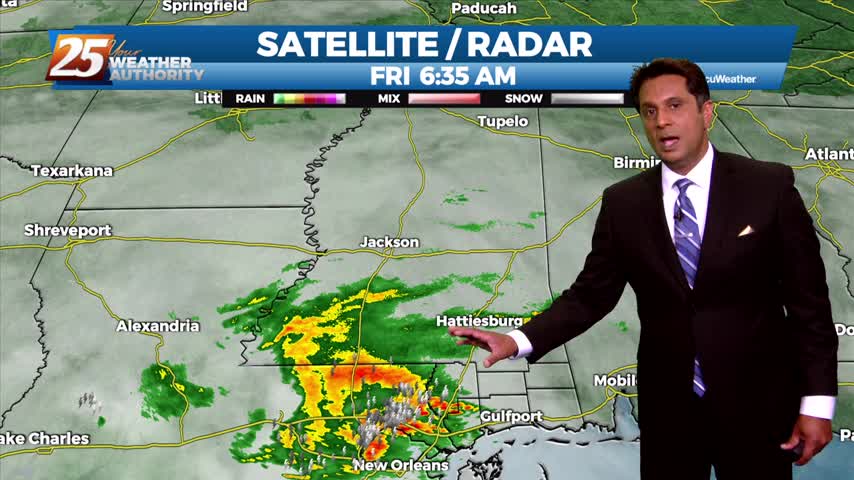
The low level remnants of Nicholas continue to spin across the region producing scattered showers and thunderstorms. Expect the scattered precip to continue with increased activity this afternoon coupled with daytime heating. Activity will become more isolated overnight with areas…
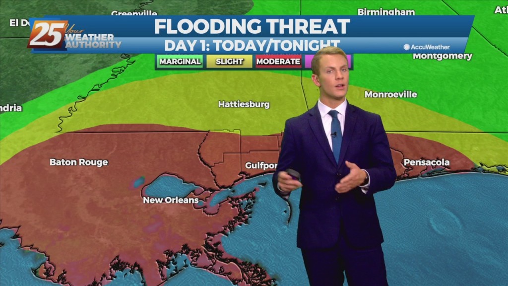
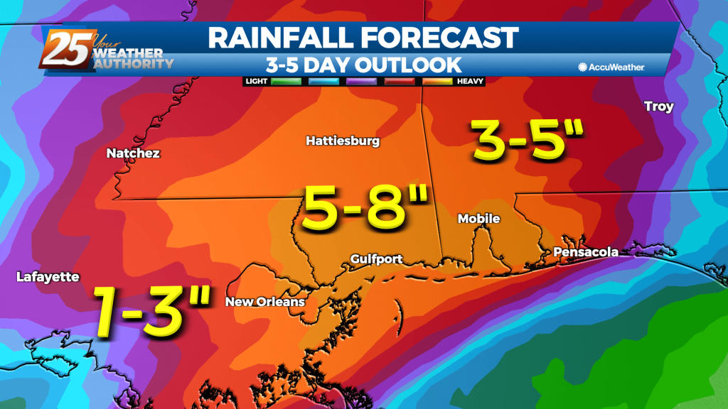
Focus will become more toward rainfall rates and not as much on totals area wide. Rates could be around 2 to 3 inches per hour today through Saturday and isolated areas could see 3 to 5 inches over that time frame.…
Today, the focus will become more toward rainfall rates and not as much on rainfall totals area wide. Rates could be around 2 to 3 inches per hour today through Saturday and isolated areas could see 3 to 5 inches…
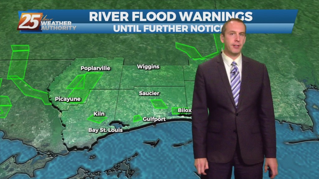
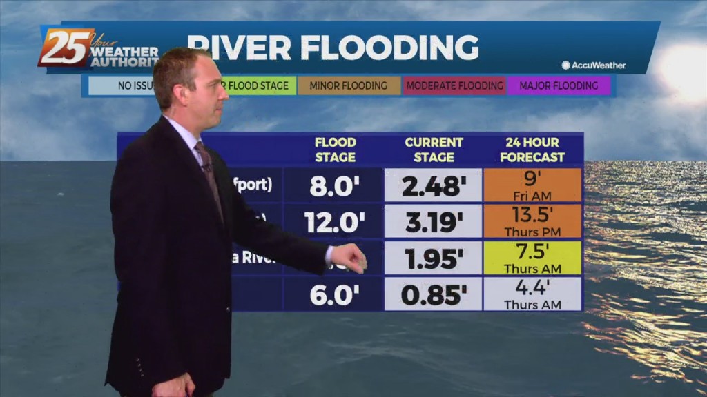
Flood watches remain in effect across South MS as more and more rain moves through. Several inches have already fallen since early this morning, mostly in East Harrison…
Flooding woes have popped up and will continue across South MS as more and more rain moves through. Several inches have already fallen since early this morning, mostly…
This will be the first notable wet period of an upcoming seven day stretch of wet weather. Cloudy with very high rain chances, but that`s not the most important headline. This will be the period of the approach of Nicholas'…
I expected at least a few heavy showers this afternoon, but so far only a light rain over most of South MS. The light rain will continue, but…
It is not important to just focus on the eventual dissipation of any tropical cyclone. Some of the most damaging and life threatening variables can still be associated with it. Flooding rains and gusty conditions will still be an…
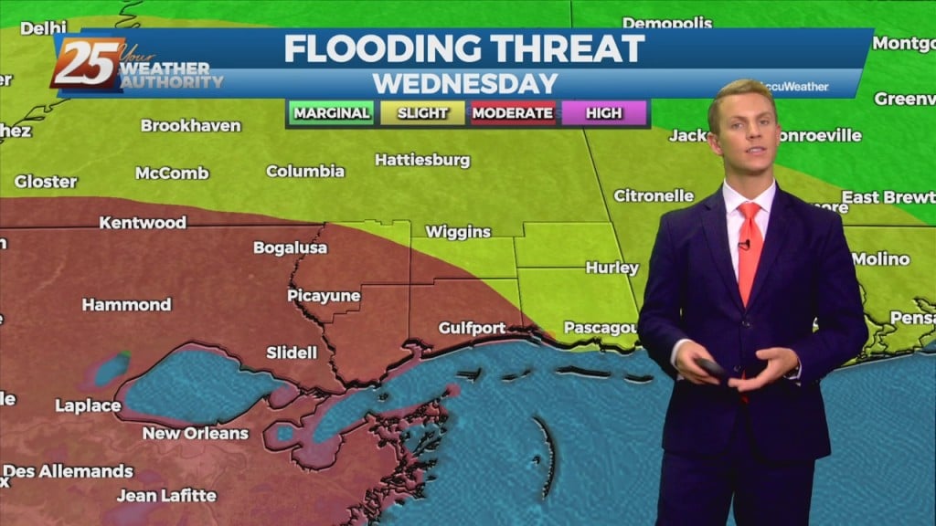
There will also be a limited risk of an isolated severe storm forming over the next couple of days. The latest rainfall forecast in the near term has trended downward about one-half inch area-wide. While we still…
Based on the latest high resolution models, it will likely to take another few hours for this system to shift south and east to push thunderstorms far enough offshore to relax the flash flood threat across significant population areas. The…
A break from the rain this afternoon as organized activity will begin moving back into the area this evening...
Moderate/heavy rain from the west is beginning to move into south Mississippi...
It's already quite damp out there with flooding issues popping up, and we still have at least a day or so of rain left!

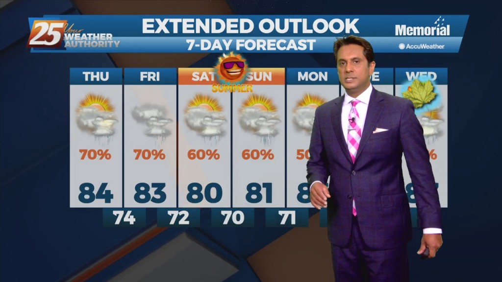
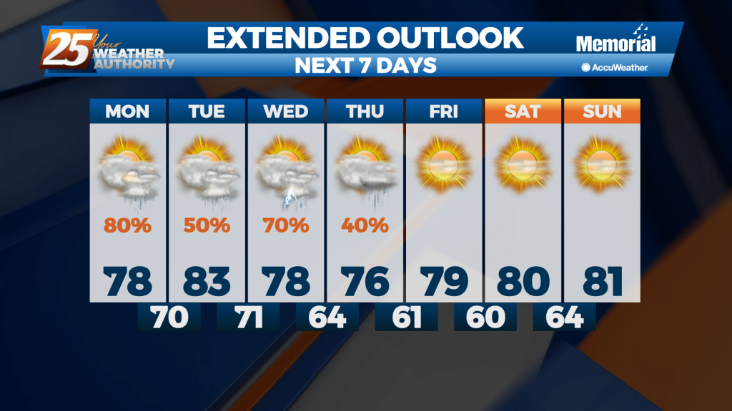
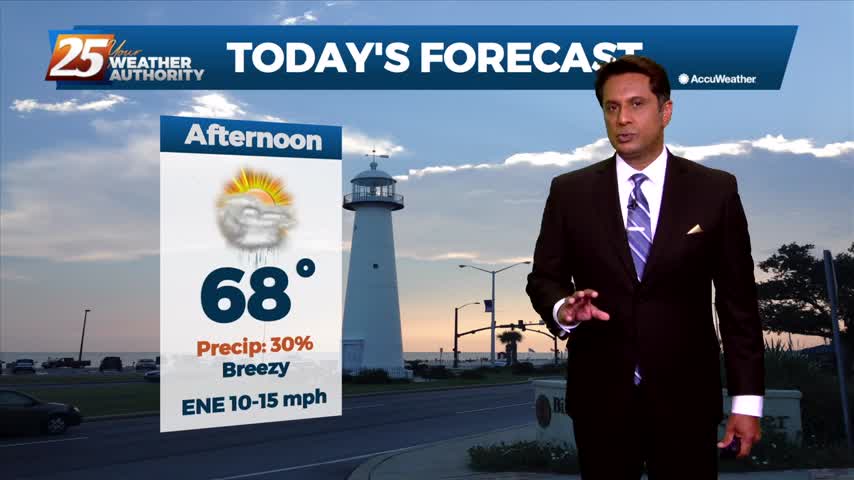
Expect cloudy through the next day or two with highs today in the lower to mid 70s. High temperatures tomorrow are expected to top out in the 70s once again due to increased cloud coverage and a higher chance of…
Highs today will reach the mid to upper 70s along the coast with some inland locations reaching the lower 80s. Scattered showers will make things cool off quickly in select areas. Tonight, lows fall into the mid 50s over the…
Showers and thunderstorms with heavy rainfall continue to push into the area from the southeast with deep Gulf moisture. Doppler radar indicated heavy rain due to thunderstorms. This is causing urban and small stream flooding. As of early this morning,…
Heavy rain may lead to flash flooding along the Mississippi Gulf Coast over the next couple of days. Tuesday, expect scattered showers through the morning. By Tuesday afternoon, widespread showers and thunderstorms with heavy downpours will move into the area.…
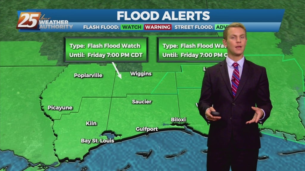
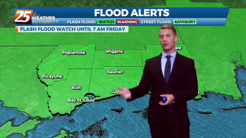
Wet weather is in the forecast once again today. There’s around an 80 percent chance of showers and thunderstorms through the early evening and we could see some heavy rainfall. A Flash Flood Watch is in effect until 7 p.m…

Another day of showers with isolated t-storms before the pattern begins to change. A FLASH FLOOD WATCH is in effect through this evening as another inch or 2 of accumulation will be possible. The drier period that starts on Thursday…