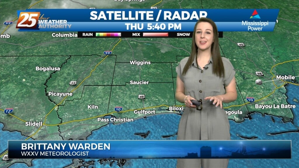
5/2 - Jeff Vorick's "Quiet" Tuesday Evening Forecast
Quiet conditions continue for the first portion of this week across the area. Dominant ridge of high pressure is shaping the forecast for South Mississippi at the moment.…
Quiet conditions continue for the first portion of this week across the area. Dominant ridge of high pressure is shaping the forecast for South Mississippi at the moment.…
As an area of low pressure continues to drag a cold front through the region, isolated t-storms will continue this afternoon but begin to diminish late afternoon.…
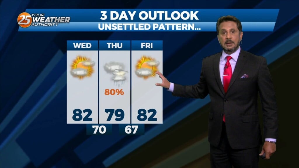
This afternoon will bring pleasant conditions as sky condition will vary between partly/mostly cloudy skies. Much of the focus is on Thursday as severe weather seems…
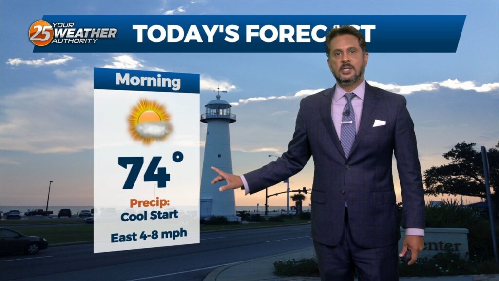
Today will bring a fairly quiet weather pattern with cloud coverage varying through this evening with slightly warmer as low-level winds start turning more onshore flow. The…
Starting on Wednesday, a disturbance over the northwest is expected to eject over the southern plains. This will pick up a stalled front over the coast and…
With a disturbance over the Great Lakes, and another disturbance over the northwest, we look to stay in zonal flow for the next couple of days, keeping…
The upper pattern this morning has high pressure over the Great Lakes, with weakness from Montana into west Texas, and over Florida. At the surface, high…
A weak disturbance moving across Louisiana will move across the local area late this afternoon and tonight. Considering the dry airmass, I don’t anticipate any precipitation,…
The upper troughs are located north of the Great Lakes and off the British Columbia coast this morning with high pressure over the center of the…
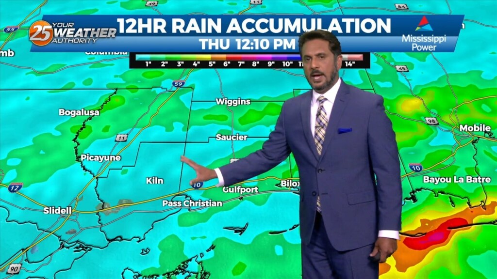
A surface low will develop rather rapidly by a strong divergent flow aloft which is also indicative of heavy rain potential ahead. The disturbance that…
Warm & windy conditions will continue as a cold front to the west has slowed dramatically. This means that just about all of the associated dynamic…
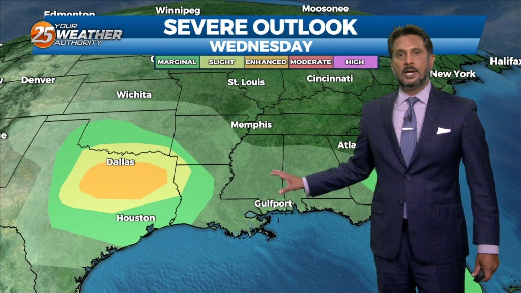
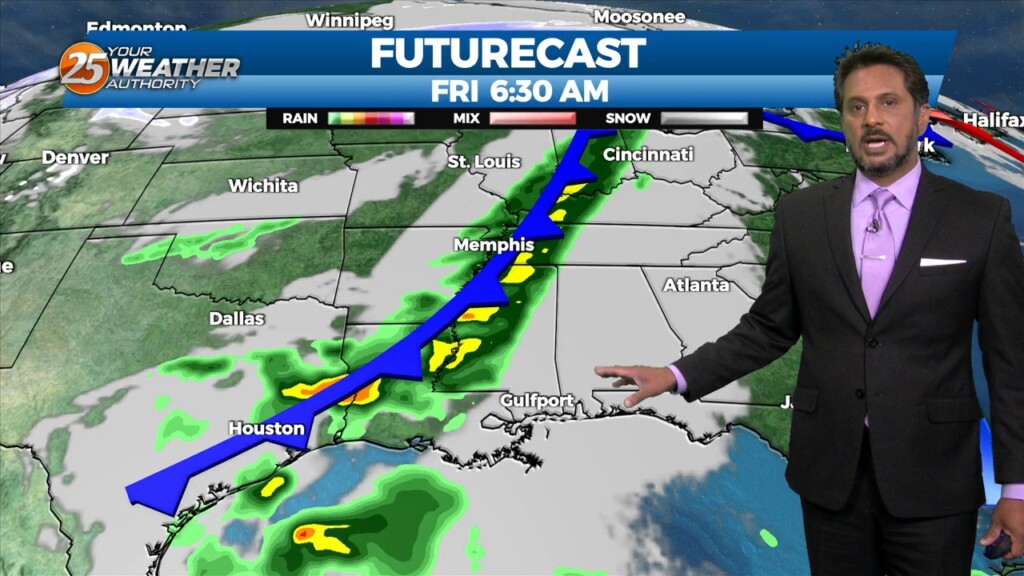
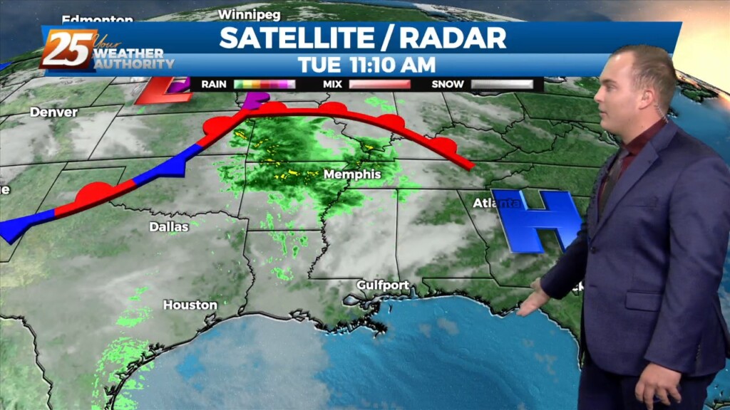
A cold front drapes south into the southern Plains where severe weather is ongoing across the AR/OK/MO region and will continue NE into the Ohio Valley…
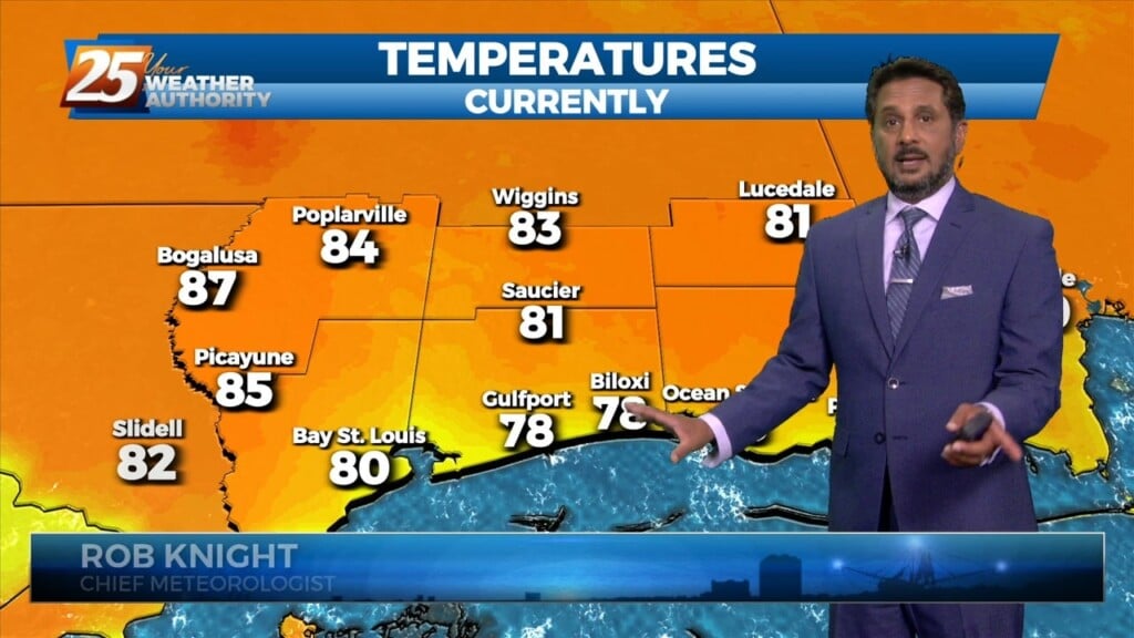
Starting out with early this morning, geez it's a bit muggy! Moist, onshore return flow continues to pump low to mid 70 dew-points well north…
An upper level disturbance Memphis is moving quickly eastward in zonal flow across the southern states. Another strong upper disturbance is moving onshore in the…
High pressure will continue to move east today with the axis crossing the local area late this afternoon and tonight. This will allow winds to turn…
High pressure was currently located over the Great Plains, with the next in the series of strong storm systems moving across California. At the surface, high…
Overall...A weak and diffuse boundary is draped across the local area near the coast. A fast-moving shortwave currently located near the four corners region will progress eastward…
Late Friday into Saturday morning, a shortwave system will move through the area. Strong warm air advection due to southerly winds ahead of the system will help enhance instability.…
The warm-up has begun across our area! Temperatures are soaring well into the 60s this afternoon under plenty of sunshine. Winds are breezy out of the…
All is quiet now as we await our next weather system. The upper trough is currently over the Dakotas with a weaker shortwave/jet type feature moving…
All is quiet now as we await our next weather system. The upper trough is currently over the Dakotas with a weaker shortwave/jet type feature moving across the…
Warmer temperatures will affect the area this afternoon as a southerly return flow develops. Expect partly to mostly cloudy skies from west to east as moisture…

A few shower in the area will begin to dissipate this afternoon as a drier air mass moves in behind a cold front moving SE. High…
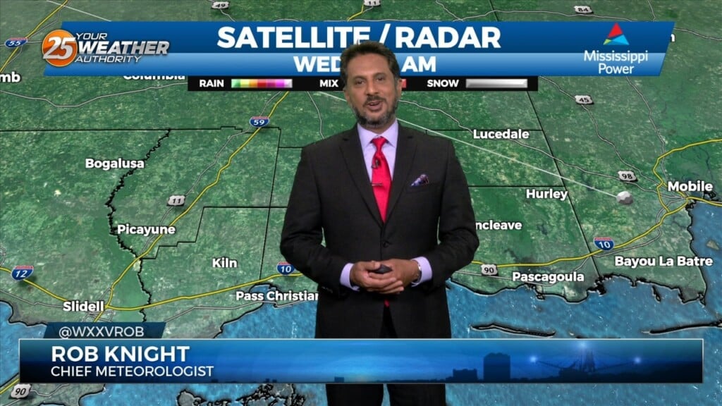
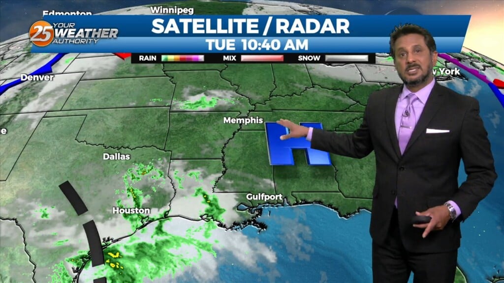
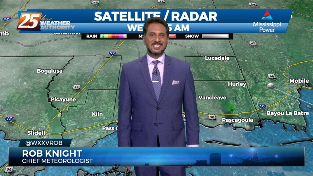
Currently there is a narrow line of showers across western Louisiana. Expect that to continue to move off to the east through the late morning hours.…