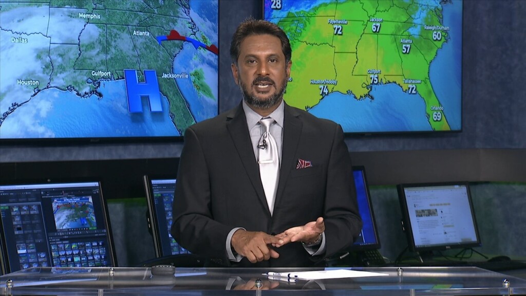
4/7 - The Chief's "Rain Approaching" Good Friday Morning Forecast
A cold front remains over the forecast area early this morning. Just behind the front, stratiform showers and a few elevated thunderstorms have develop generally along…
A cold front remains over the forecast area early this morning. Just behind the front, stratiform showers and a few elevated thunderstorms have develop generally along…
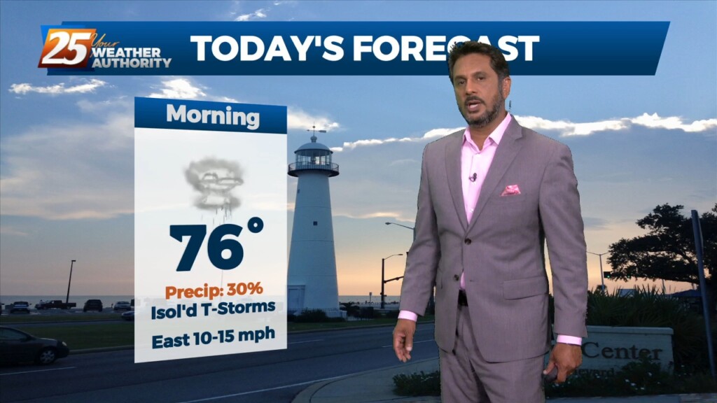
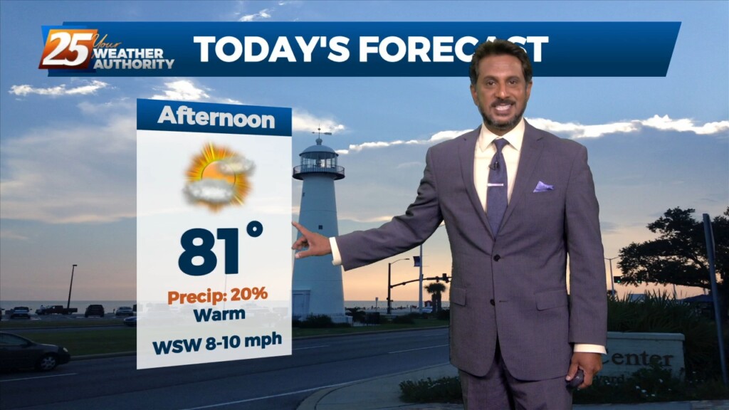
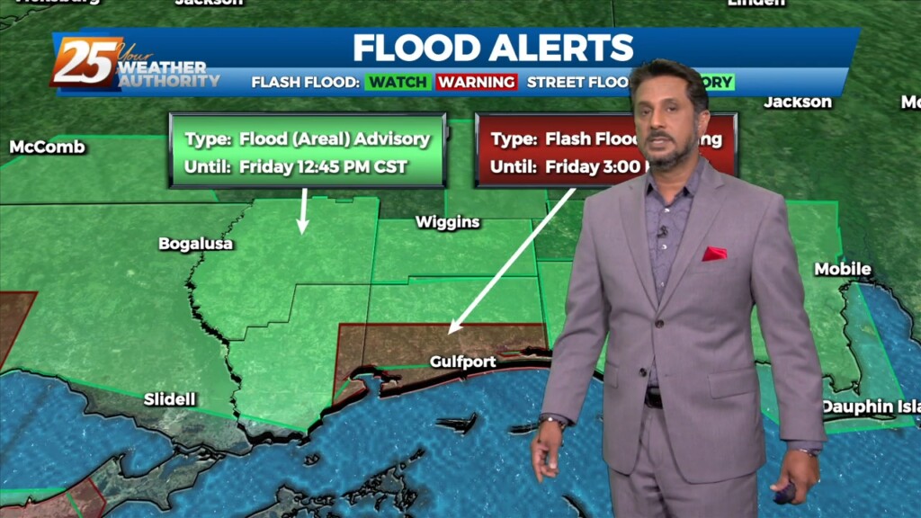
The main story for today will be increased rain chances as what has been mentioned for days now as a front slowly drifts east into our area.…
Warm & windy conditions will continue as a cold front to the west has slowed dramatically. This means that just about all of the associated dynamic…
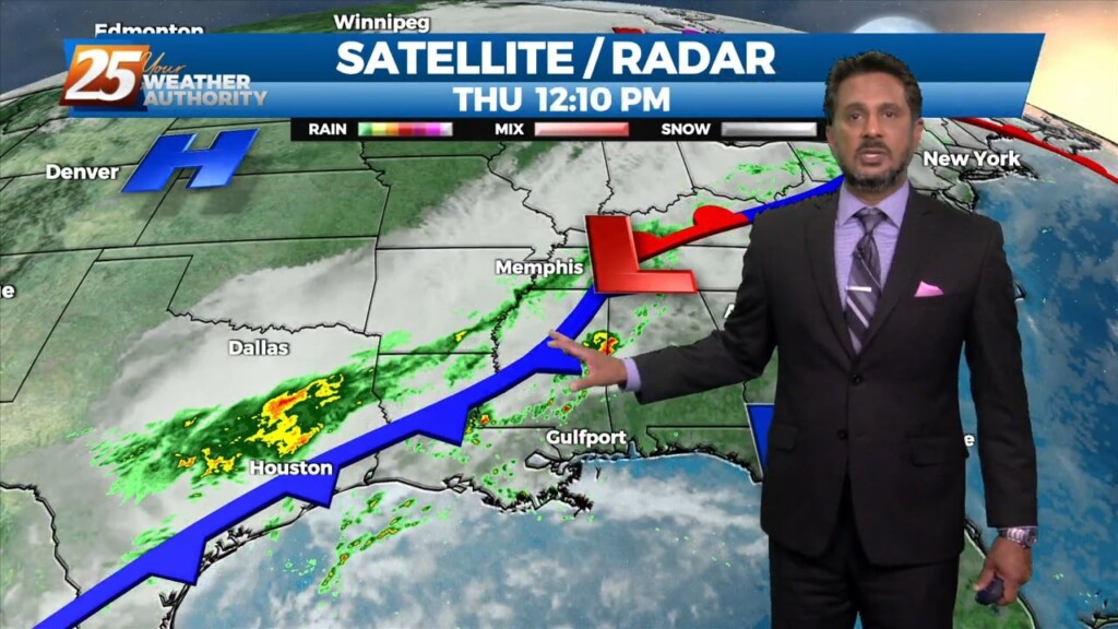
A cold front drapes south into the southern Plains where severe weather is ongoing across the AR/OK/MO region and will continue NE into the Ohio Valley…
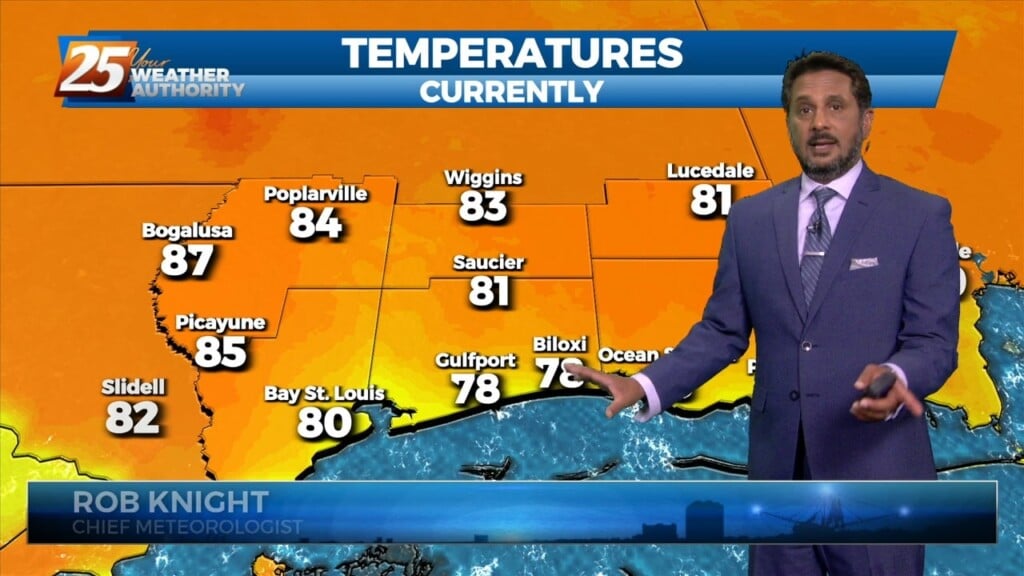
Starting out with early this morning, geez it's a bit muggy! Moist, onshore return flow continues to pump low to mid 70 dew-points well north…
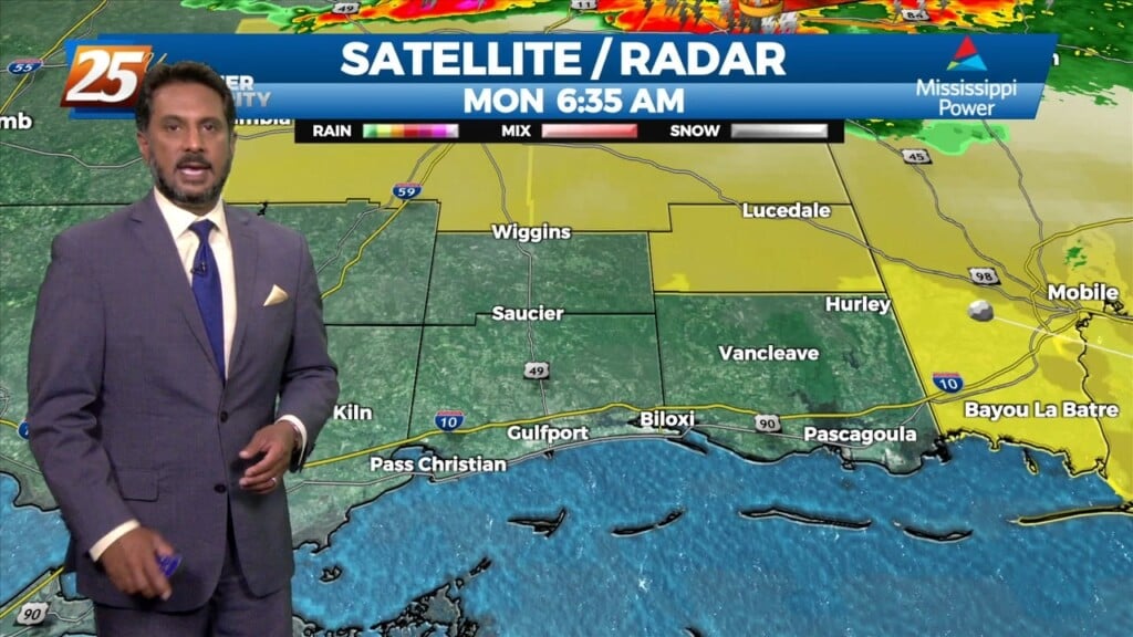
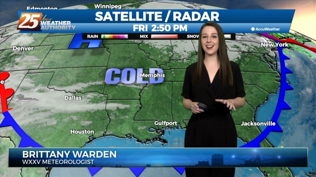
An upper level disturbance Memphis is moving quickly eastward in zonal flow across the southern states. Another strong upper disturbance is moving onshore in the…
At the surface, high pressure was centered off the Virginia coast. Low pressure was centered over Nebraska with a trailing cold front to west Texas. Moisture…
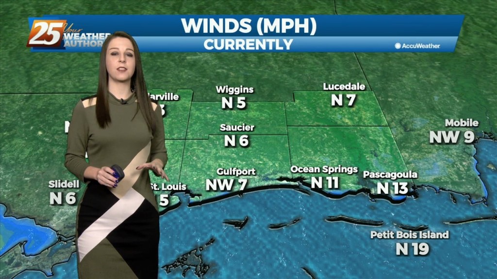
High pressure will continue to move east today with the axis crossing the local area late this afternoon and tonight. This will allow winds to turn…
A very warm start to the day with another warm day expected across the region and no sign of a change at least in the…
At the surface, high pressure was along the Atlantic Coast with an area of low pressure over western Ontario had a cold front to near Chicago, St. Louis,…
A line of strong to severe thunderstorms will move through our area this afternoon. As this line moves into our area it will…
A weak disturbance will be passing over the area within the next few hours, but not causing much noise as it comes through. It will delay…
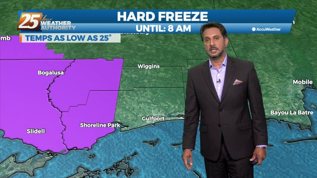
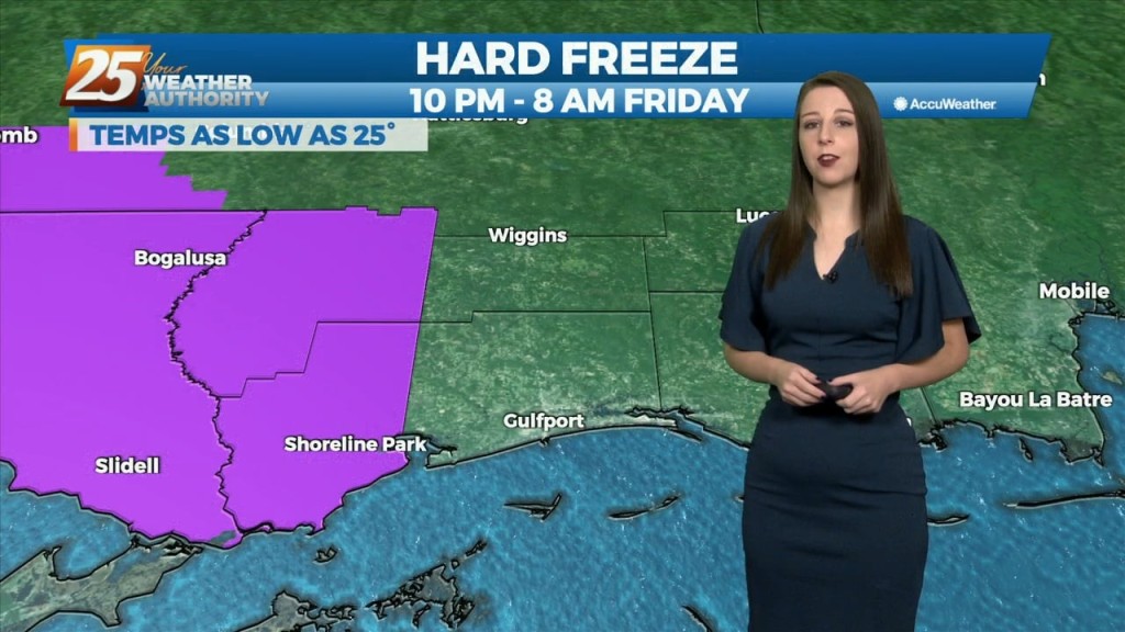
The very VERY COLD Arctic air mass brought bitter cold conditions to the region last night, with high temperatures earlier today only maxing out in the low to…
An Arctic front and a very cold air mass to the NW continues to move SE. Current expectation is that cold front will reach the…
Another weak disturbance will move through the area today bringing chances for some light precipitation, mainly in the afternoon. Models are still showing quite a bit…
A weak disturbance currently over northern Texas will track east today and tonight, passing through the lower Mississippi Valley. Showers have developed well ahead of that system…
Eyes begin to focus to our southwest this afternoon as a coastal disturbance just east of the lower Texas coast begins to sharpen. The…
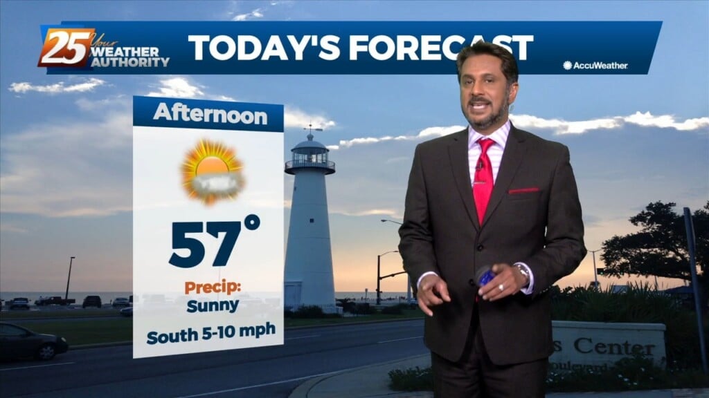
After a cold start to the day, expect mostly sunny or filtered sunshine across the region through the morning and into the afternoon hours.…
Behind a weak front which moved through earlier this afternoon, a rather strong Canadian high pressure will settle into the region tonight. With the calmer winds…
WINTER-LIKE conditions to continue through the weekend... High pressure will continue to build into the region and usher in quite cold air for this time of year.…
Strong high pressure will build into the region and usher in quite cold air for this time of year. Highs and lows will be 15+…

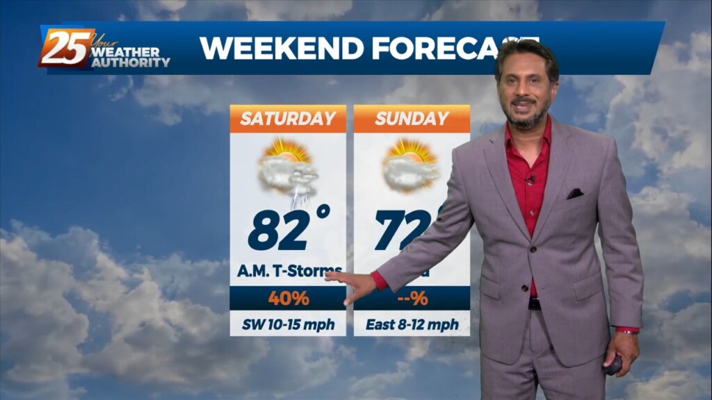
A moist air from the gulf continues to filter in this afternoon which could cause some fog issues tomorrow morning. Showers are expected to come in Friday…
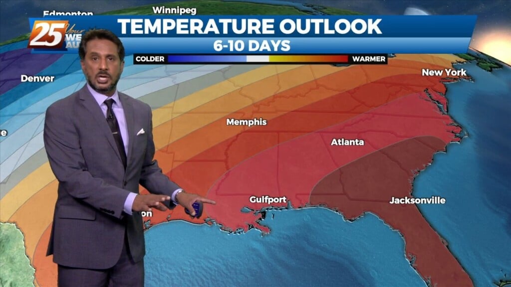
The forecast for the rest of the workweek is going to be quiet and dominated by high pressure building over the Gulf and southeastern CONUS. Heading…
The only real impact overnight with an area of weakness moving NE, was a deck of mid clouds over the region which should clear out slowly…