10/17 - Brittany's "Enter Winter Conditions" Monday Evening Forecast
The cold front has passed through the area with breezy conditions in store for the remainder of the evening. Temperatures will quickly cool off tonight into the…
The cold front has passed through the area with breezy conditions in store for the remainder of the evening. Temperatures will quickly cool off tonight into the…
A cold front overhead will move southeast and continue to provide cloud coverage along with a few spotty showers. With a lack of atmospheric moisture and a…
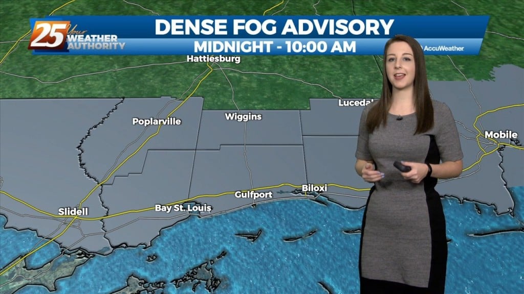
With an approaching cold front to the NW positioned to move through the area, widespread dense fog is affecting South Mississippi this morning. A dense fog…
Zonal flow will continue to dominate the upper level pattern tonight. Southerly surface winds will continue to enhance warmer, moist air advecting into the area. Rain chances…
A departing surface high and an increased onshore flow regime will be the primary drivers of the weather forecast through Saturday night. As southeasterly flow increases tonight…
High pressure will continue to shape the forecast. It will provide a nice evening with southeast winds around 5 to 10 MPH becoming light and variable tonight.…

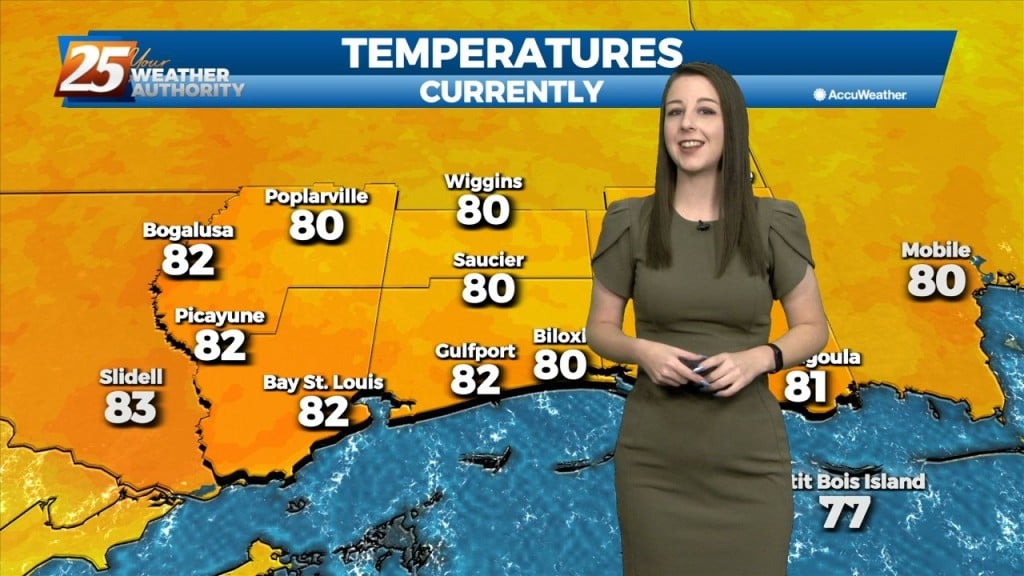
Temperatures have warmed quickly today under a dry airmass. It will get to around 80 degrees this afternoon with east winds shifting to southeast at 8 to 12…
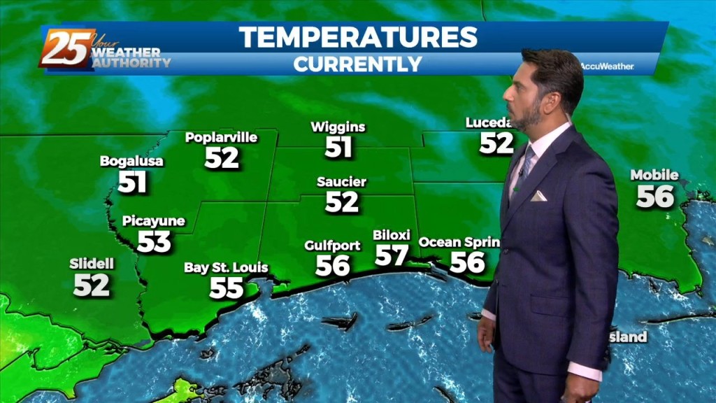
This morning we have clear skies and cooler temperatures in the area. The airmass overhead is a drier one and it is being aided by high pressure…
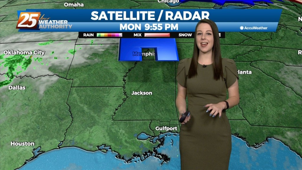
The cold front that passed through the area earlier has cleared our outer waters. The front brought and precipitation chances out of our area as well, leaving mostly clear…
Skies have cleared following the passage of a cold front this morning. Drier air has moved in with clear and cool conditions overnight and temperatures cooling to the…
Cold frontal passage will occur this morning with a 30% chance of showers and thunderstorms associated with it. Mostly cloudy skies will clear this afternoon…
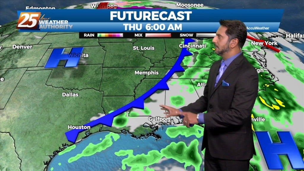
As post frontal air mass and high pressure builds into the region on Thursday, rainfall activity clears out and clouds will be on the decrease. While not looking at…
Scattered to numerous showers and thunderstorms from this afternoon will diminish through this evening. With the cold front still NW, a few showers including spotty thunderstorms…
An approaching cold front from the northwest coupled with daytime heating will continue to increase shower and thunderstorm activity this afternoon. Upper level high pressure…
Main focus on the short term is upcoming rain chances today into tonight. A developing upper level disturbance near the Pacific Northwest will dig south and amplifying…
The pattern will moderate from the recent dry air pattern to a more humid flow through the day today. This morning, we will find clear skies…
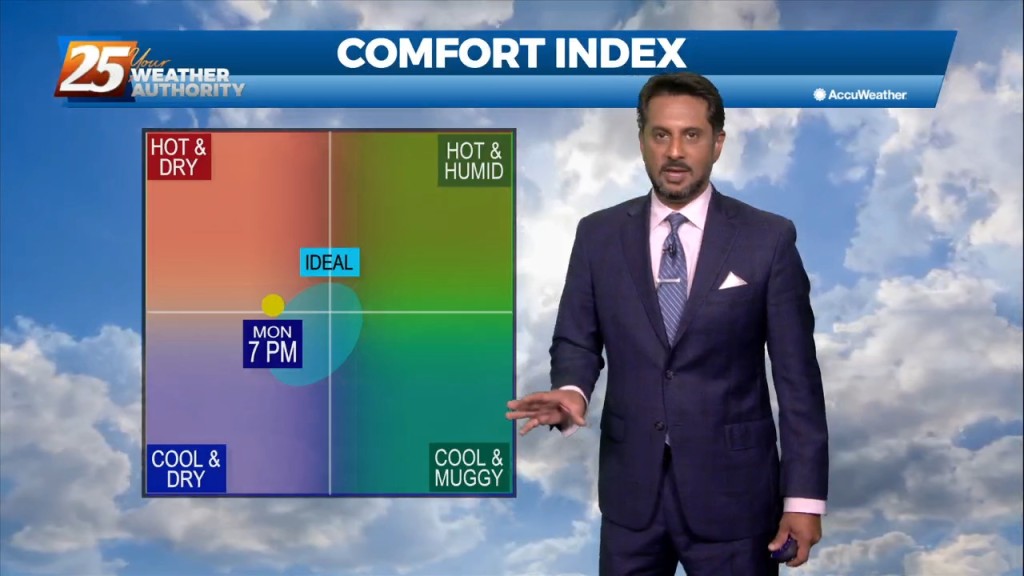
After a beautiful day to start the workweek, high pressure to the north will begin to move to the east and the return flow will begin. Humidity…
Overall, a fairly tranquil day across the region with mostly sunny skies. Speaking of sun, plenty of insolation has occurred allowing for the boundary layer to mix…
High pressure to our north is in control of today’s weather and will remain in control most of tomorrow. It will be breezy at times with…
High pressure to our north will control the area's weather today and most of Tuesday. It will be breezy at times with highs in the low 80s…
Dry high pressure will continue to control the area`s weather through the short term. Expect cool nights and warm afternoons with near to slightly below normal overnight…
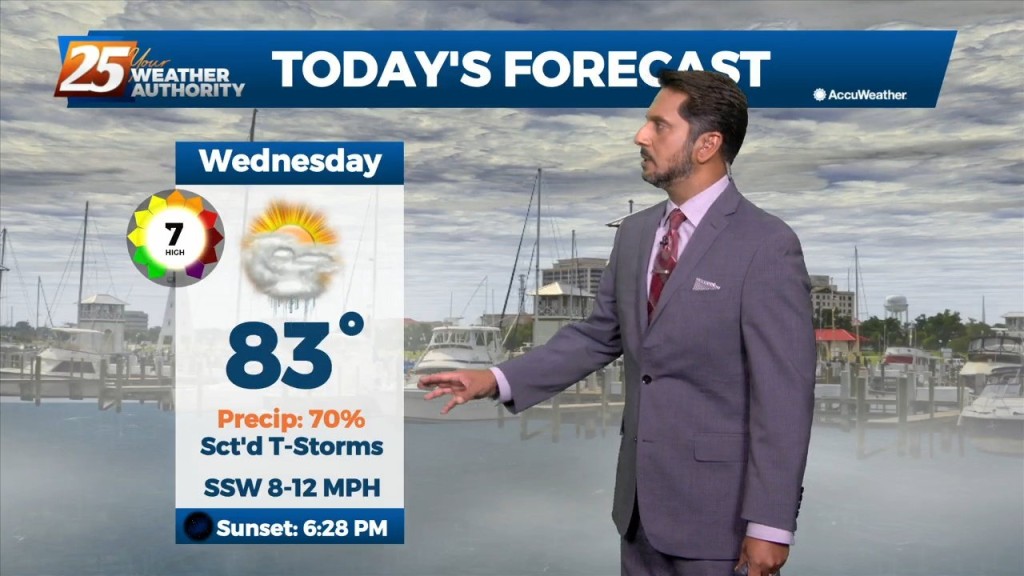
After a warm and humid afternoon, a cold front will move into and through the area just before midnight. Winds will shift to a…
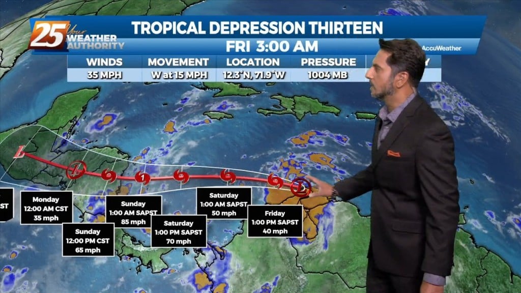
Tropical Depression 13 has formed overnight near Aruba and north of Venezuela. The structure of it has not changed much. Most of the thunderstorm activity is on…
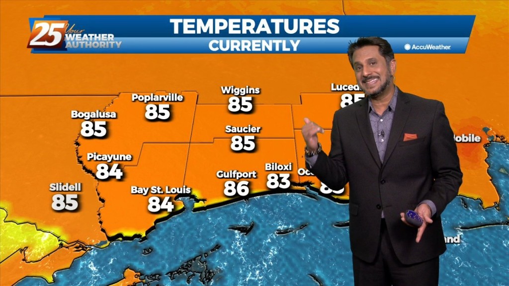
Temperatures will warm into the mid-80s across the viewing area ahead of a cold front. Winds will be out of the south, shifting to southwest around…