12/6 - The Chief's "December...Spring-Like Pattern" Continues
The warm front yesterday retreated quickly and even by this morning was already north of the area and we are now in a warm air regime. This could set the…
The warm front yesterday retreated quickly and even by this morning was already north of the area and we are now in a warm air regime. This could set the…
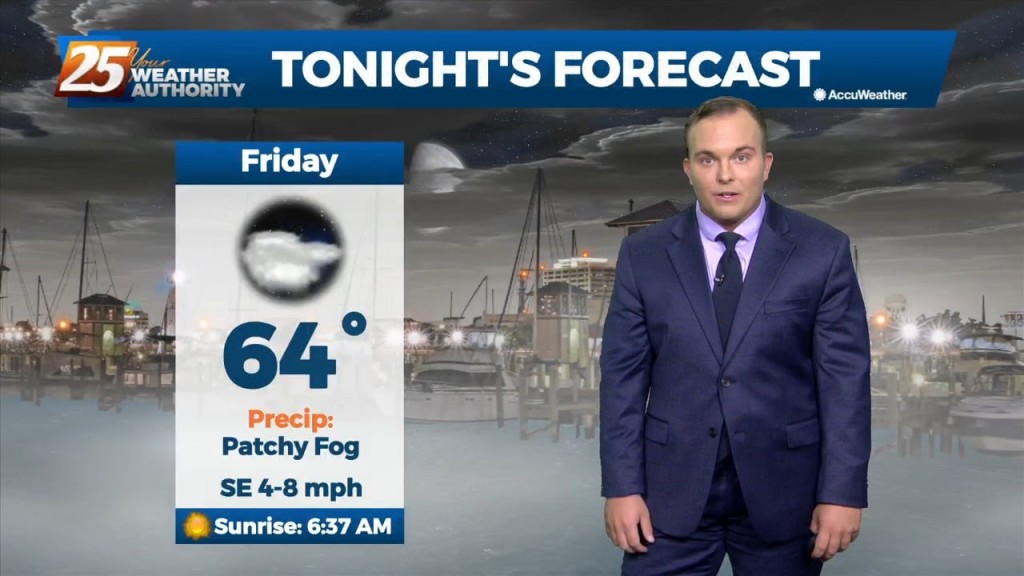
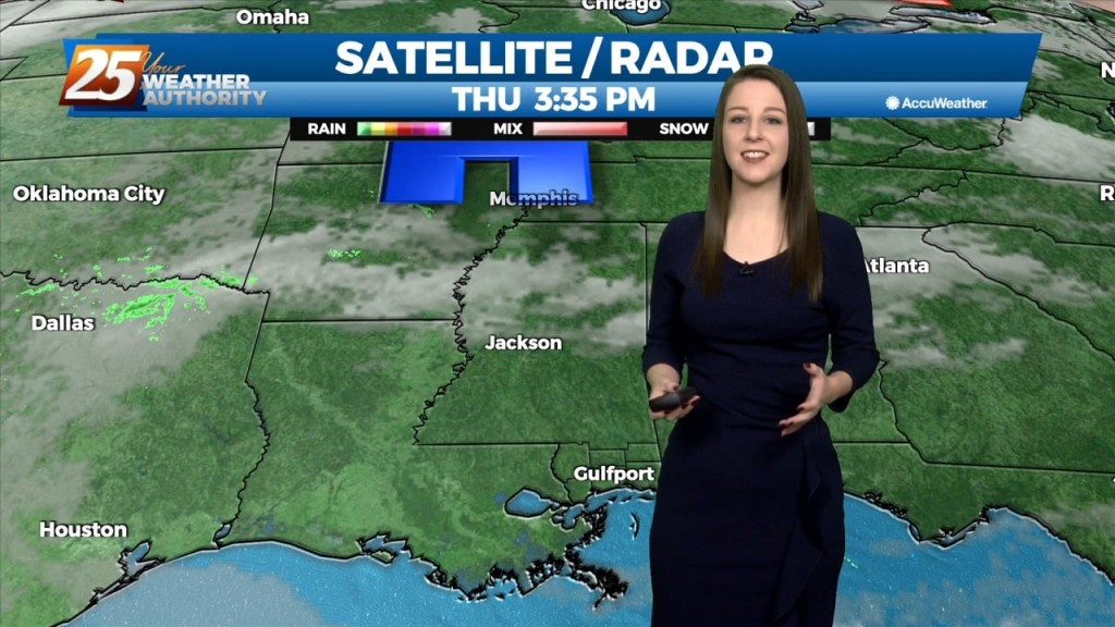
For the short term, like the last few days the primary forecast issue is fog potential tonight. We'll be under a DENSE FOG ADVISORY tonight, beginning at 10pm,…
Low clouds and even some haze/light fog has been impacting the region outside of the light rain. The warm front retreated quickly and even by this morning…
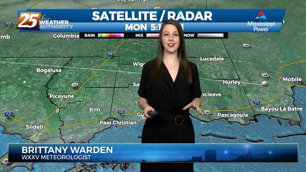
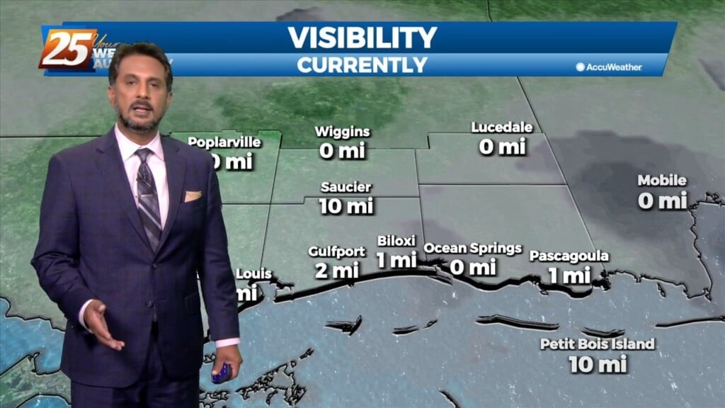
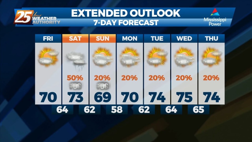
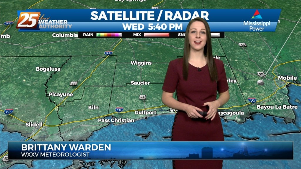
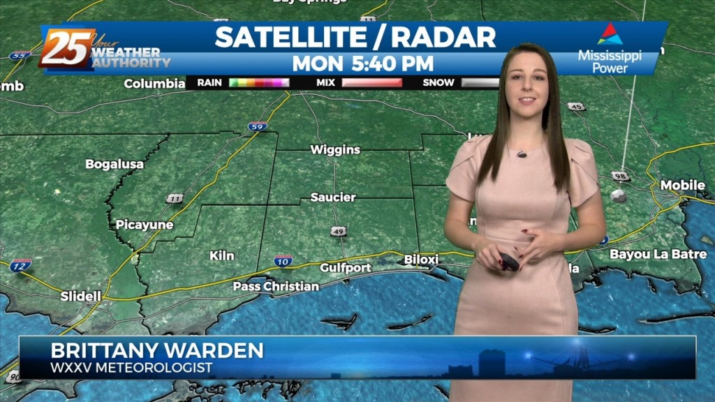
Visibility issues were widespread across South Mississippi this morning. A low cloud deck is still present across much of the area. Expect cloudy conditions and above-seasonal temperatures around…
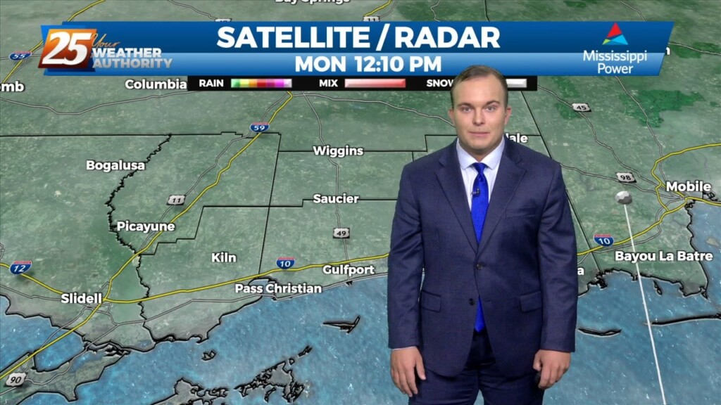
Overall a much quieter day ahead with far less impacts for most of the area. Once again the main problem has been more commerce impacted due to…
Tonight will be mild but there will be a major issue for the morning commute. Reduced visibility is already affecting the coast and more fog will settle…
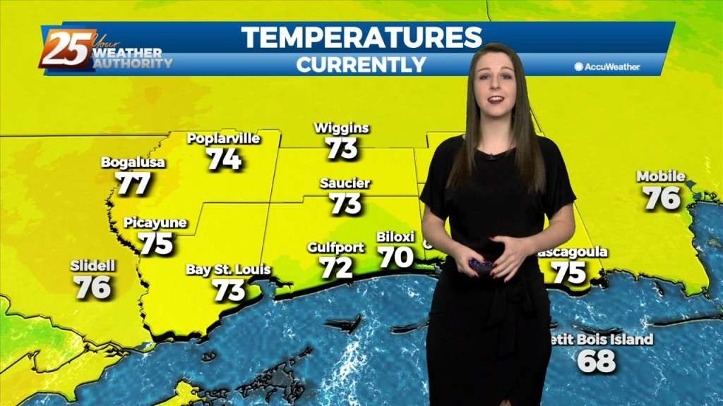
Breezy conditions and cloudy skies will be in place this evening. A warmer and more humid airmass has worked into South Mississippi throughout the day. Temperatures…
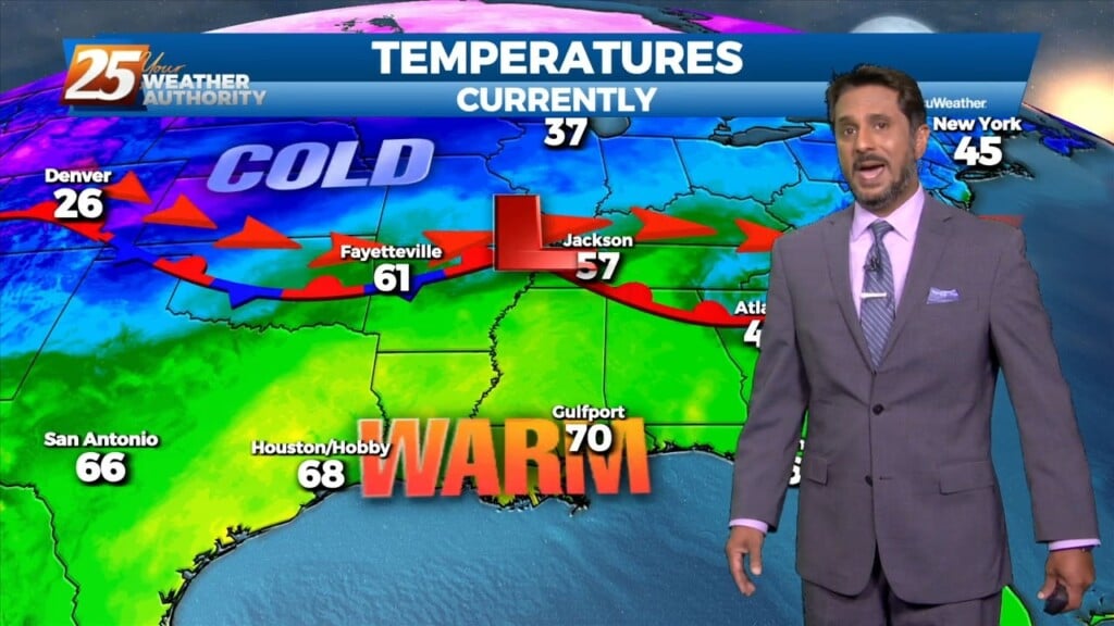
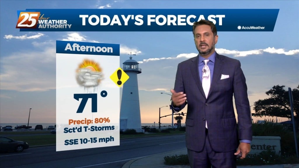
The warm-up today has been profound! Temperatures will near 70 degrees with increasing cloud cover throughout the afternoon and evening. Moisture will be increasing across South Mississippi…
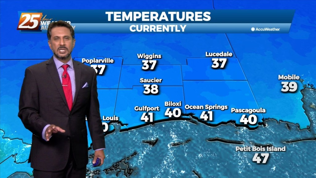
Temperatures are cold again this morning. However, changes are on the way in our pattern. High pressure will scoot to the east. This will provide for return…
Surface ridge continues to build in from the north while sliding east across the Ohio River Valley. This has kept temperatures on the cool side. This will…
A mid latitude disturbance will be tracking east across the Central and High Plains Friday, crossing the upper/mid-Mississippi River Valley Friday night. As surface ridge north of the…
Temperatures will quickly rebound to normal for this time of year on Friday as the upper level trough ejects east and ridge centered over the Gulf of…
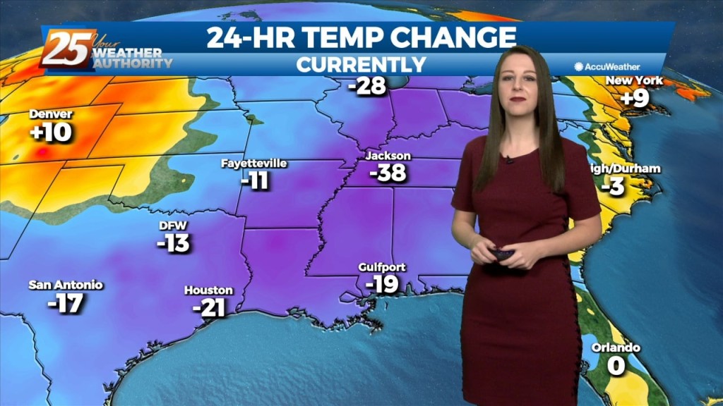
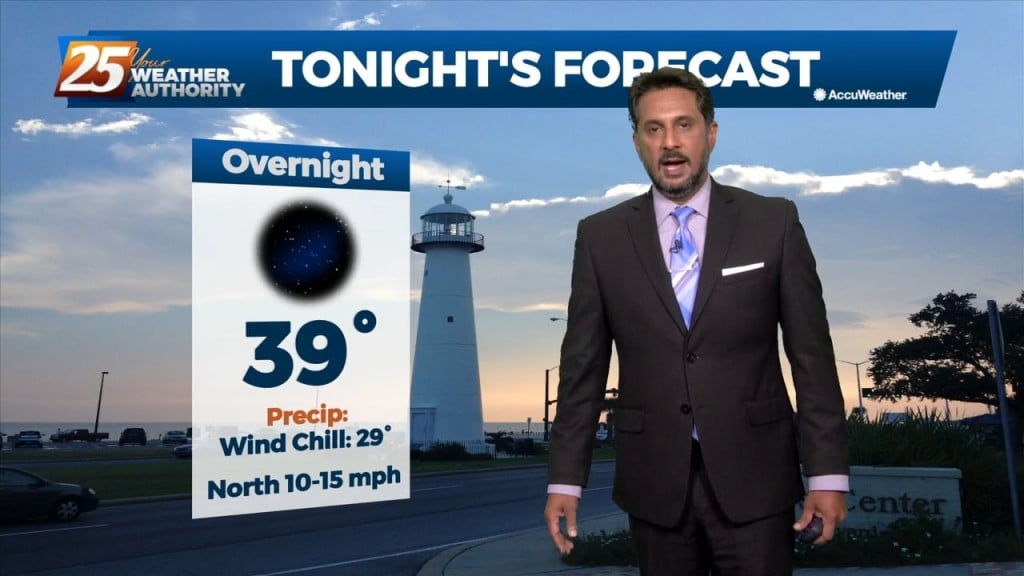
We're on tap for a clear and COLD night. Temperatures will drop down to the upper 30's tonight but given the breezy conditions we'll see, the 30's will…
The cold front that moved through the CWA early this morning is now well south and moving into the central Gulf of Mexico. Clear skies have developed…
A drier/cooler northerly wind will develop across the region today behind the departing storm system. Temperatures will slowly cool back into the mid-60s this afternoon.…
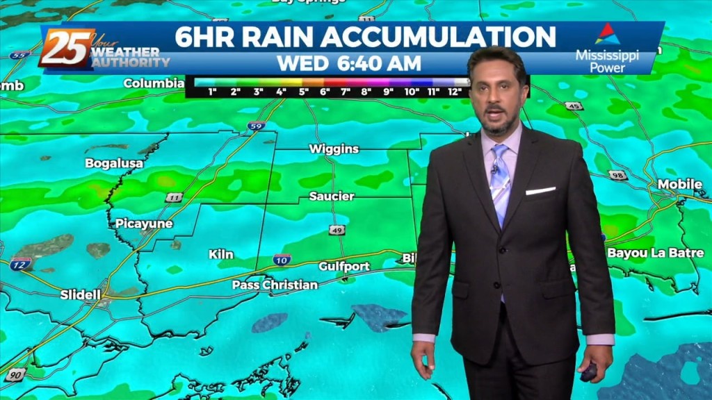
Ongoing activity will begin to settle down this morning as a front moves through the region. A drier/cooler northerly wind will develop across the region…
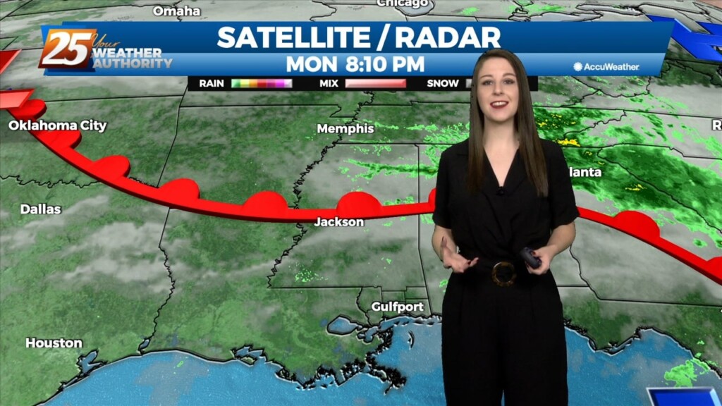
We've managed to remain relatively quiet thus for for our evening but that will be subject to change as we'll see an increasing chance for showers and…
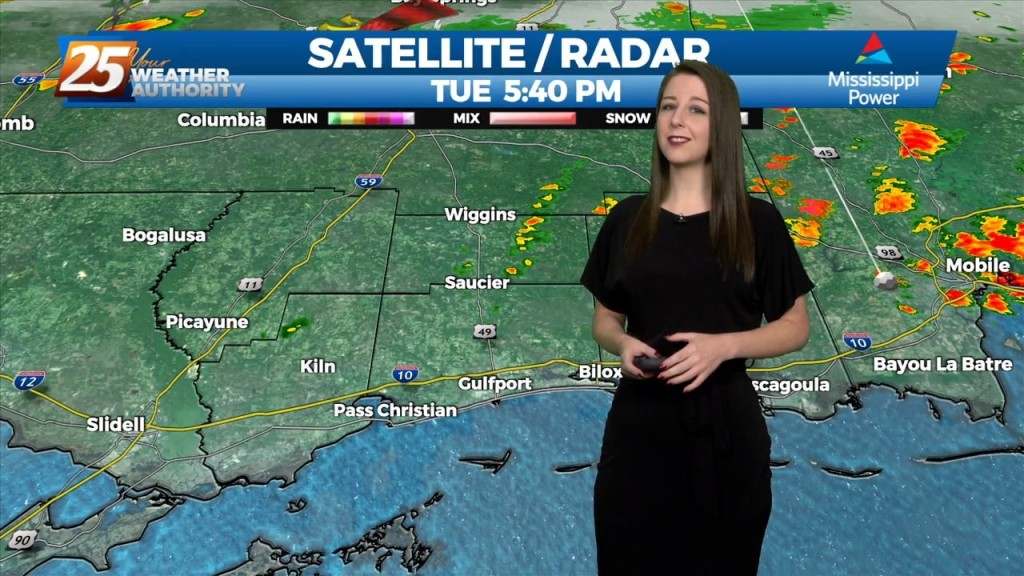
The main focus of the forecast will be the activity we'll see tonight. Tonight will hold a 90-100% chance for showers and thunderstorms in advance of an approaching…

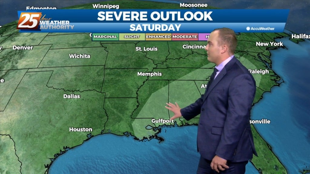
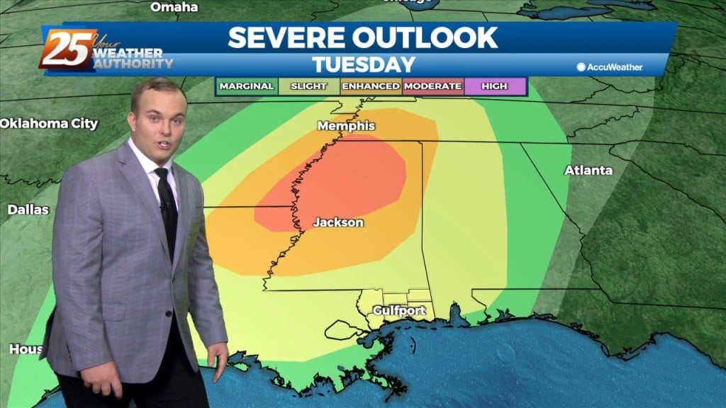
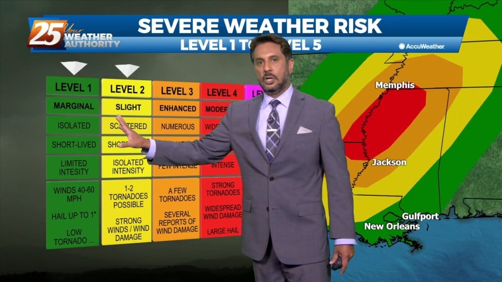
A SEVERE THREAT WILL BE IN THE AREA this afternoon and overnight... There is now a slight risk for severe storms capable of producing damaging winds,…
The latest trends in models have increased confidence in the risk for severe weather to our area and there is now a slight risk for…
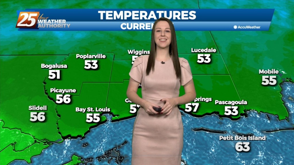
We're on tap for a quiet but chilly evening. Temperatures will bottom out towards the mid 50's and we'll see a gradual increase in cloud…
Pleasant weather with seasonable temperatures have been observed throughout the day today on the backside of a shortwave trough lifting into mid-atlantic CONUS as height rises and stable air…
This afternoon will have plenty of sunshine and temperatures warming to around 70 degrees. Winds will be southerly this afternoon into tonight. The light southerly breeze overnight…
A pleasant day ahead with high-pressure to the NW shaping the short-term forecast. The primary headline to monitor beyond today is severe weather and excessive rainfall potential…