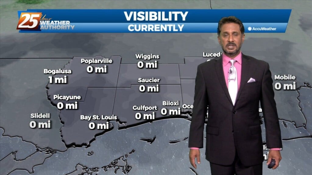
1/31 - The Chief's "WIDESPREAD DENSE FOG" Tuesday Morning Forecast
A stalled cold front is just inside the NW portion of the area this morning. The front will move SE as fast as molasses in winter. It…
A stalled cold front is just inside the NW portion of the area this morning. The front will move SE as fast as molasses in winter. It…
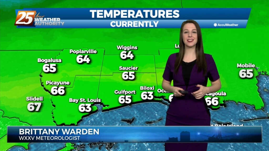
Quite the dreary start to the day but once fog burned off temps torched out with mid to upper 70s. Along and north of the stalled stalled front which…
Quite the dreary start to the day but once fog burned off temps torched out with mid to upper 70s. Along and north of the stalled stalled…
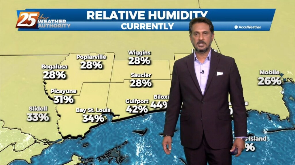
Fog has dissipated across most of our area. Some pesky marine fog remains along the beachfront. Some peeks of sunshine this afternoon will help add buoyancy to…
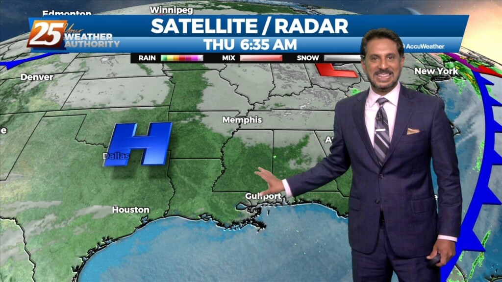
Currently there is an area of high pressure over western Cuba, and a trough extending from the Great Lakes to the central California coast are combining to produce…
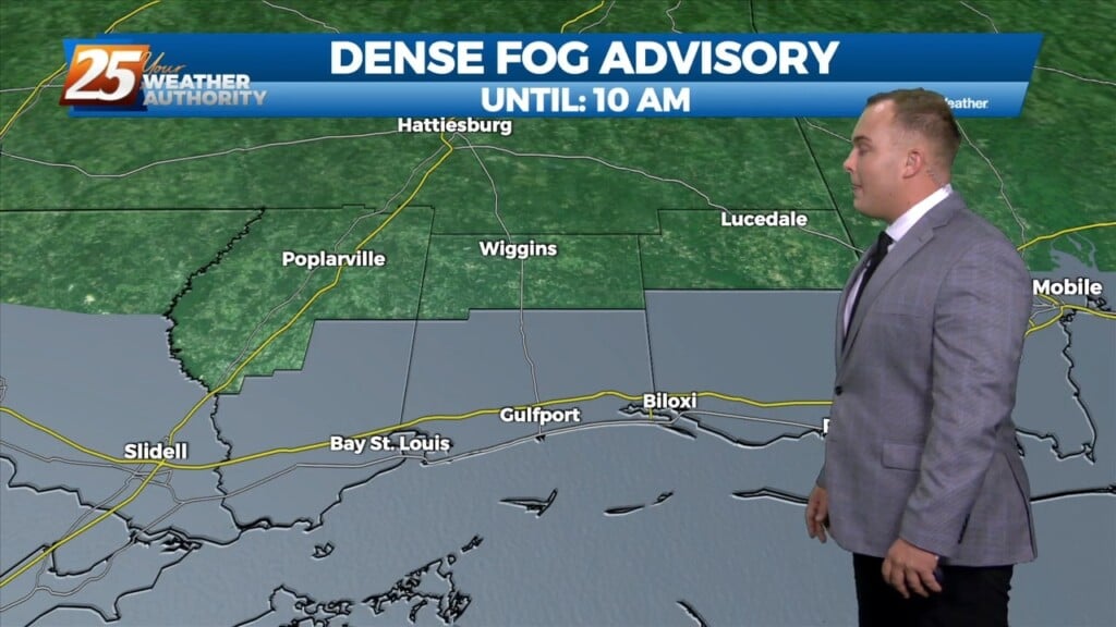
Showers coverage has diminished throughout the evening. With light southerly flow and a moist airmass, sea fog will settle in especially along and south of Interstate…
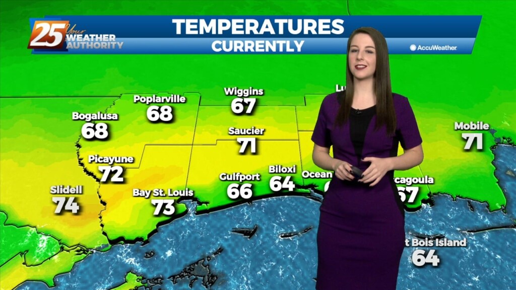
A transition to a warmer and more humid pattern will take place tonight into tomorrow as a surface ridge centered over the area today begins to shift to the…
A transition to a warmer and more humid pattern will take place tonight into tomorrow as a surface ridge centered over the area today begins to shift to the…
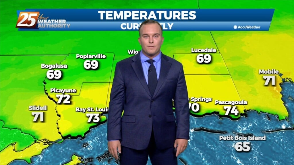
At the surface, high pressure was centered near the Sabine River. High pressure will slide eastward to the Carolina coast by Saturday evening. This will allow…
There is SW’erly upper flow across the local area this morning with an area of high pressure along N’tern Mississippi. At the surface, high pressure was centered…
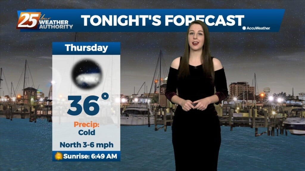
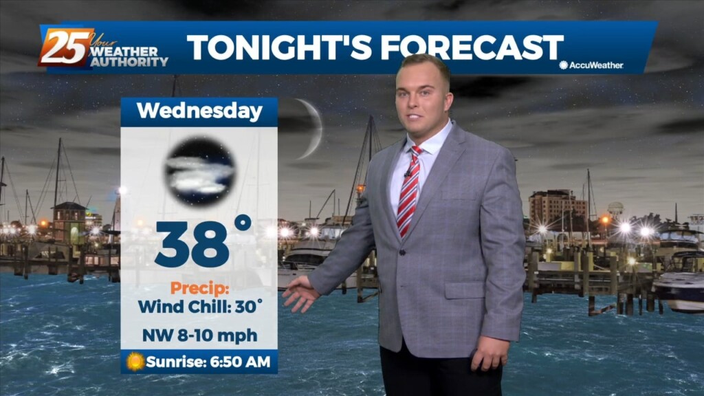
Mostly clear skies and cold temperatures will continue through the night. The only cloud cover expected will be a few high level cirrus clouds passing through on the back…
The region will be dominated by a strong surface high in the low levels, and a largely zonal flow regime in the mid to upper levels…
We are amidst a cold stretch of days to end this week. The good news for warm weather lovers is that a warming trend is in…
A disturbance over the Great Lakes has multiple bit of energy rotating through it. Flow is currently zonal across the southern states, with one disturbance exiting through…
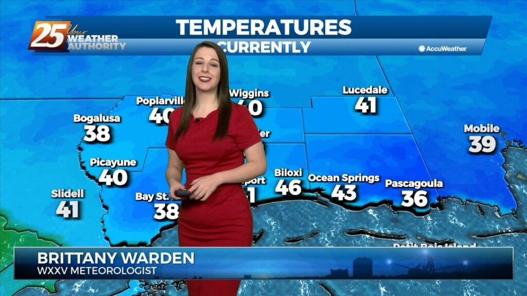
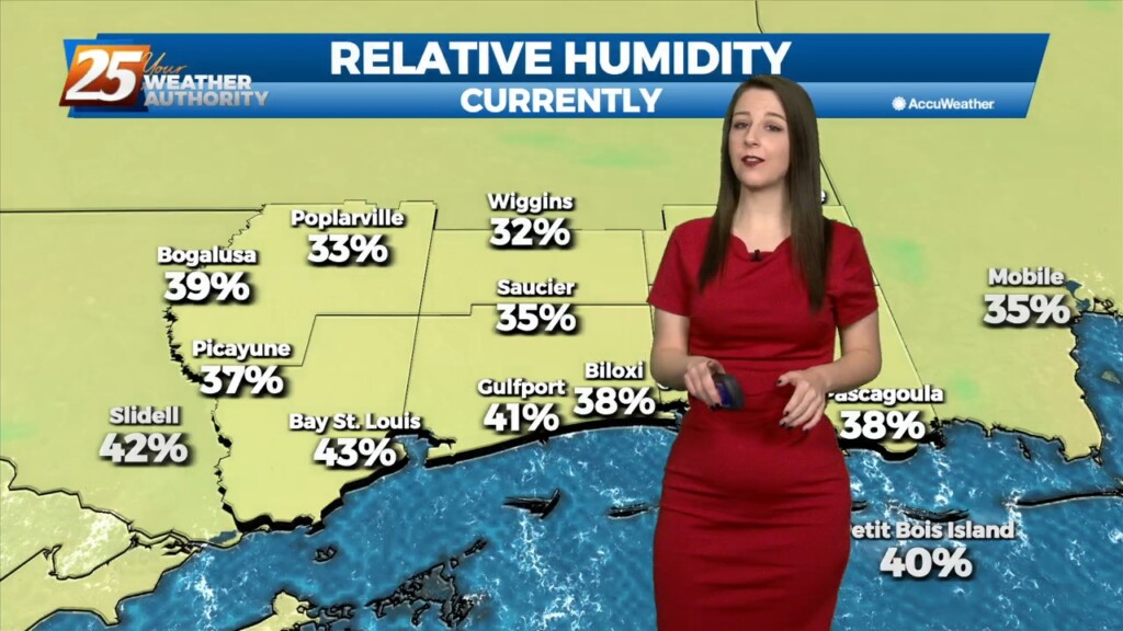
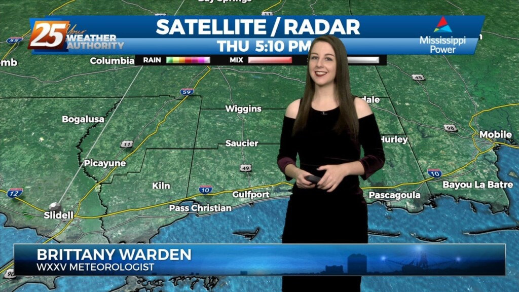
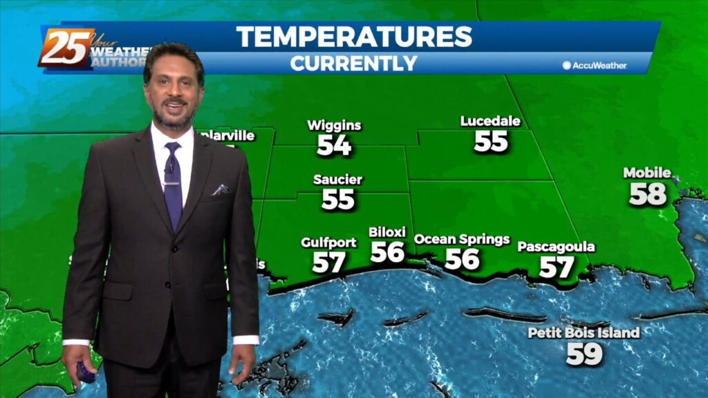
Temperatures are much colder than this time yesterday! The coldest of the airmass is working into South Mississippi. Cloud coverage will help keep temperatures from bottoming out tonight.…
The cold front associated with yesterday/last night’s system made it through our area before sunrise today. Temperatures remained in the 50s much of today with breezy northwest…
With strong cold air advection and cloud cover, temps will not warm and may actually drop off a few degrees this afternoon. Winds will also…
As the cold front exits stage right, we will see temps begin to fall this morning into the 40s and 50s by mid-morning. With strong…
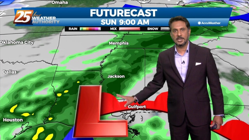
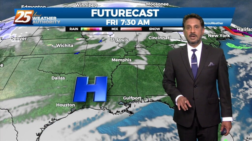
This is the time frame that will be looked at the most. A warm front will lift out of the gulf and move over the area around noon…
This is the time frame that will be looked at the most. A warm front will lift out of the gulf and move over the area around noon…
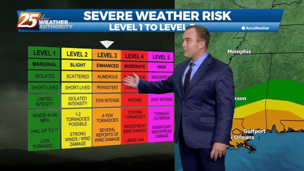
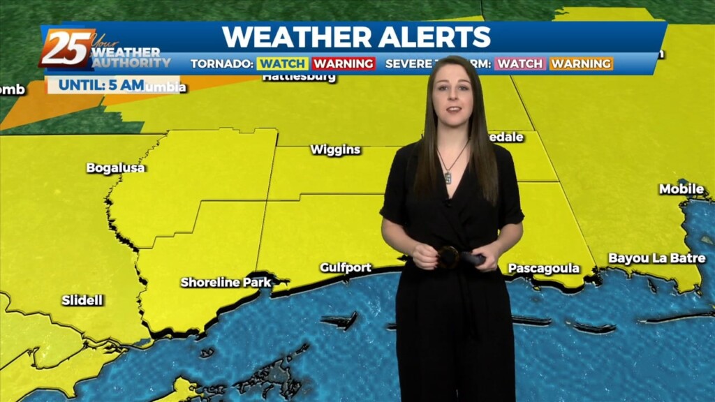
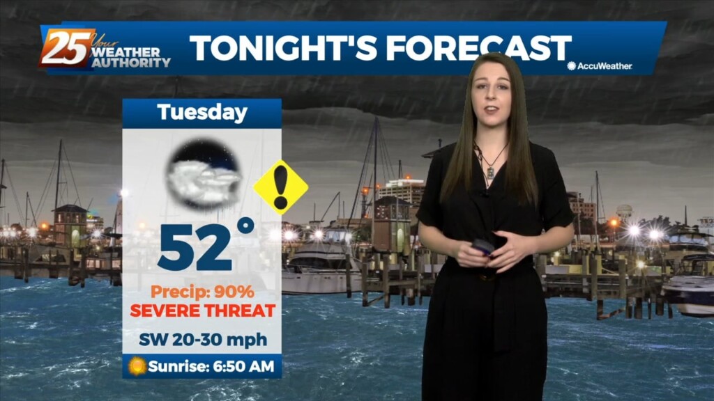
Today and tonight are shaping up to be busy across our area. The Storm Prediction Center has placed our entire area under an Enhanced (Level 3 of…
A warm front will lift out of the gulf and move over the area around noon today. This front will allow some showers/t-storms to develop by…
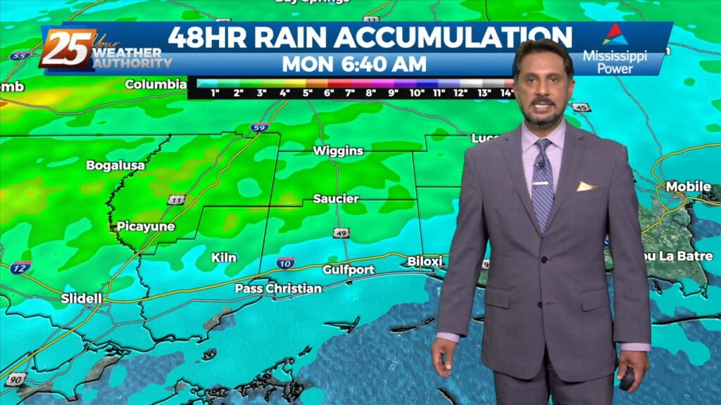
Bottom line up front...main concern for this forecast package will be with the storm system expected to impact the Gulf Coast Tuesday into Wednesday morning,…
Bottom line up front...main concern for this forecast package will be with the storm system expected to impact the Gulf Coast Tuesday into Wednesday morning, with the…