11/02 Ryan's "Slightly Clearer" Thursday Afternoon Forecast
The clouds cleared out a bit, but the temperature and humidity continued to rise as expected. Click the forecast link for the full forecast.
The clouds cleared out a bit, but the temperature and humidity continued to rise as expected. Click the forecast link for the full forecast.
After a warm/humid start to the day, above seasonal temperatures continue with mostly cloudy skies along the viewing area...
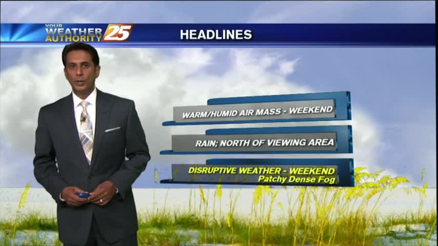
A WARM/HUMID start to the day has developed areas of PATCHY DENSE fog along the coastal counties...
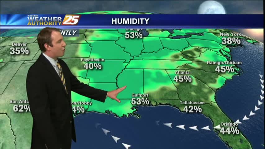
We're still seeing progressively warmer and more humid conditions each day/night, something I don't expect to change drastically for over a week. Watch the full forecast for details.
Clouds have moved in, blotting out the clear skies we've enjoyed over the past few days. Very little changes over the next week, so watch the full forecast for details.
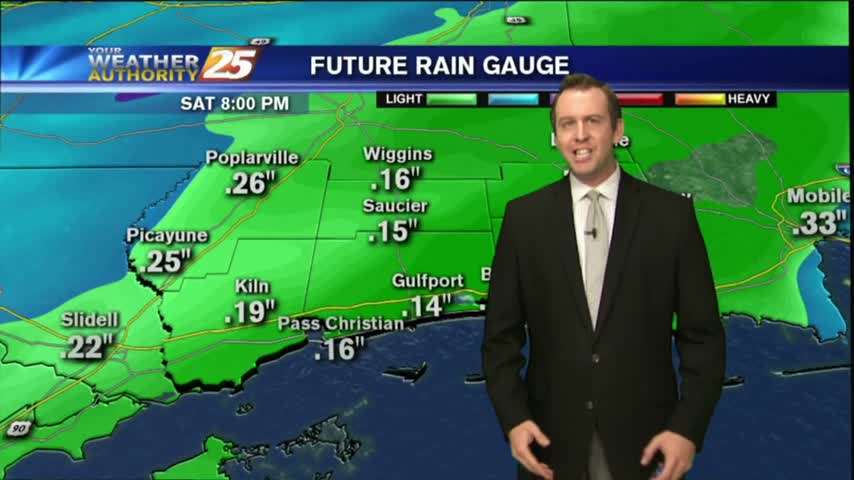
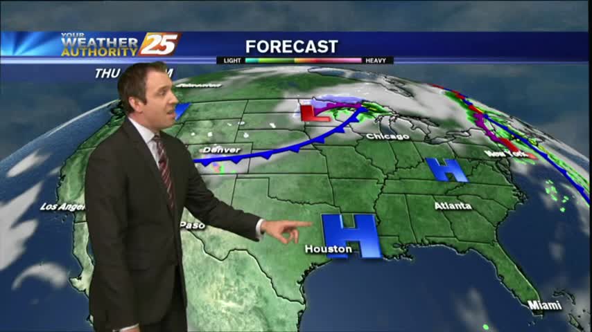
Clouds continue to move into the area, but most of the rain will stay to the northwest.
Happy first day of November, South Mississippi!
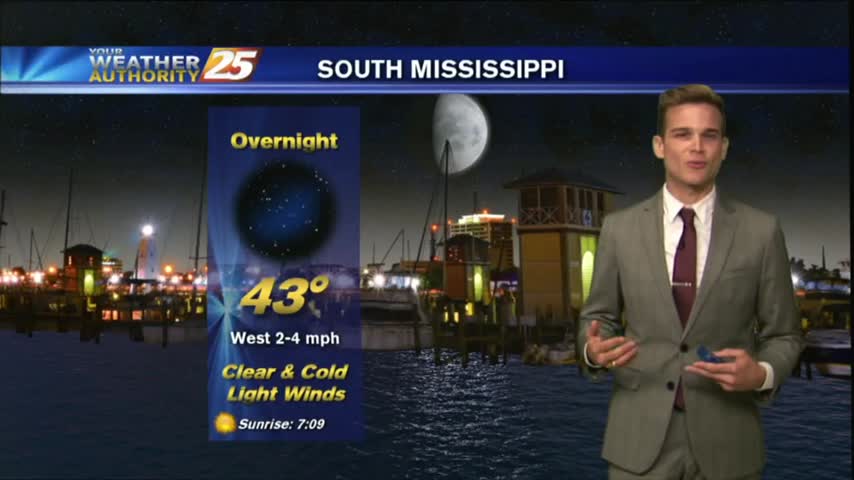
It was a cool and clear Halloween night, but the moisture and temperature continue to rise for the next several days. Very little rain is expected though, so be sure to watch the forecast for details.
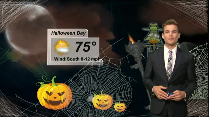
Happy Halloween! A nice day and cooling this evening for trick-or-treating.
A cool but warmer start to the day as the pattern has begun to shift...bringing warmer more humid conditions to the region...
Tonight's low will rise out of the 40s and back into the 50s, and this warming trend will continue for the next several days. Click the link for the full forecast.
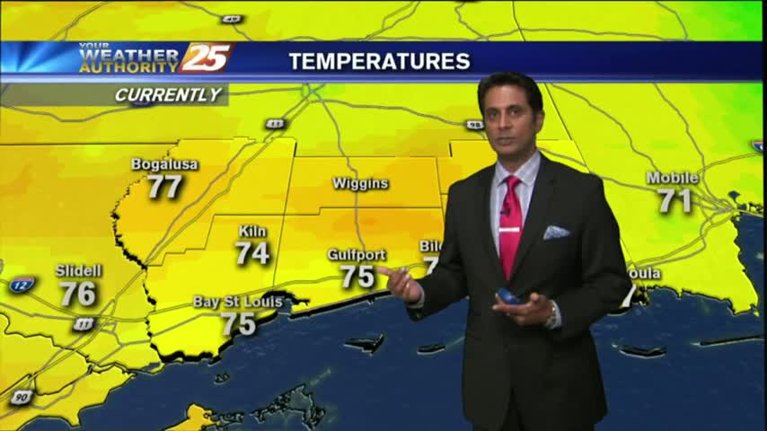
It was a cold start to the day, but temperatures are going to be very nice this afternoon.

After a COLD weekend, it's another COLD start to the day but the air mass will begin to modify as early as this afternoon...
A weekend front didn't bring much rain, but did bring much cooler and drier weather. We're starting to see that airmass change, so watch the full forecast for details.
You'll need a jacket tomorrow morning, but beautiful weather by the afternoon.
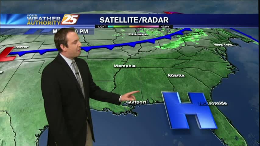
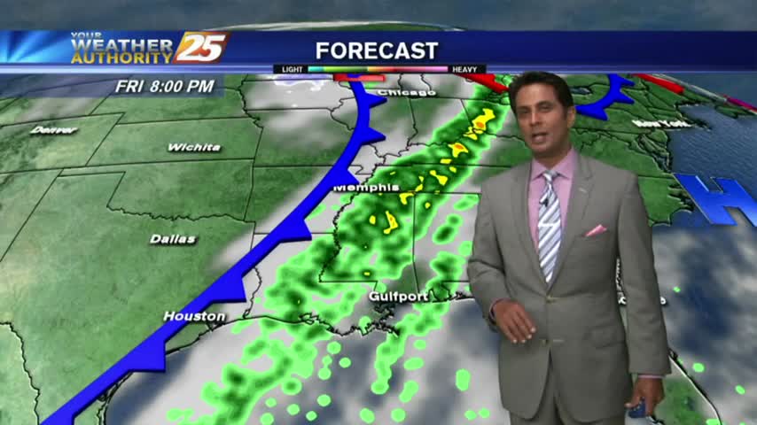
The front we've been expecting all week long is finally here, but the severe weather threat has diminished as the day wore on. Be sure to watch the full forecast for details.

The cold front we've been expecting all week is finally moving in and we'll see some potentially strong t-storms tonight. Click the link for the full forecast.
After a mostly clear start to the day, clouds continue to increase in advance of an approaching cold front along with warm & humid conditions...
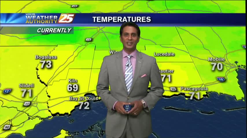
As the south wind from yesterday afternoon continues in advance of the approaching cold front, it's a WARMER more humid start to the day...

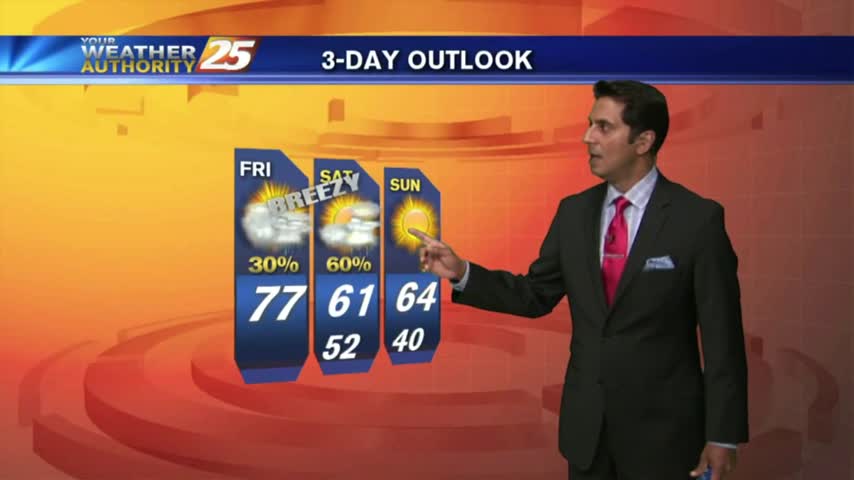
The humidity and temperature will continue to rise into tomorrow ahead of our next cold front, which could bring some damaging weather overnight Friday. Watch the full forecast for details.
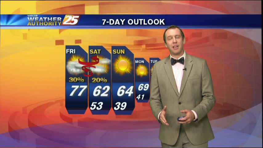
Doesn't seem like active, dangerous weather is just over 24 hours away, but a cold front is racing through the plains and brings a "marginal" risk to the area tomorrow night. Watch the forecast for details.
After another CHILLY morning...changes in the patter is bringing a more humid and unstable air mass in advance of an approaching cold front...
Another CHILLY morning along the Gulf Coast...but major changes on the way will bring the warm-up to the area beginning this afternoon...
Expect another chilly one on the Gulf Coast this evening, but it's the last for a few days as warmer temperatures and higher moisture are on their way. Watch the full forecast for details.