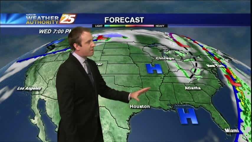
10/25 Ryan's "Upper 60s" Wednesday Afternoon Forecast
Today was the coolest afternoon we've seen since early this year, but we'll see some slightly warmer days ahead, and even some rain by the weekend. Click the link for details.
Today was the coolest afternoon we've seen since early this year, but we'll see some slightly warmer days ahead, and even some rain by the weekend. Click the link for details.
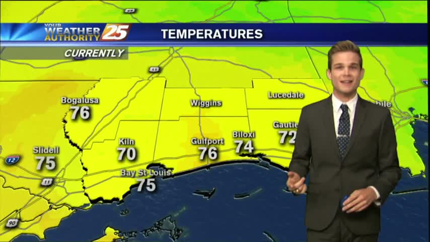
After a CHILLY start to the day, temps continue to struggle to get into the 70s as an abundance of sunshine dominates the region...
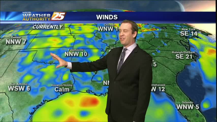
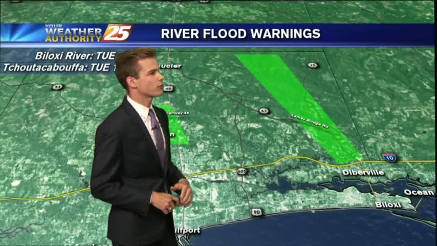
With clear skies and a north wind overnight, some of the COLDEST temperatures of the season thus far has settled along the Mississippi Gulf Coast...
Today was mild and dry, but this evening will bring the coldest temperatures we've seen since winter ended earlier this year! Watch the full forecast for details.
The first true "chilly" night lies ahead for South Mississippi, and it won't be the only one over the next several days. Click the link for the full forecast.
Beautiful weather for the second day in a row!
After a chilly night, COLDER air is on the way with a dry front overhead moving east. A reinforcing shot of COLD/DRY air will begin moving into the area...
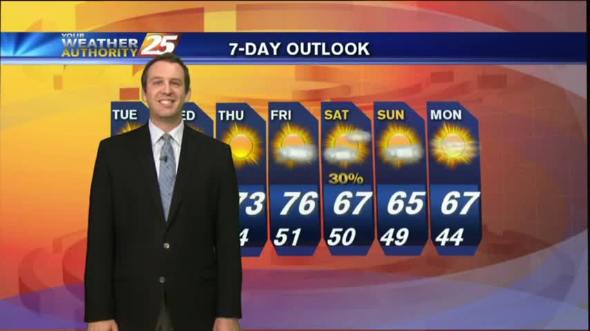
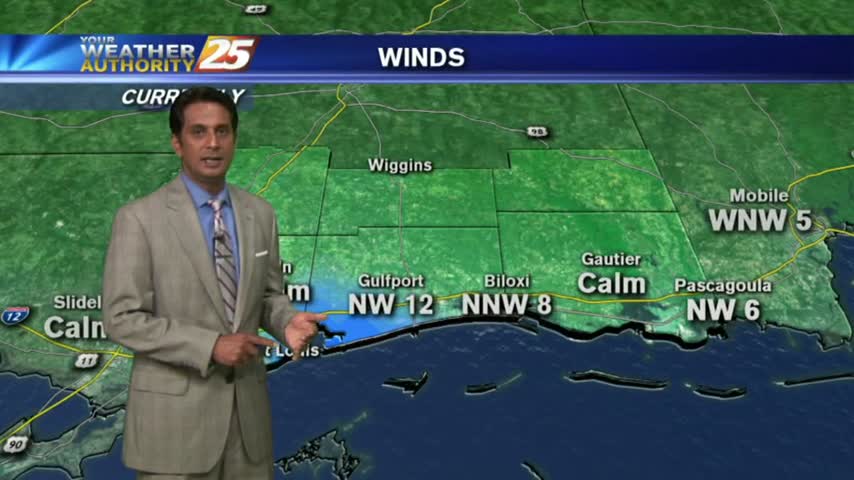
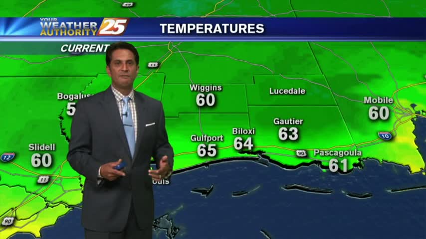
Tonight's low will fall into the lower 50s on the waterfront and upper 40s inland, but much cooler nights are ahead. Click the link for the full forecast.

The weather improved rapidly after the front moved through yesterday, and we'll see even cooler and drier days ahead! Watch the full forecast for details.
Get ready for a very nice week with drier weather and cooler temperatures.
In the wake of yesterdays BUMPY cold front, the front and activity is now east with clearing to occur this morning...
After severe weather today, beautiful is on the way.

Severe weather this morning..
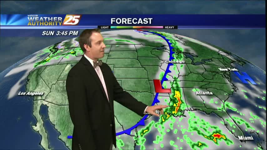
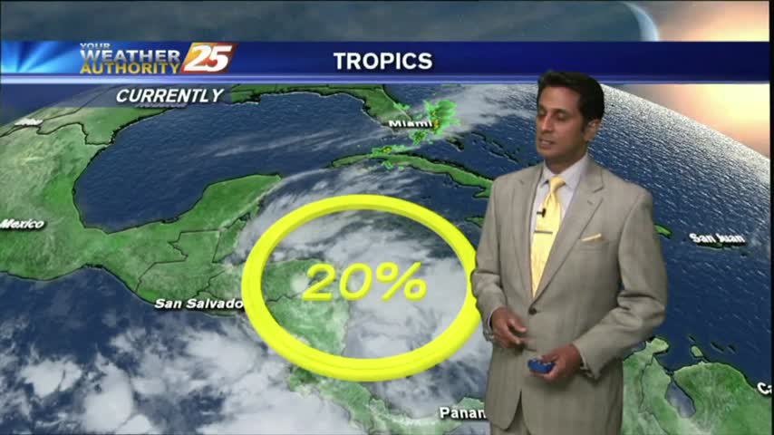
Our nice run of fall weather is already coming to an end as the temperature and humidity continue to increase ahead of a Sunday cold front. Watch the full forecast for details.
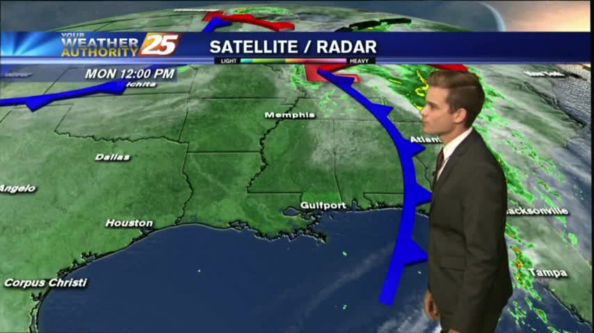
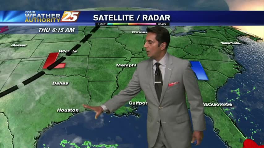
More clouds moved in today and we'll see even more tomorrow, as well as a chance of afternoon showers and t-storms. Watch the full forecast for details.
A warm and humid Friday afternoon heading into the weekend which could bring a SLIGHT THREAT for SEVERE Weather...
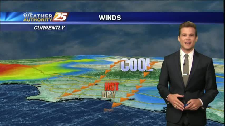
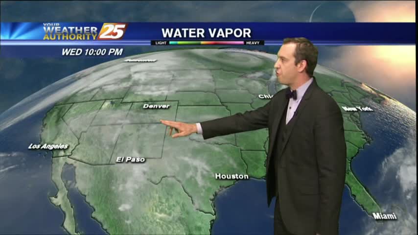
As the pattern begins to shift, it's a cool start to the day with a humid air mass beginning to move into the region...
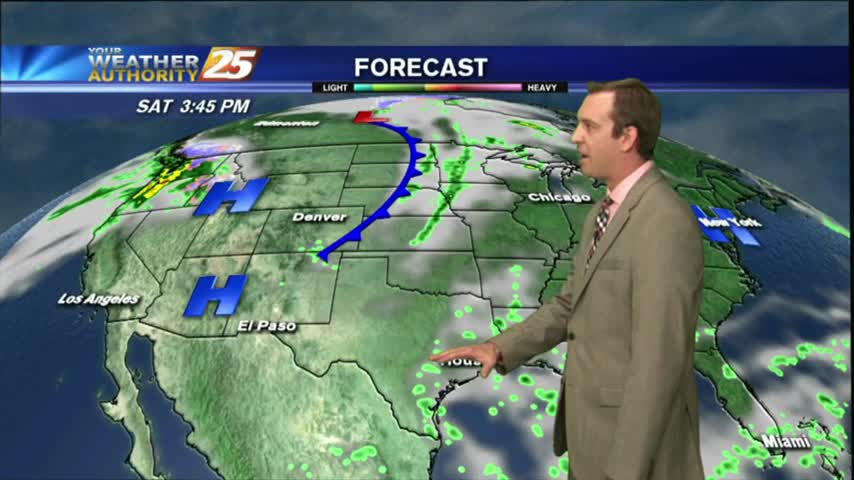
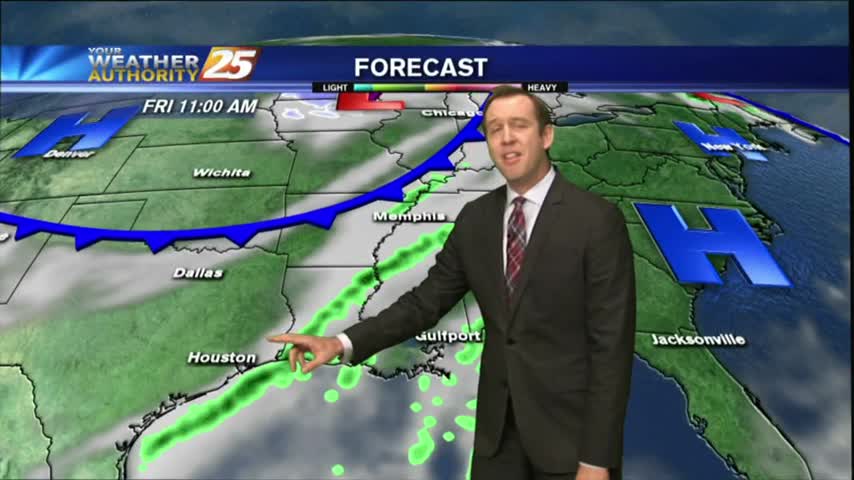
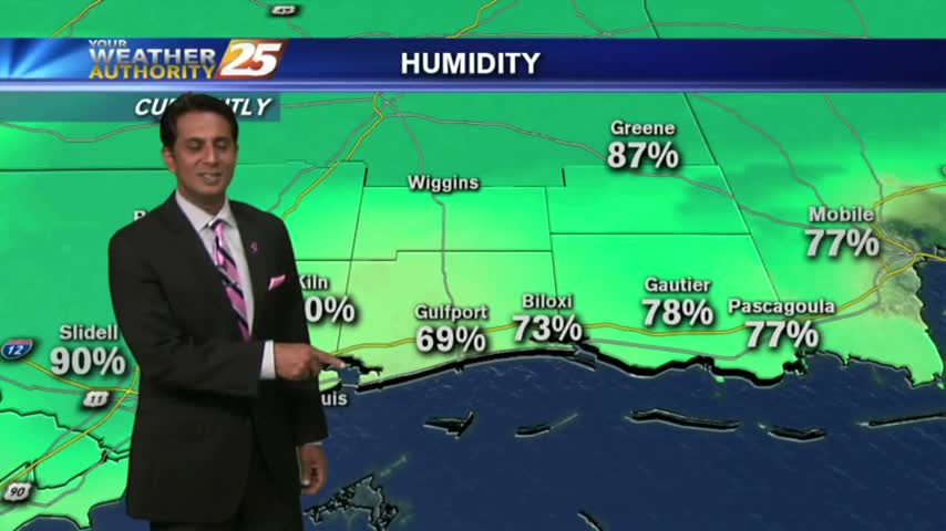
Moisture was on the rise this afternoon and will wane a bit tonight, but expect it to return in earnest for the weekend just before a front brings thunderstorms. Watch the full forecast for more.

After a clear start to the day, warming temps and low-level moisture flow has developed a few clouds along the coastal counties...
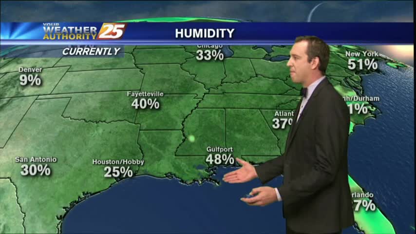
Another cool start to the day but the humidity has already begun to increase heading into the weekend...
Expect another clear, cool, and dry evening tonight with another great sunny & dry afternoon tomorrow. Conditions change by the weekend though, so watch the full forecast for details.
Today's weather warmed slightly but remained clear & sunny, a trend which will continue through the end of the week before rain moves in. Watch the forecast for details.
Enjoy more beautiful weather today!
Another cool start to he day under clear skies, but the pleasant air mass will begin to modify heading towards the weekend...