9/3 - Payton's Sunday Night Forecast
I hope you had a great weekend and enjoyed the somewhat drier conditions. That will continue into Labor with the area being hot and dry.
I hope you had a great weekend and enjoyed the somewhat drier conditions. That will continue into Labor with the area being hot and dry.
Harvey has finally moved on and drier air is moving in bringing clear and sunny days. Click the forecast link for details.
Rain-free conditions continue as temps warm into the mid/upper 80s this afternoon, under partly cloudy skies...
After dealing with the effects of HARVEY over the past week, this morning brings a drier start with light winds from the NW...
Harvey has finally moved far enough away to become inconsequential to the local forecast, so drier and sunny days are ahead! Click the link for the full forecast.
Isolated showers/t-storms continue to move into he area from the west, rotating around now TD Harvey to our NW...
A warm/humid start to the day with very BREEZY conditions and bands of rain moving in from the west...
Severe weather began popping up in the early afternoon, but didn't see much more through the evening and only a few showers & storms are likely overnight. Full forecast inside.
We expect more showers and thunderstorms through the night, but the end of Harvey is in sight. Click the forecast link for more details.
William Carey University Hattiesburg Campus cancelled Wednesday afternoon and evening classes due to the threat of severe weather. Classes will resume Thursday morning. Download the WXXV 25 Weather app for the latest on conditions in your area.
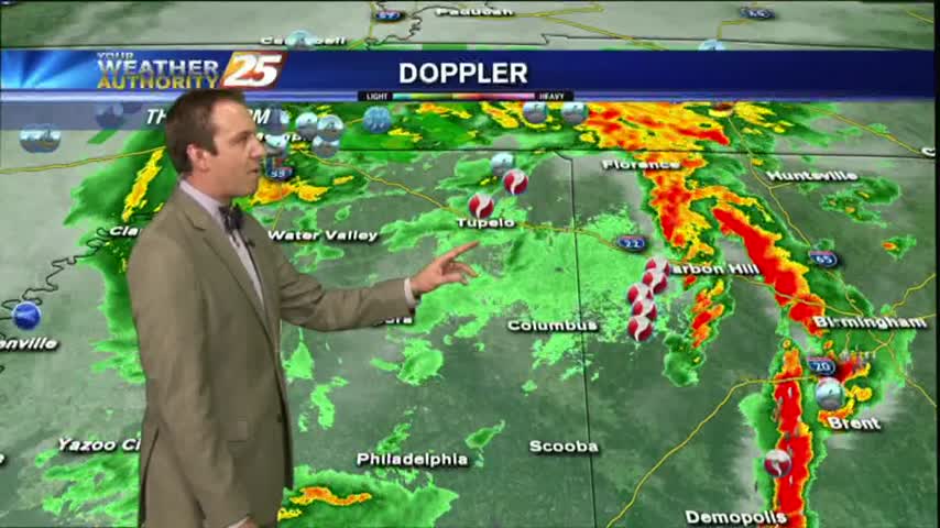
As TS Harvey continues to move NE after landfall this morning...rain continues to move in from the south with HEAVY ACTIVITY at times with a TORNADO WATCH in effect...
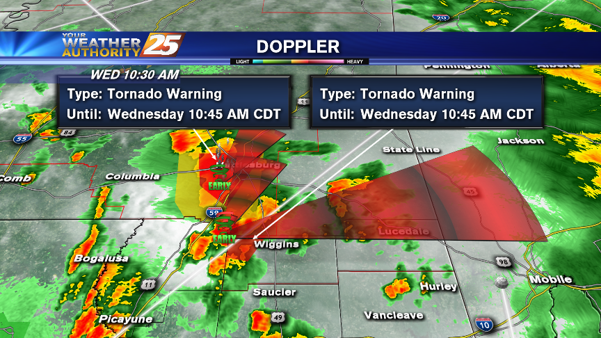
A TORNADO WATCH is now in effect - 6 p.m. Doppler indicating TORNADIC activity in PR & Stone Co. CONFIRMED touchdown SW of H'Burg.

Doug Adams with the Pascagoula Police Department tells News 25 a total of 12 people were rescued from rising waters in Pascagoula between late Tuesday night and early Wednesday morning. Pascagoula Firefighters rescued eight Tupelo Avenue residents, and four Railroad…
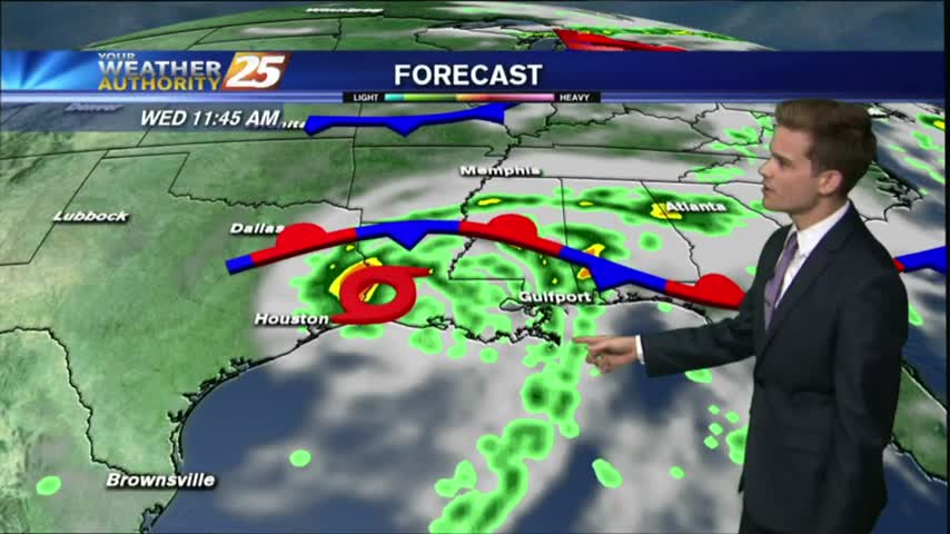
Rain overnight has continued this morning as TS Harvey has make landfall yet again in extreme SW Louisiana...
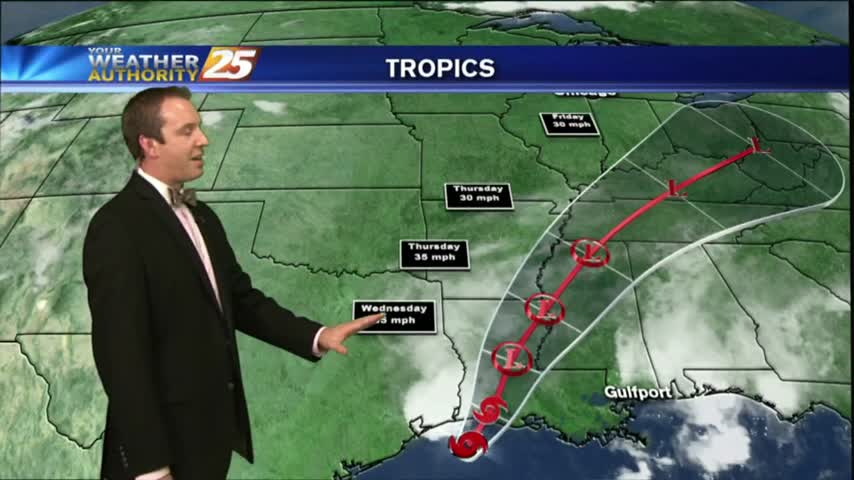
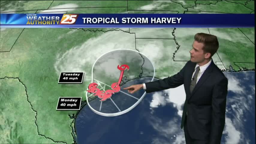
Tropical Storm Harvey continues to push East, and comes close to home on the anniversary of Katrina before moving inland. Rains expected locally, but you'll have to watch the full forecast for details.
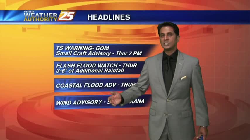
Flash Flood Watch for the area until Thursday night. Turn around, don't drown!
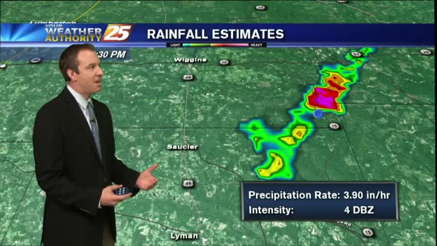
A wet/gray stat to the day as rain has been moving into the viewing area from the W/SW. Heavy activity is on-tap over the next 36 hours...
Didn't see much rain over the weekend from the tropical moisture Harvey brought into the area, but showers began tonight and we'll see more in the coming days. Details within.
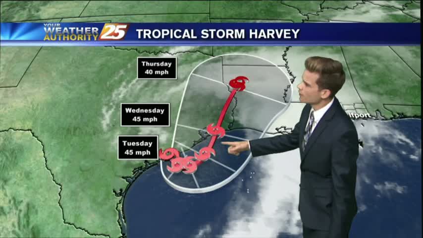
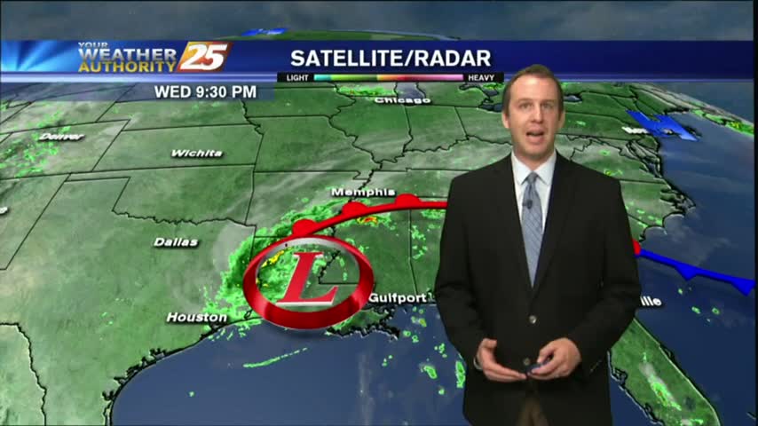
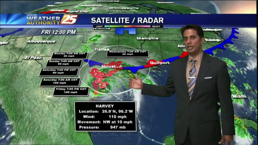
Tropical Storm Harvey will continue to be the main weather feature impacting the forecast through Wednesday as the system slowly moves offshore today and eventually pushes back inland near Houston tomorrow.
Harvey continues to pummel E/SE'tern Texas as the rain shield is beginning to move into the area: light rain moving in from the sound...
Harvey will continue to linger in Southern Texas, but eventually will start to move gradually off to the north and east.
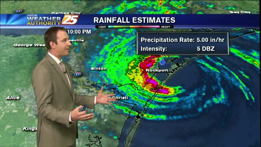
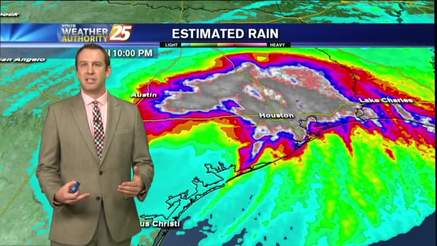
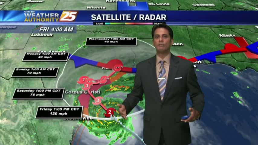
Category 4 Hurricane Harvey officially made landfall tonight, and is slowly roaring through the town of Rockport, TX. Click the forecast link for a full report, as well as local effects.
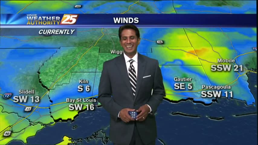
Mostly cloudy skies continue along the viewing area as an east wind is dominating the N'tern Gulf of Mexico...
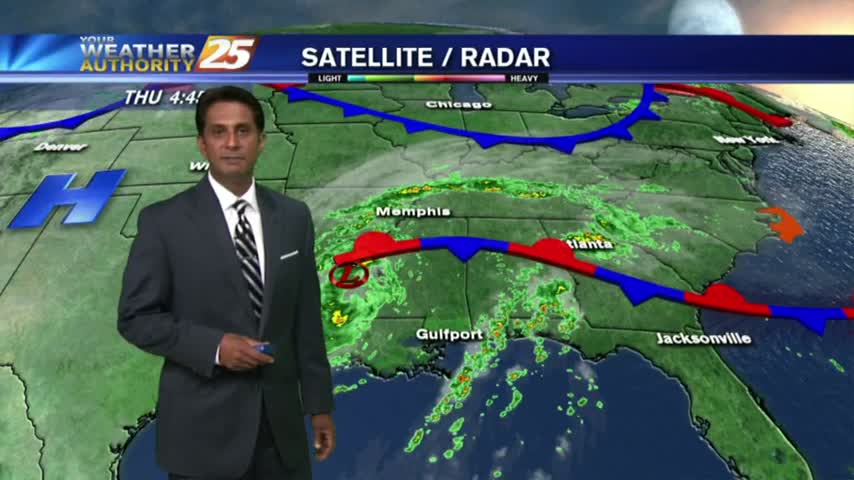
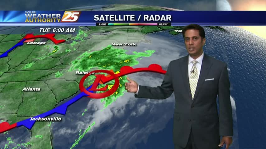
The local radar is fairly quiet this morning as most eyes are on Hurricane Harvey...