07/23 Ryan's "Hot & Humid" Friday Night Forecast
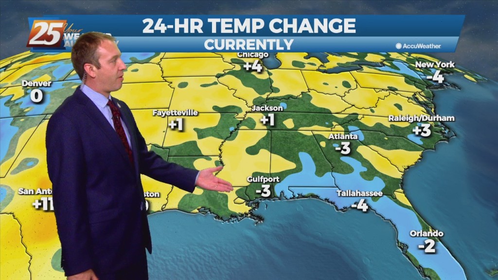
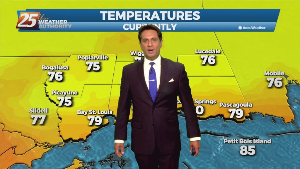
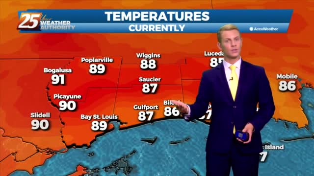
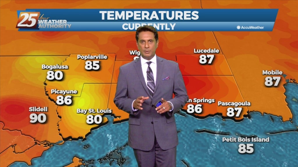
Hot temperatures and high humidity will peak this weekend, leading to some dangerously hot weather. We saw some of that weather today as a few areas climbed…
Hot temperatures and high humidity will peak this weekend, leading to some dangerously hot weather. We saw some of that weather today as a few areas climbed…
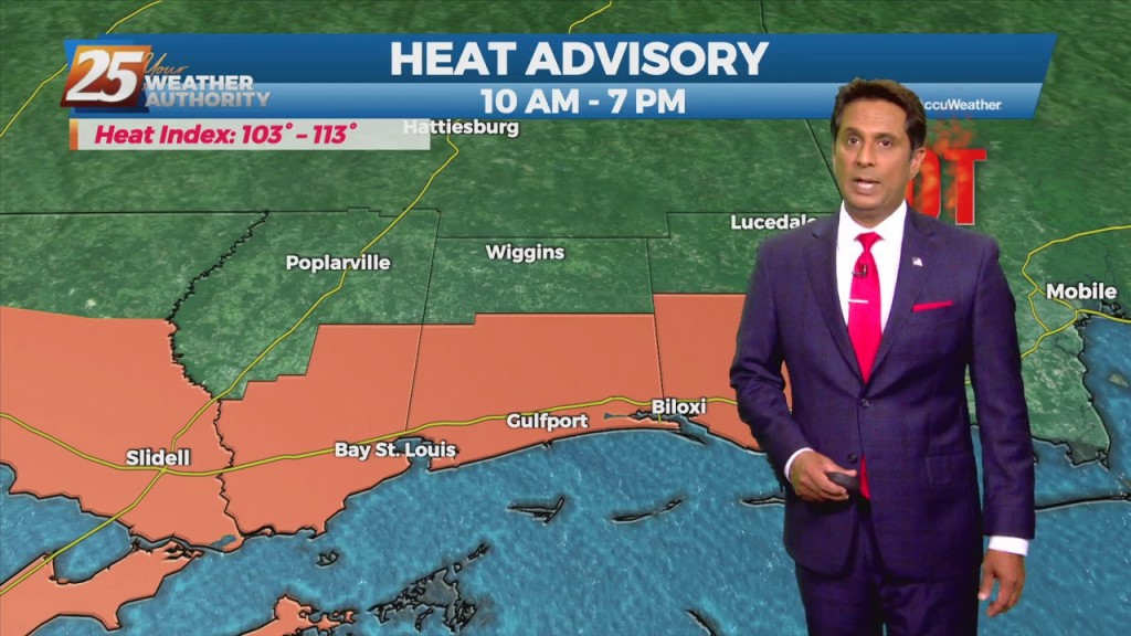
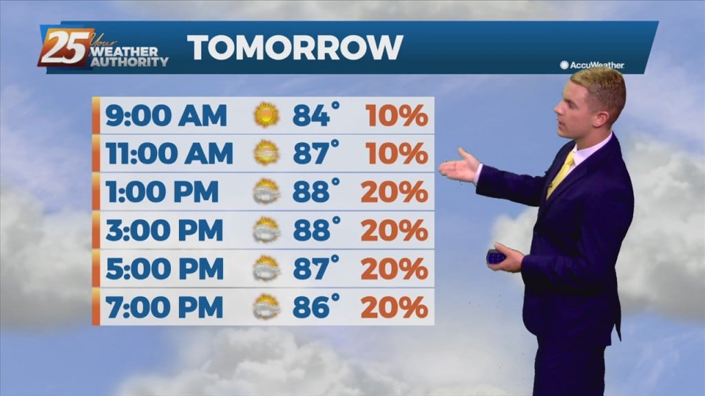
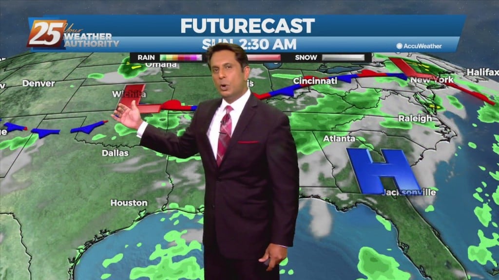
Today through the weekend HEAT will be the primary concern. At this time it appears that today - Sunday has the best chance of seeing heat index values approaching the 110 mark and greater. With high temperatures expected to max…
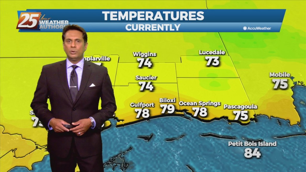
Drier today as we didn't see much rain, but that led to some sweltering conditions with heat indices near 105! That sadly is "the rub" when it comes…
Didn't see much rain today, but that led to some sweltering conditions with heat indices near 105! That sadly is "the rub" when it comes to our weather.…
A Weak frontal boundary draped along the lower Tennessee valley will continue to slide east and out of the region, high-pressure will slowly build eastward through Friday as this weakness moves off the east coast over the next 48 hours.…
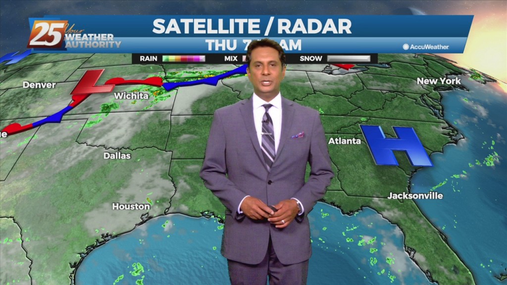
A much drier trend is already beginning to take hold with less than 20% coverage for showers/t-storms. The upper level weakness continues to hold over the mid-Atlantic and northeast with upper level high-pressure in place over the nation's mid-section. Our…
Rain chances are much lower across the region now that our weather pattern has finally started to change. With high pressure slowly building in from the west, we should only see a few showers and thunderstorms each day. Rain chances…
Rain chances are much lower across the region now that our weather pattern has finally started to change. With high pressure slowly building in from the west, we should only see a few showers and thunderstorms each day. Rain chances…
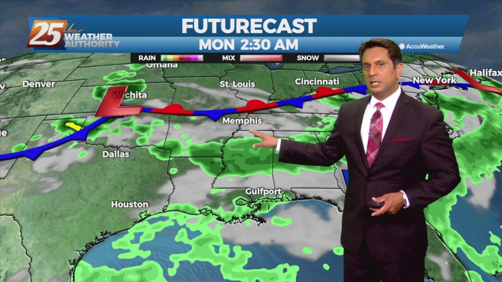
A stalled frontal boundary from the Carolinas to southeast Texas will slowly shift north and wash out by Thursday afternoon. High-pressure over the mid-section of the country will build slowly eastward by Thursday bringing lower rain chances and a return…
A frontal boundary remains stalled from the Carolinas to southeast Texas, with a weak impulse of low-pressure currently over south central Louisiana. The boundary will remain stalled over the area today thus widespread showers and thunderstorms will develop along it…
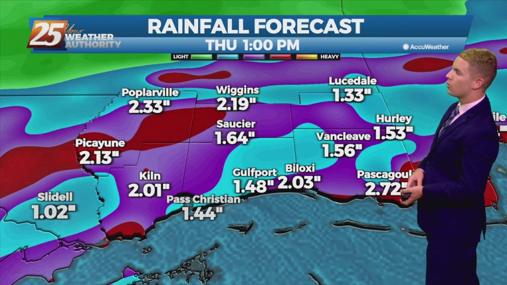
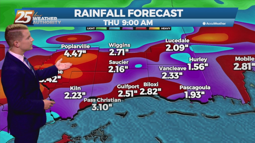
The forecast through the next day or so still remains wet and unsettled. Thursday is looking like it will be the start of a pattern change as we finally start to dry out some. There may not be a very…
The forecast through the next day or so still remains wet and unsettled. Thursday is looking like it will be the start of a pattern change as we finally start to dry out some. There may not be a very…
An area of upper level weakness over New England will be in place through the early part of the week with a massive high-pressure system sitting over the western third of the country. A frontal boundary will continue to slowly…
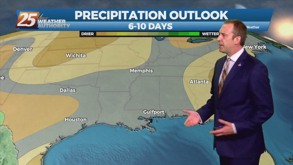
This stubborn active summertime pattern will continue throughout the middle of the workweek before a gradual drying trend expected by the end of the week. There's an area of upper level weakness over New England in place through the early…
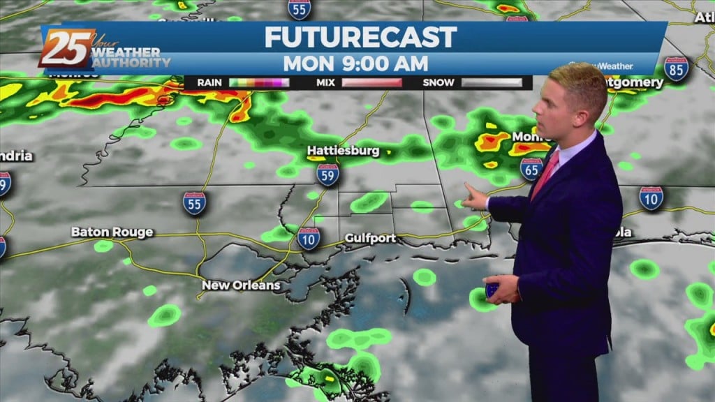
We will continue to carry high rain chances between 60-80% this evening, followed by a slight decrease to between 50-70% after midnight. With the ongoing showers and thunderstorms heading into Tuesday morning, rain chances will once again be between 70-90%…
We will continue to carry high rain chances between 60-80% this evening, followed by a slight decrease to between 50-70% after midnight. With the ongoing showers and thunderstorms heading into Tuesday morning, rain chances will once again be between 70-90%…
A stationary front will continue to slowly move south and southeastward through the plains to mid/lower Mississippi Valley area, just north of the forecast area during the period. This should lead to widespread coverage of showers and thunderstorms each day.…
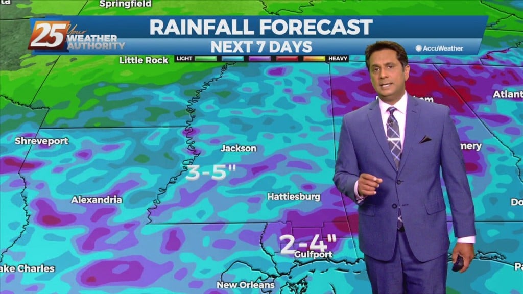
The wetter than average summer pattern is expected to continue through the period, and in fact rain chances will be even higher then recent days for much of the short term periods. A stationary front will continue to slowly move/develop…
The wetter than average summer pattern is expected to continue through the period, and in fact rain chances will be even higher then recent days for much of the short term periods. Temperatures will be held in check each day…
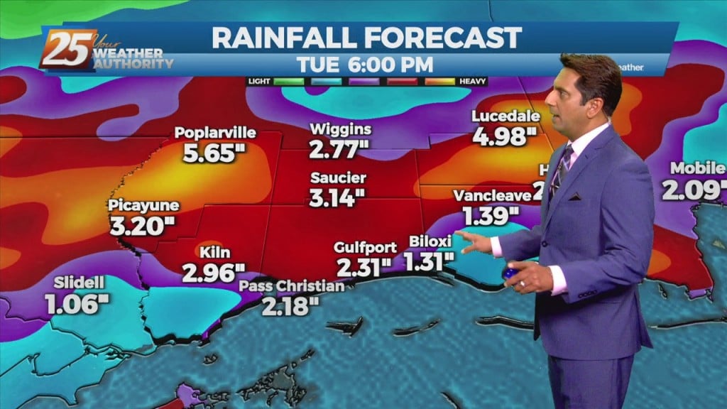
Much wetter in parts of South MS today as more widespread activity developed this afternoon. Today's t-storms lasted longer, and brought higher short-term totals that topped 4"…
This afternoon-Sunday, convection will initiate along the seabreeze/landbreeze boundary each day with thunderstorms initially forming along the weak landbreeze boundary in the offshore waters and then gradually moving inland through the day as a seabreeze boundary forms and intensifies. The…
A very normal Summer pattern is expected through Saturday night. Temperatures will be near average with highs in the upper 80s and lower 90s and lows in the 70s. Moisture values will be near normal and the convective pattern will be…
This afternoon though the weekend, south Mississippi will be in the middle of lower moisture to the east, higher moisture to the west. Convection in the onshore flow should remain isolated to scattered, with the best coverage over the western…
The Bermuda high-pressure is at the surface and aloft, extending westward across the Gulf Coast into east Texas early this morning. The eastern portions of the area may squeeze out one more relatively dry day today, as moisture flow will…