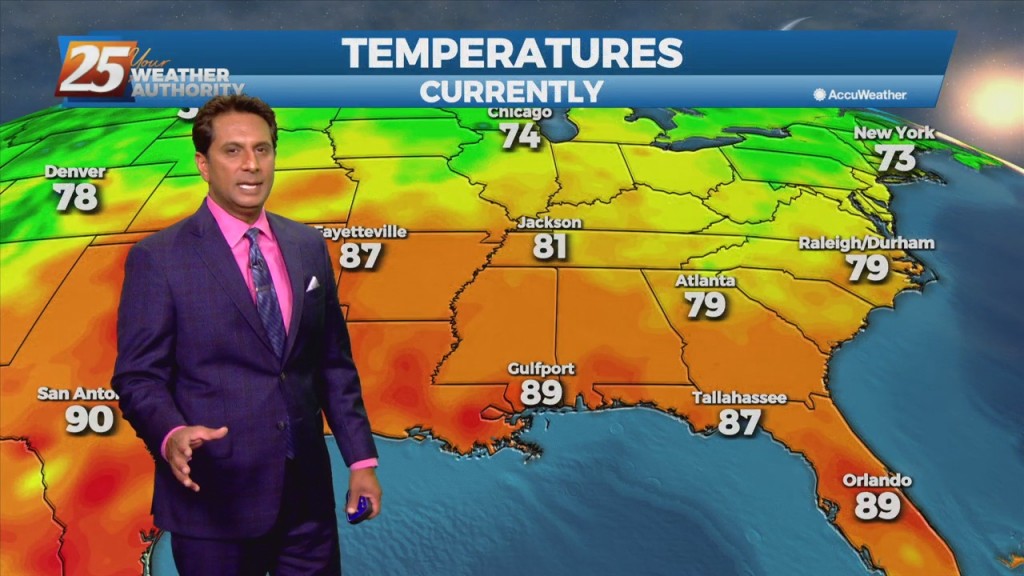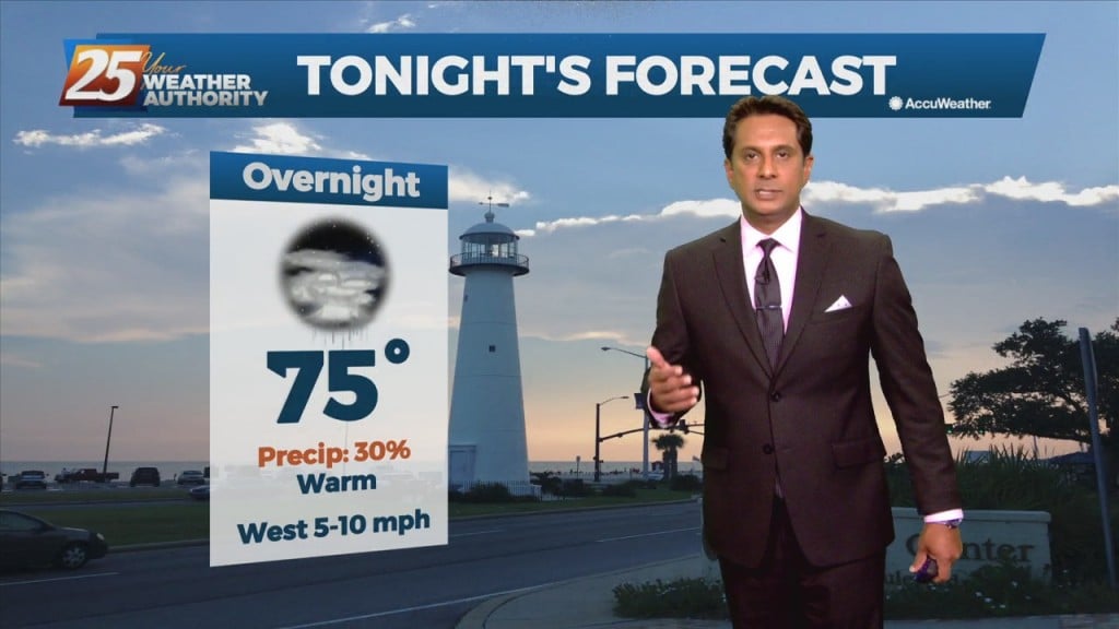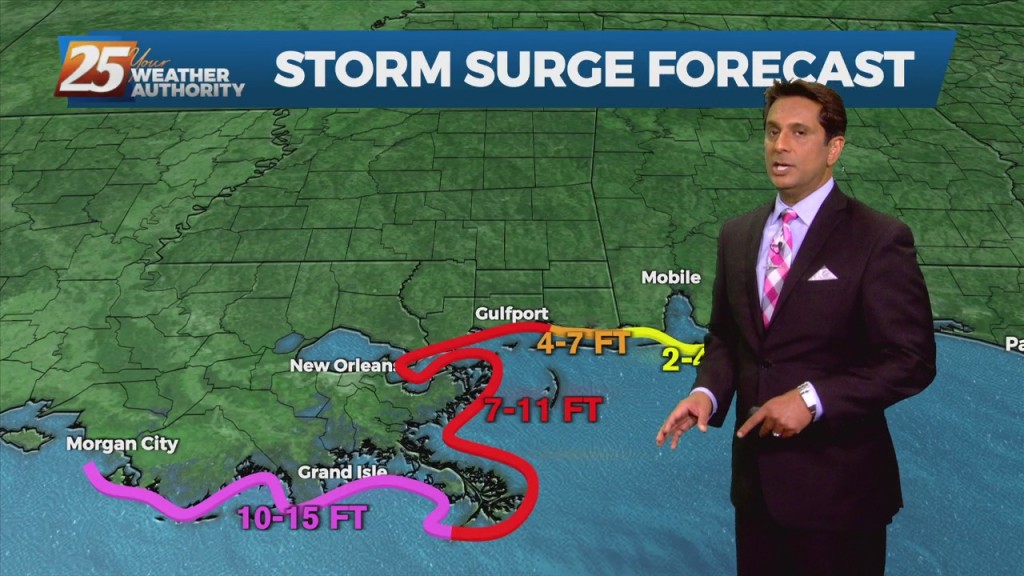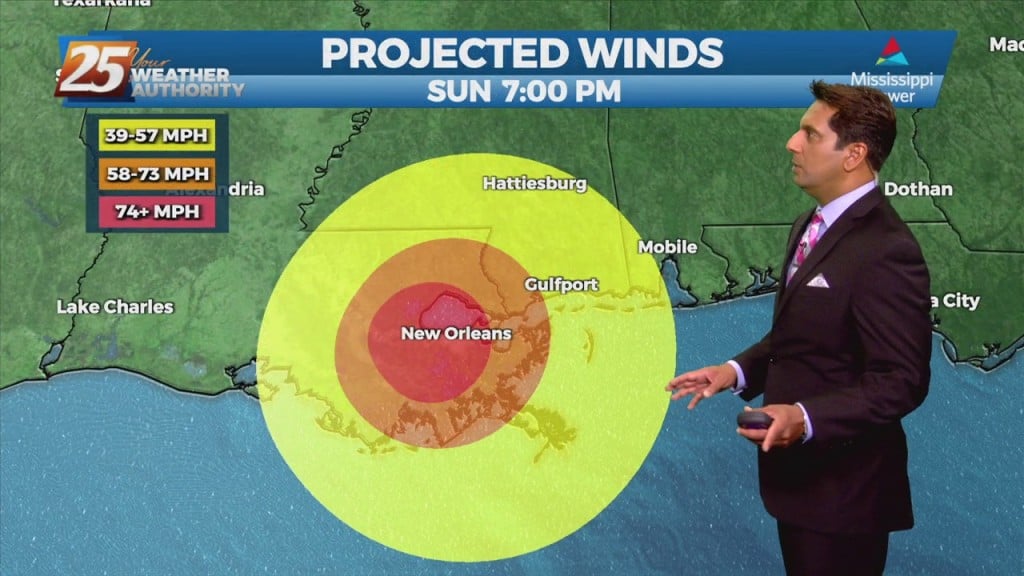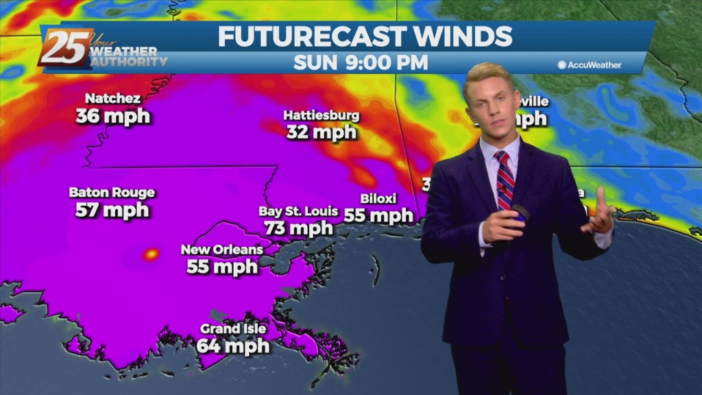
09/03 – Brantly's "Clear and Calm" Friday Evening Forecast
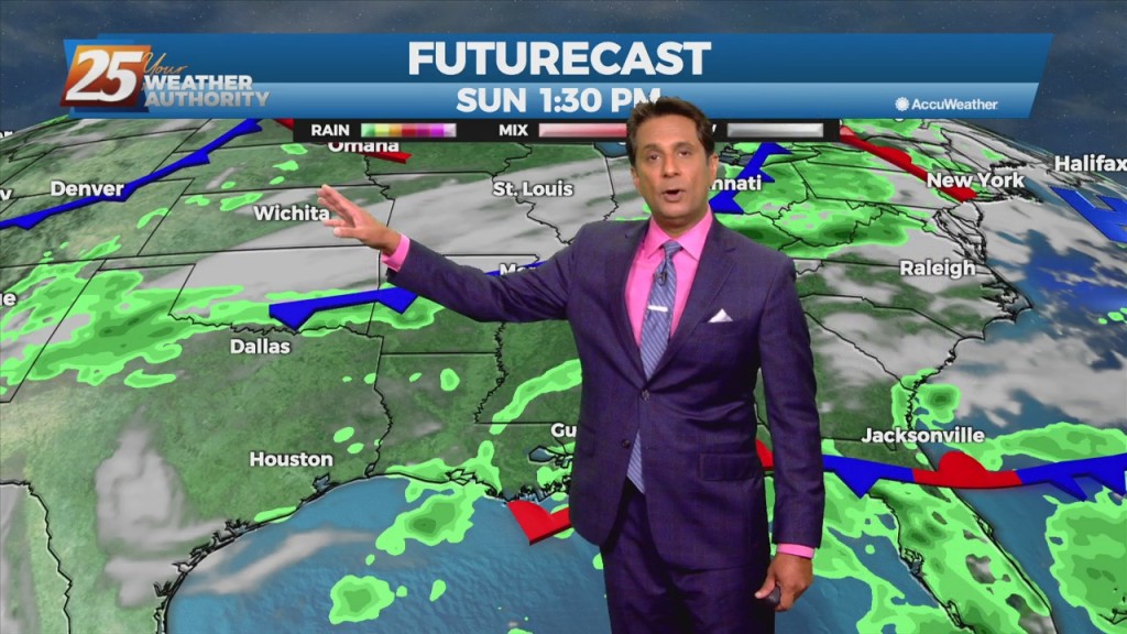
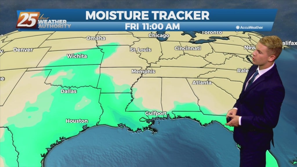
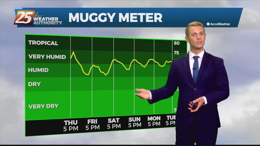
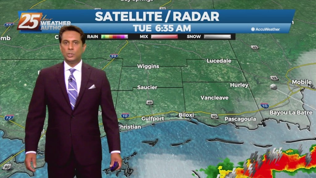
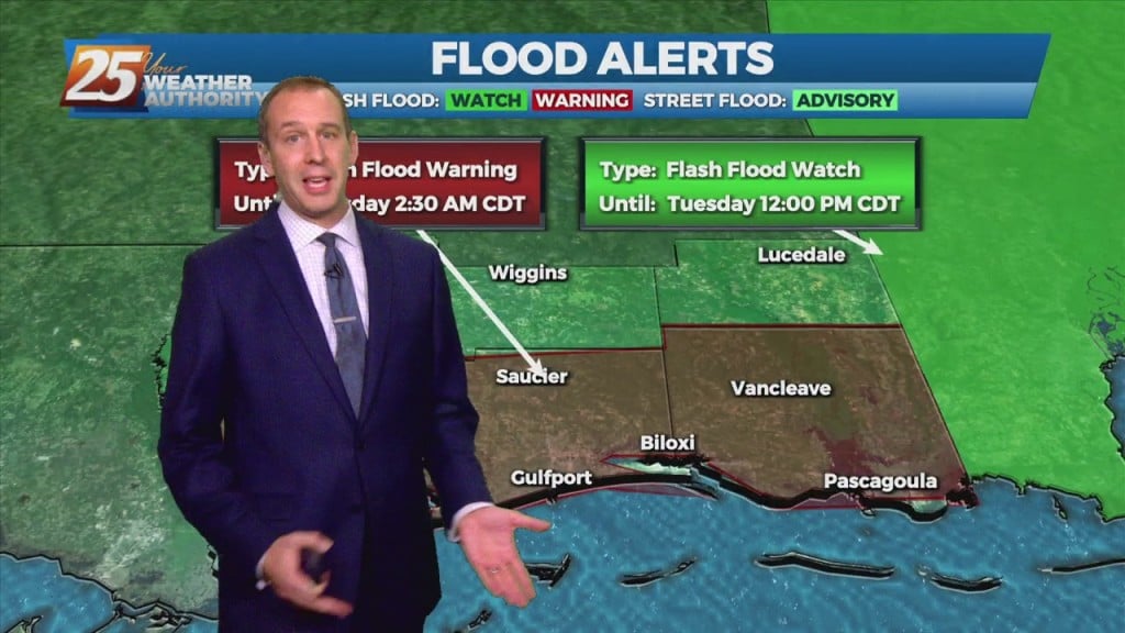
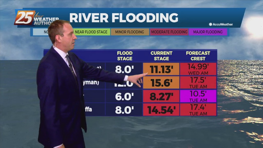
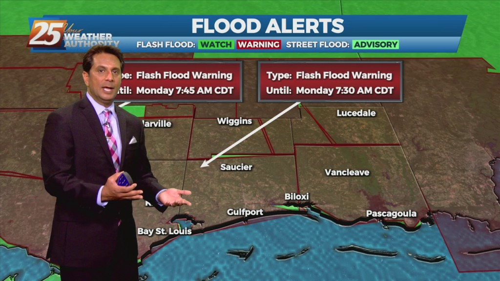
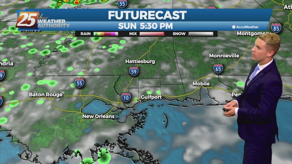
Quieter conditions continue through Sunday as high pressure remains in control over the area. The drier weather will likely come to an end by Monday and Tuesday as the upper ridge breaks down in response to a weak upper trough…