09/13 Ryan's "Grey & Muggy" Monday Evening Forecast
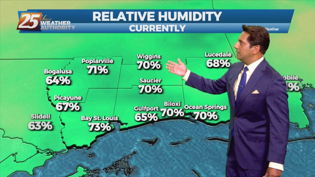
The end of last week was sunny and dry, but muggy air and grey skies have moved in. This was bound to happen eventually, but has been enhanced…
The end of last week was sunny and dry, but muggy air and grey skies have moved in. This was bound to happen eventually, but has been enhanced…
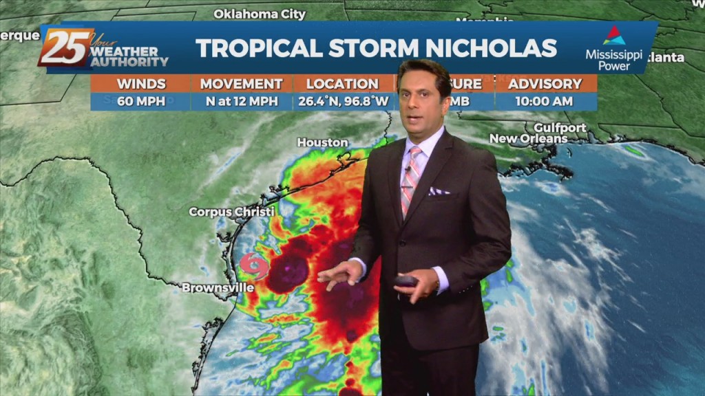
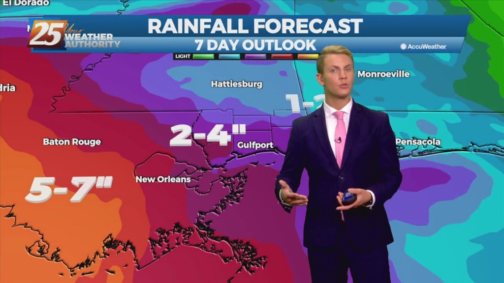
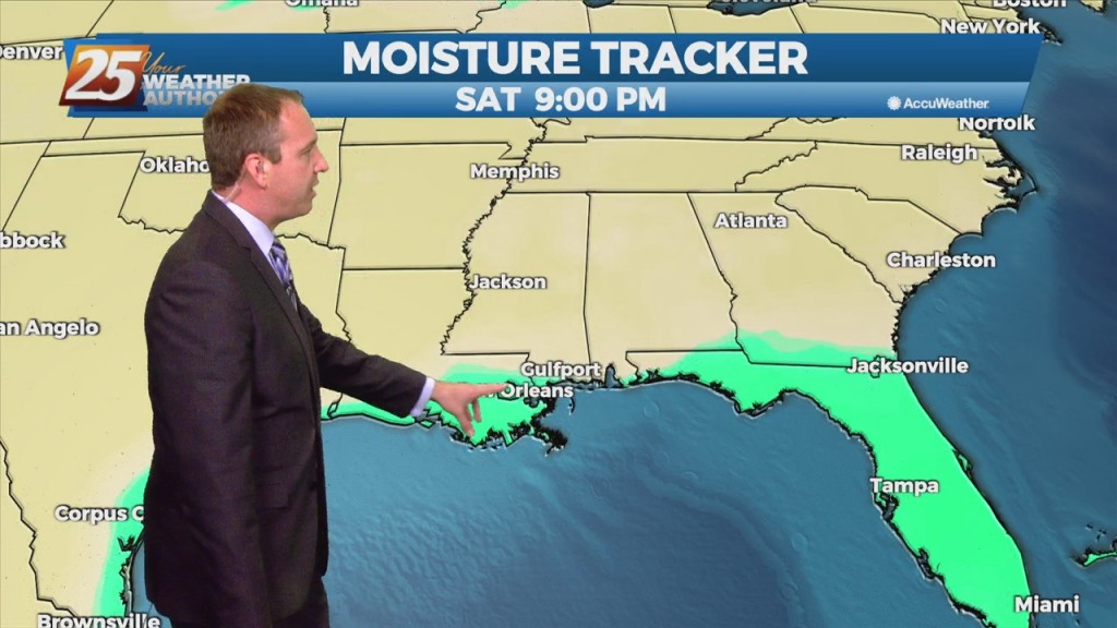
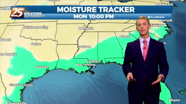
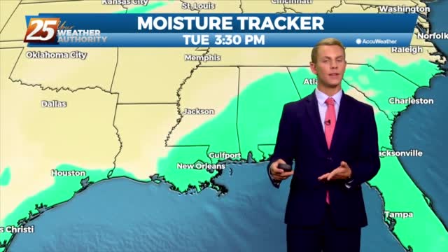
As TS Nicholas lingers in the western/NW'Tern Gulf, the moisture flow will dominate the region. Activity will be moving at a good pace for the next few days which will help keep rainfall totals for any individual storm within tolerance.…
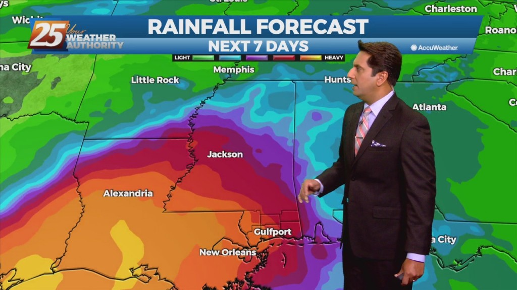
The moisture flow is back with a vengeance, which for the next several days showers/t-storms will be able to produce heavy rainfall. Activity will be moving at a good pace for the next few days which will help keep rainfall…
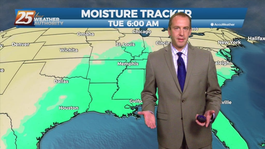
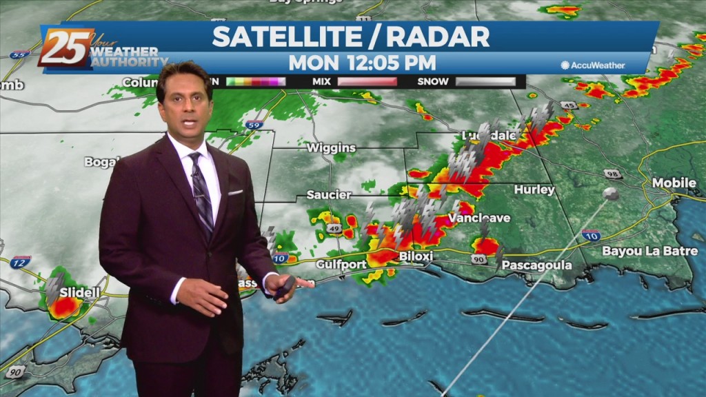
Deep tropical moisture has begun to move north through the area allowing for a return of showers and thunderstorms today. Showers and thunderstorms will continue to increase in coverage as we move into Monday. The day for the most efficient…
Deep tropical moisture has begun to move north through the area allowing for a return of showers and thunderstorms today. Showers and thunderstorms will continue to increase in coverage as we move into Monday. The day for the most efficient…
Last night and today have been a nice teaser of fall weather, but sadly it won’t last too much longer. We still have one nice fall-like night left…
Last night and today have been a nice teaser of fall weather, but sadly it won't last too much longer. We still have one nice fall-like night left…
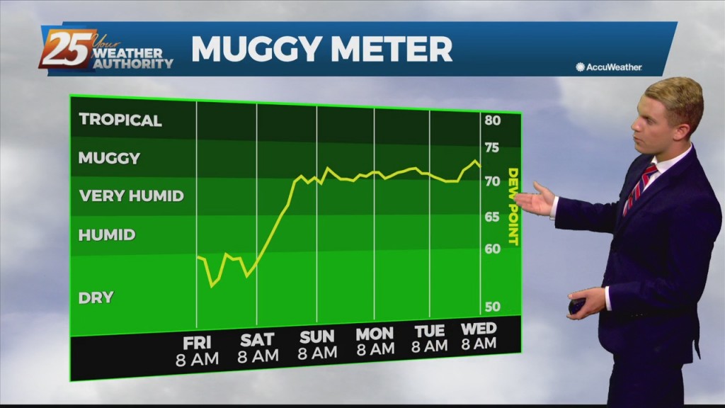
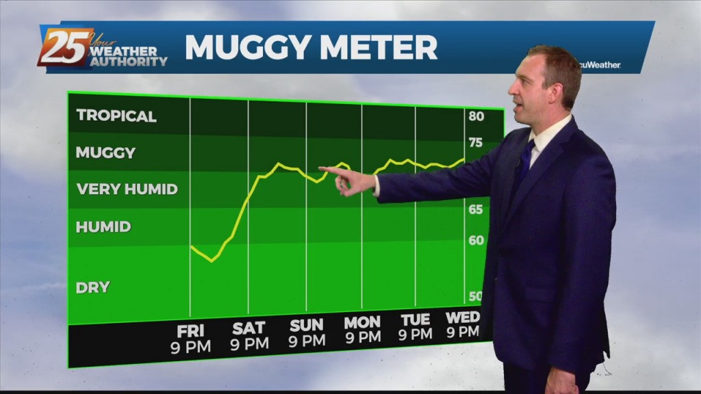
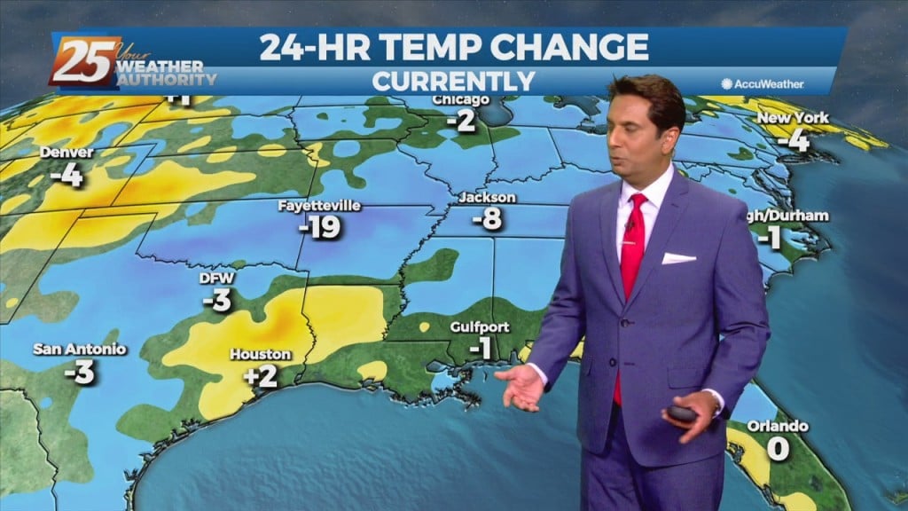
Dry air moving into the Gulf Coast behind yesterday's cold front is giving the area much needed break from the oppressive heat and humidity. These conditions will last through Saturday. Sunday will be a transition day with deep tropical moisture…
The next few days may be "fall-ish" with hot days and low humidity, but the nights will be much more "fall-like!" Expect tonight to fall into the mid 60s…

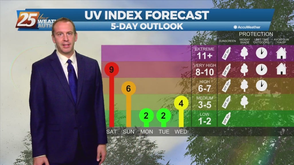
It has been a while, but some beautiful fall-ish weather is moving in! I say fall-ish, and not fall-like, because our days won't cool much, but it will be…
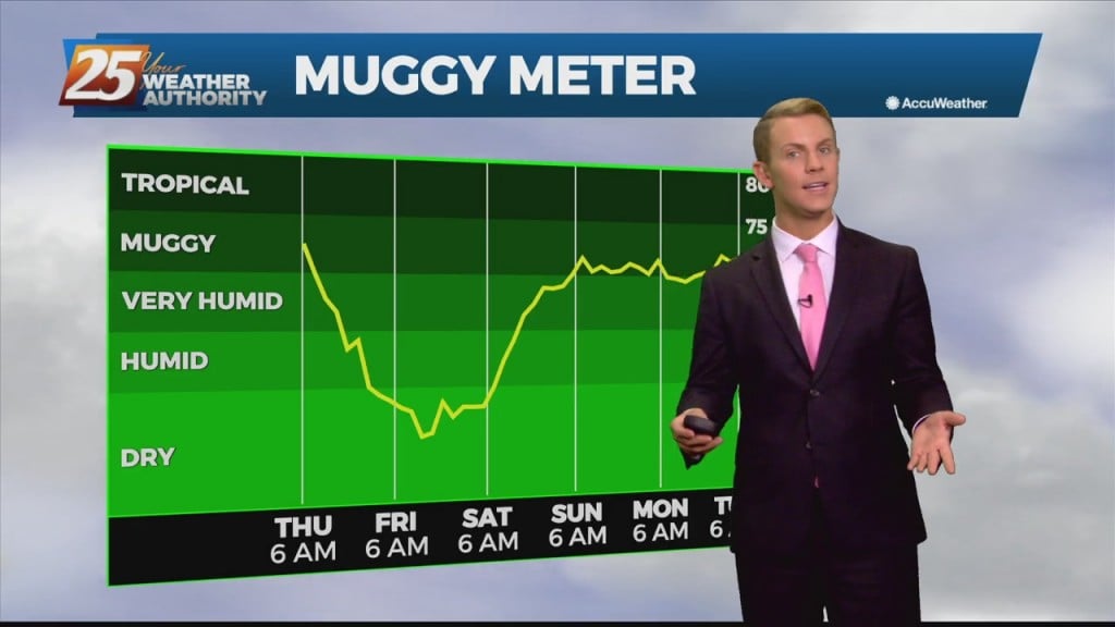
Very low humidity will at the very least be noticeable by most as the relatively dry air will make things feel a bit more comfortable. The comfortable conditions will continue through Saturday before the return flow slowly begins to work…
We will focus more on the less humid flow as a cold front slowly moves to the SE. This will at the very least be noticeable by most as the relatively dry air will make things feel a bit more…
Good news is on the way, as the cold front moves through the region during the morning on Thursday and should be south of the area by Thursday afternoon. This will turn the winds northwest to northerly during the course…
Quite the eventful day weather-wise in South MS as Mindy formed to the southeast and a front is bringing drier air and a wind shift. Locally we saw…
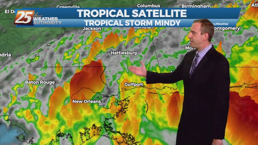
As unexpected as it was from last night's forecast, Tropical Storm Mindy formed today in the Northern Gulf. It's disorganized, and moving rapidly, but will still bring heavy…
As a tropical wave south moves towards the Florida Big Bend area, expect isolated t-storms through tonight with any heavy rain rather localized and not worthy of a large scale Flash Flood Watch. Activity will wind down this evening as…
Any significant weather impacts in the short term for most of the area should be limited to the daytime hours today. As a tropical wave south moves towards the Florida Big Bend area, expect scattered t-storms through today with any…
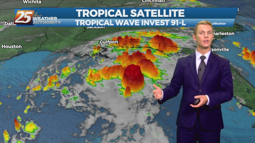
The disturbance over the central Gulf of Mexico is becoming a little better organized this morning, and more models seem to be in a little better agreement with regard to a brief, minimal development of the disturbance. This system is…

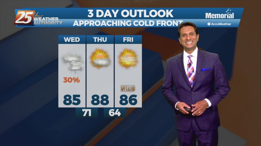
We have more rainy, damp weather ahead, but a cold front will bring drier, less humid weather for the weekend. Probably more prudent to call it a "tepid" front…
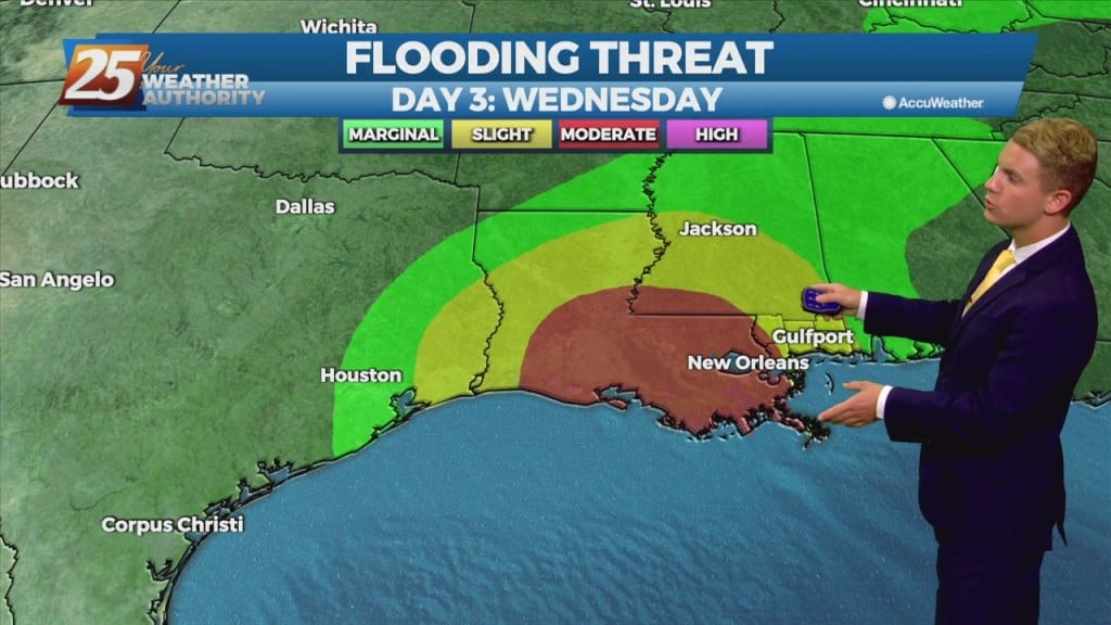
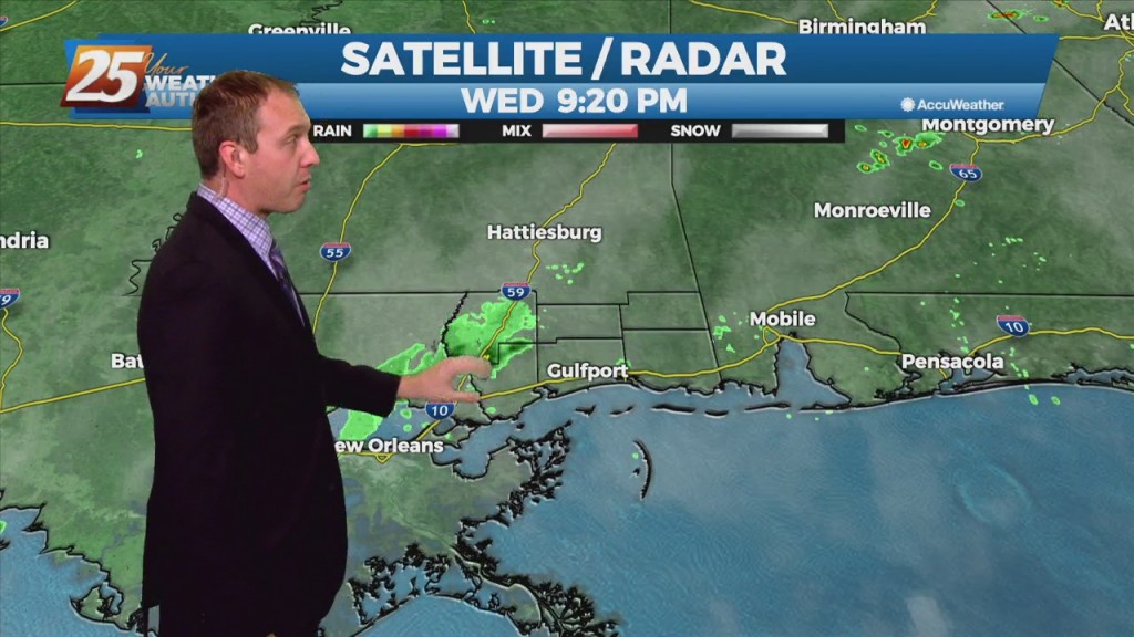
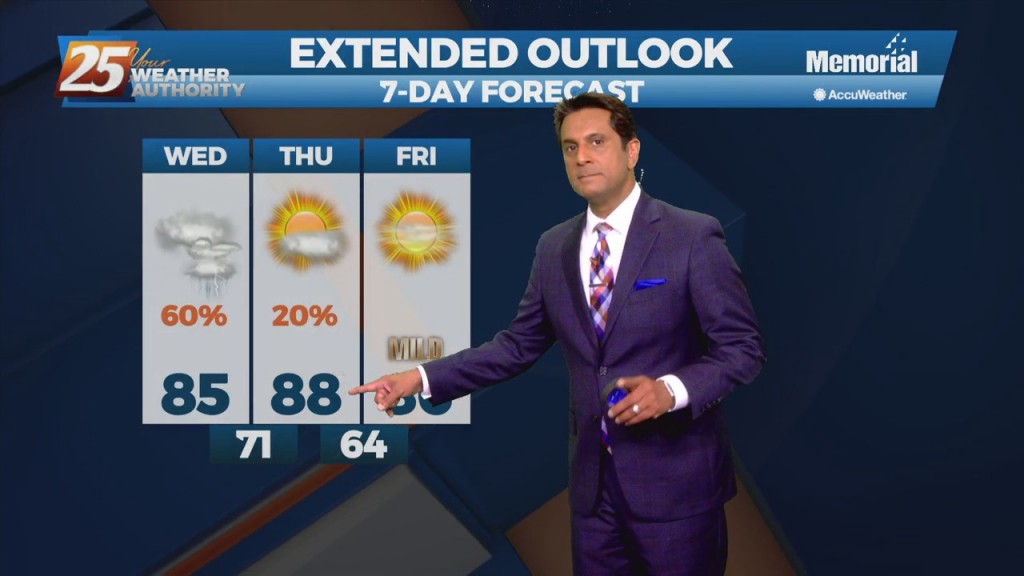
Showers and t-storms will affect the area with the potential for pockets of more heavy rainfall will exist. The Weather Prediction Center continues to outlook most of the forecast area with a Marginal risk of excessive rainfall this afternoon. An…

A frontal boundary will remain nearly stationary across the forecast area, while gradually dissipating. Showers and t-storms will affect the area with the potential for pockets of more heavy rainfall will exist. The Weather Prediction Center continues to outlook most…
An upper level trough will otherwise continue to dig southwestward and extend across Louisiana into central Mississippi tonight, and then become oriented from near the TX/LA coast through southeast MS during the day Tuesday. The surface front will meanwhile continue…
An upper level trough will otherwise continue to dig southwestward and extend across Louisiana into central Mississippi tonight, and then become oriented from near the TX/LA coast through southeast MS during the day Tuesday. The surface front will meanwhile…
A cold front will drop southeast into the forecast area, providing showers/T-Storms along the front to impact the area into tonight. Deep tropical moisture should be in place with the possibility for isolated pockets of heavy rainfall through mid-week. There…