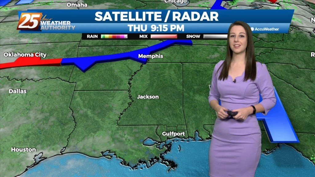
10/7 - The Chief's "More Humid Flow" Friday Morning Forecast
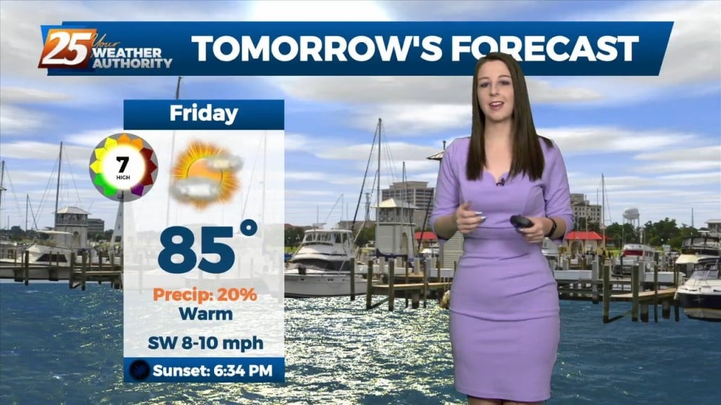
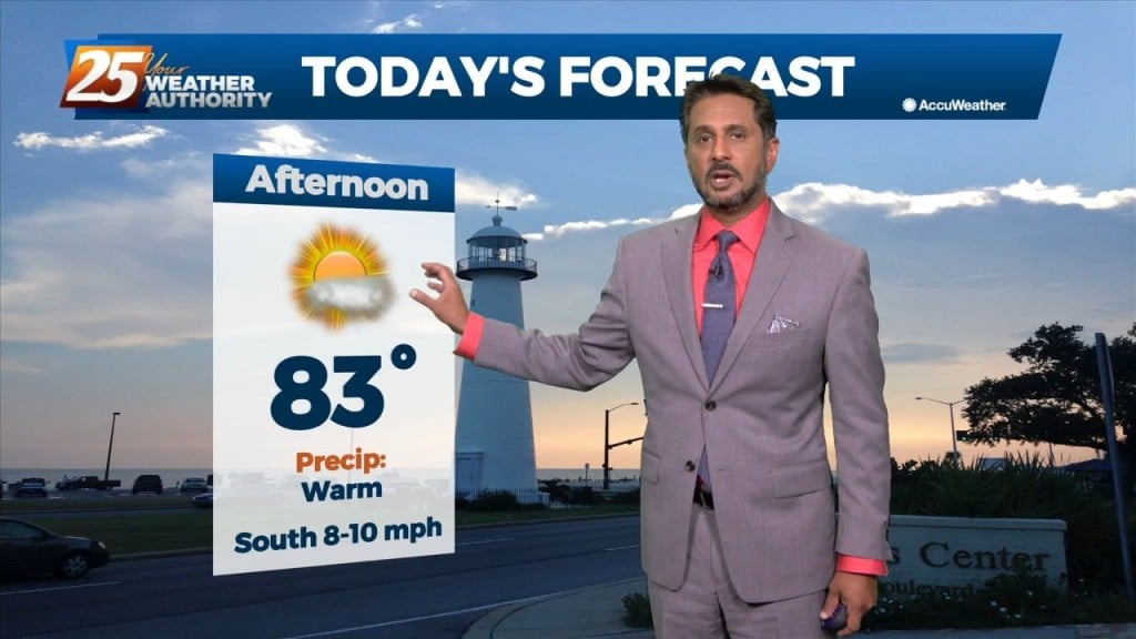
Temperatures will warm into the mid-80s across the viewing area ahead of a cold front. Winds will be out of the south, shifting to southwest around…
Temperatures will warm into the mid-80s across the viewing area ahead of a cold front. Winds will be out of the south, shifting to southwest around…
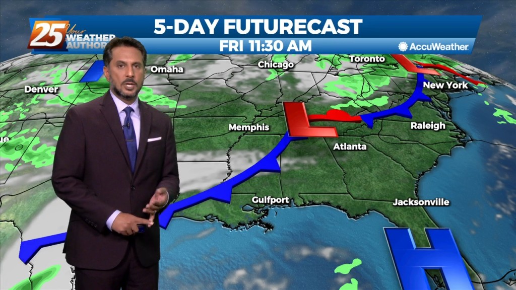
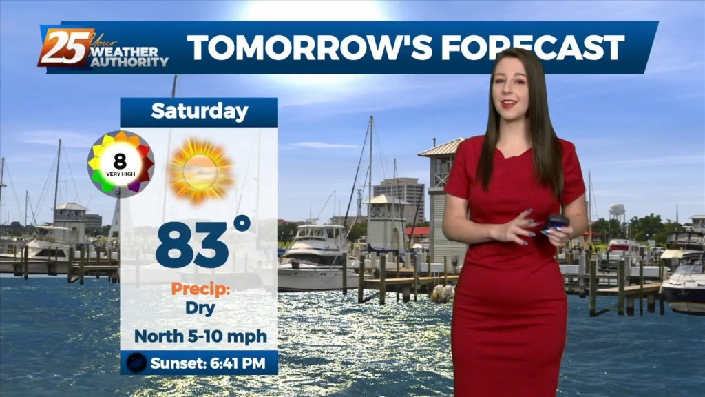
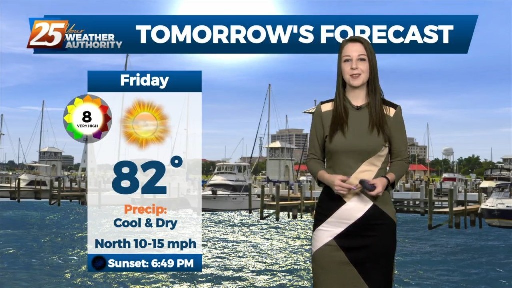
Friday temperatures will be above average thanks to some brief southerly winds ahead of a dry boundary this weekend. General model consensus shows high temperatures approaching 90 degrees.…
A mild weather pattern has been across the area today and for the remainder of the workweek. The area of high pressure is in place to…
The mild weather pattern continues across the area today and for the remainder of the workweek. The area of high pressure has moved to the…
After mixed clouds yesterday, we have had just a few upper-level clouds today. High pressure has the biggest influence on our weather pattern overnight tonight…
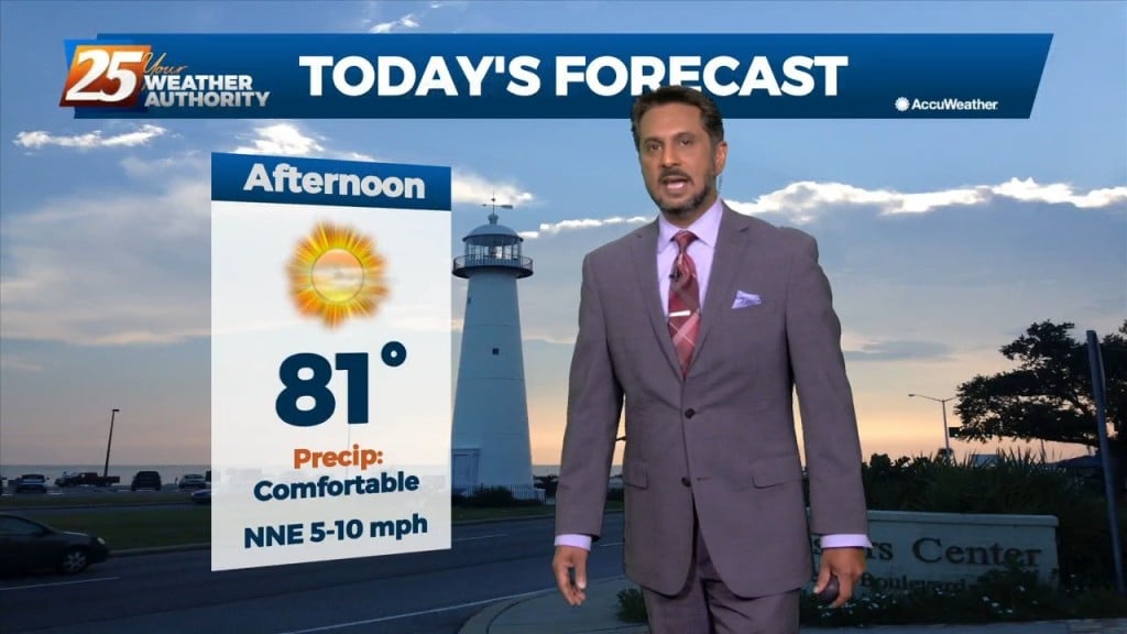
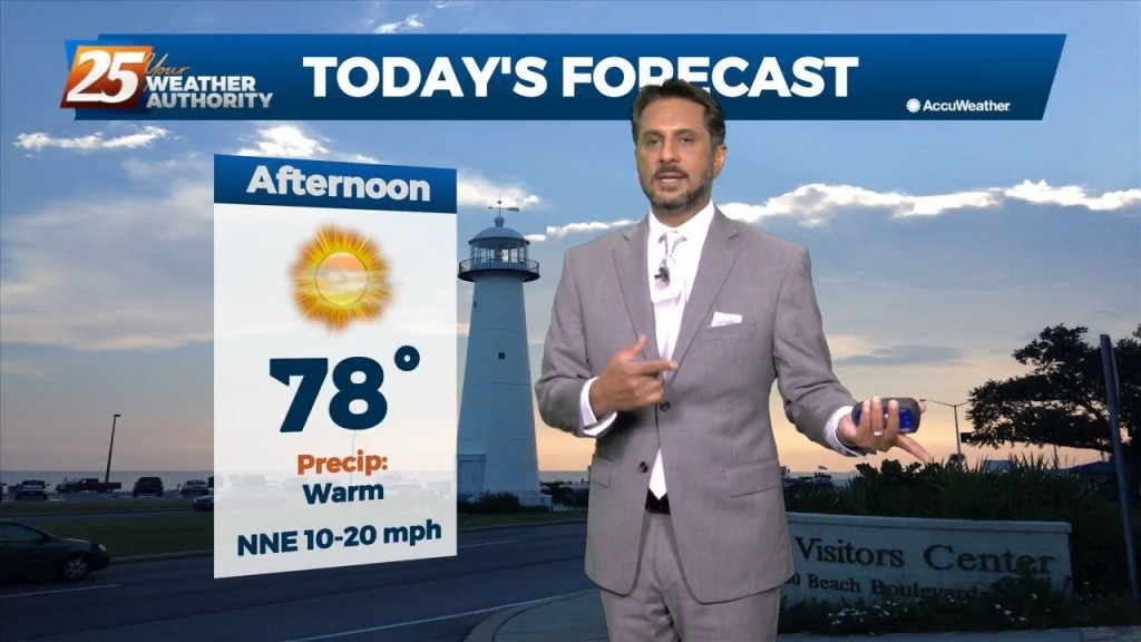
This afternoon will bring sunny skies with a few upper-level clouds as high pressure to the northeast continues to shape the forecast. Clear and mild conditions overnight…
After mixed clouds yesterday, we are only left with some upper-level cloud coverage. The small disturbance has pushed west and now with less moisture in the mid-and-upper levels,…
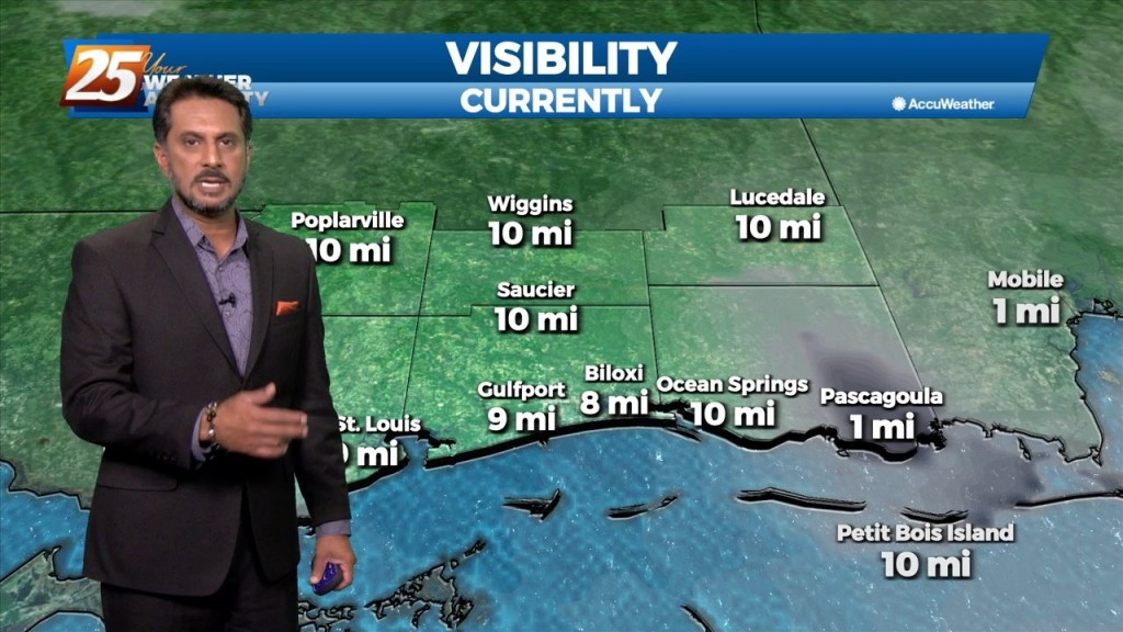
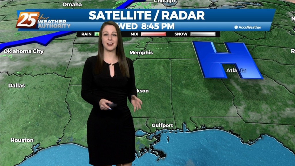
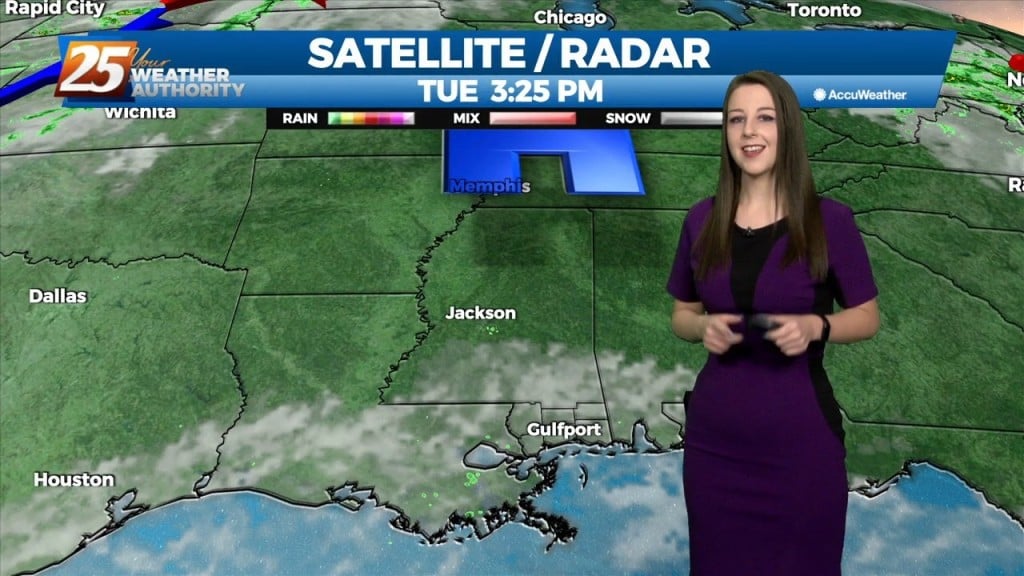
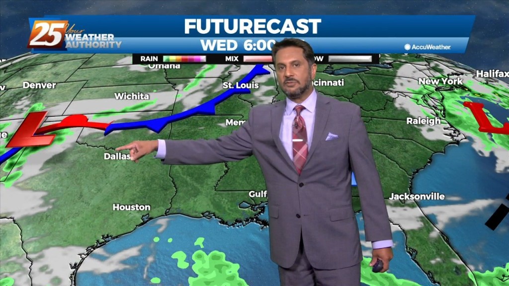
If you are looking for rain, try again. For just under 3 months there was rain just about everyday and now we may not see any appreciable…
A weak disturbance from earlier this afternoon has push through the area but the upper level clouds will continue overnight. Upper clouds coupled with increased moisture…
A weak disturbance along the North/Central Gulf will continue to push upper level clouds across the area...at times putting south Mississippi under partly/mostly cloudy skies. the upper…
High pressure continues to dominate our weather pattern across the area. A weak disturbance will move across the area this morning into this afternoon. With…
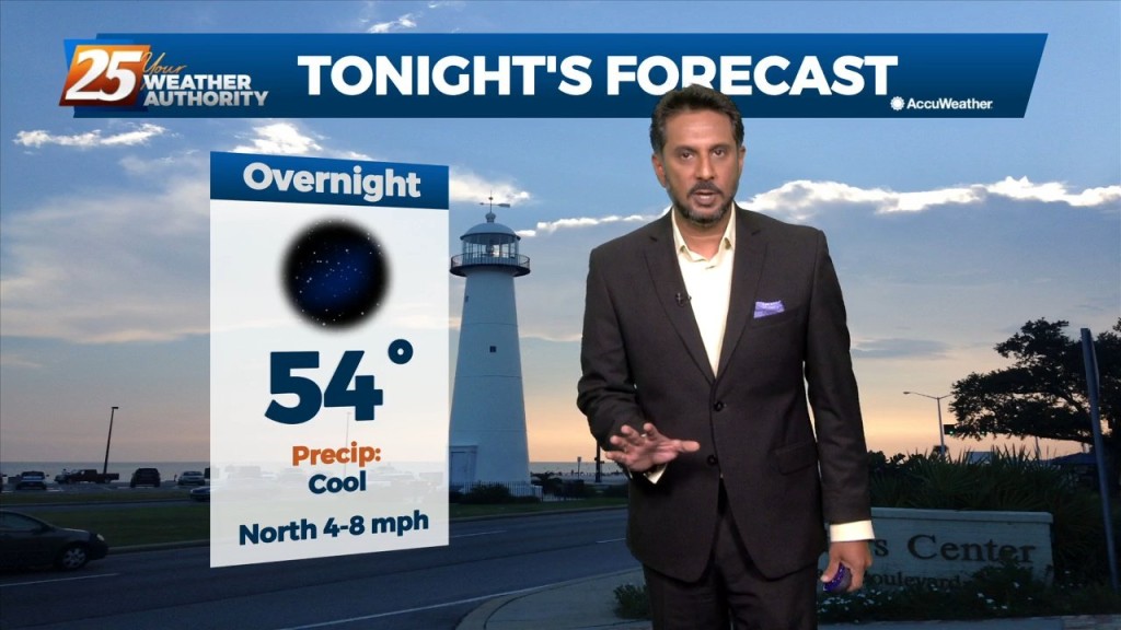
Temperatures should continue to cool off well at night with mostly clear to partly cloudy skies and low dewpoints allowing decent radiational cooling. Should be near normal across northern…
In summary, nice weather persists through the short term. Not much change in the short term forecast. Dry air mass will remain in place with high pressure centered to…
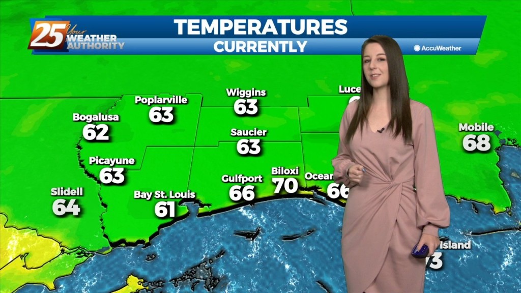
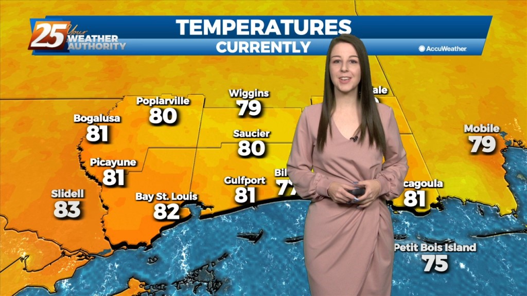
After a cool start, temperatures have warmed into the upper 70s/low-80s. A quiet weather pattern will continue through the workweek prior to the next frontal boundary…
As an area of high pressure sneaks into the area on the backside of distant low pressure, a warmer pattern takes hold. It’s only a small adjustment…
As high pressure sneaks into the area on the backside of a cut off low over the northeast, heights rise slightly which means slightly warmer temps…
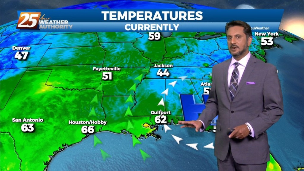
From a meteorology standpoint, we are still between a trough to the east and a ridge to the west. This is bringing winds out of the north carrying cool…
Dry fall like weather conditions will continue for the area today and tomorrow (and through the whole forecast period really). A few areas such as near…
We could not ask for more pleasant weather heading into the 1st weekend of October. It has been breezy and dry with the minimum relative humidity dropping from…
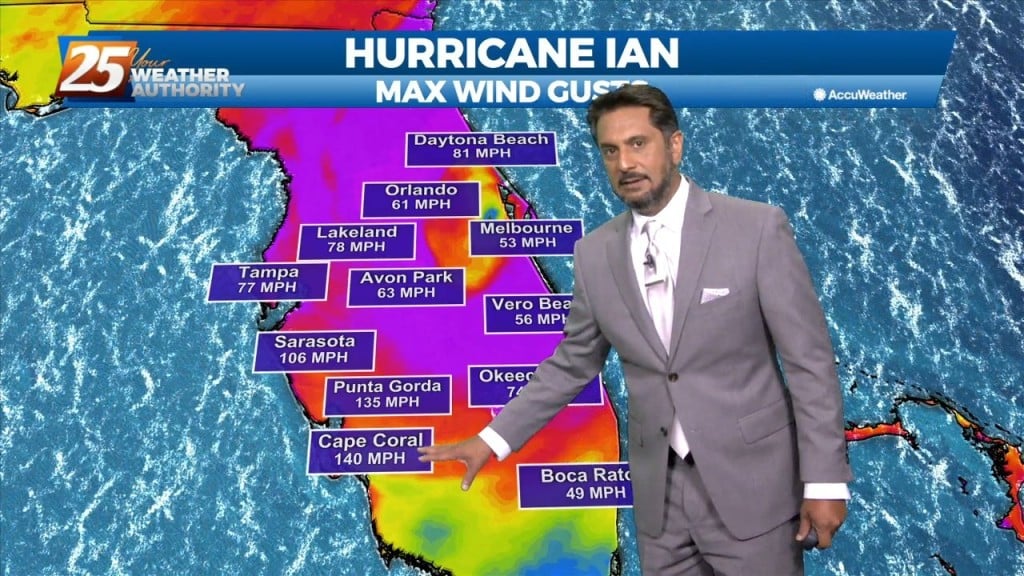
As Ian continue to affect the region with a combined flow from the NNE, the drier air will shape the forecast through the weekend. Low relative…
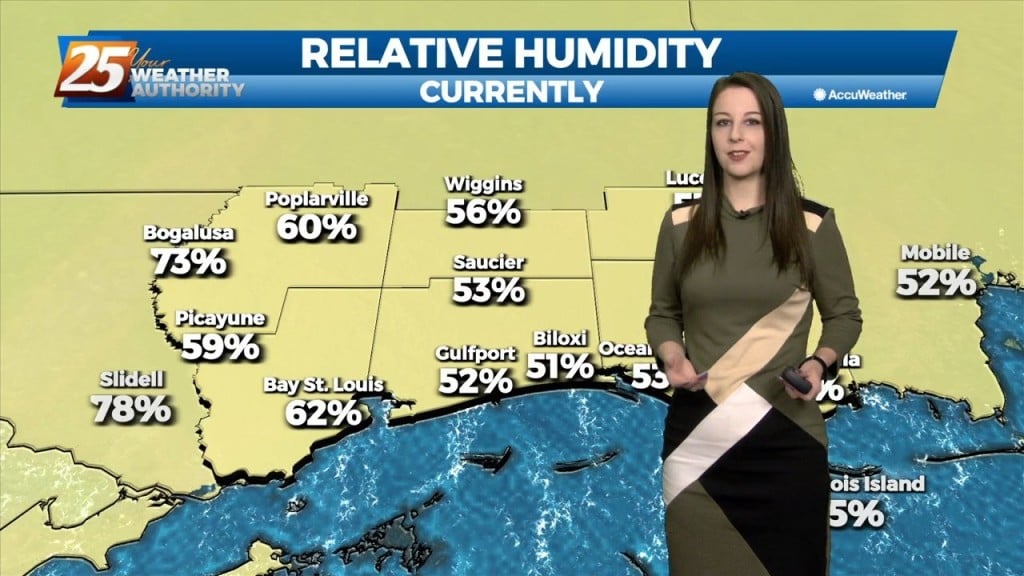
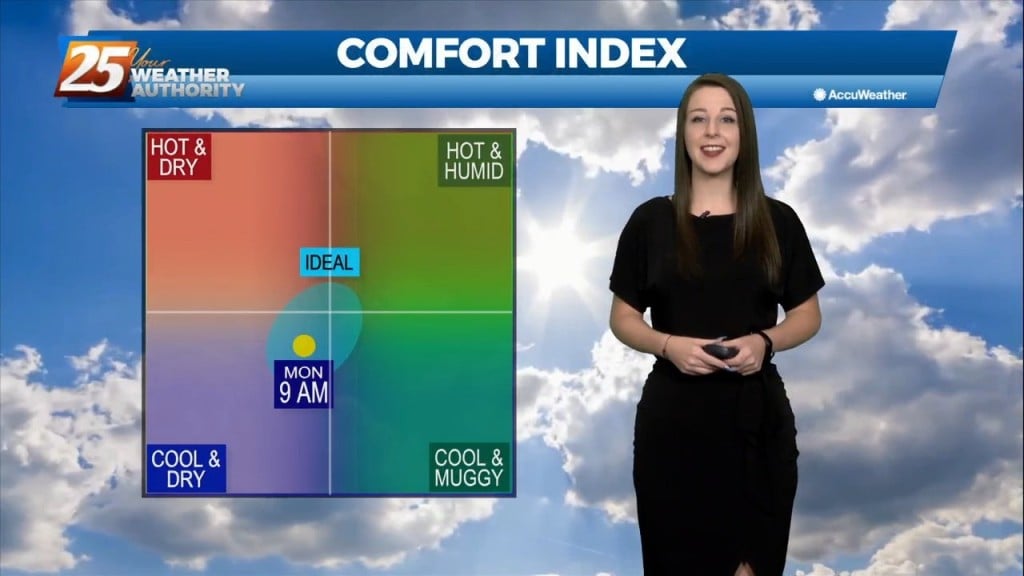
The pleasant, calm, and chilly conditions continue this evening. It has been breezy and dry with the min RH dropping from near 40% to as low as 25%. Lowest…
We could not ask for more pleasant weather right now. Honest to goodness Fall like weather out there and it should continue through the weekend and into…
Fall is in the air! No rainfall is expected for the next few days. We are still experiencing some impacts across the area from pressure gradient…
Fall is in the air! No rainfall is expected for the next few days. We are still experiencing some impacts across the area from pressure…