Wxxv25 “Today”

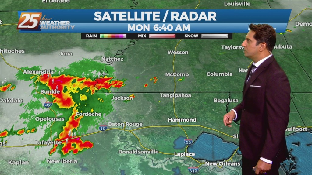
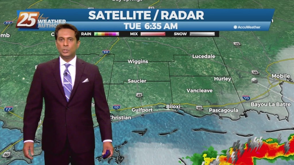
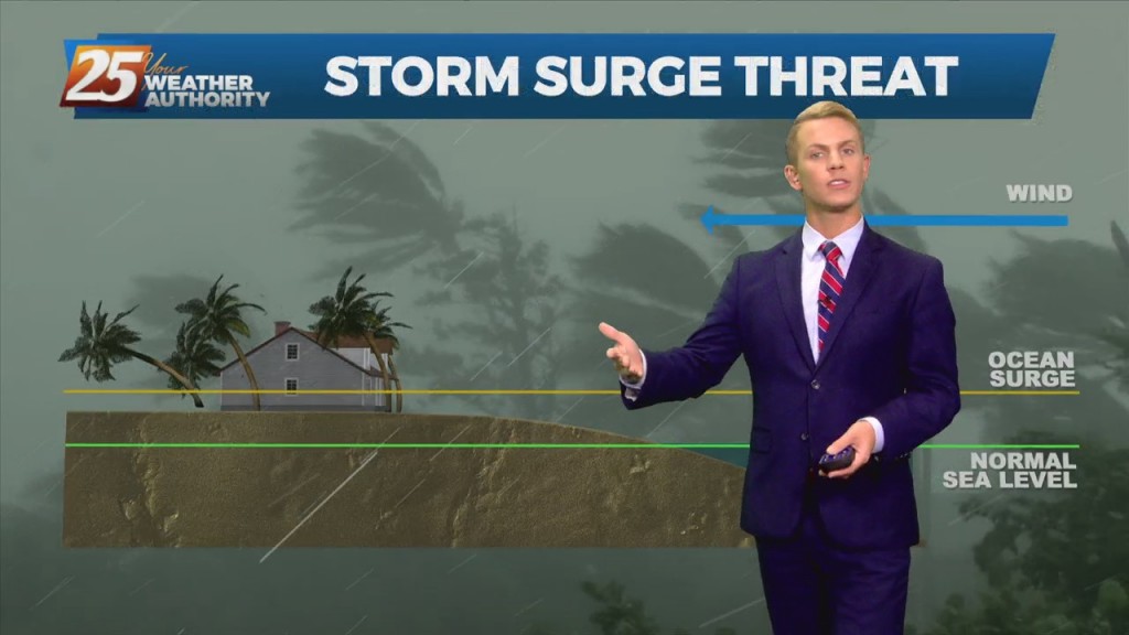
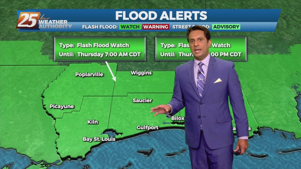
9/14 - Rob Knight's "Soggy" Tuesday Afternoon Forecast

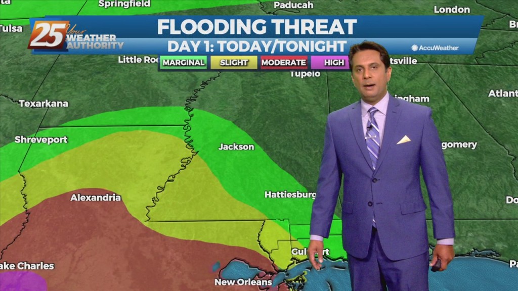
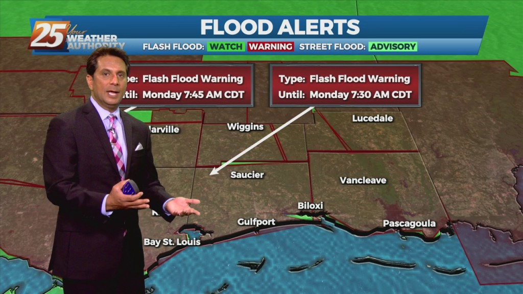
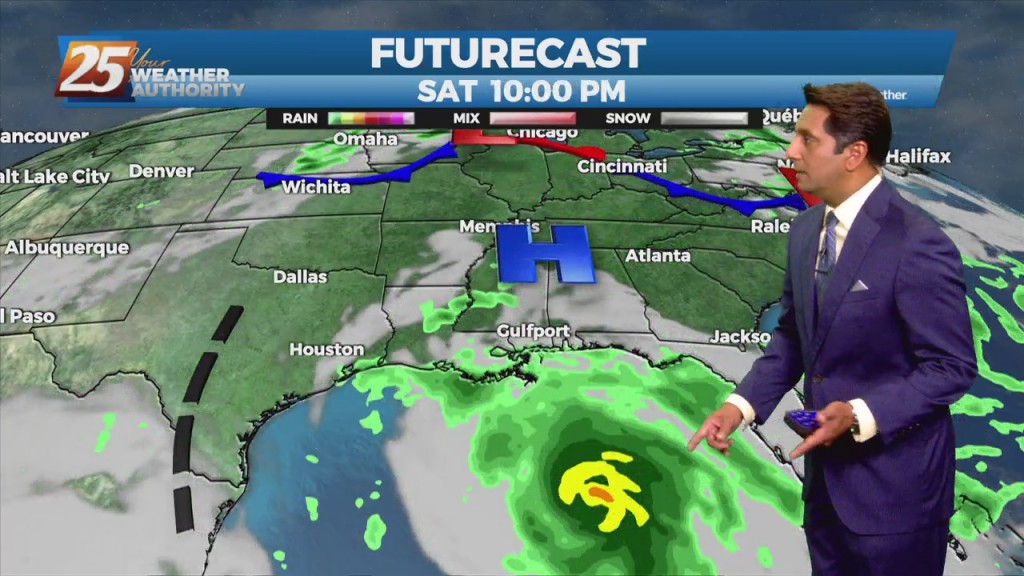
The moisture fetch over the gulf will increase along with wind speeds to around 15-25 kt and remain there for about 24 hours maybe a bit longer. This will be enough to bring up a Coastal Flood advisory for values…

9/7 - Rob's "Gray & Gloomy" Morning Forecast

A frontal boundary will remain nearly stationary across the forecast area, while gradually dissipating. Showers and t-storms will affect the area with the potential for pockets of more heavy rainfall will exist. The Weather Prediction Center continues to outlook most…

9/6 - Rob Knight's "Labor Day" Morning Forecast

The upper level high-pressure centered along the northern Gulf Coast will continue to move south and weaken. An upper level trough digging across the Mississippi Valley and an associated surface cold front will drop southeast into the forecast area. Showers/T-Storms along…

9/3 - Rob Knight's "Post-Frontal Passage" Friday Morning Forecast

In the wake of yesterday's cold frontal passage, a less humid flow will dominate heading into the weekend. The aforementioned frontal boundary will likely stall near the coast today through Saturday, with any diurnal afternoon convection being immediately along the…

9/1 - Rob's "September Outlook" Morning Forecast

A surface low associated with Tropical Depression Ida will continue to move NE, dragging a weak cold front into south Mississippi Thursday morning. Northwesterly flow aloft will develop across the area today between the upper level High pressure over Texas…

8/31 - Rob's "Tropical Moisture" Tuesday Morning Forecast

Trailing feeder bands in the wake of now remnant Ida will continue to drag across the area thorough today. These bands will slowly press southeastward into the Gulf through the morning and late afternoon. Despite southeastward movement of the band,…

8/30 - Rob Knight's "Monday Morning/Ida Update" Forecast

With IDA to the NNW moving towards north central Mississippi, expect gradual improvement through today. Widespread rain across the area will continue and gradually decrease to scattered showers later today as Ida tracks slowly to the north. After the center…

8/29 - Brantly's Sunday 4 PM "Hurricane Ida" Update

The NWS Doppler radar imagery and data from an Air Force Reserve Hurricane Hunter aircraft showed that Ida made landfall around 1655 UTC along the southeastern coast of Louisiana near Port Fourchon with estimated maximum winds of 130 kt and…

8/29 - Brantly's Mid-Afternoon Hurricane Ida Update

Hurricane Ida continues to move through SE Louisiana, moving towards the NW. South Mississippi will continue to see coastal flooding, gusting winds and the threat for tornadic activity as feeder bands move through the area. Winds will get worse late…

8/29 - Rob Knight's Sunday Morning 10 AM Hurricane Ida Update

​Ida's rapid strengthening appears to have leveled off within the past hour or so.  NOAA and Air Force Reserve Hurricane Hunter aircraft that have been in the storm this morning have reported peak flight-level winds of 146 to 148 kt between…

8/23 - Rob's "Hottest Summer Temps" Monday Morning Forecast

High-pressure slightly stronger than yesterday, is still centered along to just west of the TX/LA border and remains the biggest influence on the local weather. Its close proximity to the area means low rain potential and HOT TEMPERATURES. From a…

8/20 - Rob Knight's "VERY HOT" Friday Morning Forecast

Today and Saturday, a robust high pressure system is expected to build over the region. Southerly to southeasterly surface winds will help to enhance warm air advection and moisture advection into the area. Isolated to scattered showers will be possible…

8/18 - Rob's "Hot & Humid" Wednesday Morning Forecast

Today and Thursday, the normal summertime pattern will dominate the area. Southerly surface winds will help to advect warm air and moisture into the area, which will ultimately help with lifting in the environment. As a result, the rainfall will…