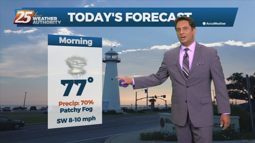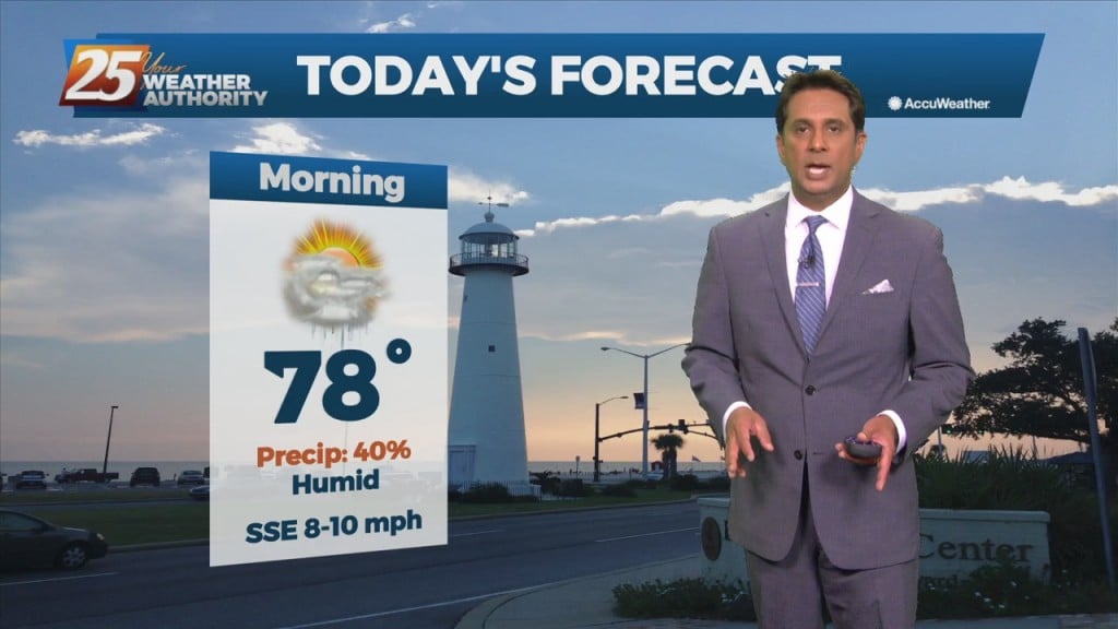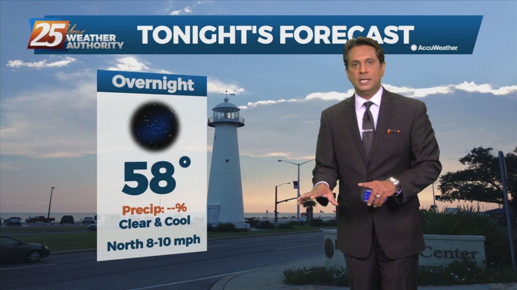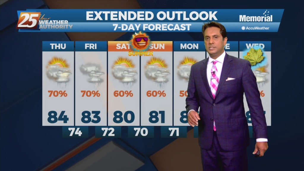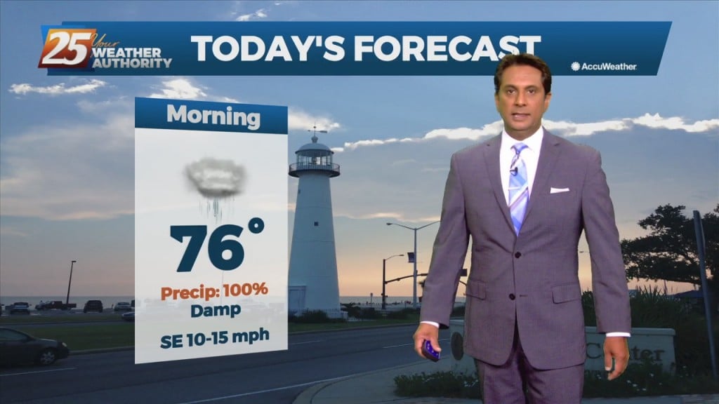
10/15 - Rob Knight's "Approaching Cold Front" Morning Forecast
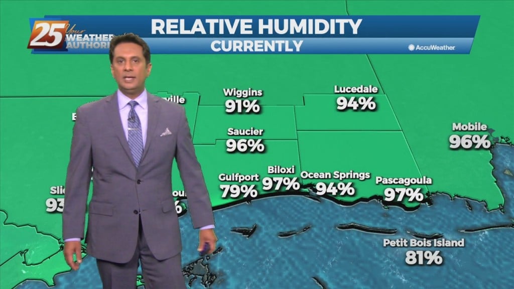
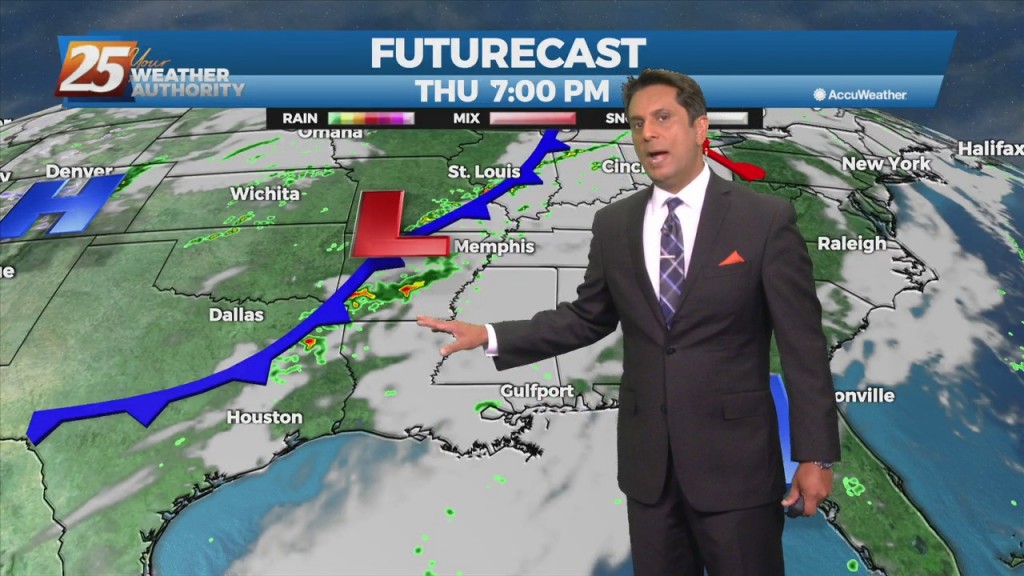
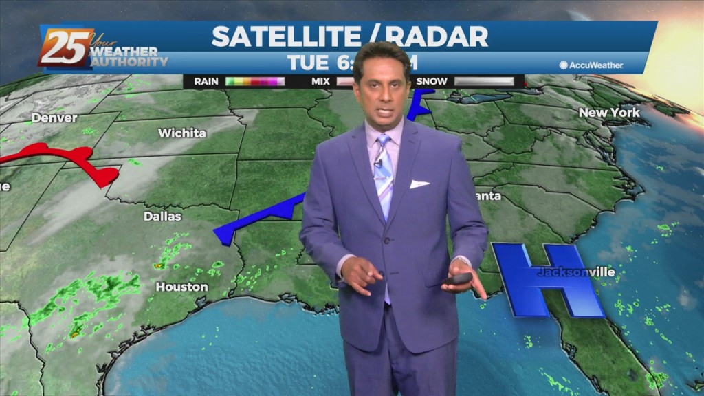
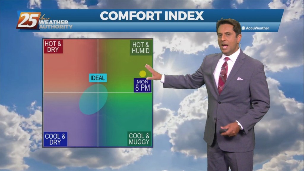
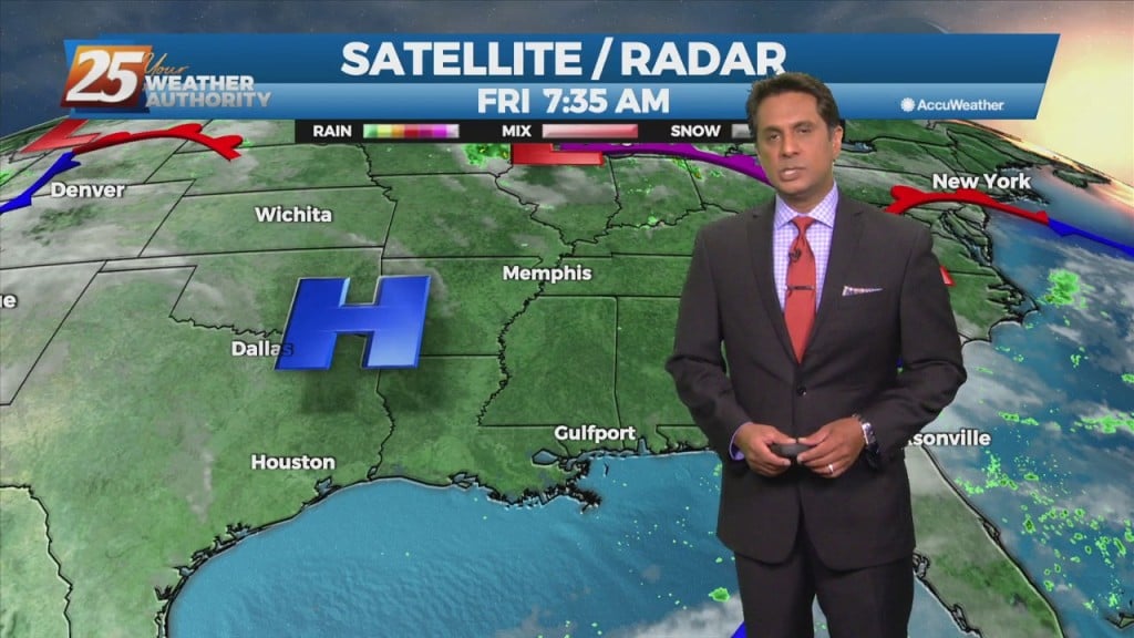
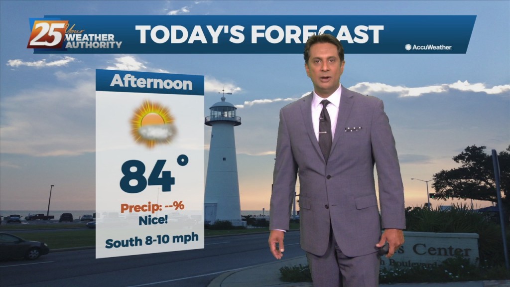
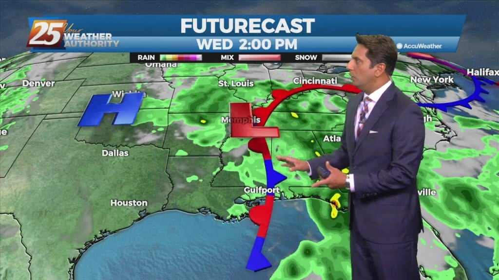
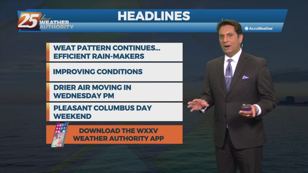
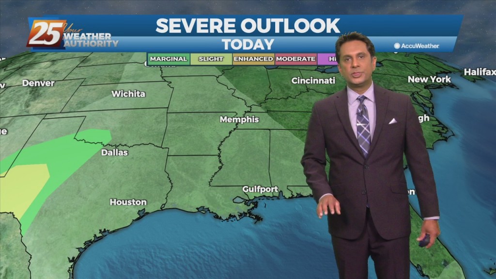
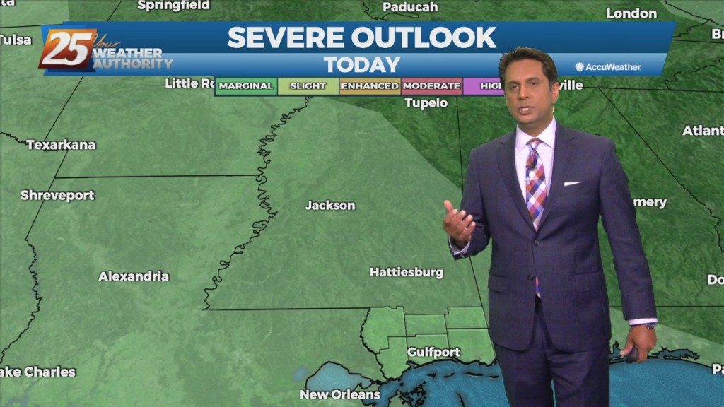
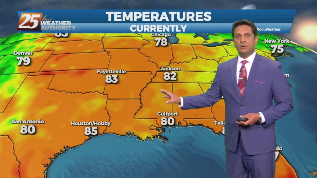
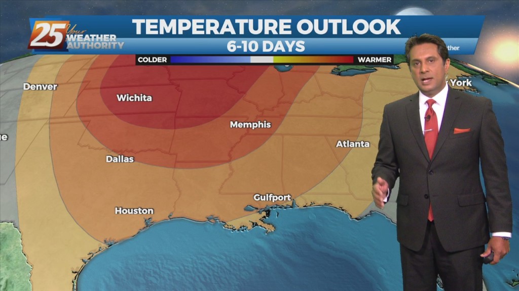
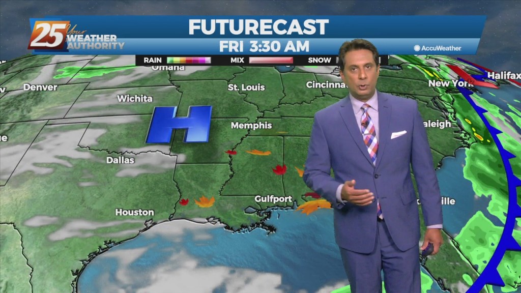
Warm & humid will continue today as an area of low-pressure along a cold front near Wichita Falls will race northeastward toward Lake Ontario by midnight tonight. The associated cold front is expected to reach northwest Louisiana by mid to late…