9/27 – Rob Knight’s 1st Full Week of Autumn Forecast
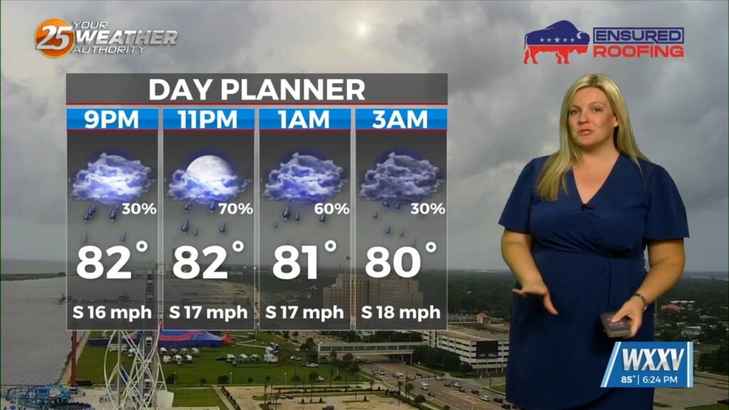
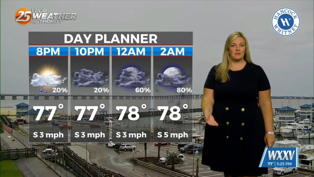
The first half of this week will be the end of clear skies and no rain as high-pressure develops and extends along the Mississippi River Valley from the Gulf of Mexico to Canada. Moisture recovery will take some time but should start to see a west to east progression of showers developing today. Portions of the forecast area east of I-55 shouldn’t see any showers and even those west of there should only experience 20-40% coverage.
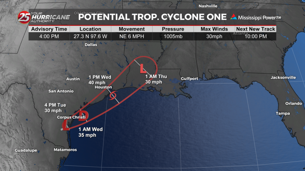
By Tuesday however, a stronger surge of moisture will east into MS. That amount of column moisture with strong daytime heating will result in scattered to numerous showers and thunderstorms. Wednesday will pretty much be a repeat of Tuesday over the area as a minor disturbance races northeast through Texas. Rain chances will decrease Thursday into Friday with only a low end possibility for a few after showers/t-storms this weekend.