12/29 - Rob Knight's "Foggy & Rainy" Morning Forecast
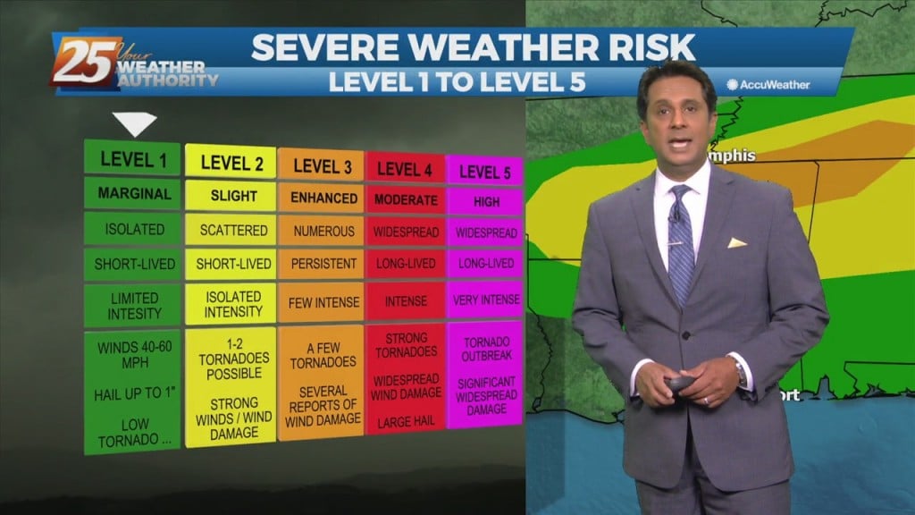
The high pressure remains just east of Florida and we'll see another impulse moving around the ridge. In the words of SPC, the chance for severe weather…
The high pressure remains just east of Florida and we'll see another impulse moving around the ridge. In the words of SPC, the chance for severe weather…
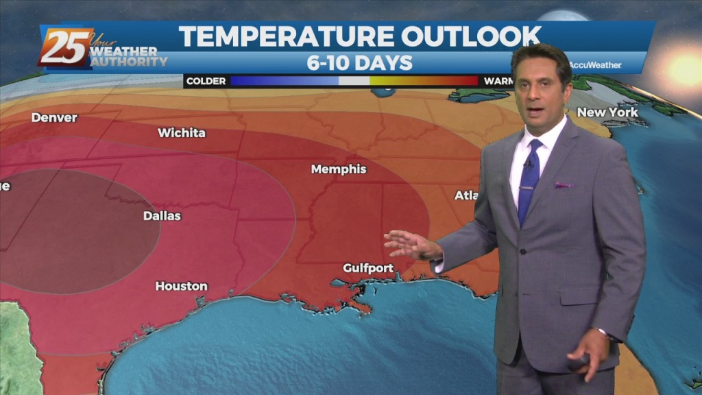
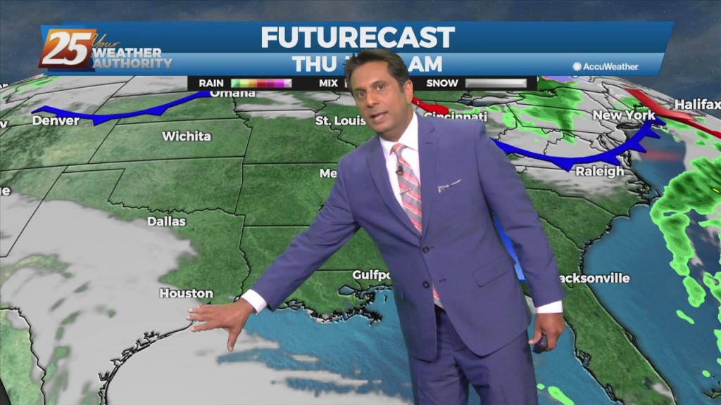
Unseasonably warm weather will continue for the remainder of the workweek. There will be several rounds of potential showers and thunderstorms, with a non-zero threat of…
The first 24 hours or so of the forecast will be more of the same that we've seen over the weekend with partly to mostly cloudy skies…
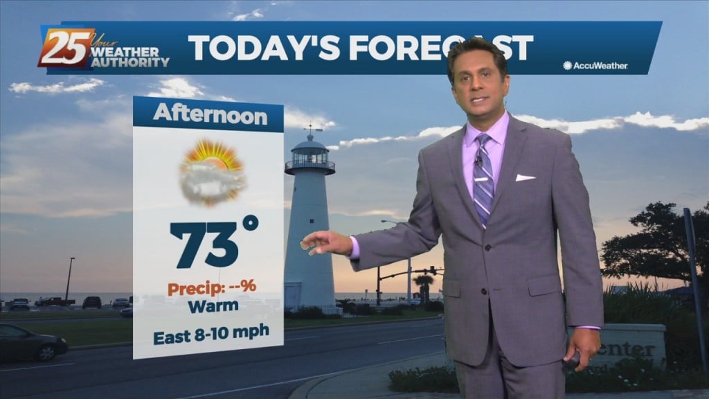
We are on track to quickly warm up later this morning and into the afternoon hours. High-pressure along the region will shape the forecast through the weekend. Tonight,…
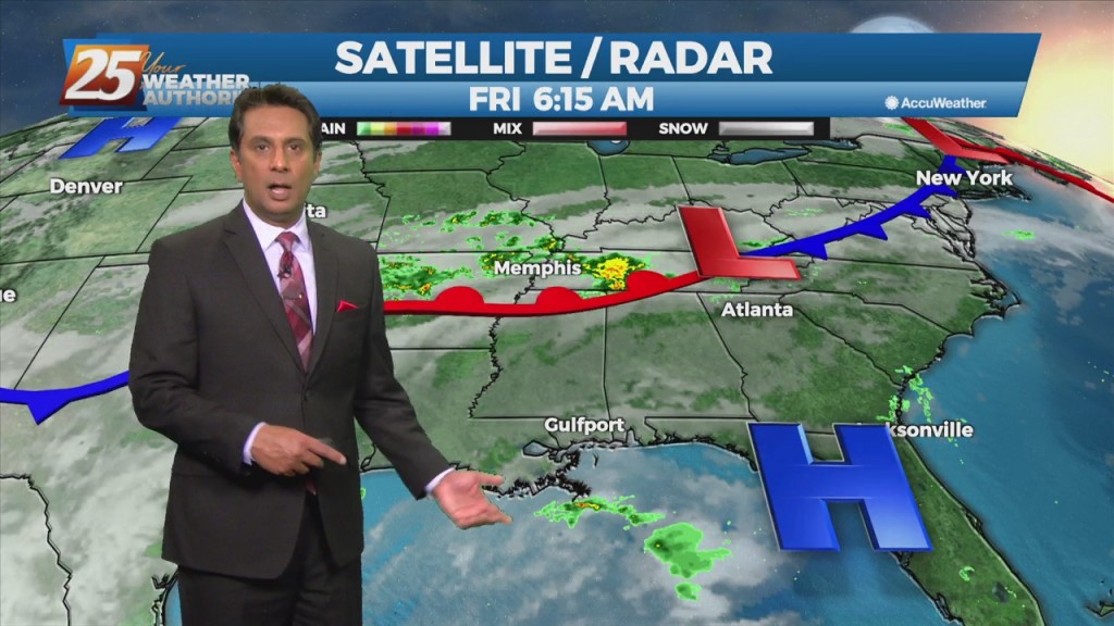
Surface high pressure remains in control of the northern Gulf coast, with a broad center/axis extending from across SE LA, northeast into MS/AL and central TN. The…
Starting out with early this morning, surface high pressure has built in across the southern MS valley region/NW GOMEX. The high center is just to our west…
The area of low-pressure is now along the NE'tern GOM moving ENE. Rain is out of the area but clouds will longer today as low-level moisture flow…
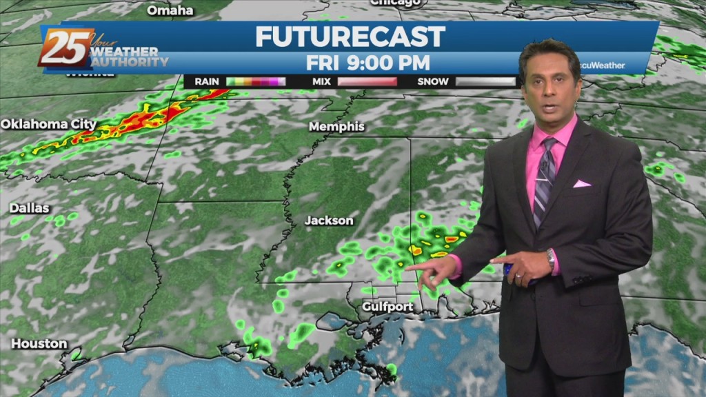
The primary forecast concern through Tuesday will be the progression of a fast moving low-pressure system along the northern Gulf. The low-pressure should continue to…
An upper level high-pressure centered near south Florida expands from east of the Bahamas to the western Gulf of Mexico. Models show a plume of moisture on the…
Today will continue the trend of quiet conditions as high pressure located just east of our area remains dominant over the forecast. High temperatures today are…
Today will be fairly quiet as high pressure remains the dominant feature of the short term forecast for the next couple days. High temperatures today warm back…
A fetch of low-level Gulf moisture riding north over a stationary frontal boundary will continue to bring cloud coverage to the area along with above seasonal…
Return flow in the low-levels is already trying to begin but by midday and for the next few days it will increase with temperatures already moderating today…
A couple light showers will be possible through this evening, but most areas likely remain dry for the day. High temperatures will warm to near…
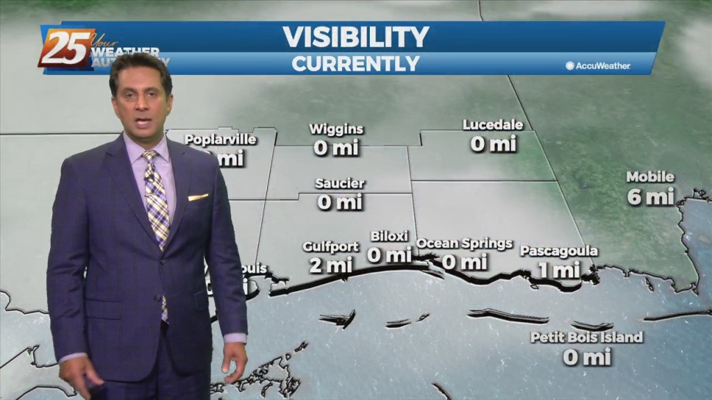
Fog continues to be the say of the day. The dense fog advisory will remain through late morning, and there is the potential that some areas could…
Forecast issue over the next few days will be the location of the current frontal boundary. I don't expect much movement with the front now south…
A cold front still tracking toward the area early this morning will move into the northwest portion of the area around noon, reaching the Mississippi Coast…
At the surface, high pressure really doesn't give way over the next 24 hours. A n upper-level disturbance will move from Texas across the area Saturday…
Main weather issue over the next few days will be the threat of fog during the overnight hours through mid-morning. Not much change in forecast parameters for the…
A west-northwestly flow will remain in place through the next 36 hours while an upper level disturbance moves through the upper and middle MS Valley today. Upper level…
High pressure will remain over the area bringing dry conditions with mild days and clear cool nights. A west-northwestly flow will remain in place through the…
Very nice conditions will remain through the workweek, with the main issue over the next few nights being fog formation. This morning, conditions support low level layered…
The cold front that moved through on has cleared our area to the southeast with north-northwest winds, cooler temps and lowering dew points in its wake.…
An upper level high-pressure that has been in place over the southeast CONUS will be suppressed southward today as a cold front begins to track though the region.…