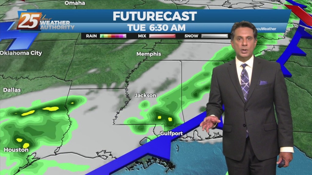
5/17 - The Chief's "Summertime Heat" Tuesday Morning Forecast
Today and Wednesday, high-pressure will set up over the area. Conditions will be dry primarily, looking at the models. Today will mainly be a transitional day where…
Today and Wednesday, high-pressure will set up over the area. Conditions will be dry primarily, looking at the models. Today will mainly be a transitional day where…
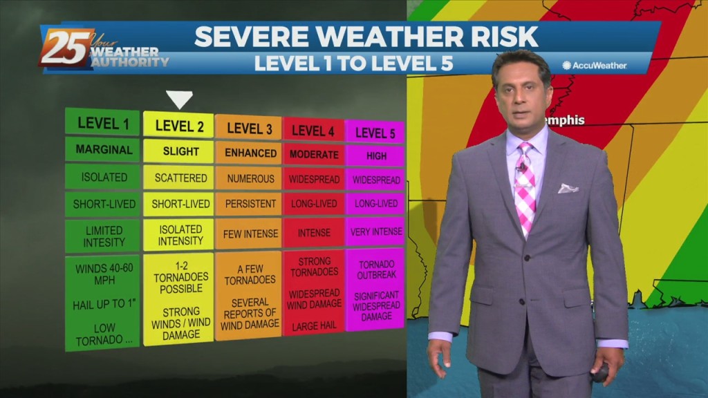
The main concern in the short term will continue to be the potential for thunderstorms and possible severe weather. We’ll remain in northwesterly upper flow…
An upper level low-pressure system currently centered in the western Atlantic will move west into FL/GA today. At the same time, an upper level disturbance to the…
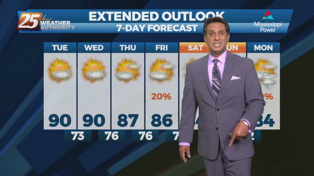
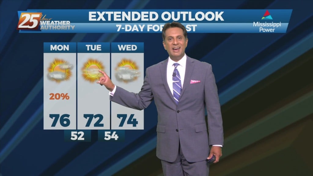
Hot and dry pattern continues as high-pressure extends SW to NE from the western Gulf of Mexico to the Great Lakes. This will easily support…
Hot and dry pattern continues as upper level high-pressure builds SW to NE across the Mississippi Valley. This will easily supports high temperatures around 90 degrees, with…
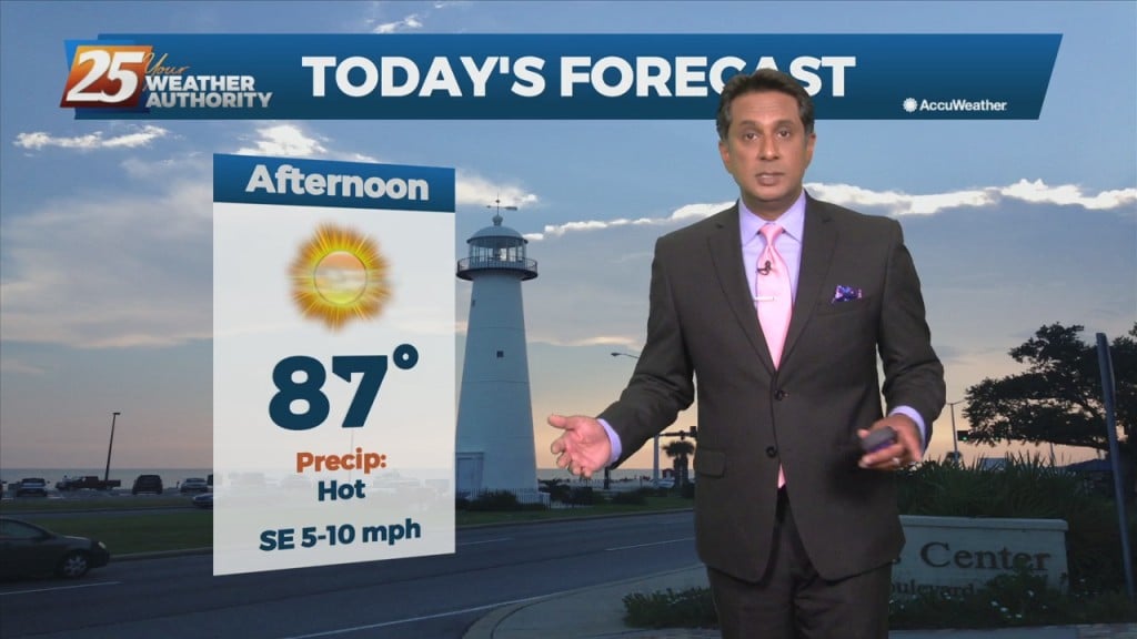
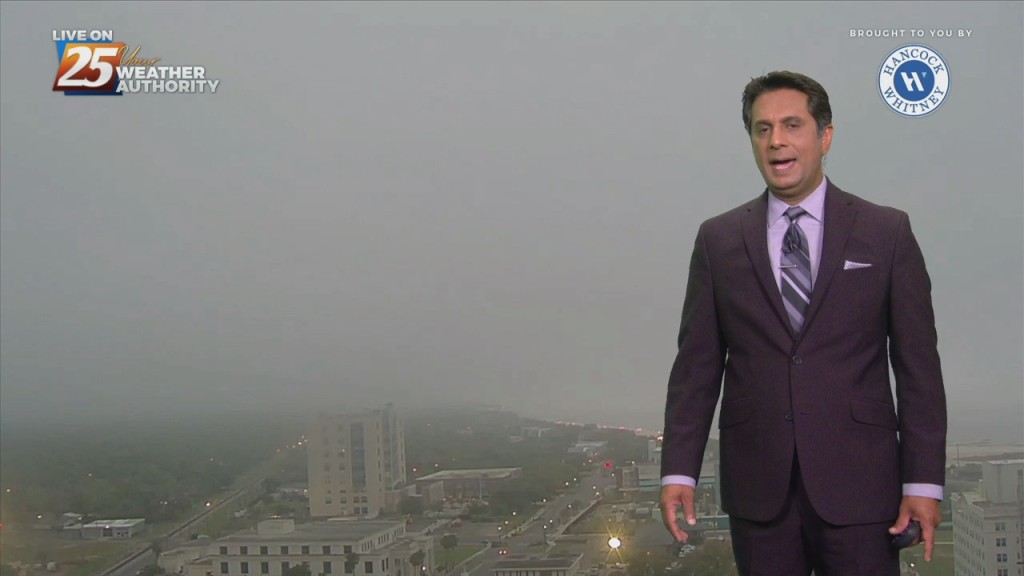
Fog this morning in a few locations and may get dense in those locations around sunrise. But most areas are seeing temps high enough to keep fog…
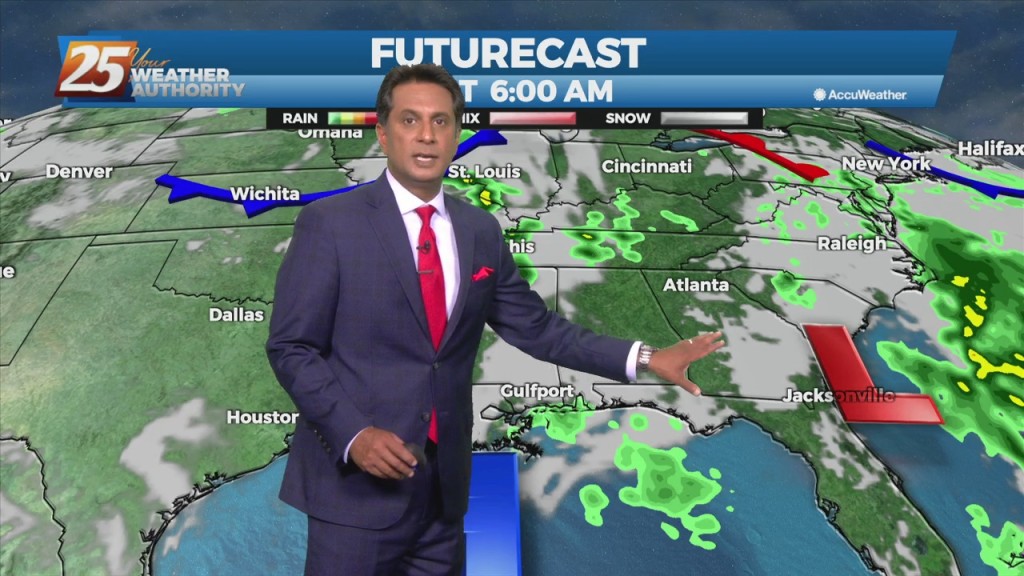
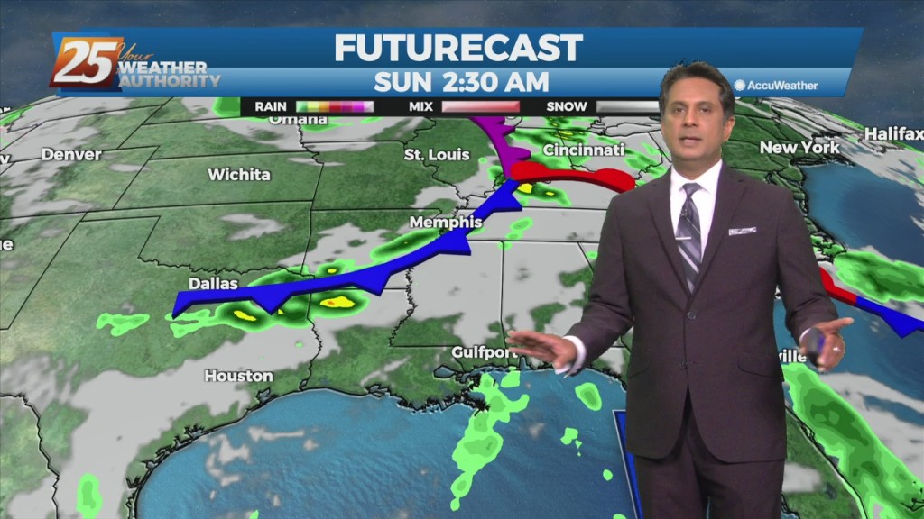
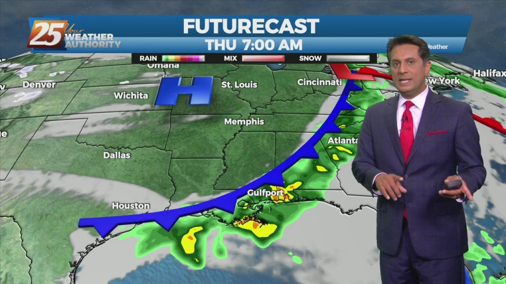
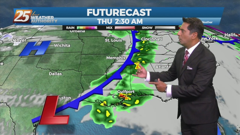
This morning will bring another line of showers/t-storms developing in response to the next disturbance which can be seen in the blowup of convection over the NW gulf.…

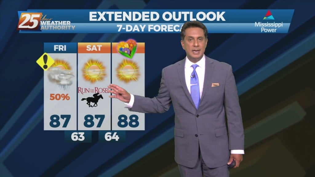
Aside from a normal start to summer and high temps well above normal values, we will throw several thunderstorms on the pile for Thursday…
Quiet conditions will continue as the warm and humid flow dominates. A more unsettled weather pattern is expected to take hold on Thursday and continue through…
A Texas disturbance will move across the area this afternoon and evening. It appears to be weakening at this time, with no significant convective development today. Beyond tonight, high-pressure…
At the surface, high pressure extended from eastern Canada into the Carolinas with a westward extension across much of the eastern half of the Gulf Coast. Low…
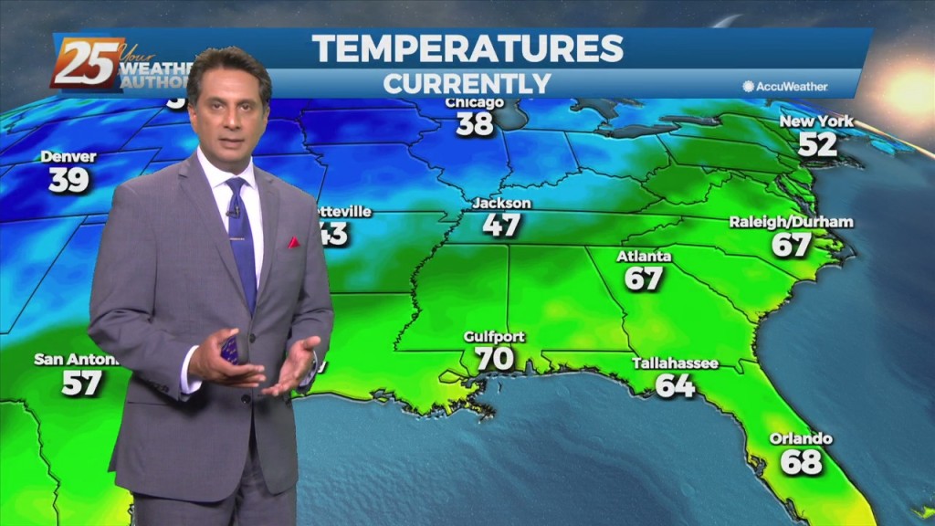
At the surface, high pressure extended from the Great Lakes southward to Florida with a weak extension southwest into the western Gulf of Mexico. This will…
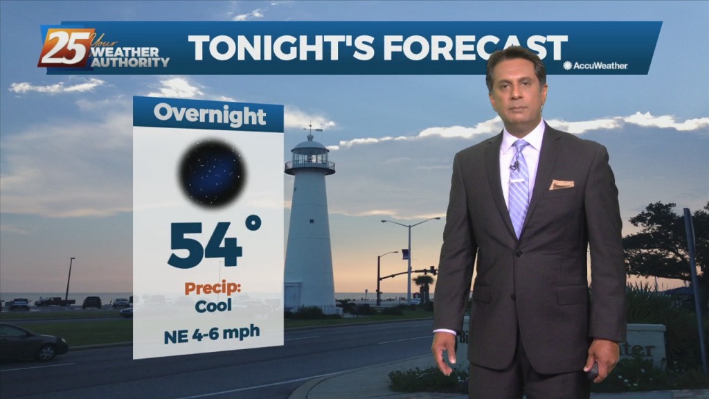
High-pressure over the region will provide for clear skies, lighter wind than what we have become accustomed to these past few weeks. A less humid air…
As the cold front is now to the east, post frontal clouds and low rain potential will continue this morning. Drier air moving in from the…
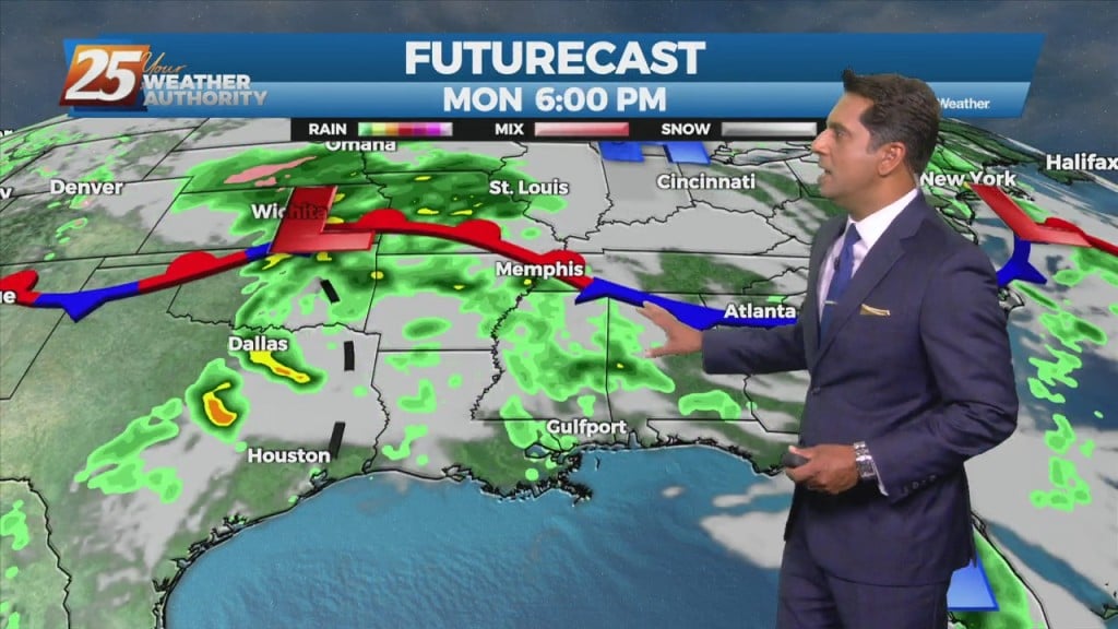
An upper low-pressure in the northern part of the country will move across the Great Lakes and into Canada. This will drive a cold front south to central LA and MS late in the day. Showers and thunderstorms along/ahead of…
Post front airmass continues to push in today as upper level high-pressure to the NW shapes the short term forecast. This will bring another below normal temperature…
The cold front will make its way through the entire area this morning bringing some very nice conditions once again. Cloudy coverage will clear by late morning…

A zonal flow regime will remain in place across the Gulf South both today and tomorrow in the mid and upper levels. In the low levels, a departing high-pressure…
The cold front has moved east of the area but will continue to be a factor in the forecast through the Easter weekend. We could still be…
A t-storm complex to the north will continue to move NE and get dissipate later this morning in advance of an approaching cold front. Going into the…
Today looks to remain quiet for the first half of the day but storms could begin to fire just to the west and southwest during the early…
Today, southerly surface winds will help advect moisture and warm air into the area. Low level convergence will help to enhance lifting in the environment.…
An area of low-pressure remains near Lake Michigan, with upper level high-pressure to the NW. Any cloud cover associated with the upper low is well to the north…
A weak upper disturbance will move across the region later this morning with the actual cold front pushing through in the evening. Showers and a few…