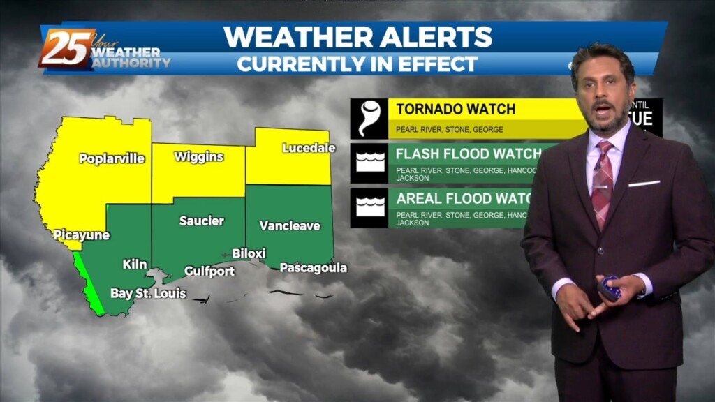
4/7 - The Chief's "Wet Easter Weekend" Friday Afternoon Forecast
Today, eyes will be focused upstream as a mid-level impulse begins to move near and over the region. This feature along with the surface convergence along…
Today, eyes will be focused upstream as a mid-level impulse begins to move near and over the region. This feature along with the surface convergence along…
The main story for today will be increased rain chances as what has been mentioned for days now as a front slowly drifts east into our area.…
Warm & windy conditions will continue as a cold front to the west has slowed dramatically. This means that just about all of the associated dynamic…
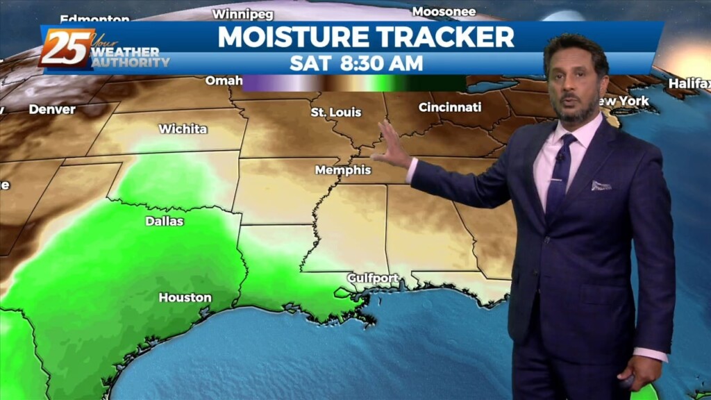
At the surface, high pressure was centered off the Virginia coast. Low pressure was centered over Nebraska with a trailing cold front to west Texas. Moisture…
High pressure will continue to move east today with the axis crossing the local area late this afternoon and tonight. This will allow winds to turn…
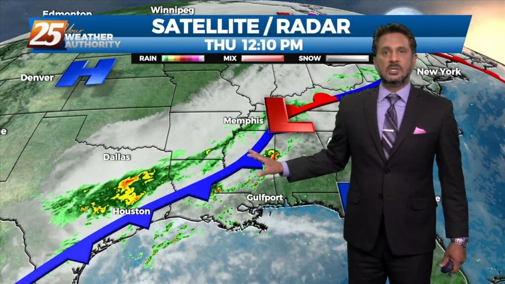
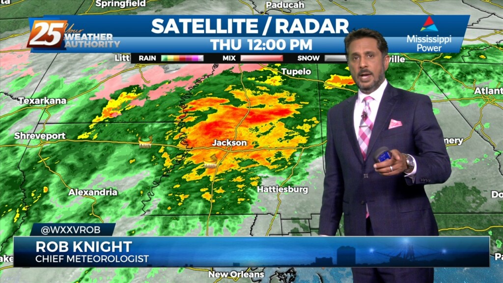
A disturbance over extreme eastern Texas will likely continue to drive t-storm development this morning as the boundary continues to sink southward. Expect this boundary to be…
Fog will become an issue tonight but winds should stay too high nearest the coast and a cloud deck at 2k` starts to move in…
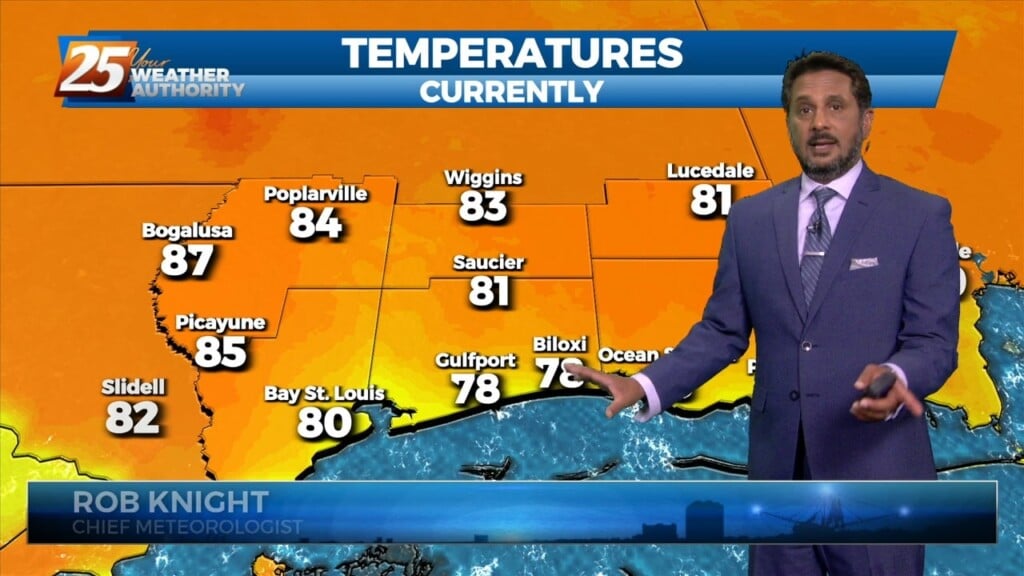
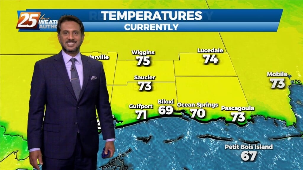
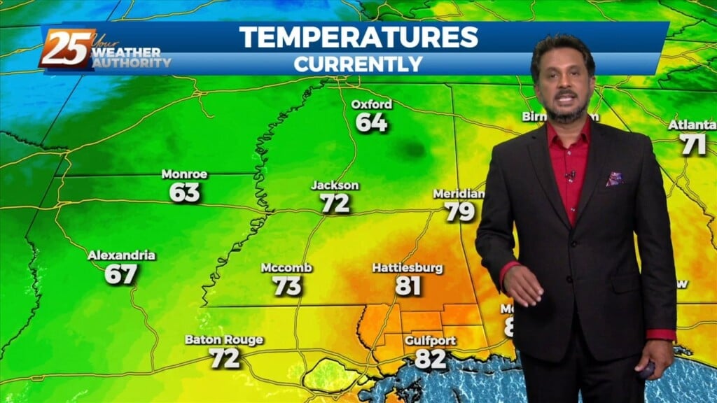
Warmer temperatures will affect the area this afternoon as a southerly return flow develops. Expect partly to mostly cloudy skies from west to east as moisture…
Widely scattered afternoon/evening showers and a few t-storms will affect the area this afternoon, dissipating this evening. The prospect of locally dense fog forming…
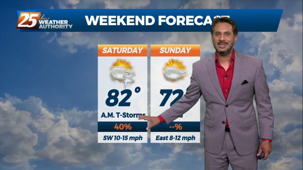
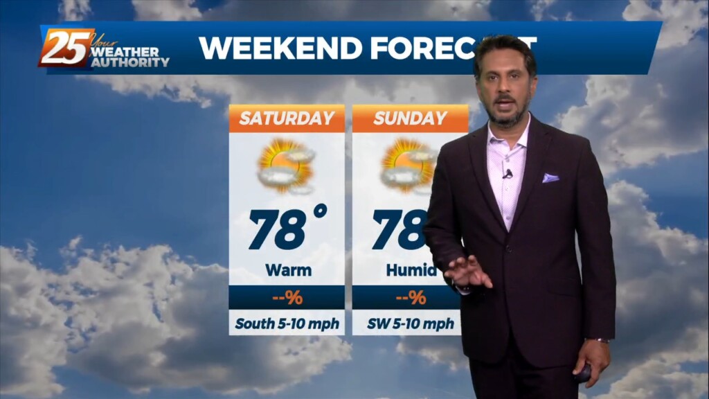
TOP TIER WEEKEND AHEAD... Behind the front this afternoon, winds will be gusty and we return back to more normal temperatures. These gusty winds and…
The main feature at the surface remains to be a frontal boundary that has come to a slow crawl or just about stationary to our…
Aloft, our region will be within the northwest periphery of the strong high pressure parked over south Florida leading to southwesterly flow. Today will mostly be a…
Today our area will reside between a strong upper level high pressure over the western Caribbean and southwest Atlantic and a strong upper level…
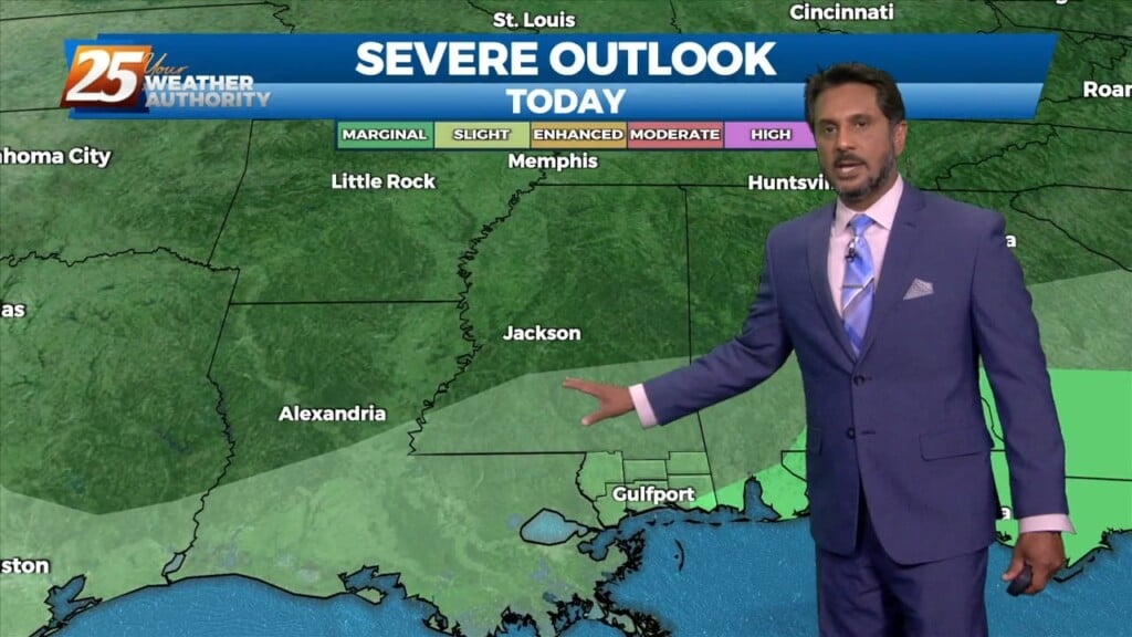
The threat for severe weather will be in the area this afternoon/evening with a cold front approaching from the west. Severe weather variables are not remarkable…
With moisture getting lifted over the colder air near a boundary to the east, we’ll likely be seeing precipitation pretty much all day today, but expect…
Sunny skies and windy conditions will prevail this afternoon, with clear and cold conditions overnight. The biggest concern for the weekend is going to be…
Areas of rain including a few t-storms will move in this afternoon as a low pressure and attendant cold front lifts NE. The low pressure will move…
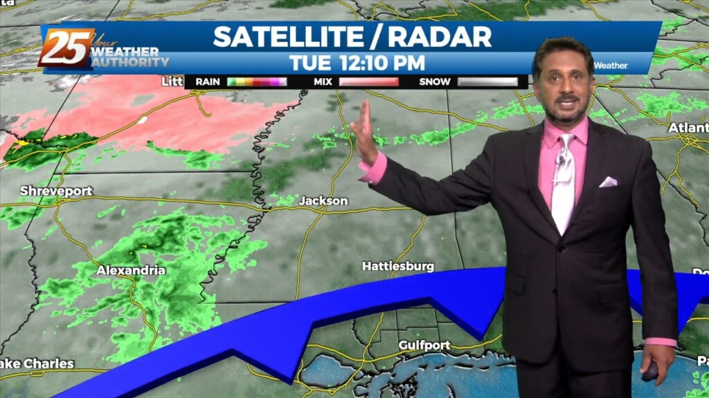
A weak cold front overhead will slowly move to the south as fast as molasses in winter. It will take from now until just before…
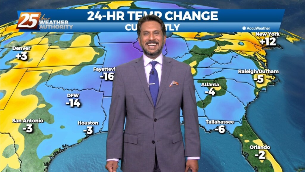
With strong cold air advection and cloud cover, temps will not warm and may actually drop off a few degrees this afternoon. Winds will also…

A BEAUTIFUL afternoon ahead with breezy conditions out of the SW. A cold front moves through Thursday and should enter the area around 9am and…
High pressure to the NW will continue to move in and shape the forecast into the weekend. With insolation during the afternoon hours, expect temperatures to…
The front to the west has begun to slow with discrete super-cell t-storms developing in advance of the main system. The low level jet does somewhat…
Sea fog will also pin right along the coast today so not expecting much improvement from earlier this morning. Outside of the fog, eyes start…
A line of strong to severe thunderstorms will move through our area this afternoon. As this line moves into our area it will…