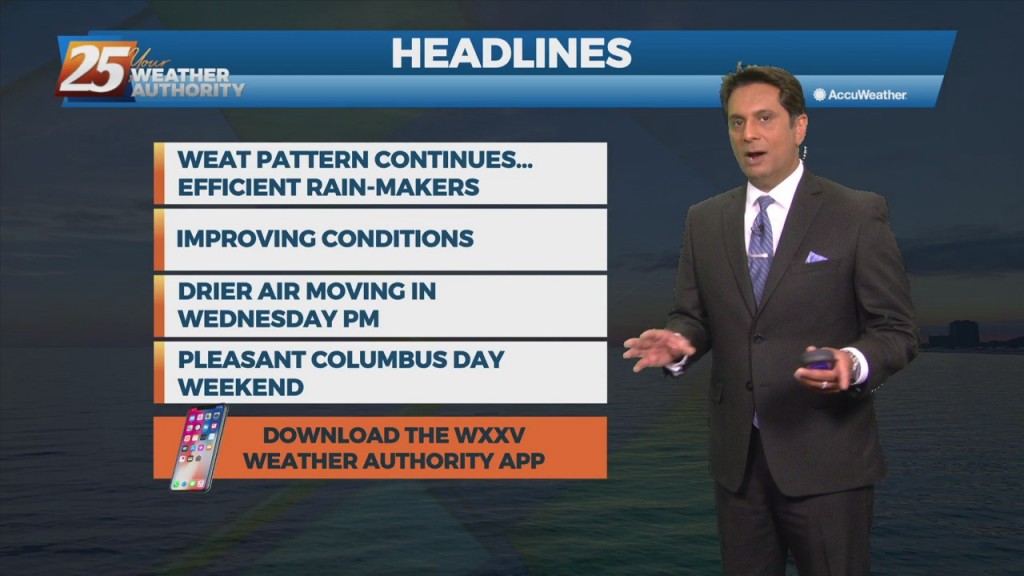
8/3 - Brittany's "Wet Pattern Continues" Wednesday Evening Forecast
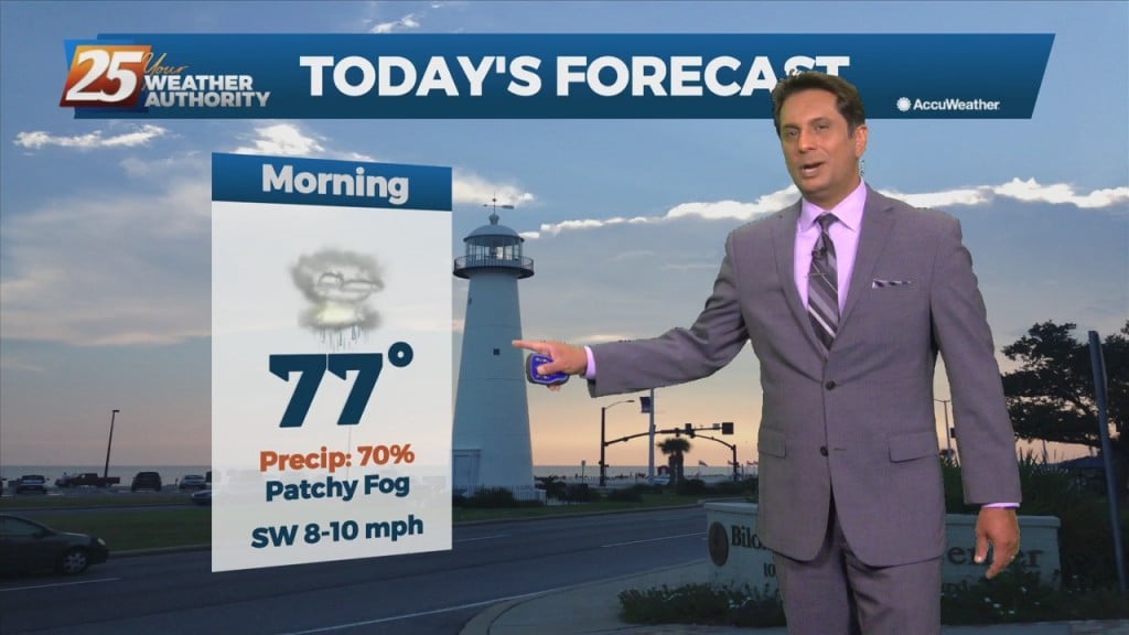
Looks like one more day of anomalously high moisture levels before some drying occurs. Now...that doesn`t mean we`re going to have totally dry and sunny days, but…
Looks like one more day of anomalously high moisture levels before some drying occurs. Now...that doesn`t mean we`re going to have totally dry and sunny days, but…
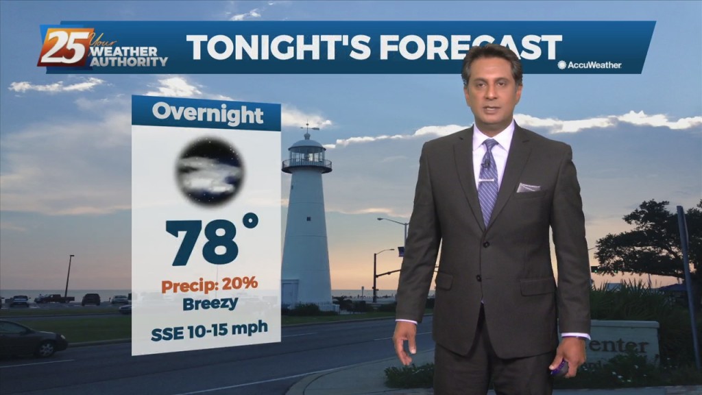
The convection will decay in the late evening as the sun goes down and it will give way to warm and muggy overnight conditions. More of the…
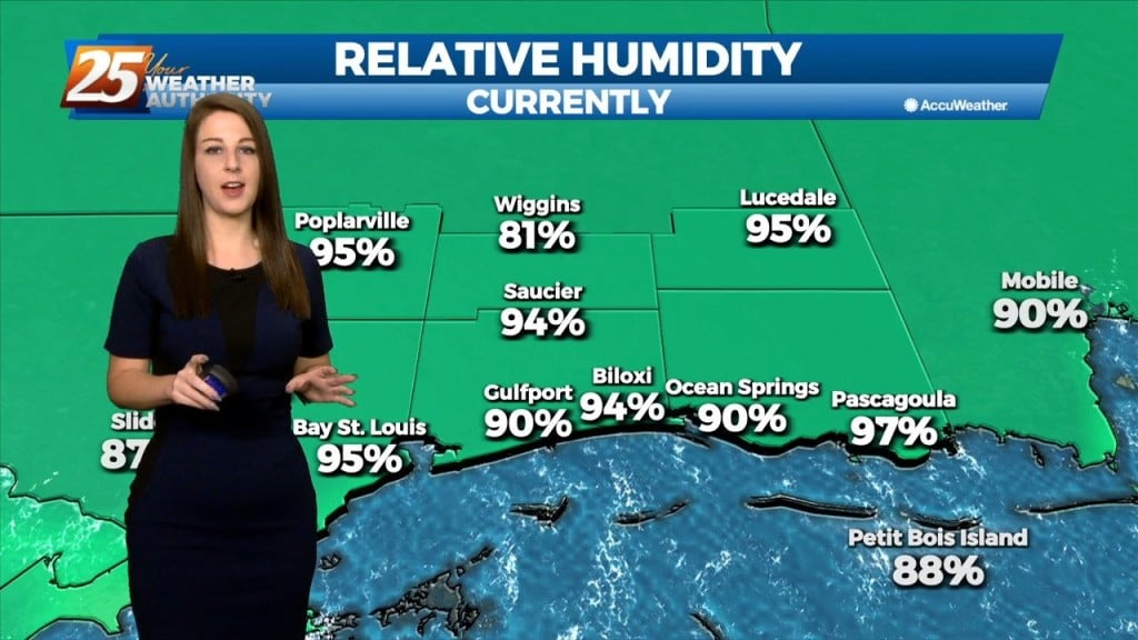
Many parts of the area have seen considerable rainfall over the past several days with a few locations having had measurable rainfall for quite an extended period. While…
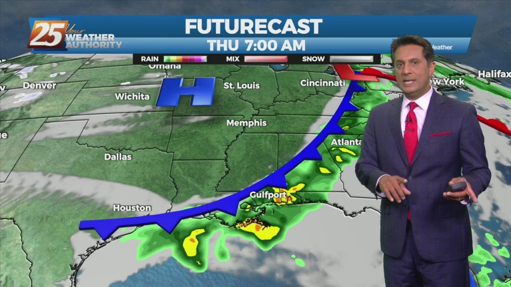
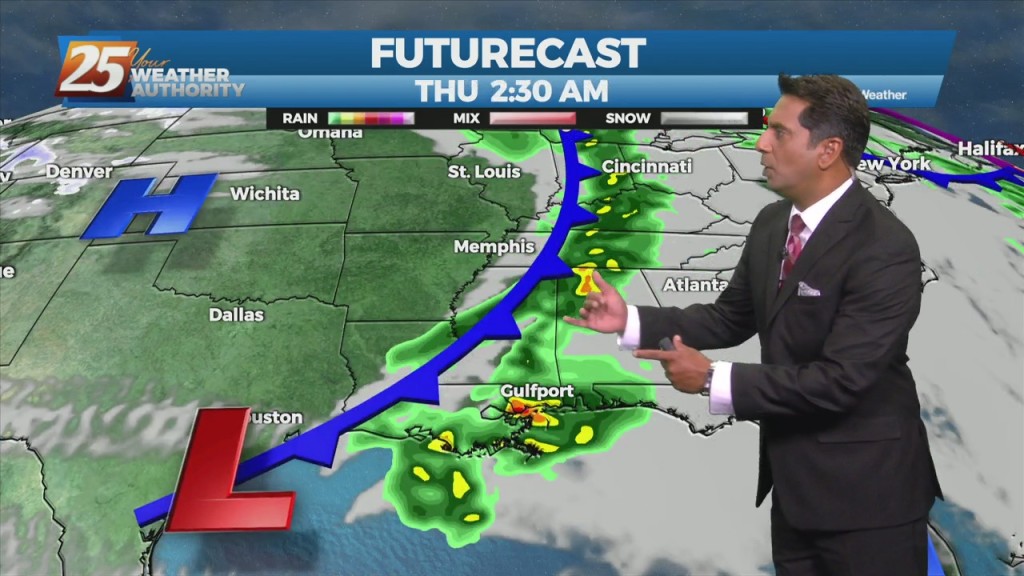
Not much in the way of change is expected tomorrow or Thursday. As mentioned yesterday, the continued rainfall across the area will accumulate as the week continues…

An upper level high pressure system centered near the 4-Corners region extends to the east coast north of Florida. This eastern portion of the ridge is rapidly eroding…

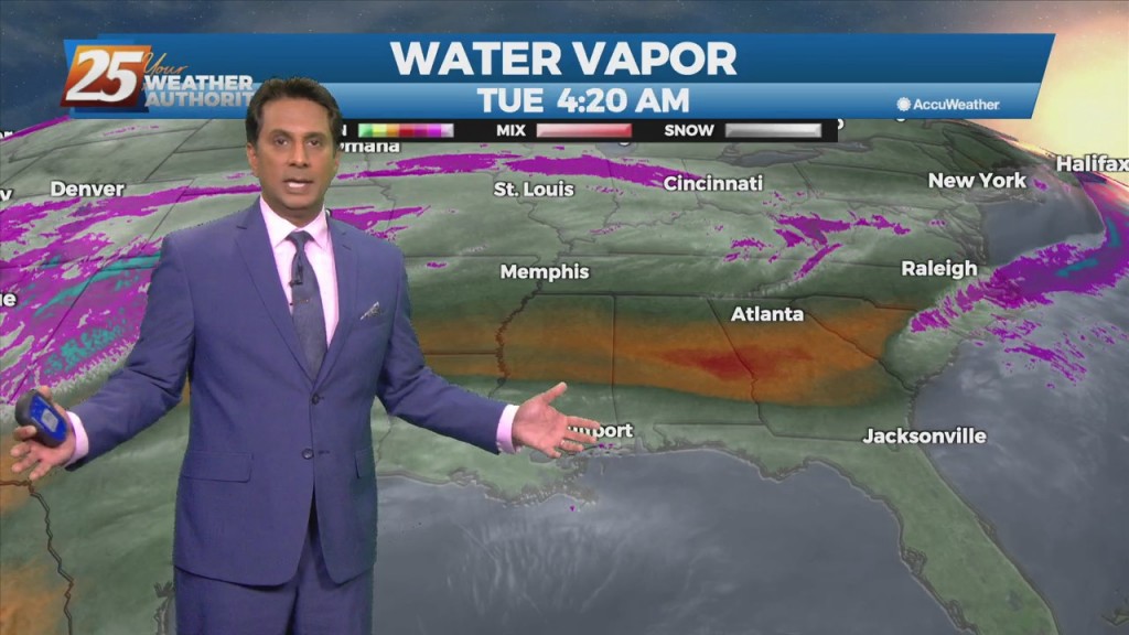
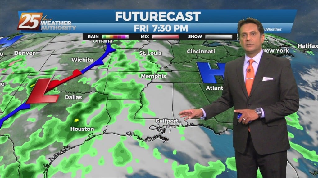
A stationary front along the coast will undulate north and south for several days, providing for rainfall and the potential for HEAVY RAIN. If…
An upper level high pressure is to the north of a stationary front situated along the Mississippi gulf coast. If there’s some good news, it is…
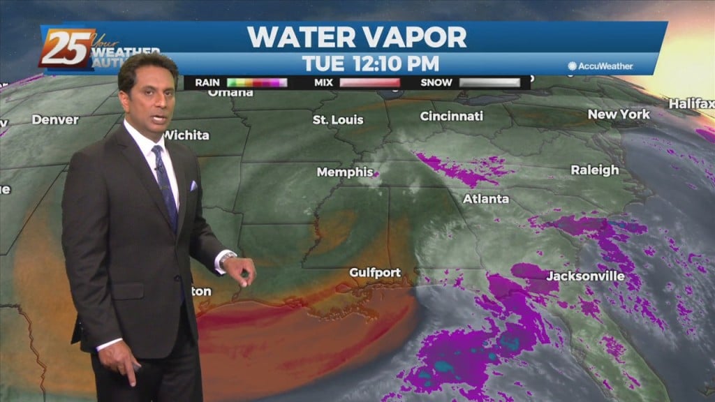
An Upper level low-pressure over the north central Gulf of Mexico will continue to drift slowly westward over the next few days, with blocking pattern finally breaking…
An upper level High-pressure remains off the Atlantic Coast with southwesterly upper flow across much of the southeast. Scattered showers and t-storms will taper off this…
An area of low pressure located of across the Northern Gulf of Mexico is producing showers and thunderstorms that are expected to move to the north and…
The hot and dry pattern will come to and end this weekend... The upper pattern will start the transition into a wetter one late in the…
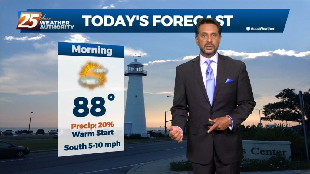
Today looks to remain quiet for the first half of the day but storms could begin to fire just to the west and southwest during the early…
Today, southerly surface winds will help advect moisture and warm air into the area. Low level convergence will help to enhance lifting in the environment.…
A stationary front to the east will continue to be the focal point for showers and t-storms again today. The development over land will be elevated…
Low pressure is currently over southern Indiana with a cold front southwestward to near Memphis and Shreveport. As the surface low continue to lift northeastward, the cold…
A cold front west will slowly move east and through the area this evening. This afternoon will bring the biggest potential for impactful weather to the local…
Rainfall moving into the area later today will continue to intensify overnight with the potential for 1/4 to 1" accumulation. The next round of rain will…
High-pressure will slowly move east as a strong cold front will begin moving rapidly SE through the Red River Valley this afternoon, with the return flow…
Forecast issue over the next few days will be the location of the current frontal boundary. I don't expect much movement with the front now south…
A region of high pressure NE of the area is steadily moving SE'ward, allowing for more moisture to move in from the south. A weakness in…
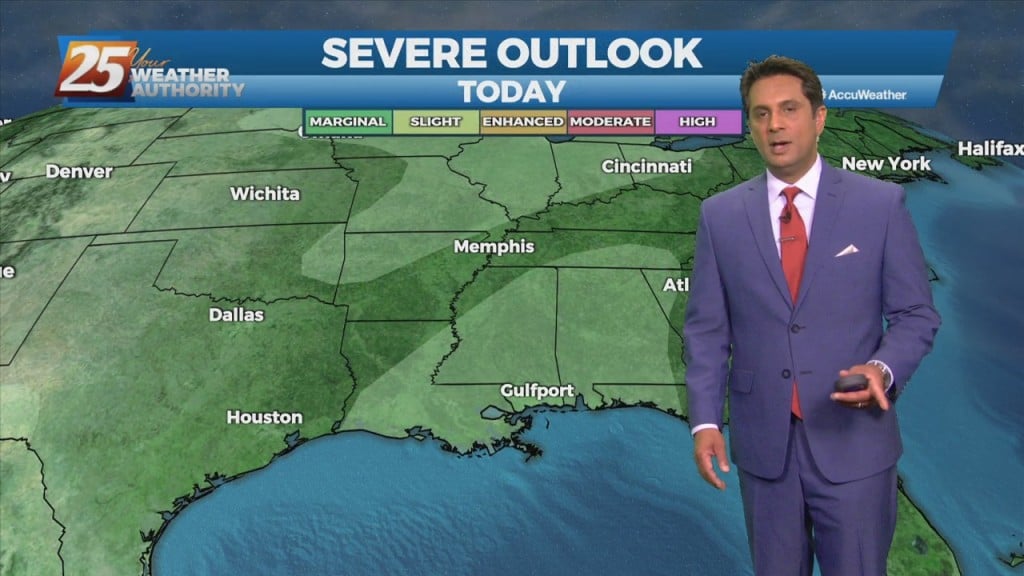
There is a marginal risk for excessive rainfall for the best chances of getting rainfall this afternoon over coastal Mississippi. This is all being brought about from an upper disturbance that extends from northern LA up into the northeast. The…
The main focus will be more toward rainfall rates and not as much on totals area wide. Rates could be around 2 to 3 inches per hour today and isolated areas could see 2 to 4 inches in a short…
Main forecast question is on rain but it is all related to the development and location of a cutoff low-pressure. This will have some greater impacts on the forecast for Tuesday and Wednesday if the low does dig into LA. As…
Pulses of weak Energy from the west are expected to continue to aid a wet environment favorable for more isolated showers and thunderstorms. Isolated showers and thunderstorms may still form later than previous days and affect west of the local…