10/04 Ryan's "Cruisin' Weather" Wednesday Forecast
The next few days will be sunny and gorgeous, but a new tropical depression is worrying Gulf Coast residents. Click the link for the latest on the tropics.
The next few days will be sunny and gorgeous, but a new tropical depression is worrying Gulf Coast residents. Click the link for the latest on the tropics.
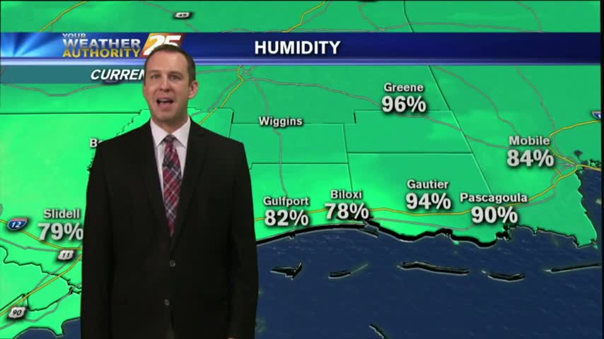
Temperatures remain warm, and the humidity is high tonight, but a cold front is expected tomorrow that will finally shake things up. Click the link for details.
The local weather has returned to our normal "Summertime" pattern, but there's only about a day and a half of Summer left! Don't expect any sudden changes, but cooler days are ahead. Details inside.
We're still expecting more predictable "summertime" weather for the rest of the week, but Fall officially begins on Friday so changes are on the way. Details within.

We have at least one nearly perfect day left before the humidity goes back up and we cloud even see some rain over the weekend. Watch the full forecast for more.
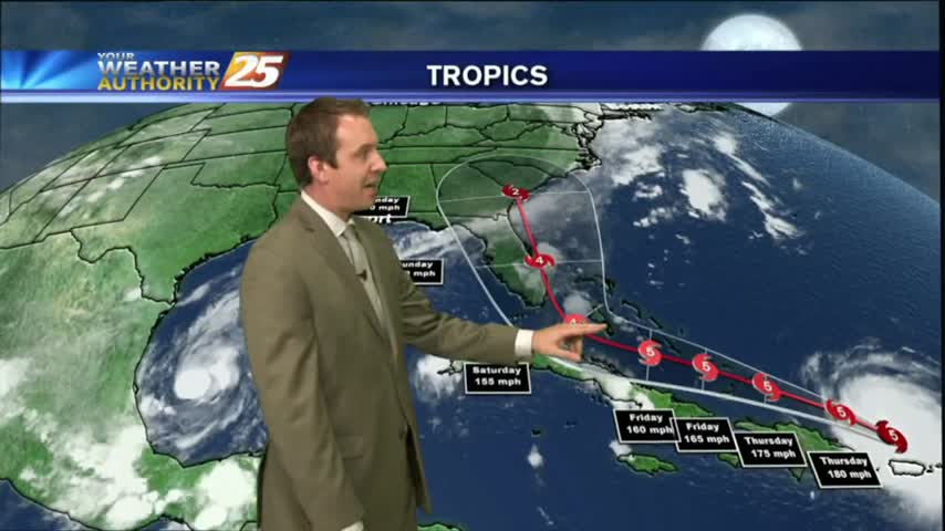
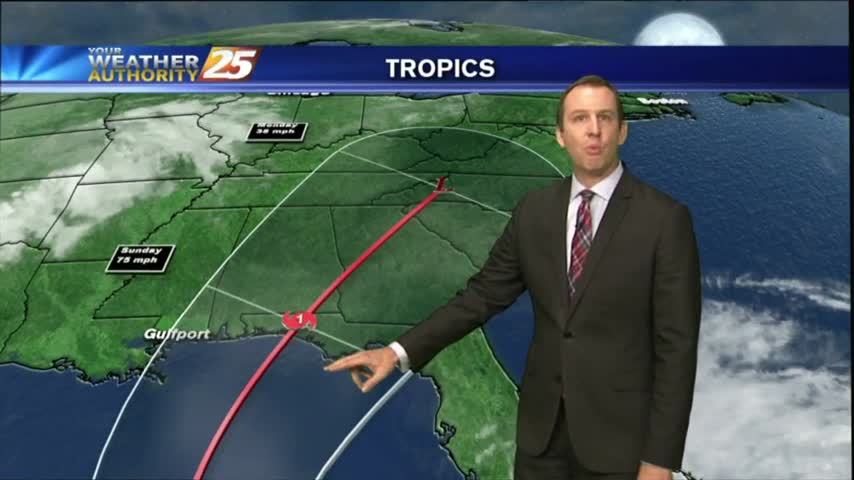
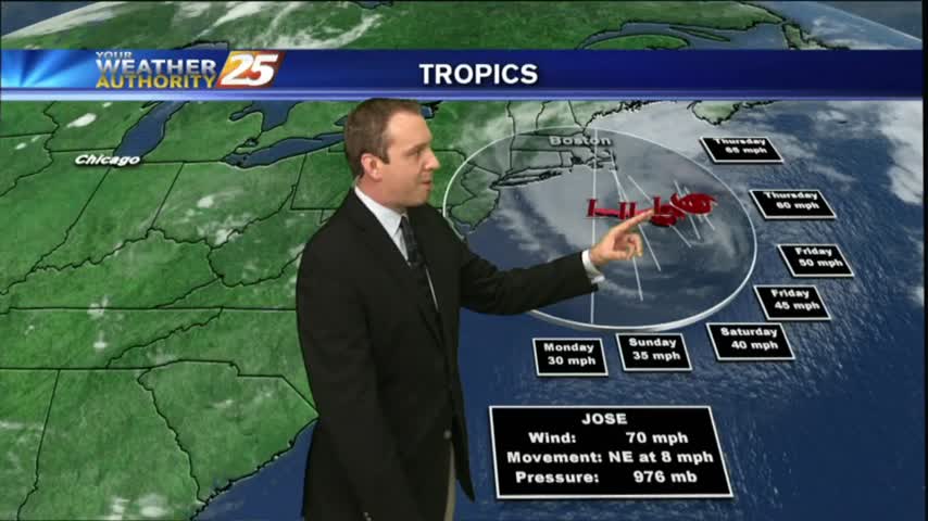
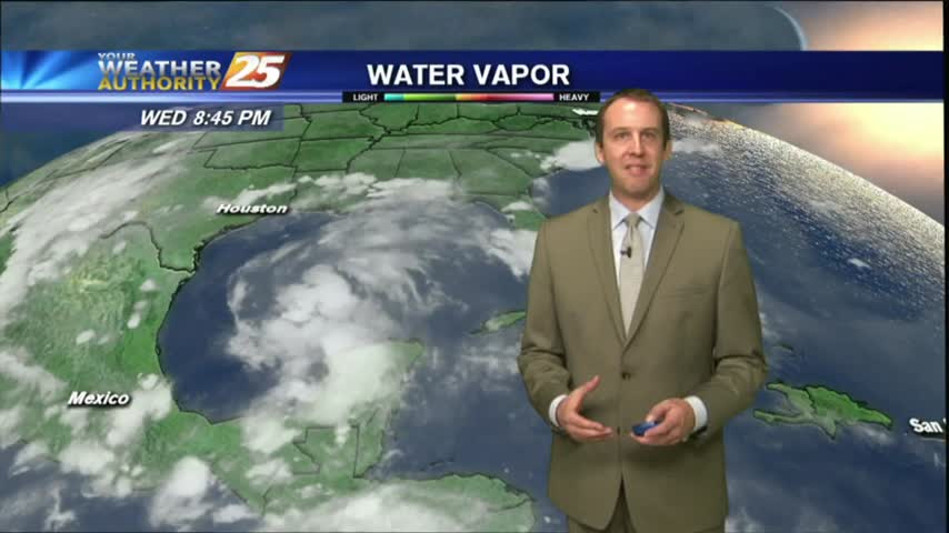
We ended yesterday with only one hurricane in the Atlantic, but we're ending today with three. Click the link for the latest on all the tropical systems.
The Atlantic tropics remain active, as now three hurricanes are expected to continue strengthening over the next few days. Click the forecast link for the full Tropical update.
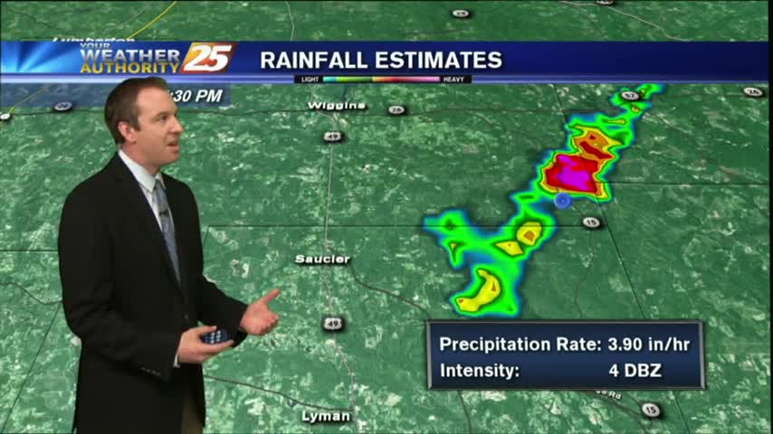
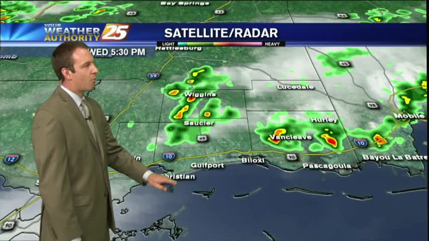
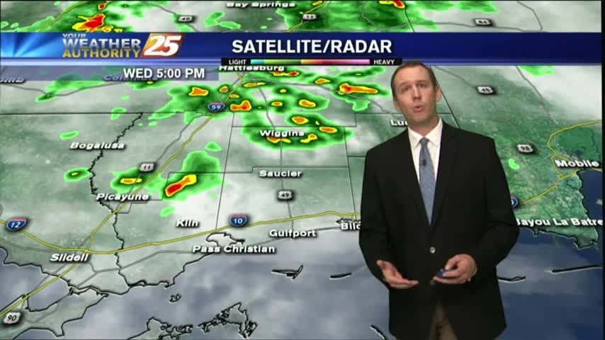
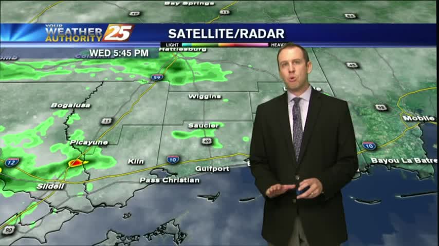
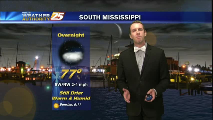
Severe weather began popping up in the early afternoon, but didn't see much more through the evening and only a few showers & storms are likely overnight. Full forecast inside.
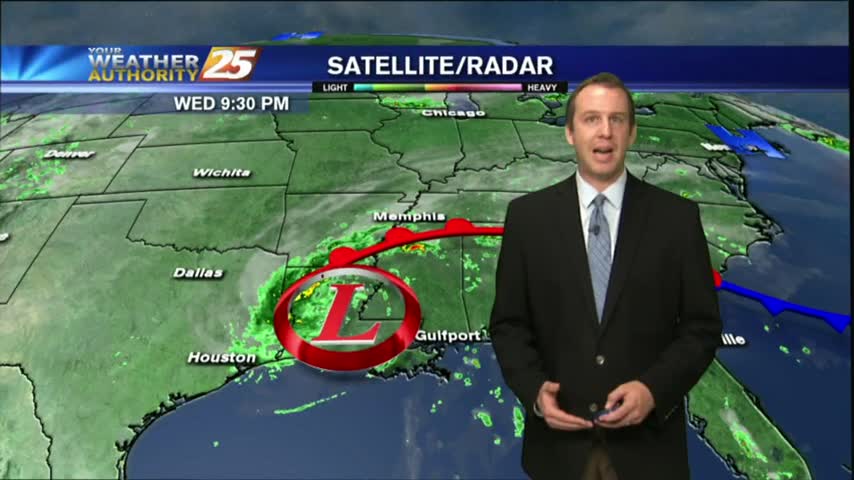
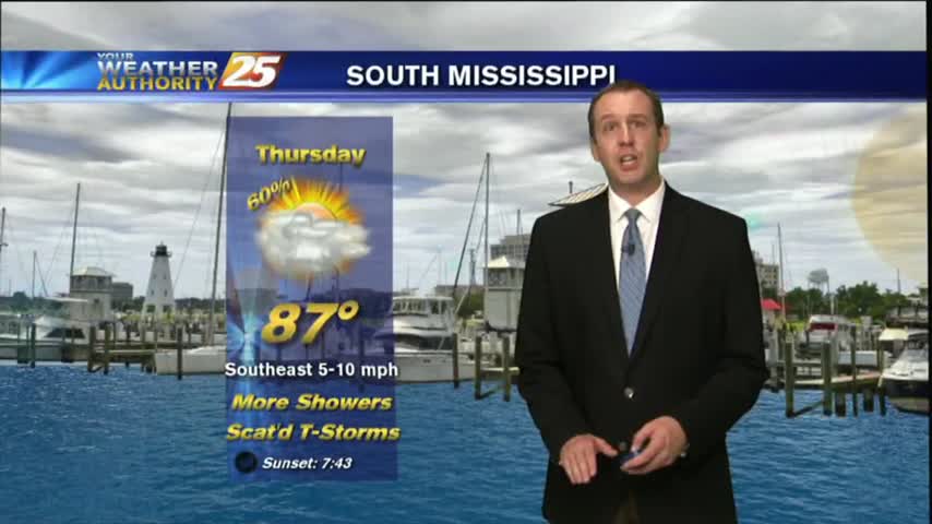
We expect more showers and thunderstorms through the night, but the end of Harvey is in sight. Click the forecast link for more details.
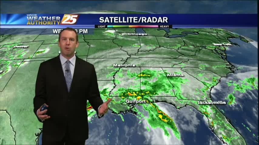
Rainfall totals will likely be high through the weekend, but some depends on tropical moisture from Harvey. We'll continue to hope for the best while preparing for the worst as we watch this developing situation. Details inside.
It was another hot & humid day with short-lived afternoon showers and thunderstorms. Expect more of the same as we approach the weekend, but heavy rains after. Details within.
Drier conditions started today as high pressure begins to strengthen in the area at the surface and upper levels, and tomorrow is lining up to be the most sunny and driest days in months! Watch the forecast for more.
Didn't see much rain this morning/afternoon, but early evening thunderstorms helped light up the night sky. This will dissipate quickly, and more rain expected soon, but you'll have to watch the forecast for more.
Some dry air moved in this afternoon as expected, keeping the showers a bit more few and far between than the day before. Watch the full forecast for more details.
Clouds increased as expected today, and showers will begin over the next few hours. Be sure to watch the full forecast for all of this weekend's rainy details.
We saw a few showers pop up this afternoon, and I'm expecting a few more tomorrow, but otherwise it will be very hot and humid. Watch the full forecast for details.
Far fewer showers & storms today as dry air began to filter in, and the dry conditions continue over the next few days. Doesn't last forever though, so be sure to watch the full forecast for details.
Our warm and humid afternoons are leading to sea breeze showers and thunderstorms, but we aren't seeing much rain after sundown. Expect more of the same for tomorrow, full forecast details inside.
Today was just another day in a long string of very similar summertime conditions, but we will see a few changes to the pattern that will make it a bit rainier. Click the forecast link for details.
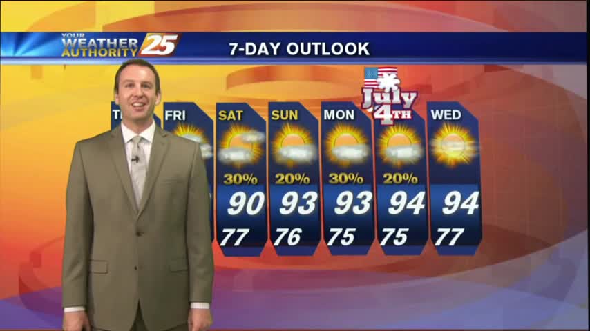
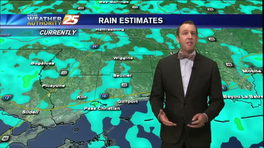
Storms moved in earlier today, but will wait until the early morning overnight hours before bringing in round 2. Best to get it out of the way now, leading to a sunny holiday! Details inside.
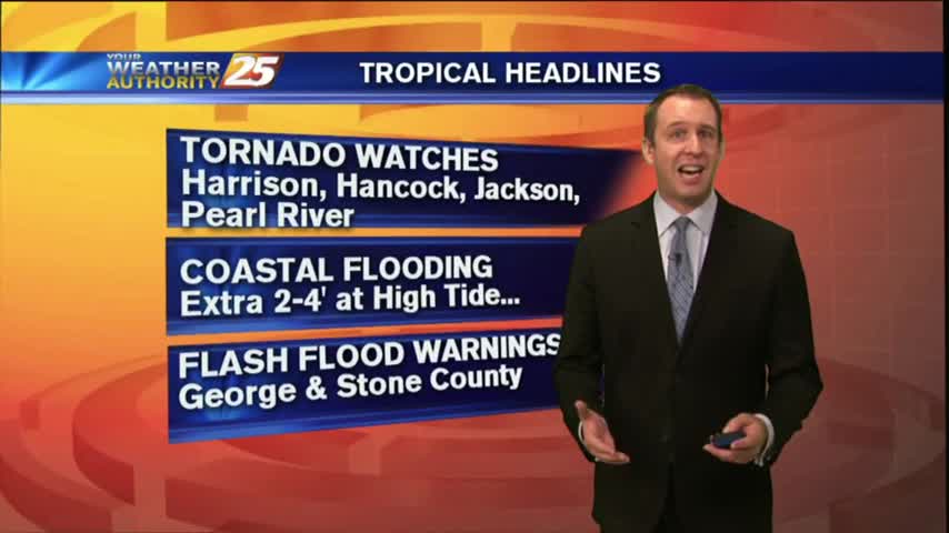
Today brought the first significant rain since Cindy left, and even a few Tornado Warnings this morning! Expect it to continue for a few days, but dry & hot weather is ahead. Click for details.
Dry air working its way into Tropical Storm Cindy has created a few "rain-free" areas, we're still expecting a few inches over the next day or so. Watch the full forecast for the details.
Skies quieted for a while after an "active" morning, but even then a few tornado warning were issued. The stormy weather will continue, so click the link for the forecast details.
Expect more of the same similar weather tonight, but we do begin seeing relatively drier weather as we head into next week. Watch the full forecast for details.