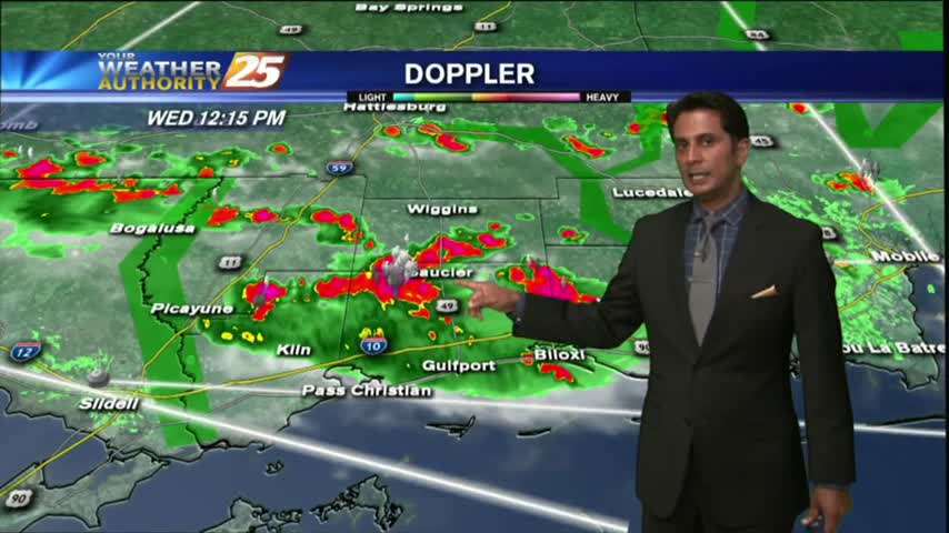
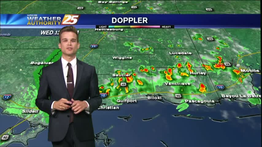
3/28 - Payton's Wednesday Afternoon Forecast
Just a few showers this afternoon, but the chance for severe thunderstorms are in the forecast for your Thursday.
Just a few showers this afternoon, but the chance for severe thunderstorms are in the forecast for your Thursday.

After a few breezy days, the winds will finally start to calm.
It was the first full day of Spring, and it was beautiful!
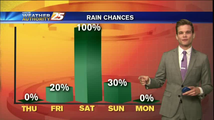
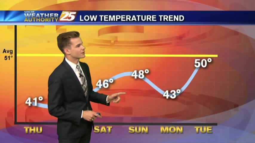
Cool today, cool tomorrow, then rain for the weekend.
Single digit wind chills and ice on the roads. Bundle up and drive slowly this morning.
Very dangerous roads this morning, and extremely cold conditions.
Cold rain tonight with a strong breeze, but nicer weather is on the way...along with colder weather!
A cold rain will return this evening and into the night, but improving conditions are on the way before another cold blast.
Another cool sunny day, but rain and warmer temperatures are on the way.
The cold front has moved through and has brought cooler temperatures and breezy conditions.
A cold front moving through the area this morning will bring colder temperatures for Thanksgiving.
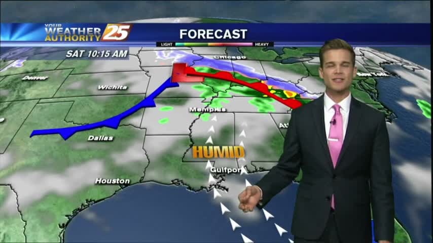
Clouds continue to move into the area, but most of the rain will stay to the northwest.
Happy first day of November, South Mississippi!
Enjoy more beautiful weather today!
After showers and thunderstorms this evening, most of the area has cleared.
Flash Flood Warning for Harrison County until 7:30 pm, but the rain will start to dissipate into the evening.
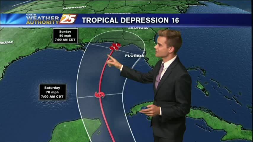
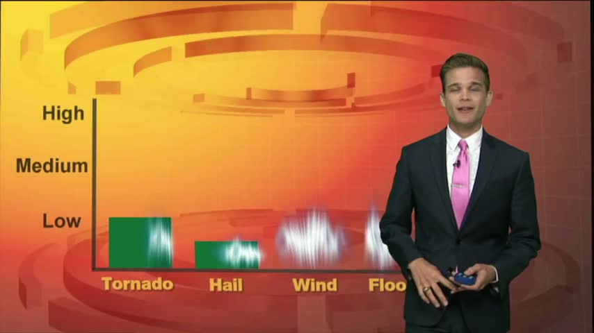
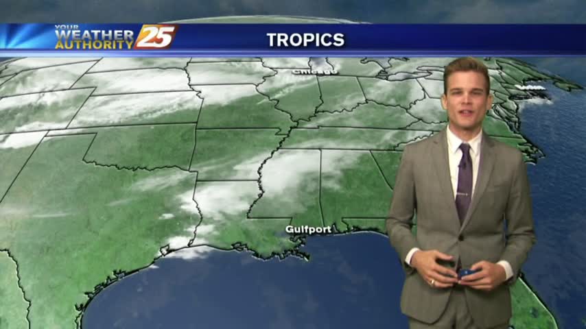
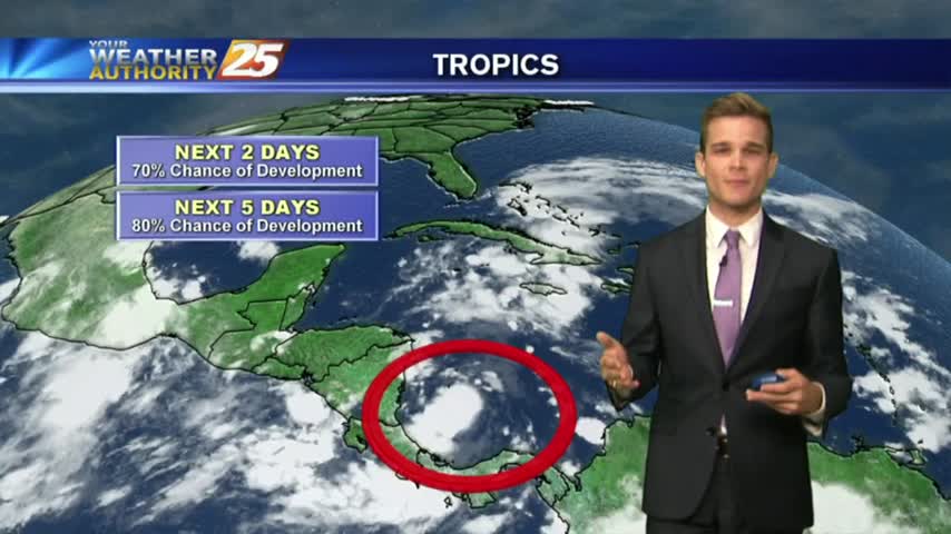
Tropical Depression 16 has formed, and could impact portions of the Gulf Coast this weekend.
Drier are has moved into the area, and that means nice weather for the next few days, but changes are on the way.
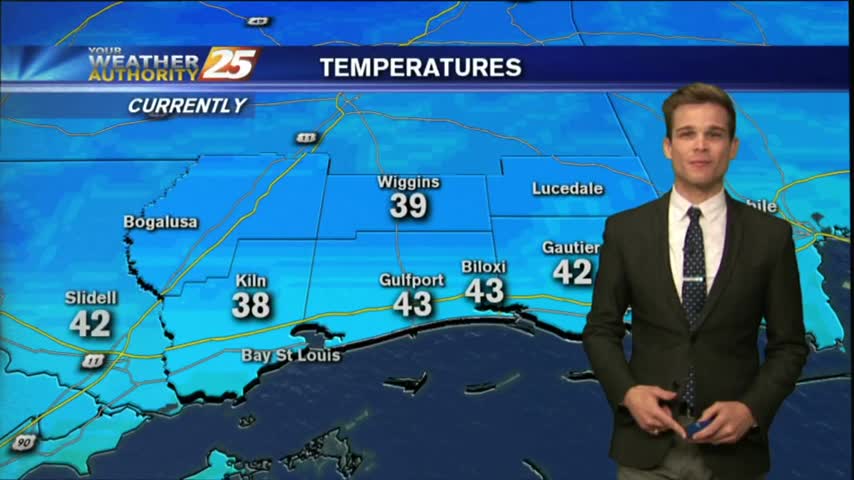
It was a chilly and dry start to the morning with temperatures in the mid 50s to lower 60s.

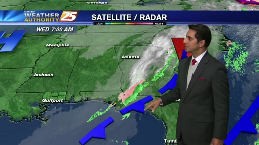
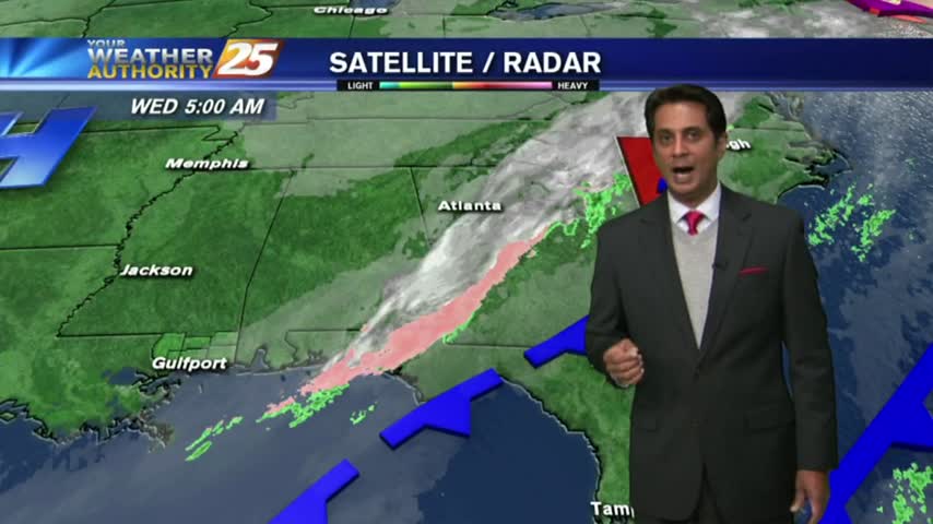
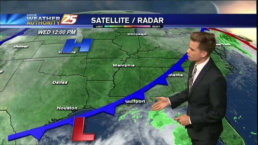
Very isolated activity across the area this afternoon as a stationary front along the Mississippi Gulf Coast stretching west to east will continue to linger in the region through the rest of the workweek.
The area of high pressure that has been centered over the Gulf Coast the past few days will start to makes its way out of the area, and rain chance will start to go up toward the weekend.
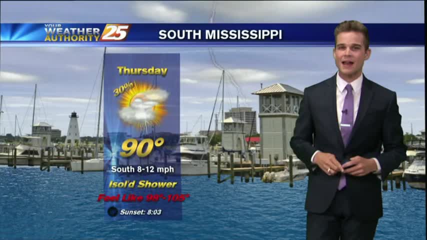
We're getting into the typical summertime pattern here in South Mississippi where it will be hot, humid & stormy during the afternoon.
Isolated activity has been moving into the area from the south since prior to sunrise...with the activity on the increase this afternoon.
Another afternoon with popup showers and thunderstorms. The strongest storms will have lightning, heavy downpours and gusty winds.