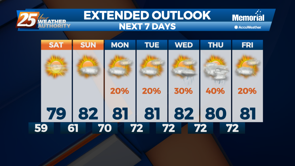
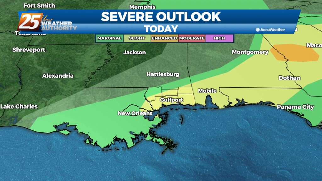
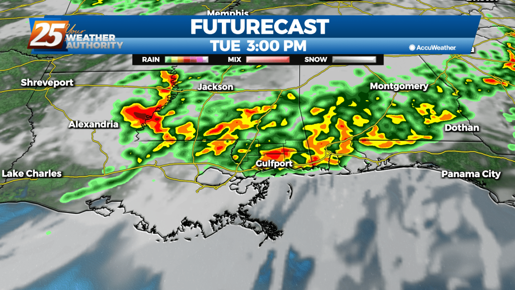
05/16 – Brantly's "Increasing Clouds" Sunday Night Forecast
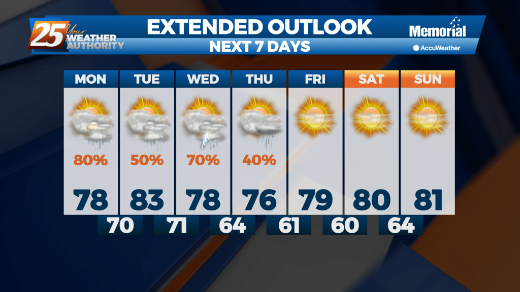
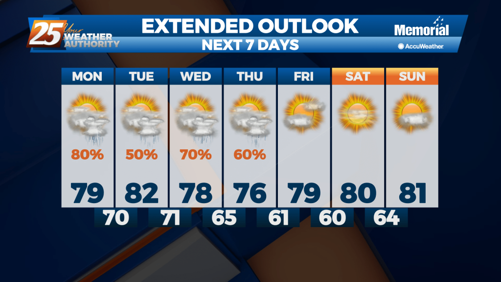
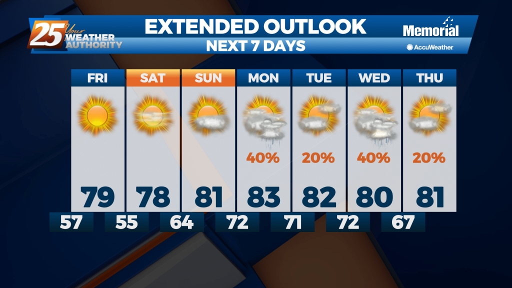
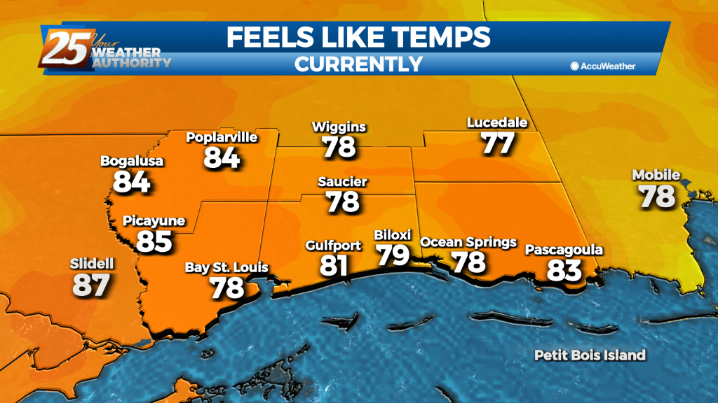
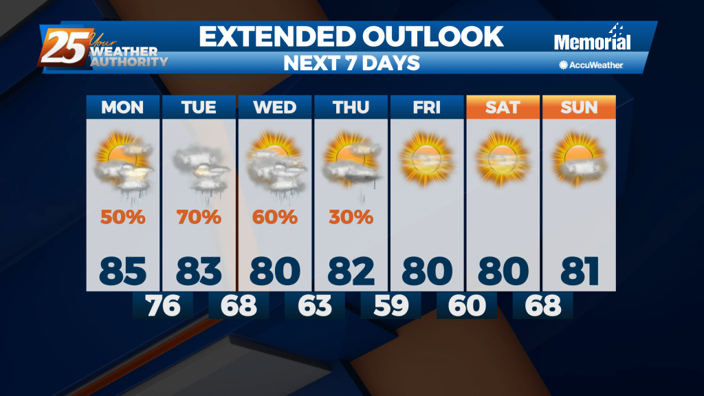
Temperatures will remain warm, generally in the lower 80s for most spots both today and Monday. Lows will be in the lower 60s to perhaps some upper 50s inland tonight. At the surface, high pressure dominates our forecast. Our surface…