5/3 - The Chief's "Hurricane Preparedness Week" Tuesday Morning Forecast
Quiet conditions will continue as the warm and humid flow dominates. A more unsettled weather pattern is expected to take hold on Thursday and continue through…
Quiet conditions will continue as the warm and humid flow dominates. A more unsettled weather pattern is expected to take hold on Thursday and continue through…
A weakening disturbance west will move east across the region with no significant convective development today. Beyond tonight, high-pressure over the western Gulf of Mexico should keep any…
A Texas disturbance will move across the area this afternoon and evening. It appears to be weakening at this time, with no significant convective development today. Beyond tonight, high-pressure…
As high pressure to the east moves further east, southerly return flow has commenced below about 10,000ft. This could produce a few showers or perhaps a thunderstorm…
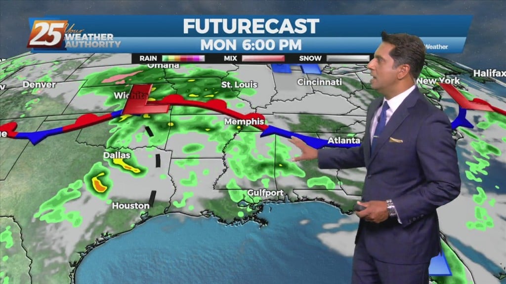
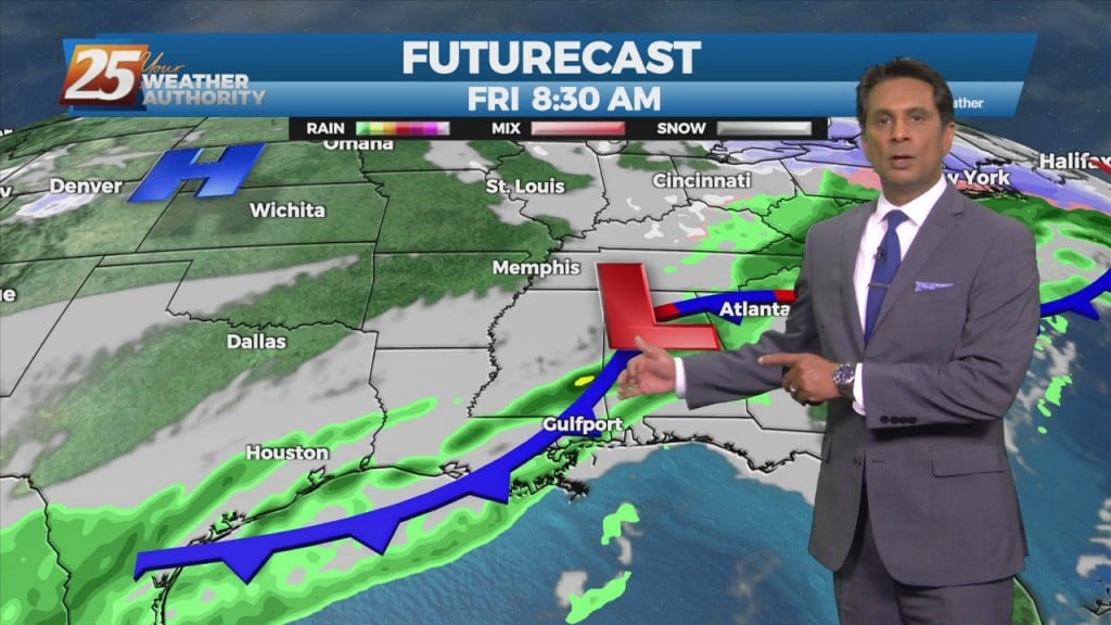
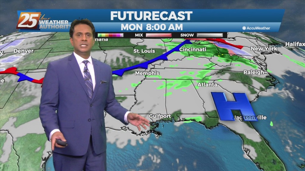
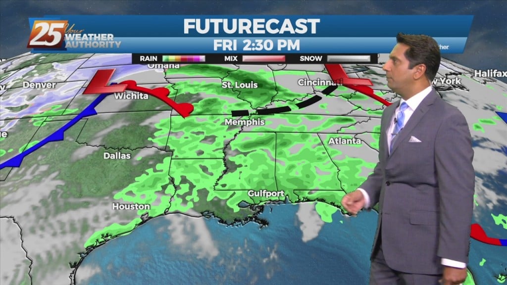
A cold front from the NW will drive south to central LA and MS late in the day. Showers and thunderstorms along/ahead of the boundary should be…
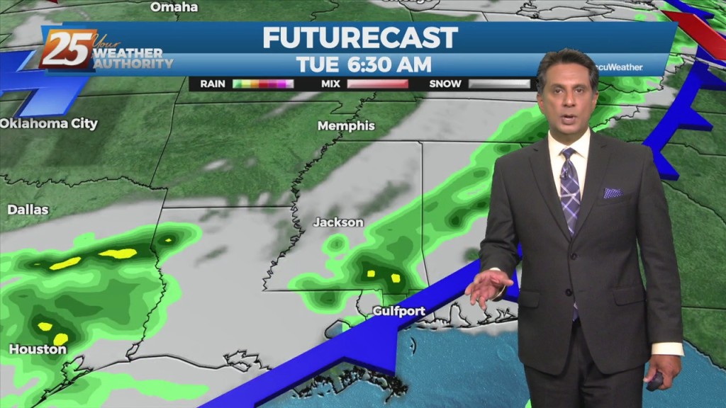
An upper low-pressure in the northern part of the country will move across the Great Lakes and into Canada. This will drive a cold front south to central LA and MS late in the day. Showers and thunderstorms along/ahead of…
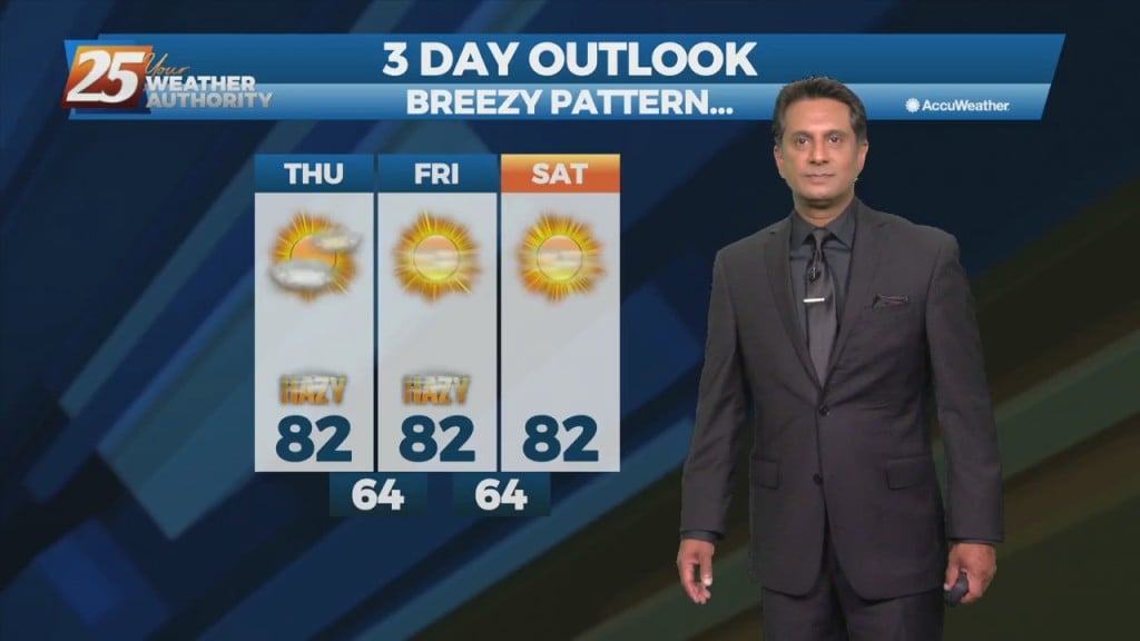
An upper level high-pressure will begin building in and across the southeastern CONUS today through Saturday. As a result, onshore flow continues to become well established. Those 2 changes will enhance moderating period that started yesterday. We will see about…
A few afternoon showers/t-storms will be possible including this evening as a cold front moves through the area. If the lift can be realized and overcome the dry…
Above seasonal average temperatures will continue until a cold front makes its way through our area early tomorrow morning. Ahead of the front, isolated showers…
A cold front is barreling down from the northwest will bring a few showers and even a brief t-storms this afternoon- evening. Winds will sharply transition and pick…
The main impact for the weekend still comes from the front moving into region. The mid to upper levels are fairly dry and additional instability exists in the…
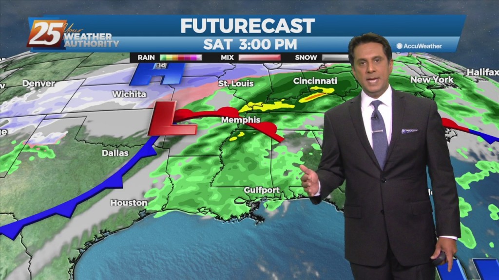
Today will bring continued warm and humid conditions with partly to mostly cloudy shies, a bit more sunshine this afternoon. The main impact for the weekend still comes…
As the high pressure remains seated over the Bahamas warm and moist air advection continues to be brought in from the Gulf. While there is the possibility of…
Rain showers and unseasonably warm temps continue through the next few days. As the high pressure remains seated over the Bahamas warm and moist air advection continues…
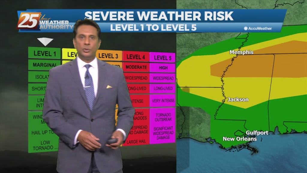
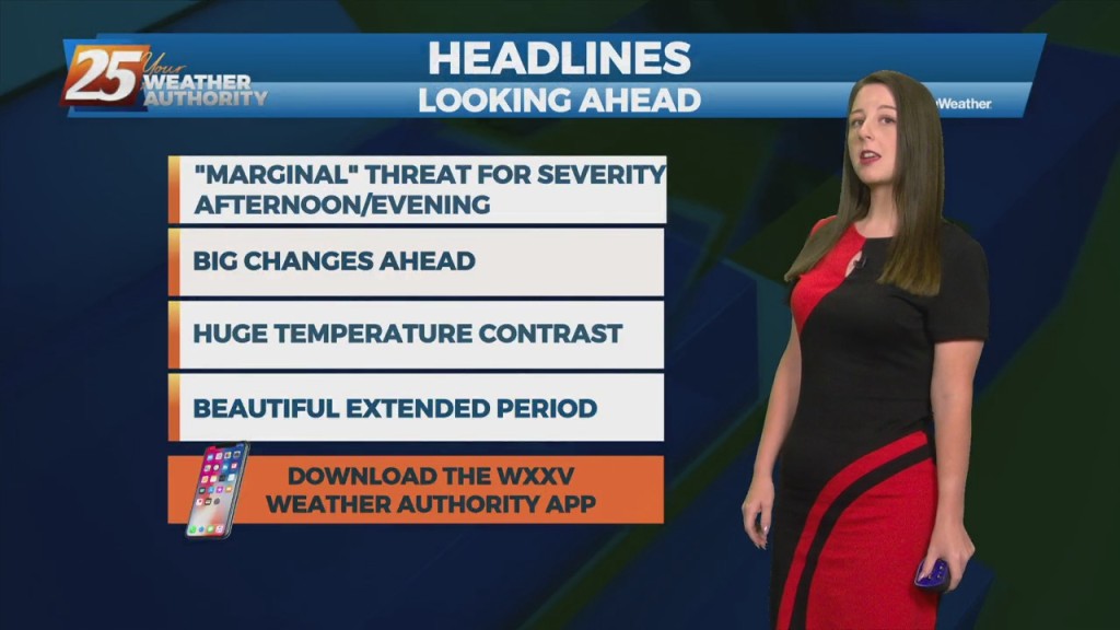
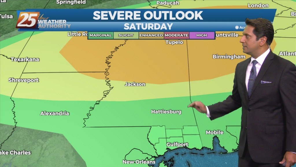
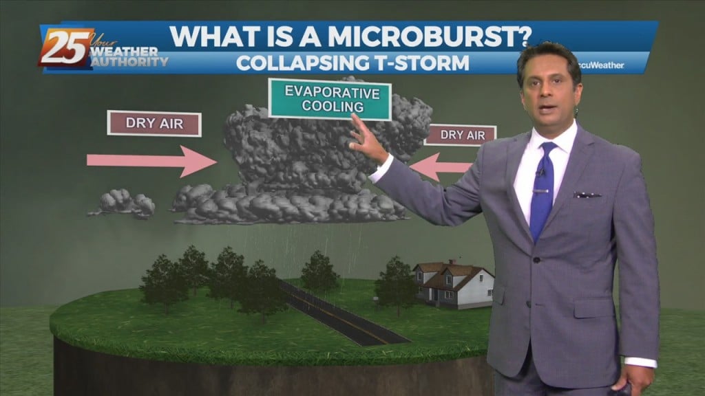
Isolated t-storms will affect the area this afternoon with a low-end threat for severity. If we get a strong thunderstorm, a damaging wind gust may be possible or…
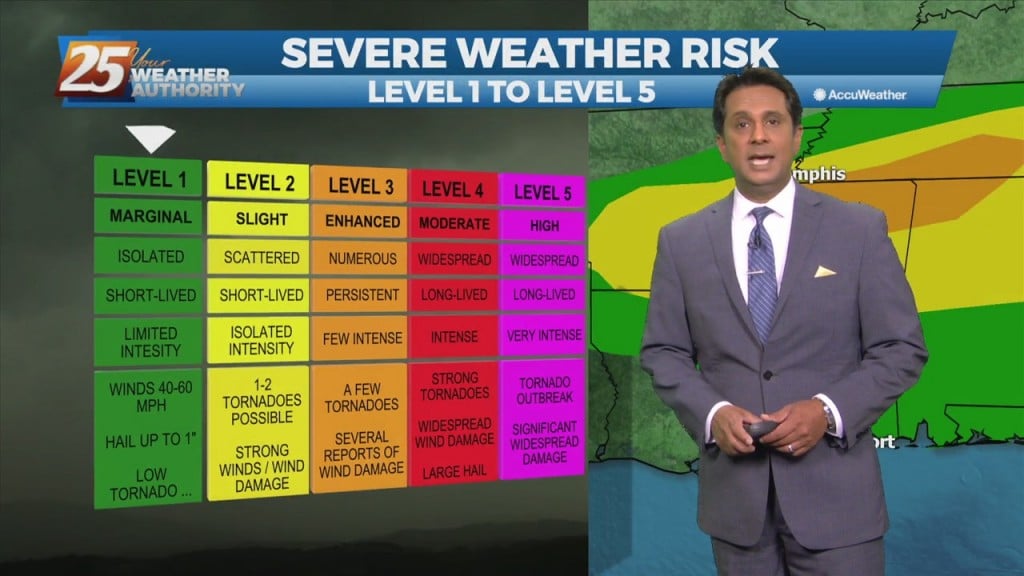
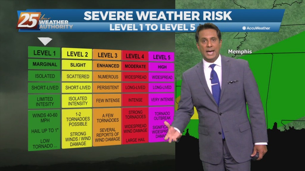
The high pressure remains just east of Florida and we'll see another impulse moving around the ridge. In the words of SPC, the chance for severe weather…
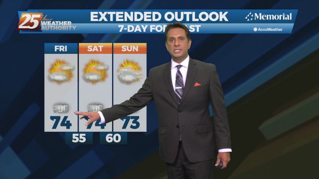
The first 24 hours or so of the forecast will be more of the same that we've seen over the weekend with partly to mostly cloudy skies…
An upper level high-pressure centered near south Florida expands from east of the Bahamas to the western Gulf of Mexico. Models show a plume of moisture on the…
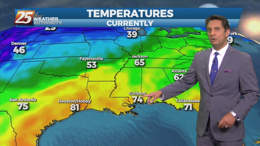
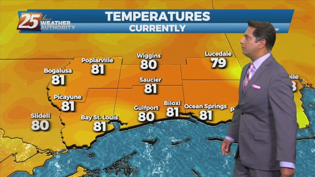
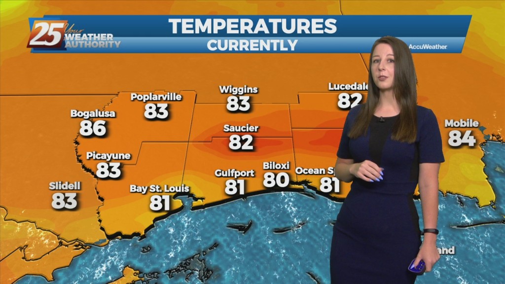
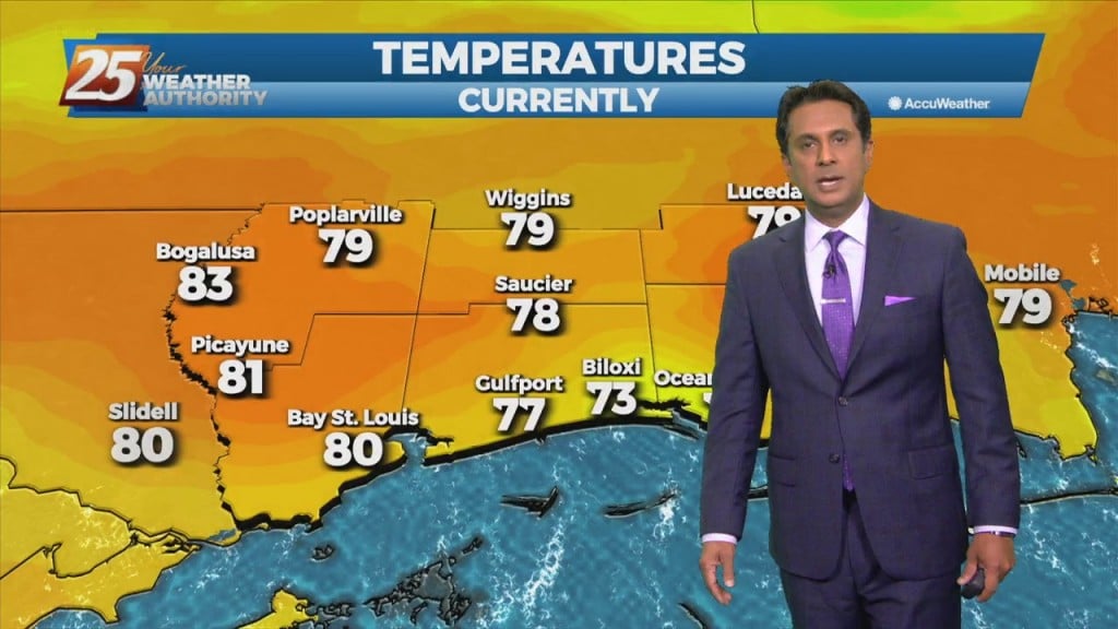
High temperatures today are forecast to reach around 80 for many areas with dew points in the mid-60s, which will make for fairly muggy conditions. I…
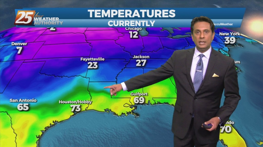
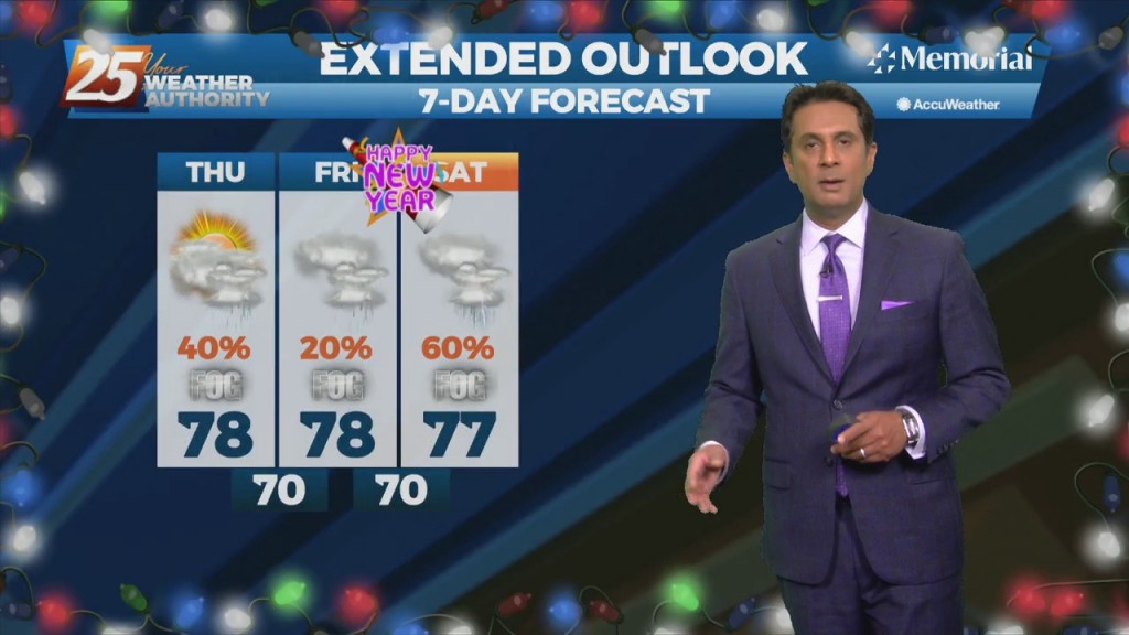
Dense morning fog will continue to be a factor through the weekend as overnight low temperatures will bottom out in the upper 50s to low/mid 60s. The winter…
A warm front west will move east through the area this afternoon, providing for scattered showers and t-storms. Precip chances are generally in the 25-40% range this afternoon before…
A cold front will bring scattered t-storms this afternoon with rain post frontal passage. The front is expected to slip to the south of the coastline overnight…
A cold front still tracking toward the area early this morning will move into the northwest portion of the area around noon, reaching the Mississippi Coast…
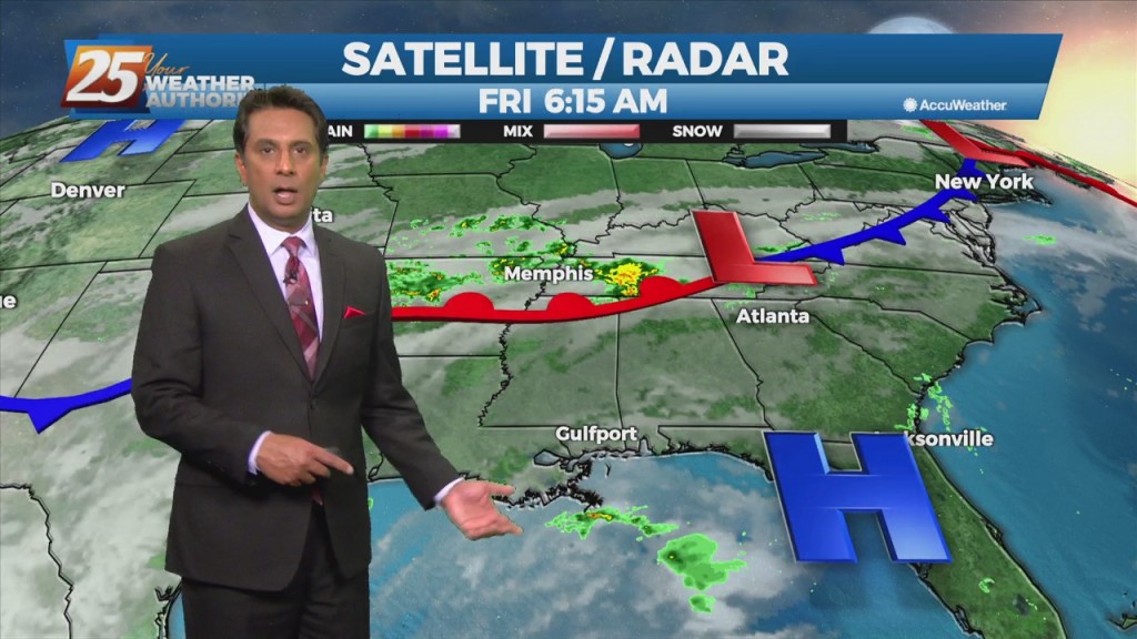
At the surface, high pressure really doesn't give way over the next 24 hours. A n upper-level disturbance will move from Texas across the area Saturday…