2/24 – Rob Knight’s “Cold Frontal Passage Ahead” Thursday Afternoon Forecast
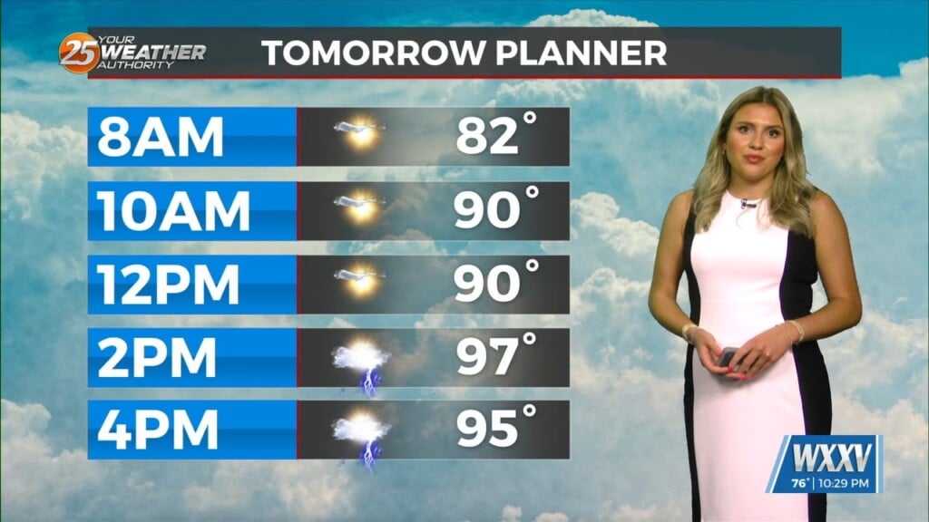
Above seasonal average temperatures will continue until a cold front makes its way through our area early tomorrow morning. Ahead of the front, isolated showers will be possible very early tomorrow morning. Colder, drier air mass will begin to move in once the front clears the area. Cloud coverage will continue through Friday and only partially clear this weekend. The tail end of the front will flair north along the northwestern Gulf of Mexico this weekend, keeping cloud coverage along the MS gulf coast. Low rain potential will be in the area but mostly west of the I-55 corridor Sunday. The pattern looks fairly quiet heading into the first week of March.


Leave a Reply