10/20 Ryan's "Late Spring?" Tuesday Evening Forecast
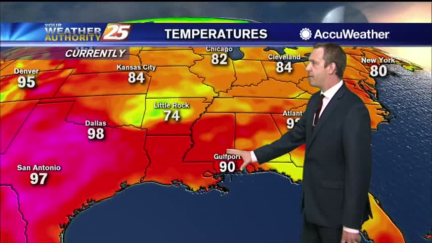
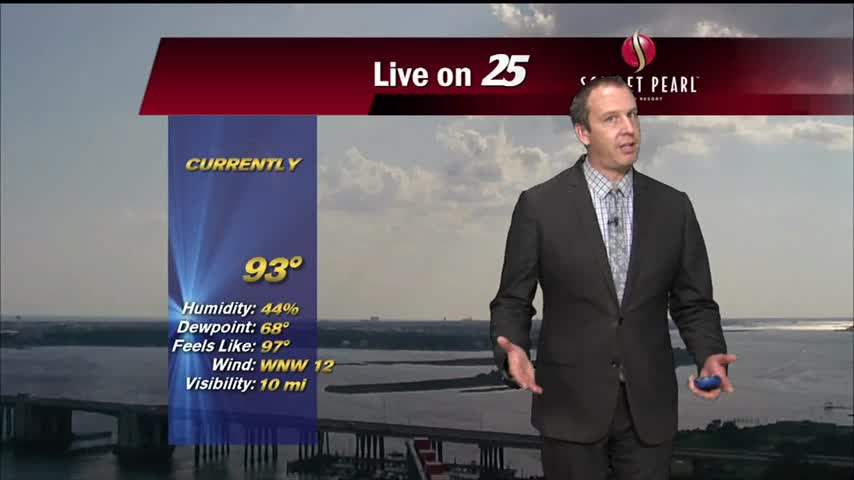
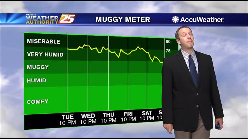
Feels pretty good outside, but it is a little warmer and more humid than it "should be."
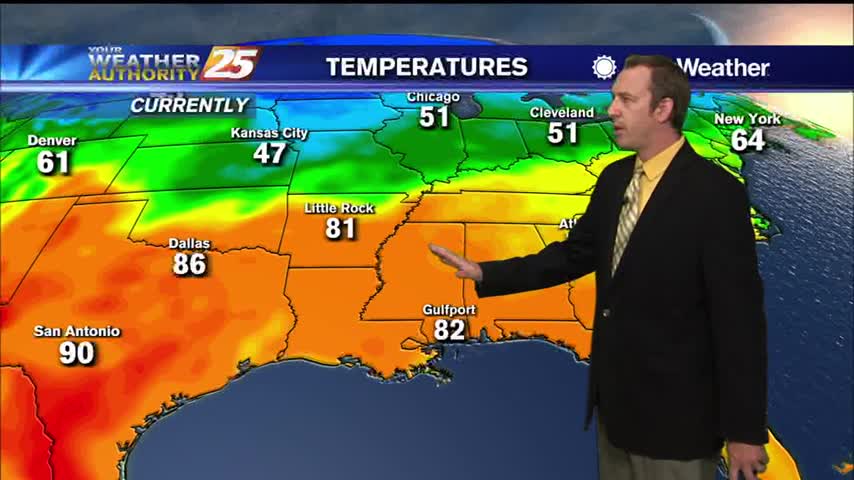
Feels pretty good outside, but it is a little warmer and more humid than it "should be."
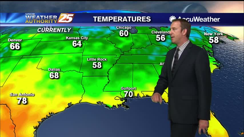
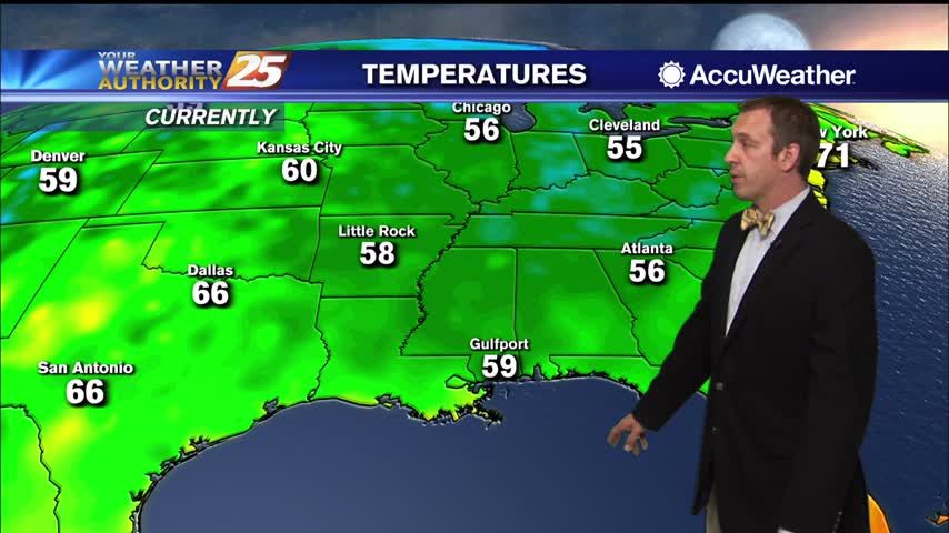
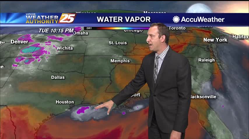
Not too much changed this afternoon, but this morning's cold front will really take hold through the night.
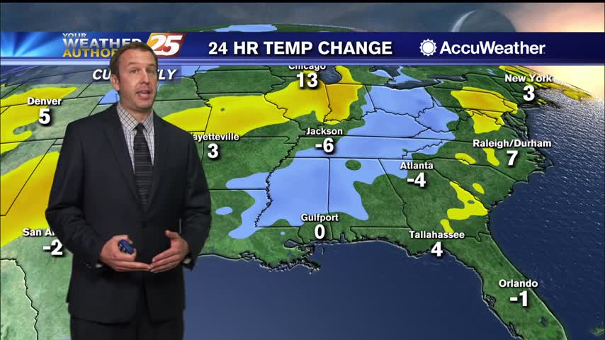
Forecast is improving for the next few days after this morning's front, but we'll see another few cool downs this week.
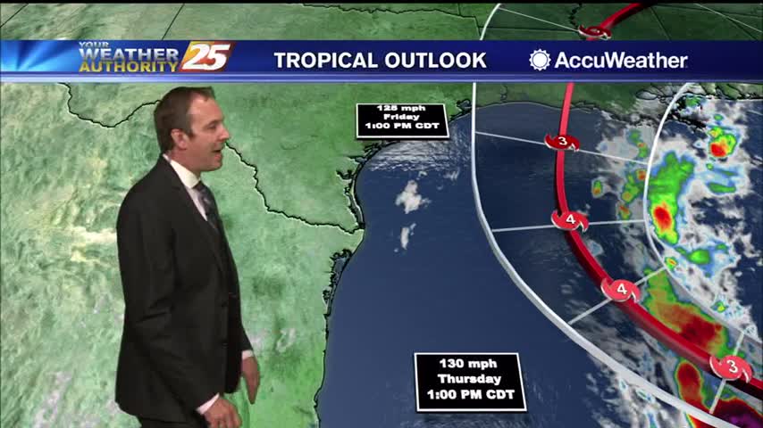
Delta continues to develop, and will be here by the end of the week. Still unclear where it will end up though....
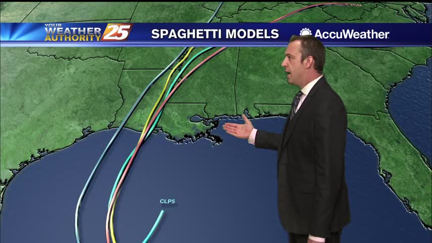
Clouds have moved in, but still almost a full week before Hurricane Delta arrives as it continues to develop.
Fall weather has arrived a little late, but will stick around for over a week this time.
It may be a week late, but a long period of textbook fall-like weather has finally arrived!
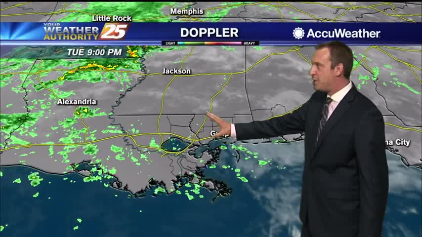
Beta has become non-tropical, but will still be responsible for days of rain in South MS.

Didn't see much rain today, but more is on the way as Beta begins to drift our direction.
Sally continues to be full of surprises thanks to an early morning strengthening session, but has thankfully moved far enough east South MS's issues are quickly diminishing.
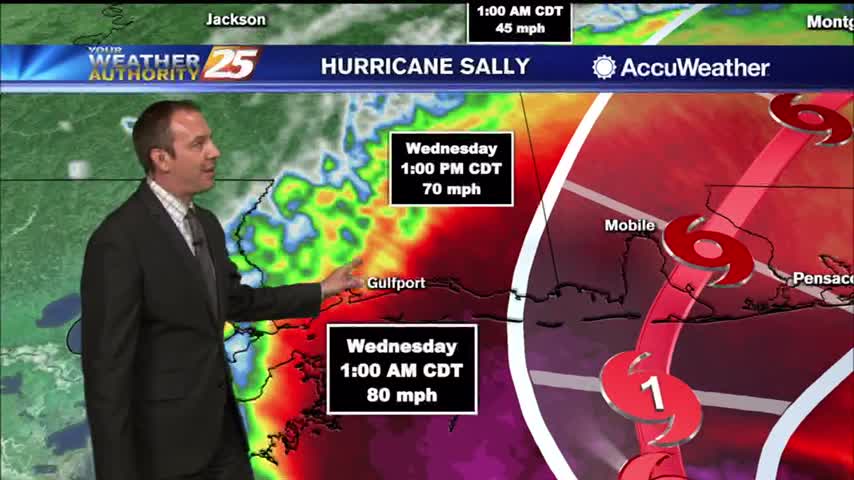
Sally has weakened a bit, but remains a category one hurricane bringing plenty of rain to the MS/AL/FL coastal areas.
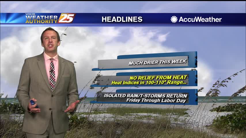
Nice and dry still to start off the week though the humidity is rising, and rain isn't far away....
Few showers today, but overall most of the week will continue on the drier side before rain moves in....
Fall won't officially start for another 3 weeks, but meteorological speaking it starts today! Either way, won't feel much like fall until likely mid-December.
August ended on the wet and muggy side, but September is starting off beautifully. Statistically though, it likely won't remain that quiet as tropical activity peaks.

It's going to miss to the left, but Hurricane Laura is on its way and will bring us a few rainy days....
Hurricane Laura will miss us to the west, but we're still in for a few days of disturbed weather.
Very few showers out there today thanks to a weak sea breeze, which will be a bit stronger tomorrow.
A weak sea breeze tried to bring some afternoon rain, but not much was able to happen today thanks to upper level drier air.

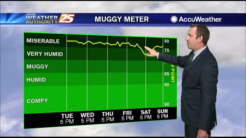
Not cooling far into the 70s each night for the rest of the week, and our afternoons will be just as hot and humid as the last few have been.
Another excessively hot and humid afternoon is in the books, with only a few afternoon showers coming to cool us down....
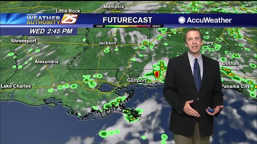
Not really any cooler, but it'll feel that way as slightly drier air makes its way to the surface.
Drier air has moved into the upper levels and is trickling down to the surface, meaning things will stay a bit cooler and drier for now.
More rain tonight and tomorrow, but drier weather finally moves in just before the weekend.