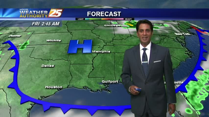
11/21 - Payton's Tuesday Afternoon Forecast
Another day of nice weather, but another cold front will move into the area later tonight.
Another day of nice weather, but another cold front will move into the area later tonight.
Gloomy start to the day, but more clouds and rain are on the way.
As a zonal flow continues, warm/humid conditions along the Mississippi Gulf Coast continues to provide areas of PATCHY DENSE FOG...

Happy Halloween! A nice day and cooling this evening for trick-or-treating.
Beautiful weather for the second day in a row!
The beautiful weather continues for South Mississippi, and it's going to last a few more days.
A very weak cold front is approaching the area from the west…currently located in Eastern Tx.
With a very saturated air mass in place, DISRUPTIVE WEATHER is in the area once again in the form of FOG, and ADVISORY is in effect...
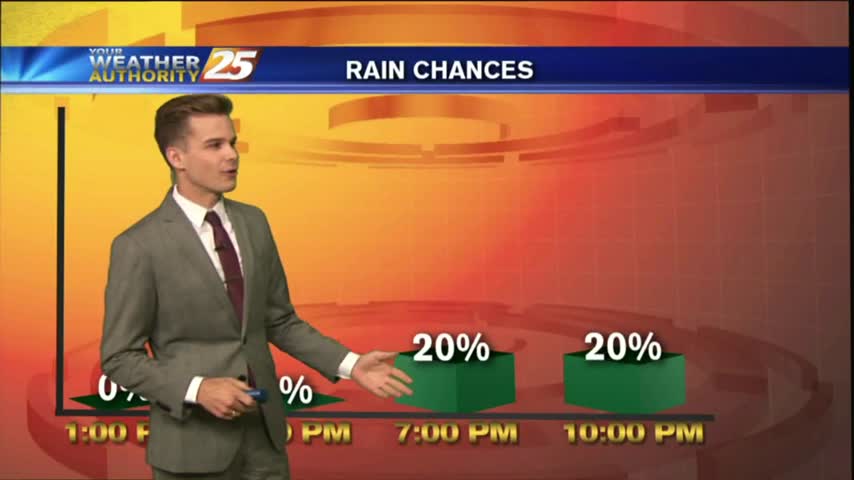
Precipitation should stay low as we approach the weekend with a few passing showers possible from day to day.
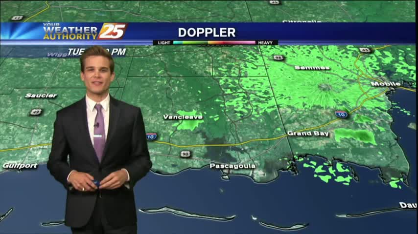
Showers and thunderstorms that moved off the waters this morning continue to slowly dissipate, but we could see more this afternoon.
Seeing a few showers in the area this morning ,but drier weather is on the way.
As IRMA continues its track to the NW…now moving through N’tern Alabama as a low pressure system, the lovely conditions will continue here in South Mississippi.
IRMA, now a TROPICAL DEPRESSION moving through N'tern Alabama continues to bring lovely conditions and a dry north wind to south Mississippi.

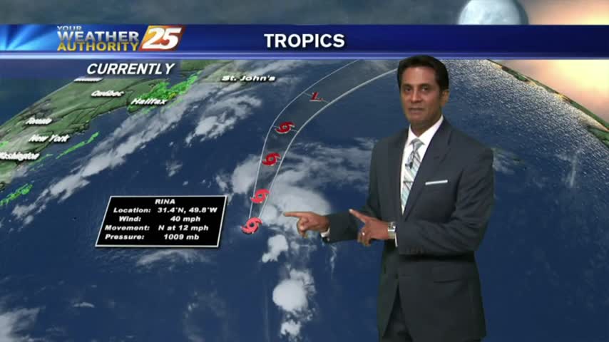
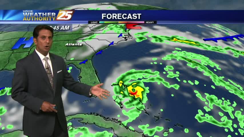
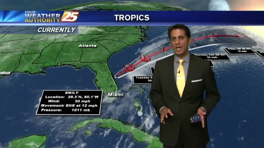
Irma continues to strengthen this morning and afternoon into the strongest Hurricane ever recorded in the Atlantic Basin with winds up to 180 mph.
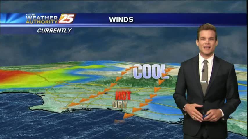
With an approaching cold front to our NW...this morning is a bit more HUMID under a good bit of mid/upper level clouds...
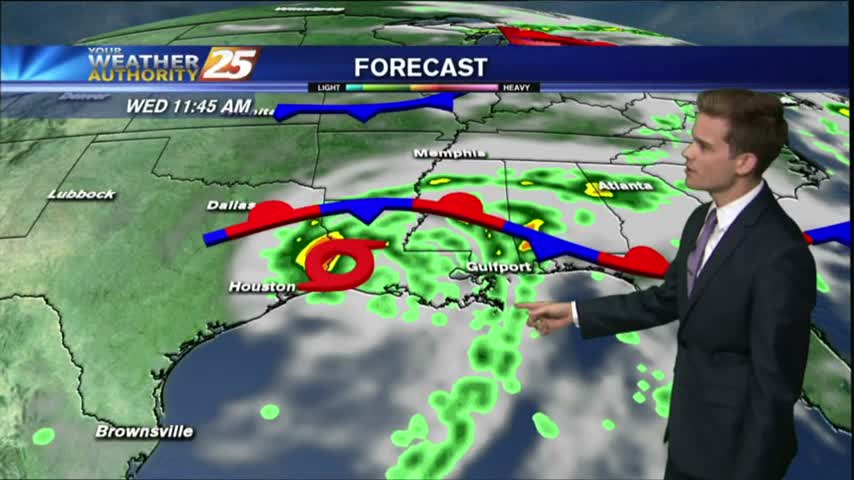
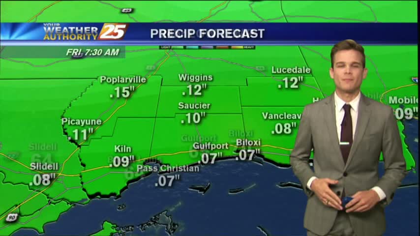
Flash Flood Watch for the area until Thursday night. Turn around, don't drown!

The best chances for showers and thunderstorms will remain in the morning over the waters and along the coast, and then chances move inland throughout the morning and afternoon hours.
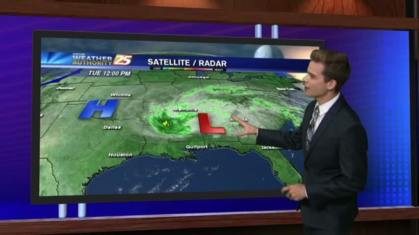
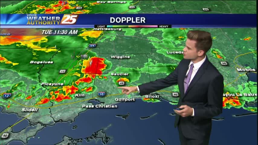
Showers and thunderstorms have developed across the area as an unstable and very tropical air mass continues to dominate across the Mississippi Gulf Coast.
We continue to see isolated showers and thunderstorms starting to develop.
A beautiful day to start August with temperatures in the upper 80s and sunny skies, but changes are on the way.
A pleasant start to the day with several reporting sites in the mid/upper 60s, under clear skies...
Today will bring the same scenario with the activity in the area. An additional 2-4 inches of rain is not out of the question with the strongest storms.
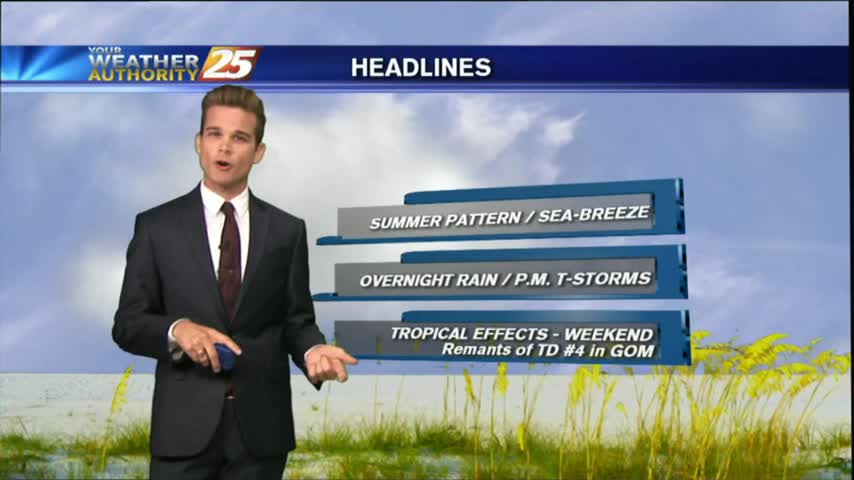
A typical summertime pattern for South Mississippi continues for most of this week.
Today will be much like yesterday with hot/humid conditions with isolated showers and thunderstorms.