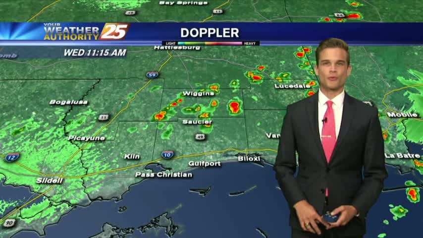
5/30 - Payton's Wednesday Afternoon Forecast
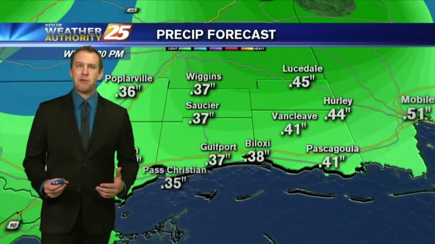
Best rain chances are today, but heat and humidity will be on the increase.
Best rain chances are today, but heat and humidity will be on the increase.
Heavy showers and a few thunderstorms this morning, but more heat and humidity in the forecast.
Heat and humidity will be the story as we head into this week.
Hot and humid today, and that's not going anywhere anytime soon...
Alberto officially made landfall this afternoon near Laguna Beach, Florida.
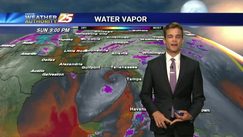
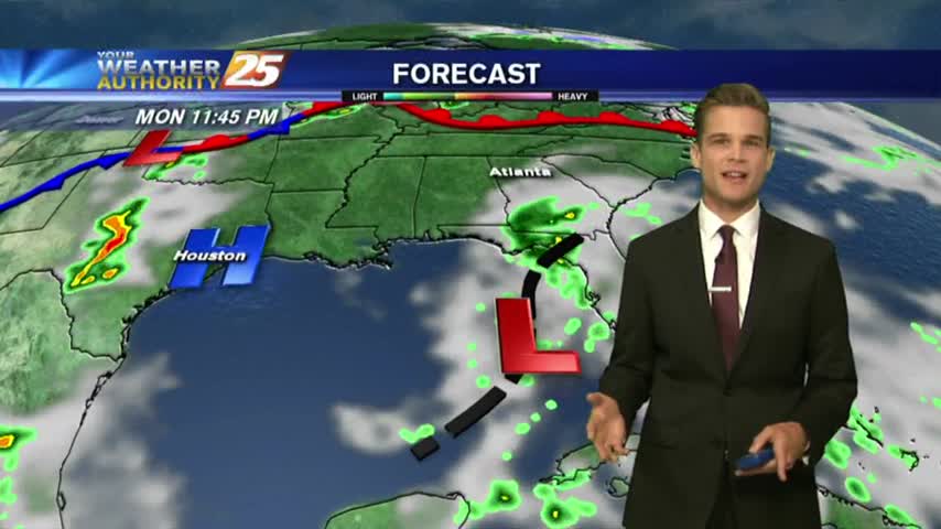
Alberto continues to strengthen, but the worst will stay off to the east.
The latest update brings good news regarding the path of Alberto, but we're still expecting several inches of rainfall through the weekend and into next week....
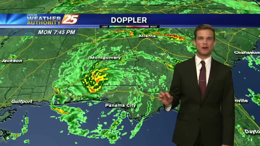
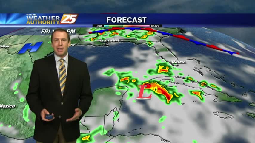
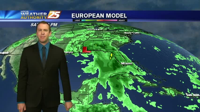
Outside of any tropical influences, we're still expecting showers and thunderstorms through the weekend before Alberto moves in though its path is still uncertain.
We've already seen several days in a row with afternoon showers and storms, and it seems a tropical system may arrive just in time for the holiday weekend.....
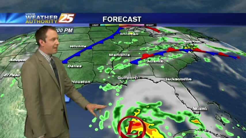
We'll finish off the week with more random, afternoon showers, but heavier, more organized rain will move in with a developing tropical system....
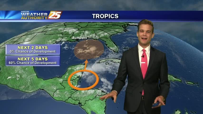
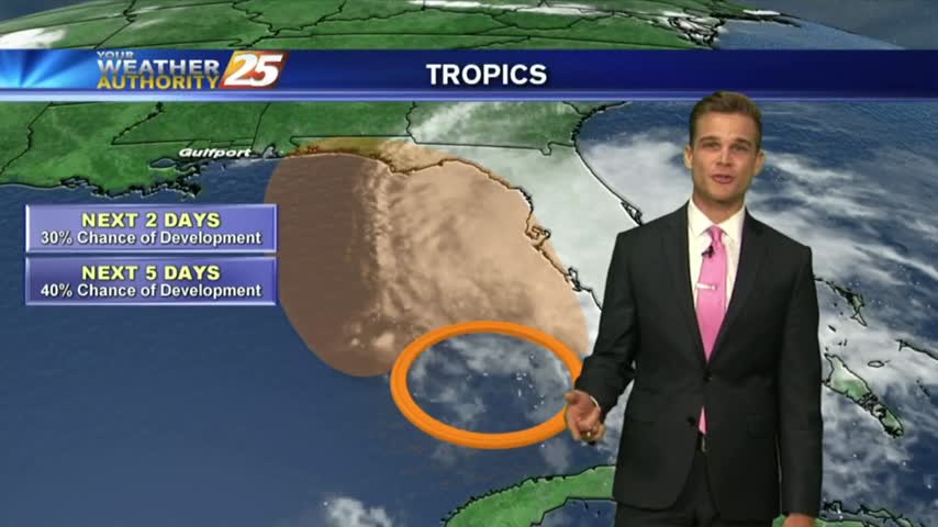
Tropical development is likely over the next five days, but heavy rain continues to be the primary threat.
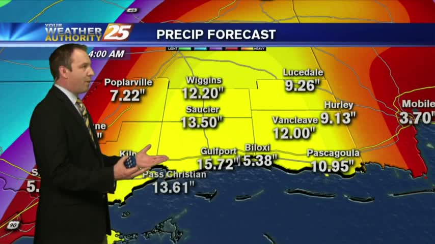
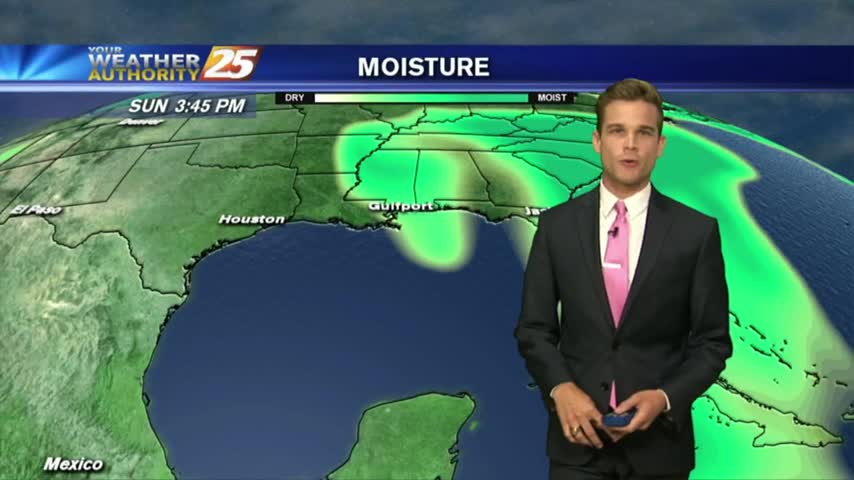
Hot and humid weather continues, but the flooding threat could go up as we head into the weekend.
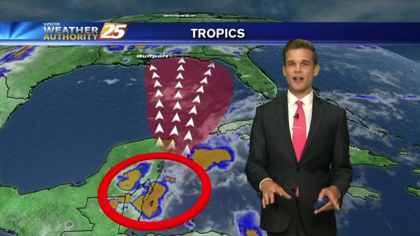
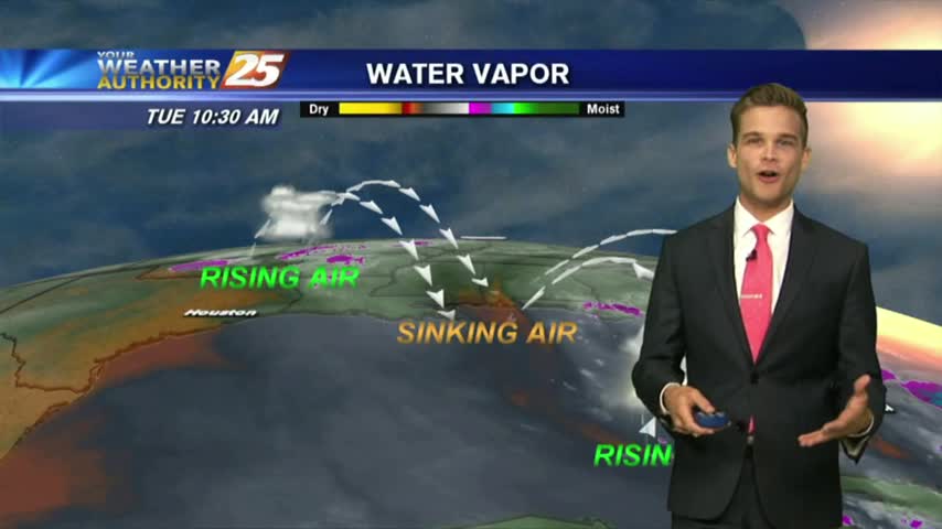
The tropics continue to heat up...what does that mean for South Mississippi?
We're in for a wet week ahead as we'll see several days like today with late morning/afternoon showers and partly sunny skies. Weekend outlook not looking good....
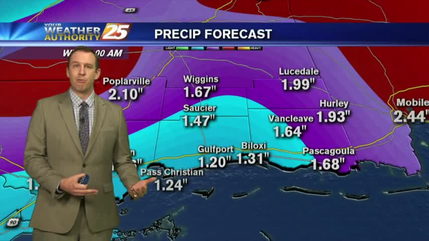
Expect this week to be significantly different from the last with cooler temperatures, more clouds, and much more rain....
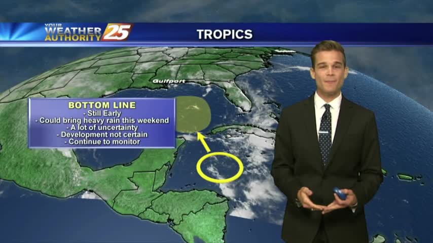
Afternoon showers and thunderstorms, and we are keeping an eye on the tropics.
More record heat today, but some relief is on the way.
Heat and humidity continue this week, but we will add rain chances.
Another hot one, but now our attention turns to the tropics.
Another nice and warm day, but we are tracking a cold front on its way to South Mississippi.
Enjoy more beautiful weather today!
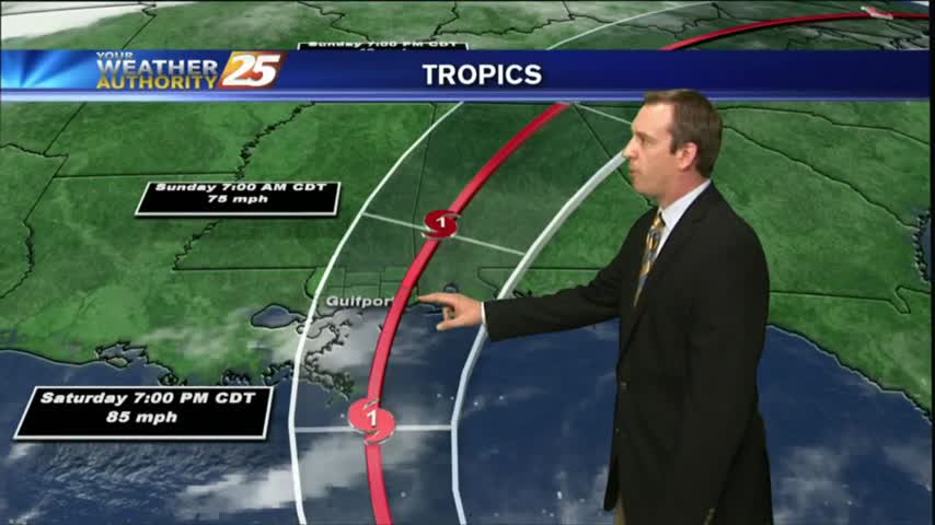
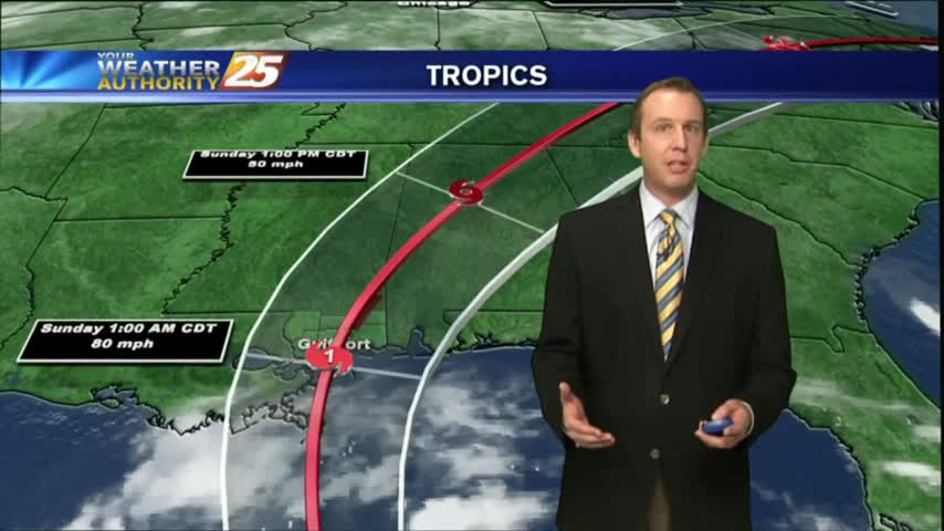
The latest update pushes the forecast track slightly further East and strengthens it a bit as well. There's still a lot that can happen between now and landfall, so watch the full forecast for details.
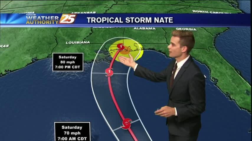
Today remained beautiful as expected, but conditions will begin to deteriorate rapidly as we head into tomorrow afternoon and Nate moves in. Full update inside.
A Hurricane Warning and Storm Surge Warning for South Mississippi...